Free Downloads: Geo Referenced Moving Map
License: All | Free
The MapSys Cadastral GIS offers specialized functionality for each stage of processing including the digital Map creation, plotting cadastral and topographical plans, generating and combining Geo-Referenced data in order to obtain a validated relational Geo-database. This can be used in MapSys or in other GIS programs or database application.
Category: Home & Education / Teaching Tools
Publisher: GEOTOP, License: Freeware, Price: USD $0.00, File Size: 143.9 MB
Platform: Windows
MapCreator 2.0 is a software to create maps and animated maps with a good quality.
MapCreator can be used in presentations because is versatile and can be adequate for any kind of presentation, from travel presentations to professional presentations.
MapCreator is Geo-Referenced so any Map or portion of the Map will have the exactly portions of latitude...
Category: Home & Education / Miscellaneous
Publisher: primap software, License: Freeware, Price: USD $0.00, File Size: 103.3 MB
Platform: Windows
The Balloon Browser recognizes and highlights geo-coordinates in web pages.
The Balloon Browser recognizes and highlights Geo-coordinates in web pages. Hovering over a recognized location advises another application to show a Map of the corresponding area. For now the only program Balloon Browser can interact with is Google Earth.
Instead of waiting for the one true Geo-notation and markup standard, Balloon Browser tries to parse a...
Category: Internet / Browsers
Publisher: Michael Krause, License: Freeware, Price: USD $0.00, File Size: 5.6 MB
Platform: Windows
TerraExplorer allows users to shape their own digital world.
TerraExplorer allows users to shape their own digital world.
By editing and annotating Geo-Referenced 3D terrain databases created through TerraBuilder, users can customize the experience to highlight specific geographic content. By overlaying unique or proprietary information onto a 3D Map, the user creates an exciting, interactive application that can...
Category: Home & Education / Miscellaneous
Publisher: Skyline Software Systems, Inc., License: Freeware, Price: USD $0.00, File Size: 29.5 MB
Platform: Windows
G2G is a P2P (peer to peer) extension for ArcGIS Desktop.
G2G is a P2P (peer to peer) extension for ArcGIS Desktop. The extension allows two or more users to collaborate without any intermediate server. G2G (gis to gis) supports:
1) Text chatting,
2) Exchange of Map content (Geo-Referenced screenshots),
3) Ink and graphics collaboration (shared editing),
4) Share navigation (one person can pan the...
Category: Internet / Misc. Servers
Publisher: ESRI, License: Freeware, Price: USD $0.00, File Size: 1.3 MB
Platform: Windows
FSM Moving Map is a Freeware software with some neat features.
FSM Moving Map is a Freeware software with some neat features. With proper road maps, you will be able to find your road (or lack of) in FS environment, or fly at ease using Sectional or terminal charts.
The concept is very simple: you, the user define all the maps once you are flying, FSMMM will try to locate the best Map available, and display it on screen....
Category: Home & Education / Miscellaneous
Publisher: RanaInside, License: Freeware, Price: USD $0.00, File Size: 1.1 MB
Platform: Windows
When posting a photo on your favorite Social Network, online photo gallery, or web page, you are inviting danger.Most smartphones and some cameras made today are equipped with Geo tags. Geo tags are imbedded in the picture and use the same concept as GPS.
The Geo tag in the photo is a smart tool that allows the photo to be tagged to an exact location. Unless you know...
Category: Security & Privacy / Other
Publisher: Geotag Security Software, Inc, License: Freeware, Price: USD $0.00, File Size: 2.2 MB
Platform: Windows
GeoSetter is a freeware tool for Windows (XP or higher) for showing and changing Geo data and other metadata (IPTC/XMP/Exif) of image files (e.g. images taken by digital cameras).
fEATURES:
- Reads and writes the formats JPEG and TIFF as well as camera RAW formats DNG (Adobe), CRW, CR2 and THM (Canon), NEF and NRW (Nikon), MRW (Konica Minolta), PEF (Pentax), ORF (Olympus),...
Category: Multimedia & Design / Media Management
Publisher: Friedemann Schmidt, License: Freeware, Price: USD $0.00, File Size: 18.8 MB
Platform: Windows
 Freeware
Arm Map Explorer recreates all the functionalities of Google Maps on your desktop while expanding them with new extras. Map Explorer lets you locate and view any place on the planet using dynamic interactive maps. These maps are draggable, which means there is no need for you to click and wait for graphics to reload each time you want to view adjacent parts of a Map....
Category: Internet / Flash Tools
Publisher: ArmCode, License: Freeware, Price: USD $0.00, File Size: 5.5 MB
Platform: Windows
Immageo is all about making your photos as memorable as when you took them, by geotagging each photo. Immageo is a truly exciting example of what you can and should do with your photo collections. Its more than an album organiser, it embeds Map locations and notes into your photos. And when you come to review them Immageo displays them all in context of when and where in the Immageo...
Category: Multimedia & Design / Media Catalogers
Publisher: Immageo, License: Freeware, Price: USD $0.00, File Size: 11.0 MB
Platform: Windows
Freeware
Convert ESRI ShapeFiles (.SHP) geolocation data into AnyMap format to be used with AnyChart. AnyChart Flash Map Converter allows making use of a wide choice of maps with AnyChart Flash Component, a GIS visualization system that recognizes Map data in AnyMap format only. AnyChart Flash Map Converter makes it easy to visualize any geolocation data without hefty expenses...
Category: Web Authoring / Image Mapping Tools
Publisher: AnyChart.Com, License: Freeware, Price: USD $0.00, File Size: 1.6 MB
Platform: Windows
HydroSHEDS is a mapping product that provides hydrographic information for regional and global-scale applications in a consistent format. It offers a suite of Geo-Referenced data sets (vector and raster) at various scales, including river networks, watershed boundaries, drainage directions, and flow accumulations. HydroSHEDS is based on high-resolution elevation data obtained...
Category: Home & Education / Miscellaneous
Publisher: WWF-CSP, License: Freeware, Price: USD $0.00, File Size: 1.7 MB
Platform: Windows
Moving Jellyfish Wallpaper shows many very realistic jellyfish Moving from one side to another of your your PC desktop. If you try to catch them using your mouse, they will try to escape. This Moving wallpaper has a SysTray which lets you to close software and get help online. If you like jellyfish, you should give Moving Jellyfish Wallpaper a try. Compatible with...
Category: Desktop Enhancements / Misc. Themes
Publisher: digiaquascr, License: Freeware, Price: USD $0.00, File Size: 589.8 KB
Platform: Windows
Freeware
Bandwidth Vista 2, The Next Generation bandwidth monitor with Geo-IP Connection Mapper. Displays Real-Time TCP and UDP Connections including Country and City. Holds a full log of bandwidth usage. New to Bandwidth Vista 2 is Voice Alerts and a Whois Lookup Tool and two kinds of graph. Bandwidth Vista 2 runs quietly from the system tray displaying network activity while you work or you can...
Category: Utilities / Network
Publisher: Bandwidth Vista, License: Freeware, Price: USD $0.00, File Size: 16.2 MB
Platform: Windows
Metal Slug is a series of run and gun video games first released on Neo-Geo arcade machines and game consoles created by SNK. It was also ported to other consoles, such as the Sega Saturn, the PlayStation, the Neo-Geo Pocket Color and more.
Now You can play on your PC for free on Softendo Mario Games. Collect many interesting weapons and bonuses, fight againts many...
Category: Games / Action
Publisher: Softendo, License: Freeware, Price: USD $0.00, File Size: 7.2 MB
Platform: Windows
Freeware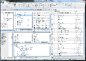
Modern ribbon-based data manipulation tool for Microsoft SQL Server Main features: Quick database browser. Database oriented perspective, database projects. Table designer, edit columns, keys, uniques, checks. Database editor, view and and views, stored procedures, functions, triggers. Export, import - CSV, HTML, SQL, MS Excel, dBase DBF files. Data analysis without importing...
Category: Business & Finance / Database Management
Publisher: JenaSoft, License: Freeware, Price: USD $0.00, File Size: 6.2 MB
Platform: Windows
Geo.De.Sy is a complete drawing environment with survey utilities free for the customers of IQSoft and CivilShop. You can create drawing , open and save DWG and DXF untill Autocad version 2011, insert point to drawing , create grid, dtm beta , image correlation.
It is the first release of the program. It is under hard development. The features that are in active development...
Category: Multimedia & Design / Image Editing
Publisher: IQSoft, License: Freeware, Price: USD $0.00, File Size: 14.3 MB
Platform: Windows
Moving Koifish Wallpaper shows many very realistic koifish Moving from one side to another of your your PC desktop. If you try to catch them using your mouse, they will try to escape. This Moving wallpaper has a SysTray which lets you to close software and get help online. Compatible with Windows Vista Windows 7 and Windows 8. When trying to run Moving koifish...
Category: Desktop Enhancements / Misc. Themes
Publisher: digiaquascr, License: Freeware, Price: USD $0.00, File Size: 2.8 MB
Platform: Windows
Freeware
An interactive Flash USA Map with all the features you need for your web site or project. This is the ideal solution for dealer maps, real-estate listings, or visualizing state statistics. Nearly every aspect of the Map is customizable. However, unlike competing products, our Map is very simple to install and edit. Just upload XML and SWF files and embed.
Category: Internet / Flash Tools
Publisher: http://www.flashusamap.com/trial/flashus, License: Freeware, Price: USD $0.00, File Size: 93.8 KB
Platform: Unknown
Map of Africa is one of the many maps created for GPS TrackMaker.
Map of Africa is one of the many maps created for GPS TrackMaker. You are able to download the installation package from the TrackMaker website. In order to preview the contents of this package, you need to install GPS TrackMaker.
Using the above mentioned application, you will be able to see the Map of Africa. Just click on the "Open Temporary...
Category: Home & Education / Miscellaneous
Publisher: Geo Studio Technology, License: Freeware, Price: USD $0.00, File Size: 18.3 MB
Platform: Windows
Metal Slug is a series of run and gun video games first released on Neo-Geo arcade machines and game consoles created by SNK.
Metal Slug was also ported to other consoles, such as the Sega Saturn, the PlayStation, the Neo-Geo Pocket Color and others more.
Fight your way through the canyons taking out the enemy on the way down. Look out for upgrades and...
Category: Games / Action
Publisher: Softendo, License: Freeware, Price: USD $0.00, File Size: 8.2 MB
Platform: Windows
Program shows you an actual X3 sector-map, with detailed information about most in-game objects.
Program shows you an actual X3 sector-Map, with detailed information about most in-game objects. The Map is based on a log-file that is created with an in-game script (by Andrei[<>Ace]). If you just want to view the standard Map (or if you don’t have the game) the program will work with the included default Map, which was created with an English X3 game...
Category: Games / Misc. Games
Publisher: SUU Design, License: Freeware, Price: USD $0.00, File Size: 1.4 MB
Platform: Windows
New Zealand Map Reference Converter (NZMapConv) is software that LINZ provides to convert Map references between the old NZMS260 Map series and the new NZTopo50 Map series.NZMapConv is a Windows programme designed to convert individual coordinates entered manually.
Category: Multimedia & Design / Media Management
Publisher: Land Information New Zealand, License: Freeware, Price: USD $0.00, File Size: 2.4 MB
Platform: Windows
When the XMAP software is communicating with an XEDE via the comms cable each Map will show, at the top of the Map display, an RPM and load value (x and y axis for the Map) in real time. Also in each Map a yellow highlighted block will show the current position within the Map. Beside the real-time display on each Map are the undo and redo buttons which...
Category: Home & Education / Miscellaneous
Publisher: ChipTorque, License: Freeware, Price: USD $0.00, File Size: 1.7 MB
Platform: Windows
Sig Panama Has :
Digital maps of Panama, Digital Map of Panama-City, digital Map of Taboga, digital Map of Bocas del Toro, digital Map of Colon and Free Zone, digital Map of Contadora Island, digital Map of Coronado, Panama, Zona Libre, Map of Panama, Map of Panama City, Map of Colon, Map of Zona Libre, Map of...
Category: Internet / Misc. Plugins
Publisher: DP Imperial, LLC., License: Freeware, Price: USD $0.00, File Size: 44.9 MB
Platform: Windows
QView provides you with instant access to any queue, along with the ability to drill down into any Referenced queues. Add the global template and with one line of code you can safely examine any queue. You can format fields using standard clarion pictures that will be remembered next time the library sees the queue and you can dump any queue out to a delimited file. You can sort a queue,...
Category: Software Development / Misc. Programming
Publisher: SDK Software, License: Freeware, Price: USD $0.00, File Size: 3.1 MB
Platform: Windows
Geo-SLOPE GeoBorrow
License borrowing allows a company that has purchased GeoStudio 2007 network licenses to have an end-user ‘check out’ a license for use while disconnected from the corporate network. This feature enables you to temporarily make use of a network license in a standalone capacity. Once a license is borrowed, the license is removed from the pool,...
Category: Business & Finance / Database Management
Publisher: GEO-SLOPE International Ltd., License: Freeware, Price: USD $0.00, File Size: 1.6 MB
Platform: Windows
The easiest way to get a paper map with MapPlot is the Plot Map menu.
The easiest way to get a paper Map with MapPlot is the Plot Map menu.
On the following dialog, simply paper size and scale have to be chosen - the result is ready to be printed directly, edited (e.g. for additional entries) or to be displayed as a preview.
Category: Utilities / Misc. Utilities
Publisher: AGIS GmbH, License: Freeware, Price: USD $0.00, File Size: 5.4 MB
Platform: Windows
Create the GeoDatabase for the entire world. This program create the geographical location Latitude, Longitude, and Altitude (Elevation) for every city, village, region, state, county in the World. The program crawls the data from the website www.heavens-above.com which collect data from US Geological Survey for the USA (and dependencies) and The National Imaging and Mapping Agency for all...
Category: Software Development
Publisher: Mewsoft, License: Freeware, Price: USD $0.00, File Size: 1.1 MB
Platform: Windows
This utility allows you to import airports plates in PDF format as well as images in JPEG and BMP format and compile them to MGL Avionics plates format which combines multiple plates into single files (for example plates retated to an airport). Plates can also be cropped and Geo-Referenced.
Category: Games / Simulations
Publisher: MGL Avionics, License: Freeware, Price: USD $0.00, File Size: 3.8 MB
Platform: Windows
Tibia Map Viewer is a useful freeware and Open Source application that allows you to view maps generated by Tibia game client and create or edit Map symbols.
You can view the entire Tibia Map you have explored, both upper and lower levels of the Map, with zoom ratio from 25 to 400 percents. It also allows you to export to BMP file.
Category: Games / Tools & Editors
Publisher: Yury Sidorov, License: Freeware, Price: USD $0.00, File Size: 193.7 KB
Platform: Windows
Spinning Gobe Sample demonstrates how to manipulate the navigation, Map style, Map font size, and view of the Map programmatically through the MapPoint ActiveX Control. Using this simple Visual Basic project, you will learn the objects, methods, and properties that are used to navigate a MapPoint Map or change how it looks.
Category: Home & Education / Miscellaneous
Publisher: Microsoft, License: Freeware, Price: USD $0.00, File Size: 3.4 MB
Platform: Windows
The C-Map Chart Catalog allows you to view, navigate, select and order C-Map electronic charts, or various weather options, in an interactive way. After selection of required items is completed, simply press the 'E-mail order' button, and enter the address of your local C-Map distributor.
Category: Home & Education / Hobbies
Publisher: Jeppesen Marine, License: Freeware, Price: USD $0.00, File Size: 6.1 MB
Platform: Windows
3D Moving Ball Screensaver is a very beautiful screensaver that brings colorful balls bouncing on your desktop screen. This 3D screensaver shows multiple colored balls, they are all Moving at the random velocity in random directions. The movement of the ball according to the physics law. The movement of the a ball after the collision represents kinetic energy that will transfer to...
Category: Desktop Enhancements / Shell & Desktop Managers
Publisher: CustomAquariumScr, License: Freeware, Price: USD $0.00, File Size: 3.0 MB
Platform: Windows
World Heroes is a fighting game series created by ADK.
World Heroes is a fighting game series created by ADK.Originally released for the Neo Geo. Also ported onto Sega Genesis on August 16, 1994 and SNES in September of 1993 by Sega Midwest Development Division/ Sega Midwest Studio and Sunsoft, respectively. The Neo-Geo version has been released through Nintendo's Virtual Console service and in SNK Arcade Classics Vol. 1 as a...
Category: Games / Misc. Games
Publisher: Sega, License: Freeware, Price: USD $0.00, File Size: 1.8 MB
Platform: Windows
GEOCatalog is an application to allow easy management of the files created by the authoring programs that comprise the Geo Software Suite.
GEOCatalog finds and collates all ODF files within any defined local or network path(s), and displays them within a customizable 'spread-sheet' format.
Category: Utilities / Misc. Utilities
Publisher: SDC Software Ltd., License: Freeware, Price: USD $0.00, File Size: 15.3 MB
Platform: Windows
Utilizing the latest Geo-Mapping technology, PhotoTrackr allows you to precisely record and review your trip no matter where you have traveled. If you took pictures on your trip, it will show you the exact location and time of your pictures. Furthermore, if you loved sharing, PhotoTrackr will enable you to share your whole vacation experience with others.
Category: Home & Education / Miscellaneous
Publisher: GiSTEQ, License: Freeware, Price: USD $0.00, File Size: 17.0 MB
Platform: Windows
Moving Veiltail Goldfish Wallpaper is an interactive and smoothly desktop background which let you click of your mouse to guide Moving Veiltail Goldfish fish in any given direction. Veiltail Goldfish is a very gracious and beautiful aquarium fish of the goldfish species. The Veiltail goldfish should be bright and alert, with a short, rounded body with a smooth outline. The...
Category: Desktop Enhancements / Misc. Themes
Publisher: digiaquascr, License: Freeware, Price: USD $0.00, File Size: 3.3 MB
Platform: Windows
C&C 3 Map Manager streamlines the process of installing custom maps for C&C 3: Tiberium Wars and Kane's Wrath. Now you can install fan maps from C&C fansites without having to delve into your computer's folders to find the right place to put them: Map Manager handles this for you. Map Manager also allows you to delete fan maps after you get sick of...
Category: Games / Tools & Editors
Publisher: CNC Generals World, License: Freeware, Price: USD $0.00, File Size: 612.3 KB
Platform: Windows
Karnaugh map minimalizator - for minimalize logical functions for 3-8 variables.
Karnaugh Map minimalizator - for minimalize logical functions for 3-8 variables. This program help you safe logical circuits. This program is special for students. On left you can see a full Map of your function. Negation of variable is big capital.
Category: Home & Education / Mathematics
Publisher: Vaclav Kozak, License: Freeware, Price: USD $0.00, File Size: 253.0 KB
Platform: Windows
The D2D Map Editor enables the rapid creation of multilayered tile based map grids.
The D2D Map Editor enables the rapid creation of multilayered tile based Map grids. It’s easy to learn and can be used by programmers and non-programmers alike. The maps generated can be deployed in games and applications developed in C++, C#, Actionscript and XML.
D2D Map Editor has been developed in C# and is currently released as a Beta version.
Category: Games / Tools & Editors
Publisher: D2D Map Editor, License: Freeware, Price: USD $0.00, File Size: 2.5 MB
Platform: Windows
Character Map displays all of the characters for a selected font.
Character Map displays all of the characters for a selected font. Features:
- Pastes any character into your current document.
- Special characters can be translated into their HTML-equivalents.
- More than a replacement for the Windows (9x/NT) character Map "charmap".
- Many additional features
- Ready for €
- Uncrippled...
Category: Utilities / Misc. Utilities
Publisher: Thomas Bigler, License: Freeware, Price: USD $0.00, File Size: 88.5 KB
Platform: Windows
With links and additional information on important topics for geography lessons.
With links and additional information on important topics for geography lessons. 3D-view of atlas (book) maps on a virtual globe, high resolution physical Map, political Map, satellite images, land coverage and earth-at-night Map. Create your own Map legend, use the drawing tool, move and insert atlas symbols and much more.
Category: Multimedia & Design / Fonts
Publisher: Imagon GmbH, License: Freeware, Price: USD $0.00, File Size: 6.1 MB
Platform: Windows
If you don't have internet access on your phone, or you want to self-select a larger region of mapping, then the Map Chooser tool can be used to make Map tile selections. Choose your own mapping areas with the flexible select tool that lets you select unlimited areas of mapping. Based on a grid, you can choose any grid squares you like - so you can pick an area in Sussex and...
Category: Home & Education / Miscellaneous
Publisher: ViewRanger, License: Freeware, Price: USD $0.00, File Size: 213.2 MB
Platform: Windows

Business moving manchester calculator for your browser .
Business Moving manchester calculator for your browser . This is a gift from us for your browserThis very handy little calculator allows you to do all your calculating with no effort - you will wonder how you managed without it. . We assist you to find the very bestservice for your business Moving in Manchester. Visit our site at http://www.businessmovingmanchester.com .
Category: Software Development / Help File Utilities
Publisher: Business movers Manchester, License: Freeware, Price: USD $0.00, File Size: 414.0 KB
Platform: Windows
Panoply is a Java application which enables the user to plot raster images of Geo-gridded data from netCDF datasets. Panoply is an utility that enable user to plot raster image. Depending on the data, it can draw global longitude-latitude images or pole-t
Category: Multimedia & Design / Illustration
Publisher: giss.nasa.gov, License: Freeware, Price: USD $0.00, File Size: 9.4 MB
Platform: Windows, Mac, 2K, 2K3, Vista
Nokia Map Manager is a program that allows you to manage and transfer GPS maps to mobile phone.
Nokia Map Manager is a program that allows you to manage and transfer GPS maps to mobile phone. The Map Manager is for the 6110 Navigator only. The program is provided with scan function to search maps on the computer and DVD. Nokia Map Manager is an additional application and is used together with Nokia PC Suite 6.86 and later versions.
Nokia Map Manager helps...
Category: Internet / Communications
Publisher: Nokia, License: Freeware, Price: USD $0.00, File Size: 0
Platform: Windows
CaddyConnect is a software that helps you to connect the Caddy devices to your computer and download the required course Map (subject to a valid Golf Plus membership or Map Credit being available). Once the Map has been successfully downloaded onto the Caddy Lite, it is ready for use when the device is switched on and the course selected when the player arrives at the golf...
Category: Business & Finance / Business Finance
Publisher: GolfPlus UK Limited, License: Freeware, Price: USD $0.00, File Size: 10.2 MB
Platform: Windows
In this game there will be a map filled with colored grids.
In this game there will be a Map filled with colored grids. Your colony starts with the home grid in the center of the Map marked by a flag. The goal of the game is to turn all the grids into the same color. You can change the color of your home grid and all connected grids by clicking on other colored grids in the Map. Continue the process and you will be able to turn all...
Category: Games / Misc. Games
Publisher: Novel Games Limited, License: Freeware, Price: USD $0.00, File Size: 264.5 KB
Platform: Windows
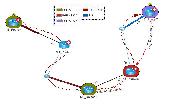
NetBrain Map Edition Lite is a free software designed to help network professionals to learn network skills easier and faster. For instance, you can use this software to document your learning process toward CCIE, CCNP or CCNA with a data-driven Map. Using NetBrain Map Edition Lite, dynamic network diagrams can be created instantly in many different ways. For example, you...
Category: Internet / News Applications
Publisher: NetBrain Technologies,Inc., License: Freeware, Price: USD $0.00, File Size: 53.0 MB
Platform: Windows