Free Downloads: Geographic Coordinates
License: All | Free
DIVA-GIS is a free computer program for mapping and Geographic data analysis (a Geographic information system (GIS). With DIVA-GIS you can make maps of the world, or of a very small area, using, for example, state boundaries, rivers, a satellite image, and the locations of sites where an animal species was observed.
Category: Business & Finance / Applications
Publisher: diva-gis, License: Freeware, Price: USD $0.00, File Size: 3.8 MB
Platform: Windows
The OSTN02 extension for ArcPad is a FREE tool that automatically transforms GPS data and aligns it with Ordnance Survey (OS) background map. This easy-to-use extension removes the need to manually post-process GPS data by providing’ on the fly’ transformation of WGS84 latitude and longitude into OSTN02 corrected British National Grid coordinate. Data capture using GPS and ArcPad is...
Category: Home & Education / Miscellaneous
Publisher: ESRI (UK) Ltd, License: Freeware, Price: USD $0.00, File Size: 8.0 MB
Platform: Windows
DXF2XYZ converts a DXF file to an XYZ file, ie a comma delimited text file containing just xyz Coordinates. It can be useful for extracting the raw XYZ Coordinates from a DXF file containing say contours or other elevation entities.
This utility it limited to extracting the XYZ Coordinates from the following DXF entity types:
POINT, LINE, POLYLINE /...
Category: Business & Finance / Calculators
Publisher: H. Wind, License: Freeware, Price: USD $0.00, File Size: 657.6 KB
Platform: Windows
GeoSurveillance is software that combines spatial statistical routines with some basic Geographic Information Systems (GIS) functions to carry out retrospective and prospective statistical tests for the detection of Geographic clustering. In this software, the focus is primarily on the spatial statistical analysis. Consequently, full GIS functionality is not provided. GIS...
Category: Home & Education / Miscellaneous
Publisher: NCGIA, License: Freeware, Price: USD $0.00, File Size: 2.4 MB
Platform: Windows
OrbisGIS is a Geographic Information System developped for and by research.
OrbisGIS is a Geographic Information System developped for and by research. This cross-platform GIS is developed by French IRSTV institute and is able to manipulate and create vectorial and raster spatial data. OrbisGIS is distributed under GPL 3 license.
Category: Home & Education / Miscellaneous
Publisher: Free Software Foundation, Inc., License: Freeware, Price: USD $0.00, File Size: 15.4 MB
Platform: Windows
GoArrow displays an arrow on your screen that points towards coordinates that you specify.
GoArrow displays an arrow on your screen that points towards Coordinates that you specify. This is very handy if you have to run to Coordinates with obstacles in the way (like mountains), or if you're just directionally-challenged.
GoArrow has the ability to find a route between any two locations in Dereth, as well as look up locations' details from either the...
Category: Home & Education / Miscellaneous
Publisher: Digero of Leafcull, License: Freeware, Price: USD $0.00, File Size: 7.7 MB
Platform: Windows
Korti is a Google Earth plugin which allows you to see the unique 3D satellite map of Korti within your Google Earth application.
Korti provides you a detailed satellite imagery and Geographic information about this Geographic place.
To have Korti installed on your PC, first install for free Google Earth and then Korti 3D map plugin. After that, simply double click...
Category: Multimedia & Design / Multimedia App's
Publisher: Maplandia, License: Freeware, Price: USD $0.00, File Size: 309 B
Platform: Windows
Do you have coordinates for some places of interest?
Do you have Coordinates for some places of interest? Do you want to find them on Earth's surface? There are more than 2,000 coordinate systems available to make Google Earth follow your interests! Plex.Mark! simply placemarks your world!
Have you found a place in Google Earth and you would like to have the Coordinates in your coordinate system? Plex.Mark! will now make...
Category: Internet / Browser Accessories
Publisher: Plexscape, License: Freeware, Price: USD $0.00, File Size: 601.9 KB
Platform: Windows
Get a full 3D satellite map view of El Petacon on your PC.
Get a full 3D satellite map view of El Petacon on your PC. If you have already installed Google Earth, you will be able to view the El Petacón 3D map. You will enjoy a beautiful view of this Geographic place and you will have the world's Geographic information at your fingertips.
Category: Home & Education / Miscellaneous
Publisher: Maplandia, License: Freeware, Price: USD $0.00, File Size: 331 B
Platform: Windows
This program calculates the location of almost any tipe of locator.
This program calculates the location of almost any tipe of locator. It also calculates the distance, azimuth, longitude and latitude betweent two locators. The software converts latitude/longitude Coordinates to Maidenhead locators and vice versa. It converts IARU locator and longitude/latitude Coordinates ti UI-View format Coordinates.
Category: Home & Education / Miscellaneous
Publisher: ON6MU Group, License: Freeware, Price: USD $0.00, File Size: 367.8 KB
Platform: Windows
gvSIG Desktop is a powerful Geographic information system (GIS) designed to offer a free solution to all needs related to Geographic information management. It is characterized as a comprehensive, easy to use solution, it adapts to the needs of any GIS user. Access to the most common formats, both vector and raster, both local and remote is possible. It integrates with OGC...
Category: Multimedia & Design / Multimedia App's
Publisher: gvSIG Association, License: Freeware, Price: USD $0.00, File Size: 149.5 MB
Platform: Windows
Amazing photos, the most successful, incredible views and precise focuses.
Amazing photos, the most successful, incredible views and precise focuses. There?s no need to tell a lot about the quality of National Geographic?s pictures.
Category: Desktop Enhancements / Screensavers
Publisher: 3d-screensaver-jam.com, License: Freeware, Price: USD $0.00, File Size: 3.4 MB
Platform: Windows, Mac, Vista, 2008
The Balloon Browser recognizes and highlights geo-coordinates in web pages.
The Balloon Browser recognizes and highlights geo-Coordinates in web pages. Hovering over a recognized location advises another application to show a map of the corresponding area. For now the only program Balloon Browser can interact with is Google Earth.
Instead of waiting for the one true geo-notation and markup standard, Balloon Browser tries to parse a variety of common...
Category: Internet / Browsers
Publisher: Michael Krause, License: Freeware, Price: USD $0.00, File Size: 5.6 MB
Platform: Windows
An incredibly easy app to watch and listen to your favorite video and music from around the world without annoying Geographic restrictions. Its interface is designed in an easy manner and also when you register you get 500 MB traffic as a free plan. It is easy to install and use.
Category: Audio / Utilities & Plug-Ins
Publisher: TunnelBear, License: Freeware, Price: USD $0.00, File Size: 13.1 MB
Platform: Windows
Track your websites growth and forecast internet trends with integrated features like Geographic reporting, and enhanced data mining. SmarterStats 3.x is the perfect solution for individuals, small businesses, and hosting companies who are looking for an enterprise-level web analytics application without the inflated price.
Category: Web Authoring / Web Design Utilities
Publisher: SmarterTools Inc., License: Freeware, Price: USD $0.00, File Size: 8.8 MB
Platform: Windows
In TruView, users can extract real 3D coordinates and accurately measure distances.
In TruView, users can extract real 3D Coordinates and accurately measure distances. Results appear right on the point cloud image. Markups are also easy to create, save and share with your peers, your service provider, or with clients for more effective communications.
Category: Audio / Utilities & Plug-Ins
Publisher: Leica Geosystems, License: Freeware, Price: USD $0.00, File Size: 7.9 MB
Platform: Windows
The Orbit Visualization Tool (OVT) is a software for visualization of satellite orbits in the Earth's magnetic field. The program can display satellite orbits in five coordinate systems (GEI, GEO, GSM, SMC, GSE), satellite footprints projected on the Earth's surface and shown in either Geographic (GEO) or geomagnetic (SMC) Coordinates. In addition to satellite orbits the...
Category: Home & Education / Astrology & Numerology
Publisher: OVT Team, License: Freeware, Price: USD $0.00, File Size: 0
Platform: Windows
Free automated mouse clicking on your screen by Coordinates or wherever you decide to leave your mouse. Also includes a screen coordinate finder.
Category: Desktop Enhancements / Misc. Themes
Publisher: Mofiki Software, License: Freeware, Price: USD $0.00, File Size: 1.0 MB
Platform: Windows
Aten is a tool to create, edit, and visualise coordinates.
Aten is a tool to create, edit, and visualise Coordinates. It was written primarily to be of use to people performing simulations of condensed matter, but it may very well be useful to others out there dealing with non-periodic systems.
In brief, Aten can:
Provide a GUI for editing atomic Coordinates
Create models, even periodic ones, from...
Category: Software Development / Misc. Programming
Publisher: T Youngs, License: Freeware, Price: USD $0.00, File Size: 5.6 MB
Platform: Windows
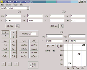
Calc 3D is a collection of mathematical tools for highschool and university. The calculator can do statistics, best fits, function plotting, integration. It handles vectors, matrices, complex numbers, Coordinates, regular polygons and intersections. For objects ( like point, line, plane and sphere) distances and intersections are calculated. Cartesian, spherical and cylindrical...
Category: Home & Education
Publisher: Greuer Andreas, License: Freeware, Price: USD $0.00, File Size: 4.1 MB
Platform: Windows
 Freeware
Arm Map Explorer recreates all the functionalities of Google Maps on your desktop while expanding them with new extras. Map Explorer lets you locate and view any place on the planet using dynamic interactive maps. These maps are draggable, which means there is no need for you to click and wait for graphics to reload each time you want to view adjacent parts of a map. Basically, viewing...
Category: Internet / Flash Tools
Publisher: ArmCode, License: Freeware, Price: USD $0.00, File Size: 5.5 MB
Platform: Windows

IPSearchLight is a software component used to identify the Geographic location of website visitors, often within a few miles from the exact location. The process utilizes each visitor's IP address; this technique is silent and unintrusive. IPSearchLight is ideal for practical applications like the delivery of localized content, targeted advertising, multi-lingual websites, e-commerce...
Category: Software Development
Publisher: IPSearchLight, License: Freeware, Price: USD $0.00, File Size: 8.5 MB
Platform: Windows
Geographic databases management and exploitation, attribute-based and spatial queries, several join types, several classification methods, thematic cartography, statistics and geo-statistics, spatial analysis, interpolations, digital elevation models, remote-sensing and image processing, simulation, operational research, interactive metric measurements
Category: Home & Education / Miscellaneous
Publisher: IRD, License: Freeware, Price: USD $0.00, File Size: 14.2 MB
Platform: Windows

IPSearchLight for ASP Classic gives you real-time feedback on the Geographic location of website visitors by their IP address alone. The technology is completely uninvasive, yet can often track a person's location to a few miles radius on the planet. Some potential IPSearchLight uses: Localization of website language, content and currency. Targeted advertising. Preventing...
Category: Internet
Publisher: IPSearchLight, License: Freeware, Price: USD $0.00, File Size: 8.8 MB
Platform: Windows
Standard Features:
Category: Business & Finance / Database Management
-Look-up of US call signs
-Wild card searches on US call signs
-US zipcode database current as of Dec 2009
-Manual and automatic download of Master FCC Database
-Mini Internet Callsign Server
-Geographic Coordinates computed based on zip code
-Display of Ten-Ten and VP numbers
-Lookup of Ten-Ten and VP numbers
Publisher: Steinkamp Software Solutions, License: Freeware, Price: USD $0.00, File Size: 1.7 MB
Platform: Windows
The ArcGIS Editor for OpenStreetMap is designed to help ArcGIS Desktop users to become active members in the growing community of users building an open and freely available database of Geographic data.
The provided tools allow you to download data from the OSM servers and store it locally in a geodatabase. You can then use the familiar editing environment of ArcGIS Desktop...
Category: Business & Finance / Business Finance
Publisher: ESRI, License: Freeware, Price: USD $0.00, File Size: 3.6 MB
Platform: Windows

New Zealand is notable for its Geographic isolation and extraordinary fauna and flora. Due to the low population New Zealand still looks like the unpolluted paradise with clear shores, crisp waters, pure white snow and lush green foliage. The New Zealand Voyage Free screensaver shows you the amazing views of differrent urban and rural corners of the country. This screensaver will help...
Category: Desktop Enhancements / Screensavers
Publisher: Savers4Free.com, License: Freeware, Price: USD $0.00, File Size: 5.1 MB
Platform: Windows
The Geospatial Toolkit (GsT) is an NREL-developed map-based software application that integrates resource data and other Geographic information systems (GIS) data for integrated resource assessment. The non-resource, country-specific data for each GsT comes from a variety of agencies within each country as well as from global datasets.
Category: Home & Education / Miscellaneous
Publisher: National Renewable Energy Laboratory, License: Freeware, Price: USD $0.00, File Size: 39.6 MB
Platform: Windows
HEC-EFM analyses involve: 1) statistical analyses of relationships between hydrology and ecology, 2) hydraulic modeling, and 3) use of Geographic Information Systems (GIS) to display results and other relevant spatial data.
Most features in the main interface of HEC-EFM focus on the first step in this process (statistical analyses). The main interface has four tabs: Properties,...
Category: Home & Education / Miscellaneous
Publisher: Hydrologic Engineering Center, License: Freeware, Price: USD $0.00, File Size: 9.0 MB
Platform: Windows
IPSearchLight (www.ipsearchlight.com) for ASP.NET gives you real-time feedback on the Geographic location of website visitors by their IP address alone. The technology is completely unintrusive, yet can often track a person's location to a few miles radius on the planet. Some potential uses: - Localization of website language, content and currency. - Targeted advertising. -...
Category: Internet
Publisher: IPSearchLight, License: Freeware, Price: USD $0.00, File Size: 8.5 MB
Platform: Windows
Freeware
With this tool you can add GPS Coordinates to vCards - elektronic business cards - that you have previously exported from e. g. Microsoft Outlook. Therefore the tool uses the address data contained within the vCards and adds the exact GPS position on that basis to the vCard. This way you can use these vCards for example in compatible car navigation systems. Among others...
Category: Home & Education / Home Inventory
Publisher: AB-Tools.com, License: Freeware, Price: USD $0.00, File Size: 1.9 MB
Platform: Windows
Astro Helper will tell you the angle of elevation above the horizon (altitude) and the direction in degrees from North (Azimuth) of the selected objects. It will simultaneously display the Coordinates of 22 objects from a database of over 22,000 objects. With these Coordinates you can point your Dobsonian mounted telescope or other "Alt/Az" mounted scope. If you have an...
Category: Home & Education / Astrology & Numerology
Publisher: Mark Casazza Consulting, License: Freeware, Price: USD $0.00, File Size: 3.3 MB
Platform: Windows
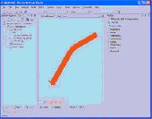
Archim is a program for drawing the graphs of all kinds of functions. You can define a graph explicitly and parametrically, in polar and spherical Coordinates, on a plane and in space (surface). Archim will be useful for teachers and students, as well as for everyone who is interested min geometry. With Archim, you will draw the graph of any function and form, just use your imagination....
Category: Home & Education
Publisher: Stochastic Lab, License: Freeware, Price: USD $0.00, File Size: 479.6 KB
Platform: Windows
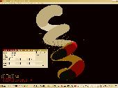
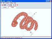
Displays lines and surfaces defined algebraically in 3D space in many forms, including z=f(x,y), cylindrical polar Coordinates, and parametric definitions with one (giving a line) and two (surface) parameters. View controls move the viewpoint through 3D space, using keyboard and mouse. There are options to display a surface, a mesh or a combination. The number of 'steps' on each edge...
Category: Home & Education / Mathematics
Publisher: Walter Milner, License: Freeware, Price: USD $0.00, File Size: 962.0 KB
Platform: Windows
Mapyrus is software to plot Geographic Information System data, plots of points, lines, polygons and labels to PostScript (high resolution, up to A0 paper size), Portable Document Format (PDF), Scalable Vector Graphics (SVG) format and web image output fo
Category: Home & Education / Miscellaneous
Publisher: mapyrus.sourceforge.net, License: Freeware, Price: USD $0.00, File Size: 2.7 MB
Platform: Windows, Mac, Vista
SkySolve it is an application which is supplied an image and with no prior knowledge of where in the sky it was taken, it uses a star pattern matching algorithm and reference database to locate the correct image Coordinates. This makes it especially useful for remote imaging observatories, where the mount pointing may become incorrect. The remote operator can simply take an image...
Category: Software Development / Help File Utilities
Publisher: John Winfield, License: Freeware, Price: USD $0.00, File Size: 371.6 KB
Platform: Windows
Never again forget which picture belongs to which place.
Never again forget which picture belongs to which place. Picopolo, the innovative software for travel and GPS, not only organises digital images but also links them to the exact place where they were taken and assigns them to own or provided maps. Coordinates can be allocated either manually or via direct data upload from GPS receivers. Picopolo easily integrates recorded routes or...
Category: Multimedia & Design / Media Catalogers
Publisher: GDMcom mbH, License: Freeware, Price: USD $0.00, File Size: 61.6 MB
Platform: Windows
World Wind is a collection of components that interactively display 3D Geographic information within Java applications or applets. Applications and applets use World Wind by placing one or more WorldWindow components in their user interface. The World Wind components are extensible. The API is defined primarily by interfaces, so components can be selectively replaced by alternative...
Category: Multimedia & Design / Graphics Viewers
Publisher: NASA, License: Freeware, Price: USD $0.00, File Size: 73.5 MB
Platform: Windows
With this FREE AutoCAD add-on you can create terrain sections
from geodetic points(heights) in the drawing. You can also
specify position of pipe(cable, road, ...) or set auxiliary
marks in the section.
Text settings, scale in X,Y axis, height of the reference
plane and type of the terrain section can be set at start-up.
There are two ways how you can create terrain...
Category: Multimedia & Design / Multimedia App's
Publisher: Cadhedral, License: Freeware, Price: USD $0.00, File Size: 69.0 KB
Platform: Windows
Freeware
GPS Converter will convert GPS coordinates between three different formats: 34. 26965, -116.
76783; N 34° 16. 179', W 116° 46. 07'; and N 34° 16' 10.
Category: Home & Education / Sports
Publisher: ALMSys, Inc., License: Freeware, Price: USD $0.00, File Size: 929.9 KB
Platform: Windows
With Bibaz you can sort your book in many categories.
With Bibaz you can sort your book in many categories. Now you can manage all your books in your library or pdf-formats so easy with the help of this software. You can categorize into many different subjects of interest like : dictionaries, cuisine books,magazines, historical books, Geographic and so on.
Category: Home & Education / Hobbies
Publisher: Jmgr, License: Freeware, Price: USD $0.00, File Size: 558.4 KB
Platform: Windows
Immageo is all about making your photos as memorable as when you took them, by geotagging each photo. Immageo is a truly exciting example of what you can and should do with your photo collections. Its more than an album organiser, it embeds map locations and notes into your photos. And when you come to review them Immageo displays them all in context of when and where in the Immageo map,...
Category: Multimedia & Design / Media Catalogers
Publisher: Immageo, License: Freeware, Price: USD $0.00, File Size: 11.0 MB
Platform: Windows
PHOTOMOD GeoCalculator is the software for points Coordinates transformation, included in the PHOTOMOD system, as well as a stand-alone free application.
Its installation package includes databases of reference systems used in the world and in Russia (approximately 1500 reference systems). User can also add reference systems on his own by specifying:
-units...
Category: Business & Finance / Applications
Publisher: Racurs, License: Freeware, Price: USD $0.00, File Size: 7.6 MB
Platform: Windows
The Grid InQuest software provides a means for transforming Coordinates between ETRS89 (WGS84) and the National coordinate systems of Great Britain, Northern Ireland and the Republic of Ireland. It provides a fully three dimensional transformation incorporating the latest geoid model and is the nationally recognised software for performing these conversions.
In conjunction...
Category: Home & Education / Miscellaneous
Publisher: Quest Geo Solutions Ltd, License: Freeware, Price: USD $0.00, File Size: 0
Platform: Windows
faceAPI provides a suite of image-processing modules created specifically for tracking and understanding faces and facial features. These powerful tracking modules are combined into a complete API toolkit that delivers a rich stream of information that you can incorporate into your own products or services.
Main features:
- Highly robust, real-time, automatic monocular 3D face...
Category: Multimedia & Design / Multimedia App's
Publisher: Seeing Machines, License: Freeware, Price: USD $0.00, File Size: 152.0 MB
Platform: Windows
Microsoft Mathematics Add-in for Word and OneNote makes it easy to plot graphs in 2D and 3D, calculate numerical results, solve equations or inequalities, and simplify algebraic expressions in your Word documents and OneNote notebooks.
The Microsoft Mathematics Add-in can help you with the following tasks:
Compute standard mathematical functions, such as roots and...
Category: Home & Education / Mathematics
Publisher: Microsoft, License: Freeware, Price: USD $0.00, File Size: 6.6 MB
Platform: Windows
CopanMobile for Palm OS is a very functional and easy-to-use geomatics engineering tool for computing and managing plane surveying and mapping Coordinates. It does numerous coordinate geometry (COGO) calculations, processes and adjusts raw field survey data, computes and adjusts map traverse data, performs map or deed checks, calculates curves, areas and perimeters, performs coordinate...
Category: Multimedia & Design / Multimedia App's
Publisher: Underhill Geomatics Ltd., License: Freeware, Price: USD $0.00, File Size: 341.0 KB
Platform: Palm
Plot Digitizer is a great piece of software developed by Joseph A.
Plot Digitizer is a great piece of software developed by Joseph A. Huwaldt. The main goal of the program is to extract information from two-dimensional plots or graphs. It is very common to find information the form of a plot or graph, showing the relation between two variables. However, this information will not be useful until data is converted to standard x-y values (table format). Once...
Category: Multimedia & Design / Multimedia App's
Publisher: Joseph A. Huwaldt, License: Freeware, Price: USD $0.00, File Size: 4.4 MB
Platform: Windows
CopanMobile for Pocket PC is a very functional and easy-to-use geomatics engineering tool for computing and managing plane surveying and mapping Coordinates. It does numerous coordinate geometry (COGO) calculations, processes and adjusts raw field survey data, computes and adjusts map traverse data, performs map or deed checks, calculates curves, areas and perimeters, performs coordinate...
Category: Business & Finance / Applications
Publisher: Underhill Geomatics Ltd., License: Freeware, Price: USD $0.00, File Size: 341.0 KB
Platform: Windows
TerraExplorer allows users to shape their own digital world.
TerraExplorer allows users to shape their own digital world.
By editing and annotating geo-referenced 3D terrain databases created through TerraBuilder, users can customize the experience to highlight specific Geographic content. By overlaying unique or proprietary information onto a 3D map, the user creates an exciting, interactive application that can highlight specific...
Category: Home & Education / Miscellaneous
Publisher: Skyline Software Systems, Inc., License: Freeware, Price: USD $0.00, File Size: 29.5 MB
Platform: Windows