Free Downloads: Gis Service Data
License: All | Free
AvisMap Gis Engine is the basic development platform for AvisMap Gis suites, which is a new generation component Gis development platform for Gis application developers. AvisMap Gis Engine 5 provides powerful Gis functions through Active X controls based on Microsoft COM component technique standards. It allows users to rapidly develop professional...
Category: Multimedia & Design / Multimedia App's
Publisher: AvisMap GIS Technologies, License: Freeware, Price: USD $0.00, File Size: 60.5 MB
Platform: Windows
DIVA-GIS is a GIS for plant biodiversity analysis.
DIVA-Gis is a Gis for plant biodiversity analysis. The project will modernize the architecture for better collaboration and extensibility based on Eclipse RCP.
DIVA-Gis can be used to map and analyze biological distribution Data, such as can be provided by natural history collections and genetic resources collections. Typically, the distribution Data...
Category: Business & Finance / Business Finance
Publisher: International Potato Center (CIP), License: Freeware, Price: USD $0.00, File Size: 122.4 MB
Platform: Windows
DIVA-Gis is a free computer program for mapping and geographic Data analysis (a geographic information system (Gis). With DIVA-Gis you can make maps of the world, or of a very small area, using, for example, state boundaries, rivers, a satellite image, and the locations of sites where an animal species was observed.
Category: Business & Finance / Applications
Publisher: diva-gis, License: Freeware, Price: USD $0.00, File Size: 3.8 MB
Platform: Windows
ArcGIS Explorer Desktop is a free Gis viewer that gives you an easy way to explore, visualize, and share Gis information. ArcGIS Explorer adds value to any Gis because it helps you deliver your authoritative Data to a broad audience.
Easy and intuitive to use it's easy for anyone to begin working with ArcGIS Explorer, with its intuitive and easy to...
Category: Home & Education / Miscellaneous
Publisher: Environmental Systems Research Institute, Inc., License: Freeware, Price: USD $0.00, File Size: 100.5 MB
Platform: Windows
 Freeware
VSceneGIS Desktop. (Gis) Analysis, Computing and Editing. Customer Project Development, Analysis, Computing and Gis editing. VSceneGIS Desktop applies the concept of Tree and Graph Topology to implement the Data model in a Gis. Validation, Editing and Topological Behavior Export and import of Data sources: PostgreSQL / PostGIS, Oracle, MySQL, SQLite /...
Category: Home & Education / Science
Publisher: vscenegis.com, License: Freeware, Price: USD $0.00, File Size: 118.4 MB
Platform: Windows
So that you can identify the Mapping & Gis product that best suits your needs, use this simple Product Comparison. There are four main product types that you can use to create a GPS Data collection and maintenance system, or mobile Gis solution. Use the links below to select a product group, and compare the features of each product within that group.
Category: Internet / Communications
Publisher: Trimble Navigation Limited, License: Freeware, Price: USD $0.00, File Size: 2.7 MB
Platform: Windows
The Quantum GIS Tethys repository contains a lot of software from OSGeo projects.
The Quantum Gis Tethys repository contains a lot of software from OSGeo projects. Quantum Gis Tethys and all dependencies are included, along with Python, GRASS, GDAL, etc. This is most suitable for people who want to be able to update dependencies from the Quantum Gis Tethys repository easily. The installer is able to install from internet or just download all needed...
Category: Multimedia & Design / Graphics Viewers
Publisher: QGIS Development Team, License: Freeware, Price: USD $0.00, File Size: 369.0 KB
Platform: Windows
AccuGlobe Desktop 2007,a standardized platform for delivering solutions to the global Gis community, offers even more of what you demand in a desktop Gis application. Combining user-friendly design with significantly increased functionality, AccuGlobe Desktop 2007 gives you greater freedom in analyzing spatial Data. In addition to functioning as the core engine behind many...
Category: Multimedia & Design / Multimedia App's
Publisher: Digital Data Technologies, Inc., License: Freeware, Price: USD $0.00, File Size: 9.8 MB
Platform: Windows
NexGeo Office™ provides all of the functionality needed to organize a Data collection project and manage Data collected from Nexteq GPS/Gis handhelds. It provides tools for viewing, editing and exporting Data to a format suitable for your existing Gis and CAD infrastructure.
Category: Multimedia & Design / Image Editing
Publisher: Nexteq Navigation, License: Freeware, Price: USD $0.00, File Size: 7.4 MB
Platform: Windows
GeoMedia Viewer is an easy to use, FREE Gis software application for desktop viewing and distribution of geospatial Data.It allows an organization to maximize the value of its geospatial Data by extending availability to novice users who wouldn’t otherwise have access because of the barriers of purchasing and learning how to use a full Gis software application.
Category: Multimedia & Design / Graphics Viewers
Publisher: Intergraph Corporation, License: Freeware, Price: USD $0.00, File Size: 115.0 MB
Platform: Windows
SuperGIS DataConvertor is a powerful Data conversion tool which is able to convert files between the common Gis formats to the SuperGeo self-defined formats. Therefore, your Data can be used in SuperGeo series products, and also the SuperGeo self-defined formats can be used in other related platforms or systems. You will no longer need to worry the compatibility of...
Category: Business & Finance / Calculators
Publisher: SuperGeo, License: Freeware, Price: USD $0.00, File Size: 3.2 MB
Platform: Windows
Quantum Gis provides a continously growing number of capabilities provided by core functions and plugins. You can visualize, manage, edit, analyse Data, and compose printable maps. QGIS is an official project of the Open Source Geospatial Foundation (OSGeo). It runs on Linux, Unix, Mac OSX, and Windows and supports numerous vector, raster, and database formats and functionalities.
Category: Home & Education / Miscellaneous
Publisher: qgis.org, License: Freeware, Price: USD $0.00, File Size: 92.2 MB
Platform: Windows
ArcGIS Explorer is a free, downloadable Gis viewer that gives you an easy way to explore, visualize and share Gis information. ArcGIS Explorer adds value to any Gis because it helps you deliver your authoritative Data to a broad audience.
The ArcGIS Explorer Desktop Current User setup is intended for users who do not have administrator access on their...
Category: Desktop Enhancements / Shell & Desktop Managers
Publisher: Environmental Systems Research Institute, Inc., License: Freeware, Price: USD $0.00, File Size: 94.0 MB
Platform: Windows
Cityvu is a 3D GIS data viewer able to load CityGML data format from any compatible data source.
Cityvu is a 3D Gis Data viewer able to load CityGML Data format from any compatible Data source.
Cityvu features 3D hardware rendering using OpenGL with a complete navigation system that allows automated tour of the rendered scene. It has been designed to be used to develop customized software solutions, built on the specific needs. Cityvu supports in...
Category: Multimedia & Design / Graphics Viewers
Publisher: 3D GIS Cityvu, License: Freeware, Price: USD $0.00, File Size: 9.9 MB
Platform: Windows
GeoSurveillance is software that combines spatial statistical routines with some basic Geographic Information Systems (Gis) functions to carry out retrospective and prospective statistical tests for the detection of geographic clustering. In this software, the focus is primarily on the spatial statistical analysis. Consequently, full Gis functionality is not provided. Gis...
Category: Home & Education / Miscellaneous
Publisher: NCGIA, License: Freeware, Price: USD $0.00, File Size: 2.4 MB
Platform: Windows
With MapAuthor you can create, print and save desktop maps, using Data that you obtain from commercial sources or perhaps your in-hous Gis department as shapefiles (shapefiles are a very common Gis exchange format.) You can also produce internet-based maps based on Google Maps, for use on your web site.
MapAuthor allows you to link your own Data to maps, for...
Category: Internet / Misc. Plugins
Publisher: MapAuthor.com, License: Freeware, Price: USD $0.00, File Size: 6.3 MB
Platform: Windows
GenesisIV understands GIS concepts like layers, shape objects and georeferencing.
GenesisIV understands Gis concepts like layers, shape objects and georeferencing. It interfaces to industry standard Gis systems such as MapInfo and ArcView so you can use your existing Data without having to learn new concepts or perform difficult manipulations.
GenesisIV is the only landscape product designed specifically to help teach geographical concepts....
Category: Multimedia & Design / Multimedia App's
Publisher: Geomantics, License: Freeware, Price: USD $0.00, File Size: 17.6 MB
Platform: Windows
Freeware
Convert ESRI ShapeFiles (.SHP) geolocation Data into AnyMap format to be used with AnyChart. AnyChart Flash Map Converter allows making use of a wide choice of maps with AnyChart Flash Component, a Gis visualization system that recognizes map Data in AnyMap format only. AnyChart Flash Map Converter makes it easy to visualize any geolocation Data without hefty...
Category: Web Authoring / Image Mapping Tools
Publisher: AnyChart.Com, License: Freeware, Price: USD $0.00, File Size: 1.6 MB
Platform: Windows
AutoDEM (aka as AutoMNT) is a freeware Gis software to create Digital Elevation Models (DEM) from scanned topographic maps for Windows.
Through different Data layers (map, contours, DEM, etc.), AutoDEM provides many tools for :
-Topographic map analysis
-Contour lines extraction and reconstruction
-Contours to DEM interpolation and DEM analysis
-DEM...
Category: Multimedia & Design / Animation
Publisher: Joachim Pouderoux, License: Freeware, Price: USD $0.00, File Size: 27.6 MB
Platform: Windows

The free AvisMap Viewer opens most Gis/CAD and raster image file types and most ArcView, ArcExplorer, and MapInfo projects. Besides just opening and viewing files, the Viewer supports an extensive list of features including visual layer properties control, legend control, thematic mapping, spatial and attribute querying, custom labeling, on-map measurements, hyper-linking, PDF export...
Category: Software Development / Components & Libraries
Publisher: AvisMap GIS Technologies, License: Freeware, Price: USD $0.00, File Size: 22.3 MB
Platform: Windows
DNRGarmin is a smart tool used to directly transfer Data between Garmin GPS handheld receivers and various Gis software packages.
DNRGarmin was built to provide users the ability to directly transfer Data between Garmin GPS handheld receivers and various Gis software packages. Using DNRGarmin a user can use point features (graphics or shapefile) and...
Category: Utilities / Misc. Utilities
Publisher: GIS Section, Minnesota Department of Natural Resources, License: Freeware, Price: USD $0.00, File Size: 11.3 MB
Platform: Windows
Use this software option to differentially post-process raw GPS Data collected with the Ashtech MobileMapper Field software. Through post-processing, the positions of every Gis feature you collect in the field can be improved to sub meter (< 1m) accuracy. Create and update maps for analysis and maintenance in a standard Gis system.
Category: Business & Finance / Business Finance
Publisher: Magellan, License: Freeware, Price: USD $0.00, File Size: 119.2 MB
Platform: Windows
The MapSys Cadastral Gis offers specialized functionality for each stage of processing including the digital map creation, plotting cadastral and topographical plans, generating and combining geo-referenced Data in order to obtain a validated relational geo-database. This can be used in MapSys or in other Gis programs or database application.
Category: Home & Education / Teaching Tools
Publisher: GEOTOP, License: Freeware, Price: USD $0.00, File Size: 143.9 MB
Platform: Windows
GeoBase is a high performance OEM tool for embedding Gis functions in client and server applications. GeoBase has a small memory footprint - both on the hard disk for storage and in RAM during use. Compatible with both .NET and Linux, GeoBase is designed for a rapid development cycle and low deployment cost. The Map Engine displays rich, detailed maps for use in server or client...
Category: Software Development / Compilers & Interpreters
Publisher: Telogis, License: Freeware, Price: USD $0.00, File Size: 87.0 MB
Platform: Windows
The Microdrone Airborne Mapping extension to Orbit Gis provides the tools required for automated flight and high precision mapping. It contains a Waypoint Generator, a Microdrone in-flight tracker, and a captation tool. Further image-, stereoprocessing and orthorectification can be executed using the Strabo Photogrammetry extension to Orbit Gis.
Category: Multimedia & Design / Multimedia App's
Publisher: Orbit GeoSpatial Technologies, License: Freeware, Price: USD $0.00, File Size: 30.0 MB
Platform: Windows
The Geospatial Toolkit (GsT) is an NREL-developed map-based software application that integrates resource Data and other geographic information systems (Gis) Data for integrated resource assessment. The non-resource, country-specific Data for each GsT comes from a variety of agencies within each country as well as from global datasets.
Category: Home & Education / Miscellaneous
Publisher: National Renewable Energy Laboratory, License: Freeware, Price: USD $0.00, File Size: 39.6 MB
Platform: Windows
The MapInfo License Server must be installed on your network and be accessible to all MapInfo Professional users. MapInfo Professional is a powerful Microsoft Windows-based mapping and geographic analysis application from the experts in location intelligence. Designed to easily visualize the relationships between Data and geography, MapInfo Professional helps business analysts, planners,...
Category: Home & Education / Miscellaneous
Publisher: Pitney Bowes MapInfo, License: Freeware, Price: USD $0.00, File Size: 12.1 MB
Platform: Windows
spatialSQL help contains a detailed description of solutions to some common GIS problems.
spatialSQL help contains a detailed description of solutions to some common Gis problems.
The interface provides a simple mechanism for selecting tables, spatialSQL operators, where clause, distance and other qualifiers and update operators. See the description of features and benefits.
Category: Software Development / Misc. Programming
Publisher: Spatial Projects, License: Freeware, Price: USD $0.00, File Size: 7.6 MB
Platform: Windows
Whether you need accurate Data for Gis applications or visual simulation applications, GeoGenesis provides you the ability to exploit commercial satellite or aerial imagery to meet your requirements. For aerial or satellite imagery, GeoGenesis provides advanced automated tie point extraction to geospatially link multiple images together. Using our bundle adjustment algorithm you...
Category: Home & Education / Miscellaneous
Publisher: IAVO Research And Scientific, License: Freeware, Price: USD $0.00, File Size: 73.9 MB
Platform: Windows
The cloud drive storage service is a cloud data storage gateway.
The cloud drive storage Service is a cloud Data storage gateway. The Service runs on on a PC or server allowing you to access cloud storage just like a hard drive or file server. The Service improves cloud Data performance by up to 100 times, in most cases it out performs hard drives, file servers and SAN's.
The Service intelligently...
Category: Business & Finance / Business Finance
Publisher: Bruce Street Pty Ltd, License: Freeware, Price: USD $0.00, File Size: 4.6 MB
Platform: Windows
Freeware
Qvu Data Service is a wysiwyg report design, ad-hoc query and api Data Service design tool that allows users to create and save query designs in a user-friendly, web-based UI. Qvu Data Service provides REST API endpoints for users and applications to execute saved query documents and return results in tabular or json formatted result sets. Qvu...
Category: Business & Finance / Database Management
Publisher: rbtdesign, License: Freeware, Price: USD $0.00, File Size: 84.8 MB
Platform: Windows, Mac, Linux,
gvSIG project is a free and open source Geoinformation System (Gis), that enables users to interactively visualize, manage, modify and analyze spatial information in the form of digital maps, images and database tables. It is easy to learn, yet versatile and efficient enough for demanding Gis tasks.
Category: Multimedia & Design / Multimedia App's
Publisher: Oxford Archaeology Digital, License: Freeware, Price: USD $0.00, File Size: 273.0 MB
Platform: Windows
Shape2Earth Globe lets you quickly and easily capture Google Earth images for your personal use.
Shape2Earth Globe lets you quickly and easily capture Google Earth images for your personal use. Capture images for use in popular applications like Microsoft Office and ESRI's ArcMap.
Shape2Earth Globe also saves the bounding box of the image in a kml file. This Data is then used to generate a world file and projection file so that your image can be loaded into a Gis,...
Category: Multimedia & Design / Multimedia App's
Publisher: Shape2Earth, License: Freeware, Price: USD $0.00, File Size: 402.5 KB
Platform: Windows
The Mapping and Gis License Manager software allows you to manage multiple licenses for the GPS Pathfinder Office software. Using the GPS Pathfinder Office License Administrator software, users of the GPS Pathfinder Office software can choose either a single use or a floating license.
Category: Business & Finance / Business Finance
Publisher: Trimble, License: Freeware, Price: USD $0.00, File Size: 26.8 MB
Platform: Windows
PlanetGIS Explorer is a free viewer for PlanetGIS maps and GIS exchange files.
PlanetGIS Explorer is a free viewer for PlanetGIS maps and Gis exchange files. PlanetGIS Explorer allows you to navigate through maps, query map elements and view attribute information from linked database tables. Also PlanetGIS Explorer allows you to customize the appearance of maps for purposes of creating hardcopy printouts, but does not allow you to save any changes to maps.
Category: Multimedia & Design / Graphics Viewers
Publisher: Planet GIS, License: Freeware, Price: USD $0.00, File Size: 5.4 MB
Platform: Windows
The Framework Free Viewer is optional but is provided in case you do not have access to Gis software. The Framework Free Viewer is only useful when when working with Data provided by Framework Archaeology.
The Framework Free Viewer requires 12MB of disk space to install and once installed will take up 6MB of disk space.
Category: Home & Education / Genealogy
Publisher: Framework Archaeology, License: Freeware, Price: USD $0.00, File Size: 4.4 MB
Platform: Windows
gvSIG Desktop is a powerful geographic information system (Gis) designed to offer a free solution to all needs related to geographic information management. It is characterized as a comprehensive, easy to use solution, it adapts to the needs of any Gis user. Access to the most common formats, both vector and raster, both local and remote is possible. It integrates with OGC...
Category: Multimedia & Design / Multimedia App's
Publisher: gvSIG Association, License: Freeware, Price: USD $0.00, File Size: 149.5 MB
Platform: Windows
HEC-EFM analyses involve: 1) statistical analyses of relationships between hydrology and ecology, 2) hydraulic modeling, and 3) use of Geographic Information Systems (Gis) to display results and other relevant spatial Data.
Most features in the main interface of HEC-EFM focus on the first step in this process (statistical analyses). The main interface has four tabs:...
Category: Home & Education / Miscellaneous
Publisher: Hydrologic Engineering Center, License: Freeware, Price: USD $0.00, File Size: 9.0 MB
Platform: Windows

Painting Service Surrey-Canada,painting Service vancouver canadaExterior Painting Service,Painting Decor Service;DMJ Painting Service Canada.DMJ Painting Service In Canada,DMJ Painting Ltd Provides painting Service In Cost Effective Way,Painting Service Like Spray painting,Fence Painting,Hardy Painting In Canada.DMJ Painting Ltd. Also...
Category: Home & Education / Home Inventory
Publisher: DMJ painting Ltd, License: Freeware, Price: USD $0.00, File Size: 3.5 MB
Platform: Windows, Linux, iPhone, Java, MS-DOS, Other
Data Recovery Service is an easy-to-use, windows based CD Data recovery software and DVD Data recovery software. It could recover lost and deleted files from damaged, scratched or defective CD and DVD discs. Data Recovery Service program can recover files recorded by common CD/DVD writing software. It supports Data recovery from all CD and DVD...
Category: Utilities / Backup
Publisher: Spyware Cleaner, License: Freeware, Price: USD $0.00, File Size: 5.0 MB
Platform: Windows
Encom PA provides advanced interactive visualisation in one-, two-, and three-dimensions with support for most geophysical and geological information types used by companies to cover regional exploration through to mine development.
Encom PA is an interactive geophysical interpretation tool for the analysis of Data in point, profile, drillholes, grid, RGB image, remote sensing,...
Category: Multimedia & Design / Graphics Viewers
Publisher: Encom Technology Pty Ltd, License: Freeware, Price: USD $0.00, File Size: 36.5 MB
Platform: Windows
MIST (Management Information System) is a holistic and unified database management system designed to Service protected areas and park management needs.
MIST Gis and MIST Administrator Installation. For single personal computer installations. Does not come with other MIST programs.
Category: Utilities / Misc. Utilities
Publisher: Ecological Software Solutions, License: Freeware, Price: USD $0.00, File Size: 1.8 MB
Platform: Windows

DMJ Painting Service In Canada , DMJ Painting Ltd Provides painting Service In Cost Effective Way,Painting Service Like Spray painting,Fence Painting,Hardy Painting In Canada.DMJ Painting Ltd. Also Provide Paints,Painter Service,Interior,Exterior Painting Service,Commercial Painting Service,Residential Painting Service,Pressure Washing...
Category: Desktop Enhancements / Shell & Desktop Managers
Publisher: DMJ painting Ltd, License: Freeware, Price: USD $0.00, File Size: 3.5 MB
Platform: Windows, Linux, Mac,
Gismaps Viewer is a GIS viewer that can be used for geospatial analysis and map production.
Gismaps Viewer is a Gis viewer that can be used for geospatial analysis and map production.
The main features are:
- read Shape files using geographic coordinate system
- view satellite images (MrSid, jpeg, bmp and tiff file formats)
- generate thematic maps, queries and labels
- export do Google Earth KML (shp2kml)
- configure map colors and...
Category: Multimedia & Design / Graphics Viewers
Publisher: Gismaps Sistemas Ltda., License: Freeware, Price: USD $0.00, File Size: 10.2 MB
Platform: Windows

Exterior Painting Service,Painting Decor Service;DMJ Painting Service Canada.DMJ Painting Service In Canada,DMJ Painting Ltd Provides painting Service In Cost Effective Way,Painting Service Like Spray painting,Fence Painting,Hardy Painting In Canada.DMJ Painting Ltd. Also Provide Paints,Painter Service,Interior,Exterior Painting...
Category: Desktop Enhancements / Shell & Desktop Managers
Publisher: DMJ Painting Ltd., License: Freeware, Price: USD $0.00, File Size: 3.5 MB
Platform: Windows, Linux,
You can use your existing digital (vector) maps in Autodesk MapGuide® software by converting them to Spatial Data Files (SDF). SDF is a special Data format for delivering large amounts of Data quickly over an intranet or the Internet. The SDF Loader is a utility used to create Spatial Data Files (SDF) and their accompanying Spatial Index Files (SIF) from a...
Category: Multimedia & Design / Multimedia App's
Publisher: Autodesk, Inc., License: Freeware, Price: USD $0.00, File Size: 54.6 MB
Platform: Windows
The Biogeography Branch’s Sampling Design Tool for ArcGIS provides users a means to efficiently sample a population, be it people, animals, objects or processes, in a Gis environment. The tool was created for sampling when the population and component sampling units are defined by known dimensions.
The Sampling Design Tool was developed in response to a need by...
Category: Business & Finance / Applications
Publisher: Center for Coastal Monitoring and Assessment, License: Freeware, Price: USD $0.00, File Size: 236.7 KB
Platform: Windows
EmbroMail is a software for sending and receiving stitch data designs as an e-mail.
EmbroMail is a software for sending and receiving stitch Data designs as an e-mail. So far only DOS-compatible stitch Data formats like Tajima or ZSK transport code could be e-mailed.
EmbroMail Writer creates a file which can be attached to an e-mail.
Category: Internet / Email
Publisher: Gis-net, License: Freeware, Price: USD $0.00, File Size: 1.7 MB
Platform: Windows
GTXImage CAD is a total raster and vector drawing system for bringing paper drawings into a modern CAD, EDM or Gis environment. It includes powerful, industry standard two-dimensional CAD functionality that fully supports comprehensive hybrid raster and vector capabilities. It also provides highly efficient raster enhancement and editing features that permit you to make the most of your...
Category: Multimedia & Design / Image Editing
Publisher: GTX, License: Freeware, Price: USD $0.00, File Size: 248.0 MB
Platform: Windows
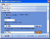
KutinSoft Reboot Service is a freeware Service designed to reboot a computer remotely or in case of memory overflow. General Service characteristics: - All aspects of Service work can be configurated; - It is able to follow quantity of free computer memory and to reboot a computer automatically at critical lack of memory; - It allows to reserve some quantity...
Category: Utilities / System Utilities
Publisher: KutinSoft.com, License: Freeware, Price: USD $0.00, File Size: 1.2 MB
Platform: Windows