Free Downloads: Gis Viewer Mac
License: All | Free
GeoMedia Viewer is an easy to use, FREE Gis software application for desktop viewing and distribution of geospatial data.It allows an organization to maximize the value of its geospatial data by extending availability to novice users who wouldn’t otherwise have access because of the barriers of purchasing and learning how to use a full Gis software application.
Category: Multimedia & Design / Graphics Viewers
Publisher: Intergraph Corporation, License: Freeware, Price: USD $0.00, File Size: 115.0 MB
Platform: Windows
AvisMap Gis Engine is the basic development platform for AvisMap Gis suites, which is a new generation component Gis development platform for Gis application developers. AvisMap Gis Engine 5 provides powerful Gis functions through Active X controls based on Microsoft COM component technique standards. It allows users to rapidly develop professional...
Category: Multimedia & Design / Multimedia App's
Publisher: AvisMap GIS Technologies, License: Freeware, Price: USD $0.00, File Size: 60.5 MB
Platform: Windows
ArcGIS Explorer is a free, downloadable Gis Viewer that gives you an easy way to explore, visualize and share Gis information. ArcGIS Explorer adds value to any Gis because it helps you deliver your authoritative data to a broad audience.
The ArcGIS Explorer Desktop Current User setup is intended for users who do not have administrator access on their...
Category: Desktop Enhancements / Shell & Desktop Managers
Publisher: Environmental Systems Research Institute, Inc., License: Freeware, Price: USD $0.00, File Size: 94.0 MB
Platform: Windows
DIVA-GIS is a GIS for plant biodiversity analysis.
DIVA-Gis is a Gis for plant biodiversity analysis. The project will modernize the architecture for better collaboration and extensibility based on Eclipse RCP.
DIVA-Gis can be used to map and analyze biological distribution data, such as can be provided by natural history collections and genetic resources collections. Typically, the distribution data would refer to...
Category: Business & Finance / Business Finance
Publisher: International Potato Center (CIP), License: Freeware, Price: USD $0.00, File Size: 122.4 MB
Platform: Windows
ArcGIS Explorer Desktop is a free Gis Viewer that gives you an easy way to explore, visualize, and share Gis information. ArcGIS Explorer adds value to any Gis because it helps you deliver your authoritative data to a broad audience.
Easy and intuitive to use it's easy for anyone to begin working with ArcGIS Explorer, with its intuitive and easy to...
Category: Home & Education / Miscellaneous
Publisher: Environmental Systems Research Institute, Inc., License: Freeware, Price: USD $0.00, File Size: 100.5 MB
Platform: Windows
The Framework Free Viewer is optional but is provided in case you do not have access to Gis software. The Framework Free Viewer is only useful when when working with data provided by Framework Archaeology.
The Framework Free Viewer requires 12MB of disk space to install and once installed will take up 6MB of disk space.
Category: Home & Education / Genealogy
Publisher: Framework Archaeology, License: Freeware, Price: USD $0.00, File Size: 4.4 MB
Platform: Windows
DIVA-Gis is a free computer program for mapping and geographic data analysis (a geographic information system (Gis). With DIVA-Gis you can make maps of the world, or of a very small area, using, for example, state boundaries, rivers, a satellite image, and the locations of sites where an animal species was observed.
Category: Business & Finance / Applications
Publisher: diva-gis, License: Freeware, Price: USD $0.00, File Size: 3.8 MB
Platform: Windows
PlanetGIS Explorer is a free viewer for PlanetGIS maps and GIS exchange files.
PlanetGIS Explorer is a free Viewer for PlanetGIS maps and Gis exchange files. PlanetGIS Explorer allows you to navigate through maps, query map elements and view attribute information from linked database tables. Also PlanetGIS Explorer allows you to customize the appearance of maps for purposes of creating hardcopy printouts, but does not allow you to save any changes to maps.
Category: Multimedia & Design / Graphics Viewers
Publisher: Planet GIS, License: Freeware, Price: USD $0.00, File Size: 5.4 MB
Platform: Windows
Gismaps Viewer is a GIS viewer that can be used for geospatial analysis and map production.
Gismaps Viewer is a Gis Viewer that can be used for geospatial analysis and map production.
The main features are:
- read Shape files using geographic coordinate system
- view satellite images (MrSid, jpeg, bmp and tiff file formats)
- generate thematic maps, queries and labels
- export do Google Earth KML (shp2kml)
- configure map...
Category: Multimedia & Design / Graphics Viewers
Publisher: Gismaps Sistemas Ltda., License: Freeware, Price: USD $0.00, File Size: 10.2 MB
Platform: Windows

The free AvisMap Viewer opens most Gis/CAD and raster image file types and most ArcView, ArcExplorer, and MapInfo projects. Besides just opening and viewing files, the Viewer supports an extensive list of features including visual layer properties control, legend control, thematic mapping, spatial and attribute querying, custom labeling, on-map measurements,...
Category: Software Development / Components & Libraries
Publisher: AvisMap GIS Technologies, License: Freeware, Price: USD $0.00, File Size: 22.3 MB
Platform: Windows
Cityvu is a 3D GIS data viewer able to load CityGML data format from any compatible data source.
Cityvu is a 3D Gis data Viewer able to load CityGML data format from any compatible data source.
Cityvu features 3D hardware rendering using OpenGL with a complete navigation system that allows automated tour of the rendered scene. It has been designed to be used to develop customized software solutions, built on the specific needs. Cityvu supports in addition to...
Category: Multimedia & Design / Graphics Viewers
Publisher: 3D GIS Cityvu, License: Freeware, Price: USD $0.00, File Size: 9.9 MB
Platform: Windows
The Quantum GIS Tethys repository contains a lot of software from OSGeo projects.
The Quantum Gis Tethys repository contains a lot of software from OSGeo projects. Quantum Gis Tethys and all dependencies are included, along with Python, GRASS, GDAL, etc. This is most suitable for people who want to be able to update dependencies from the Quantum Gis Tethys repository easily. The installer is able to install from internet or just download all needed...
Category: Multimedia & Design / Graphics Viewers
Publisher: QGIS Development Team, License: Freeware, Price: USD $0.00, File Size: 369.0 KB
Platform: Windows
Quantum Gis provides a continously growing number of capabilities provided by core functions and plugins. You can visualize, manage, edit, analyse data, and compose printable maps. QGIS is an official project of the Open Source Geospatial Foundation (OSGeo). It runs on Linux, Unix, Mac OSX, and Windows and supports numerous vector, raster, and database formats and functionalities.
Category: Home & Education / Miscellaneous
Publisher: qgis.org, License: Freeware, Price: USD $0.00, File Size: 92.2 MB
Platform: Windows
So that you can identify the Mapping & Gis product that best suits your needs, use this simple Product Comparison. There are four main product types that you can use to create a GPS data collection and maintenance system, or mobile Gis solution. Use the links below to select a product group, and compare the features of each product within that group.
Category: Internet / Communications
Publisher: Trimble Navigation Limited, License: Freeware, Price: USD $0.00, File Size: 2.7 MB
Platform: Windows
AccuGlobe Desktop 2007,a standardized platform for delivering solutions to the global Gis community, offers even more of what you demand in a desktop Gis application. Combining user-friendly design with significantly increased functionality, AccuGlobe Desktop 2007 gives you greater freedom in analyzing spatial data. In addition to functioning as the core engine behind many...
Category: Multimedia & Design / Multimedia App's
Publisher: Digital Data Technologies, Inc., License: Freeware, Price: USD $0.00, File Size: 9.8 MB
Platform: Windows
GeoSurveillance is software that combines spatial statistical routines with some basic Geographic Information Systems (Gis) functions to carry out retrospective and prospective statistical tests for the detection of geographic clustering. In this software, the focus is primarily on the spatial statistical analysis. Consequently, full Gis functionality is not provided. Gis...
Category: Home & Education / Miscellaneous
Publisher: NCGIA, License: Freeware, Price: USD $0.00, File Size: 2.4 MB
Platform: Windows
 Freeware
VSceneGIS Desktop. (Gis) Analysis, Computing and Editing. Customer Project Development, Analysis, Computing and Gis editing. VSceneGIS Desktop applies the concept of Tree and Graph Topology to implement the data model in a Gis. Validation, Editing and Topological Behavior Export and import of data sources: PostgreSQL / PostGIS, Oracle, MySQL, SQLite / SpatiaLite,...
Category: Home & Education / Science
Publisher: vscenegis.com, License: Freeware, Price: USD $0.00, File Size: 118.4 MB
Platform: Windows
Encom PA provides advanced interactive visualisation in one-, two-, and three-dimensions with support for most geophysical and geological information types used by companies to cover regional exploration through to mine development.
Encom PA is an interactive geophysical interpretation tool for the analysis of data in point, profile, drillholes, grid, RGB image, remote sensing, Gis...
Category: Multimedia & Design / Graphics Viewers
Publisher: Encom Technology Pty Ltd, License: Freeware, Price: USD $0.00, File Size: 36.5 MB
Platform: Windows
GenesisIV understands GIS concepts like layers, shape objects and georeferencing.
GenesisIV understands Gis concepts like layers, shape objects and georeferencing. It interfaces to industry standard Gis systems such as MapInfo and ArcView so you can use your existing data without having to learn new concepts or perform difficult manipulations.
GenesisIV is the only landscape product designed specifically to help teach geographical concepts....
Category: Multimedia & Design / Multimedia App's
Publisher: Geomantics, License: Freeware, Price: USD $0.00, File Size: 17.6 MB
Platform: Windows
The Microdrone Airborne Mapping extension to Orbit Gis provides the tools required for automated flight and high precision mapping. It contains a Waypoint Generator, a Microdrone in-flight tracker, and a captation tool. Further image-, stereoprocessing and orthorectification can be executed using the Strabo Photogrammetry extension to Orbit Gis.
Category: Multimedia & Design / Multimedia App's
Publisher: Orbit GeoSpatial Technologies, License: Freeware, Price: USD $0.00, File Size: 30.0 MB
Platform: Windows
NexGeo Office™ provides all of the functionality needed to organize a data collection project and manage data collected from Nexteq GPS/Gis handhelds. It provides tools for viewing, editing and exporting data to a format suitable for your existing Gis and CAD infrastructure.
Category: Multimedia & Design / Image Editing
Publisher: Nexteq Navigation, License: Freeware, Price: USD $0.00, File Size: 7.4 MB
Platform: Windows
With MapAuthor you can create, print and save desktop maps, using data that you obtain from commercial sources or perhaps your in-hous Gis department as shapefiles (shapefiles are a very common Gis exchange format.) You can also produce internet-based maps based on Google Maps, for use on your web site.
MapAuthor allows you to link your own data to maps, for example if you...
Category: Internet / Misc. Plugins
Publisher: MapAuthor.com, License: Freeware, Price: USD $0.00, File Size: 6.3 MB
Platform: Windows
SuperGIS DataConvertor is a powerful data conversion tool which is able to convert files between the common Gis formats to the SuperGeo self-defined formats. Therefore, your data can be used in SuperGeo series products, and also the SuperGeo self-defined formats can be used in other related platforms or systems. You will no longer need to worry the compatibility of Gis data, and...
Category: Business & Finance / Calculators
Publisher: SuperGeo, License: Freeware, Price: USD $0.00, File Size: 3.2 MB
Platform: Windows
MindManager Viewer is a free viewer that will allow you to open any MindManager (.
MindManager Viewer is a free Viewer that will allow you to open any MindManager (.mmap) files in read-only status. The Viewer is capable of reading notes, utilizing hyperlinks, opening attachments and standard navigation of map files.
The standalone Viewer is based on MindManager 7 for Windows, but can open files created in MindManager 9 or 8.
Category: Business & Finance / Project Management
Publisher: Mindjet LLC, License: Freeware, Price: USD $0.00, File Size: 26.4 MB
Platform: Windows
spatialSQL help contains a detailed description of solutions to some common GIS problems.
spatialSQL help contains a detailed description of solutions to some common Gis problems.
The interface provides a simple mechanism for selecting tables, spatialSQL operators, where clause, distance and other qualifiers and update operators. See the description of features and benefits.
Category: Software Development / Misc. Programming
Publisher: Spatial Projects, License: Freeware, Price: USD $0.00, File Size: 7.6 MB
Platform: Windows
Freeware
Free MOOS Project Viewer is a free online Microsoft Project Viewer that can open any MS Project file type (.mpp, .mpt, .mpx, .xml) for any Microsoft Project version (2000, 2003, 2007, 2010). It is running on any Java enabled platform including Windows, Mac OS X and Linux and it is the perfect solution for project stakeholders to view the project details in a dynamic way....
Category: Business & Finance / Project Management
Publisher: MS Project Viewer, License: Freeware, Price: USD $0.00, File Size: 9.5 MB
Platform: Windows
Freeware
RationalPlan Project Viewer by Stand By Soft is a free project scheduling software Viewer, the perfect solution for anyone (from project stakeholders to team workers) to view your projects in detail. Although the project managers plan and control the projects from start to end and make all the necessary changes, there are some other people, the stakeholders that need to check and...
Category: Business & Finance / Project Management
Publisher: Stand By Soft, License: Freeware, Price: USD $0.00, File Size: 85.7 MB
Platform: Mac
AutoDEM (aka as AutoMNT) is a freeware Gis software to create Digital Elevation Models (DEM) from scanned topographic maps for Windows.
Through different data layers (map, contours, DEM, etc.), AutoDEM provides many tools for :
-Topographic map analysis
-Contour lines extraction and reconstruction
-Contours to DEM interpolation and DEM analysis
-DEM to TIN...
Category: Multimedia & Design / Animation
Publisher: Joachim Pouderoux, License: Freeware, Price: USD $0.00, File Size: 27.6 MB
Platform: Windows
GeoBase is a high performance OEM tool for embedding Gis functions in client and server applications. GeoBase has a small memory footprint - both on the hard disk for storage and in RAM during use. Compatible with both .NET and Linux, GeoBase is designed for a rapid development cycle and low deployment cost. The Map Engine displays rich, detailed maps for use in server or client...
Category: Software Development / Compilers & Interpreters
Publisher: Telogis, License: Freeware, Price: USD $0.00, File Size: 87.0 MB
Platform: Windows
DocuWorks Viewer Light is a simple version of DocuWorks Viewer.
DocuWorks Viewer Light is a simple version of DocuWorks Viewer. DocuWorks Viewer Light is used for displaying or printing the contents of DocuWorks files. DocuWorks Viewer Light makes it possible to view DocuWorks documents in systems where DocuWorks is not installed. Its functions include text string searches, copying, jumping with link annotations, and original...
Category: Multimedia & Design / Graphics Viewers
Publisher: Xerox Corporation, License: Freeware, Price: USD $0.00, File Size: 5.3 MB
Platform: Windows
Imprudence Viewer is a SecondLife/OpenSim compatible Viewer with a focus on usability, privacy and reputability.Imprudence is an open source metaverse Viewer project based on the Second Life Viewer source. The goal of Imprudence is to greatly improve the usability of the Viewer through community involvement, thoughtful design, modern development methods, and a...
Category: Home & Education / Miscellaneous
Publisher: The Imprudence Project, License: Freeware, Price: USD $0.00, File Size: 25.5 MB
Platform: Windows
gvSIG project is a free and open source Geoinformation System (Gis), that enables users to interactively visualize, manage, modify and analyze spatial information in the form of digital maps, images and database tables. It is easy to learn, yet versatile and efficient enough for demanding Gis tasks.
Category: Multimedia & Design / Multimedia App's
Publisher: Oxford Archaeology Digital, License: Freeware, Price: USD $0.00, File Size: 273.0 MB
Platform: Windows
Geocando is a 3d Viewer for visualisation and querying of geodata and geomodels.
Geocando is a 3d Viewer for visualisation and querying of geodata and geomodels. It is especially developed for Paradigm's GOCAD® objects. Another supported format is the typical Gis exchange format ESRI Shapefile. In Geocando the objects can be visualized with different symbols, colours, scalebars, vertical exaggeration factors,etc. Typical features like get coordinates...
Category: Multimedia & Design / Graphics Viewers
Publisher: Manuel Feige, License: Freeware, Price: USD $0.00, File Size: 9.4 MB
Platform: Windows
gvSIG Desktop is a powerful geographic information system (Gis) designed to offer a free solution to all needs related to geographic information management. It is characterized as a comprehensive, easy to use solution, it adapts to the needs of any Gis user. Access to the most common formats, both vector and raster, both local and remote is possible. It integrates with OGC...
Category: Multimedia & Design / Multimedia App's
Publisher: gvSIG Association, License: Freeware, Price: USD $0.00, File Size: 149.5 MB
Platform: Windows
The Mapping and Gis License Manager software allows you to manage multiple licenses for the GPS Pathfinder Office software. Using the GPS Pathfinder Office License Administrator software, users of the GPS Pathfinder Office software can choose either a single use or a floating license.
Category: Business & Finance / Business Finance
Publisher: Trimble, License: Freeware, Price: USD $0.00, File Size: 26.8 MB
Platform: Windows
Sante DICOMDIR Viewer is a free DICOM directory viewer.
Sante DICOMDIR Viewer is a free DICOM directory Viewer. Sante DICOMDIR Viewer can be used to get a quick overview of the DICOMDIR's structure and contents. Just browse for the DICOMDIR file, load it and see the full description. In the right corner you will see a small window with the image preview.
Category: Multimedia & Design / Graphics Viewers
Publisher: Santesoft, License: Freeware, Price: USD $0.00, File Size: 1.8 MB
Platform: Windows
The MapSys Cadastral Gis offers specialized functionality for each stage of processing including the digital map creation, plotting cadastral and topographical plans, generating and combining geo-referenced data in order to obtain a validated relational geo-database. This can be used in MapSys or in other Gis programs or database application.
Category: Home & Education / Teaching Tools
Publisher: GEOTOP, License: Freeware, Price: USD $0.00, File Size: 143.9 MB
Platform: Windows
Freeware
Free ZWCAD Viewer for CAD DWG File Viewing and Plotting Light and Easy-to-use No Matter the OS or File Format Normal ZWCAD is light and handy because it has a much smaller installation package compared to other demanding software, but ZWCAD Viewer is even much lighter as it does not include tools for editing models. As the simplified version of ZWCAD, it follows a light and...
Category: Multimedia & Design / Image Editing
Publisher: ZWCAD Design Co., Ltd, License: Freeware, Price: USD $0.00, File Size: 161.9 MB
Platform: Windows
MadCap Help Viewer is a freely redistributable content Viewer that is based on Microsoft’s (NasdaqNM: MSFT) .NET framework. You may download and install the MadCap Help Viewer at any time.
The Help Viewer is not necessary for generating or using Microsoft HTML Help files, WebHelp files, or Printed Documentation.
However, you do need...
Category: Multimedia & Design / Multimedia App's
Publisher: MadCap Software, License: Freeware, Price: USD $0.00, File Size: 19.6 MB
Platform: Windows
Kiwi Log Viewer for Mac OS X is a freeware application that displays text based log files in a tabular format. Only a small section of the file is read from disk at a time which saves memory and allows you to view a file that would be too big to fit in memory. The tail option monitors the specified log file for changes and displays any new data that is added in real time. Text...
Category: Internet
Publisher: Kiwi Enterprises, License: Freeware, Price: USD $0.00, File Size: 1.5 MB
Platform: Mac
WildBit Viewer is a compact and fast image viewer with slide show and editor.
WildBit Viewer is a compact and fast image Viewer with slide show and editor. Includes and eye catching interface within blazing fast folder, file list and thumbnail Viewer.
Category: Multimedia & Design / Graphics Viewers
Publisher: wildbit-soft.fi, License: Freeware, Price: USD $0.00, File Size: 4.5 MB
Platform: Windows, Mac, Vista, 2008
The BIMx Desktop Viewer is a native Mac/Win application that allows you to view the BIM Explorer models (saved in bimx file format) on desktop computers and notebooks. Please note that the BIMx Desktop Viewer application is included in the ArchiCAD 15 package so you don't have to download it if you already have ArchiCAD 15 installed on your computer.
Using...
Category: Multimedia & Design / Multimedia App's
Publisher: Graphisoft, License: Freeware, Price: USD $0.00, File Size: 29.6 MB
Platform: Windows
AnalogX AnonyMac allows you to quickly see all of your network connections, what Mac is currently assigned to them, and then change them to a completely new one. The program also decodes the manufacturer information from the Mac so you can see who actually made the NIC, as well as some of the basic IP settings associated with the connection. There is also an ARP Viewer,...
Category: Internet / Misc. Plugins
Publisher: AnalogX, License: Freeware, Price: USD $0.00, File Size: 522.8 KB
Platform: Windows
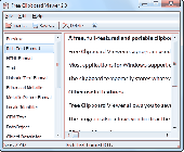
The clipboard viewer is a handy way to see exactly what's on your clipboard.
The clipboard Viewer is a handy way to see exactly what's on your clipboard. Whenever you want to see exactly what's being stored in your clipboard run Free Clipboard Viewer.
Most applications for Windows support cutting or copying data to the Windows Clipboard and pasting data from the Clipboard. The Clipboard data formats vary among applications. An application can place...
Category: Software Development / Misc. Programming
Publisher: Windows Clipboard Software, License: Freeware, Price: USD $0.00, File Size: 426.0 KB
Platform: Windows
Download, View, and Print Maps with the MrSID Viewer.
Download, View, and Print Maps with the MrSID Viewer.
To download and view maps offline you need a special Viewer. Maps are stored in MrSID format. The MRSID Viewer is a freeware tool. This library provides access to the MrSID Viewer developed by LizardTech.
NOTE:
LizardTech dropped the link for that stand-alone Viewer...
Category: Multimedia & Design / Graphics Viewers
Publisher: Lizardtech, License: Freeware, Price: USD $0.00, File Size: 2.0 MB
Platform: Windows
Control Viewer is a match viewer for the online game Hattrick.
Control Viewer is a match Viewer for the online game Hattrick. This software doesn't try the best in graphics, but allows a simple way to watch 10 matches with interesting features. It is free software, easy to use, with 1024x768 screen resolution or higher desired and much more
Category: Games / Tools & Editors
Publisher: Hattrick Control, License: Freeware, Price: USD $0.00, File Size: 2.0 MB
Platform: Windows
Cortona2D Viewer enables you to view various graphic formats including CGM, BMP, ICON, GIF and JPEG to name just a few.
Cortona2D Viewer works as a plug-in for Internet Explorer and office applications (Microsoft PowerPoint, Microsoft Word, etc). At this time the Cortona2D Viewer is available on the Windows platform.
Cortona2D Viewer is more than...
Category: Multimedia & Design / Graphics Viewers
Publisher: ParallelGraphics, License: Freeware, Price: USD $0.00, File Size: 1.8 MB
Platform: Windows
Motic VM Viewer is developed by Motic.
Motic VM Viewer is developed by Motic.
Motic VM Viewer is a powerful Digital Slide Scanning solution.
This flexible system can be applied in fields as diverse as Education, Diagnostics in Pathology, Clinical-Lab Remote Consultation and Scientific Research.
Category: Business & Finance / Business Finance
Publisher: Motic, License: Freeware, Price: USD $0.00, File Size: 15.0 MB
Platform: Windows
MDB Viewer Plus is a free viewer and editor for Access MDB and Accdb database files.
MDB Viewer Plus is a free Viewer and editor for Access MDB and Accdb database files. MDB Viewer Plus requires no install to run provided that Microsoft Data Access Components (MDAC) is installed on your computer (In most versions of Windows this is the ca
Category: Business & Finance / Database Management
Publisher: alexnolan.net, License: Freeware, Price: USD $0.00, File Size: 1.3 MB
Platform: Windows, Mac, 2K, 2K3, Vista
Shape Viewer is a free tool, which you can use to view ESRI Shape files.
Shape Viewer is a free tool, which you can use to view ESRI Shape files.
Shape Viewer can open (.shp) files that contain the geometry information of the shape file.With Shape Viewer you can also create new (.shx) file, and new empty (.dbf) file for your shape file.
If you have hundreds of shape files, and you want to view their contents rapidly, and you...
Category: Multimedia & Design / Graphics Viewers
Publisher: Mohammed Hammoud, License: Freeware, Price: USD $0.00, File Size: 35.0 KB
Platform: Windows