Free Downloads: Google Earth
License: All | Free
Download the new version of Google Earth satellite with Google Pack.
Download the new version of Google Earth satellite with Google Pack.Google pack includes 13 totally free software selected by Google for your better internet experience.Software included in Google pack - Google Earth,Norton Security Scan,Google Desktop,Google Toolbar for Internet Explorer,Spyware Doctor Starter Edition,Picasa...
Category: Home & Education / Science
Publisher: www.satelliteimage-of-my-house.com, License: Freeware, Price: USD $0.00, File Size: 589.0 KB
Platform: Windows
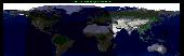
View amazing satellite images of earth with the free version of google earth software.
View amazing satellite images of Earth with the free version of Google Earth software.Google Earth is a totally free software which enables you zoom in from satellite,view,rotate or tilt just like a camera of the entire Earth inside your pc.It works just point and click on any part of Earth or by typing addrees name of city or country and...
Category: Home & Education / Miscellaneous
Publisher: www.satelliteimage-of-my-house.com, License: Freeware, Price: USD $0.00, File Size: 798.0 KB
Platform: Windows
Korti is a Google Earth plugin which allows you to see the unique 3D satellite map of Korti within your Google Earth application.
Korti provides you a detailed satellite imagery and geographic information about this geographic place.
To have Korti installed on your PC, first install for free Google Earth and then Korti 3D map plugin. After...
Category: Multimedia & Design / Multimedia App's
Publisher: Maplandia, License: Freeware, Price: USD $0.00, File Size: 309 B
Platform: Windows
GEScene is a MapInfo utility that allows images to be exchanged in both directions between MapInfo and Google Earth. Placemarks can also be created in Google Earth by using MapInfo as a point of reference to easily pinpoint more obscure locations. Images saved in Google Earth can be registered and displayed in MapInfo to compliment existing map layers....
Category: Utilities / Misc. Utilities
Publisher: Peter Doyle, License: Freeware, Price: USD $0.00, File Size: 3.2 MB
Platform: Windows
This application will measure paths in Google Earth, either saved in KML Files, or copied from the clipboard. The application uses the haversine formula to measure distances between points on a spherical object. These distances are approximate, but some test calculations I have made, show that they are in line with Google Earth's built in measuring tool...
Category: Home & Education / Miscellaneous
Publisher: Whaleycopter, License: Freeware, Price: USD $0.00, File Size: 457.5 KB
Platform: Windows
gSpatial Toolbar allows you to import, display and manipulate ESRI shapefile data in Google Earth.
gSpatial Toolbar allows you to import, display and manipulate ESRI shapefile data in Google Earth. Annotate your data and perform thematic queries on your Excel spreadsheet data or ODBC data sources, visualize results in Google Earth
Category: Multimedia & Design / Graphics Viewers
Publisher: gSpatial, License: Freeware, Price: USD $0.00, File Size: 686.1 KB
Platform: Windows

MB-GPS2KML converts a GPS log file (in plain NMEA format) to a KML file (placemark file for Google Earth) and opens this file in Google Earth. Velocity, number of satellites and HDOP are interpreted as height, color and size of the icons.
Category: Home & Education
Publisher: Markus Bader, License: Freeware, Price: USD $0.00, File Size: 441.4 KB
Platform: Windows
EarthPaint is an ideal and easy-to-use painting and drawing application for creating graphic overlays for Google Earth. Just launch Google Earth and zoom into the geographical area you wish to work on, and then open your EarthPaint program which will provide you with the choice of synchronizing its view with the current one displayed by Google Earth, or...
Category: Desktop Enhancements / Shell & Desktop Managers
Publisher: EarthPlot Software, License: Freeware, Price: USD $0.00, File Size: 255.0 KB
Platform: Windows
Do you have coordinates for some places of interest?
Do you have coordinates for some places of interest? Do you want to find them on Earth's surface? There are more than 2,000 coordinate systems available to make Google Earth follow your interests! Plex.Mark! simply placemarks your world!
Have you found a place in Google Earth and you would like to have the coordinates in your coordinate system?...
Category: Internet / Browser Accessories
Publisher: Plexscape, License: Freeware, Price: USD $0.00, File Size: 601.9 KB
Platform: Windows
GPicSync automatically inserts location in your photos metadata so they can also be used with any 'geocode aware' application like Picasa/Google Earth, Flickr, loc.alize.us.
Main fetures:
- automatically geocode your photos (in the EXIF header)
- use a GPS tracklog in the GPX format or NMEA format (multiple selection possible)
- Support...
Category: Multimedia & Design / Digital Media Editors
Publisher: Google Project, License: Freeware, Price: USD $0.00, File Size: 0
Platform: Windows
Place Finder is a program that makes it easier to find a given place using Google Earth by generating places from the user data and then launching Google Earth to view the generated places.
Category: Internet / Tools & Utilities
Publisher: Pmcc, License: Freeware, Price: USD $0.00, File Size: 665.6 KB
Platform: Windows
JCapPM allows you to associate coordinate information (x/y) to each photo.
JCapPM allows you to associate coordinate information (x/y) to each photo. JCapPM can communicate with Google Earth which allows you to geotag all your files using Google Earth. You can use JCapPM's filter in order to geotag only filtered photos at once.
Category: Home & Education / Miscellaneous
Publisher: ZeroG Software, License: Freeware, Price: USD $0.00, File Size: 2.5 MB
Platform: Windows
EarthShape is a new and useful software which enables you to easily create polygon objects in Google Earth. It's free and easy to download and simple to install.
It has some new and interesting features and has a very fiendly user interface.Download it and try it
Category: Multimedia & Design / Multimedia App's
Publisher: EarthPlot Software, License: Freeware, Price: USD $0.00, File Size: 205.3 KB
Platform: Windows
KMLCSV Converter is a tool that enables you to convert the KML file generated from Google Earth (free version) into a formatted CSV file (and vice versa). This CSV file can then be uploaded into your Garmin GPS by using Garmin POI Loader, which can be downloaded for free. This allows you to plot all the custom point of interests (POI) with Google Earth first. Then,...
Category: Business & Finance / Calculators
Publisher: Choon-Chern Lim, License: Freeware, Price: USD $0.00, File Size: 2.3 MB
Platform: Windows
Free Earth Screensaver will bring the blue planet to your desktop.
Free Earth Screensaver will bring the blue planet to your desktop. You can view the Earth from the night side, the day side and from the moon. This screensaver lets you see the pictures of our planet that you have never seen before. Earth is the third planet from the Sun and is the densest and fifth-largest of the eight planets in the Solar System. This unique Earth...
Category: Desktop Enhancements / Misc. Themes
Publisher: CustomAquariumScr, License: Freeware, Price: USD $0.00, File Size: 3.0 MB
Platform: Windows
See our Earth?s beauty in high-resolution! Fully customizable by you - you can change the size of the images as well as the transitions of the slide show. Download this screensaver and enjoy it today!
Category: Desktop Enhancements / Screensavers
Publisher: leetsoftware.com, License: Freeware, Price: USD $0.00, File Size: 3.5 MB
Platform: Windows, Mac, 2K, 2K3
Ais Decoder accepts AIS data from an AIS Receiver, the Internet or a Local Network connection, decodes the data and presents the decoded data in a form suitable for display and analysis by mapping program (eg Google Earth or Google Maps), or for analysis using Excel, or by a database (eg MySql).
The decoder will decode all the NMEA content of all 27 AIS mesage types....
Category: Business & Finance / Business Finance
Publisher: Neal Arundale, License: Freeware, Price: USD $0.00, File Size: 2.8 MB
Platform: Windows
Photo viewer providing a quick access to the Panoramio Photo Database (normally accessible through Google Earth®)
- Choice of 4 different photo sizes: 1=thumbnail (max. 100 px), 2=small (max. 240 px), 3=medium (max. 500 px), 4=original (as uploaded by the user)
- Mode 1: Access by photo index and display of the photos only (very fast with photo sizes 1,2,3)
-...
Category: Multimedia & Design / Multimedia App's
Publisher: MichaelGraphics, License: Freeware, Price: USD $0.00, File Size: 1005.0 KB
Platform: Windows
iTag is a utility that allows you to easily add title, description and keyword tags to your digital photos. The data you enter is stored into the actual photo file itself - using the open standards of IPTC and XMP. Many applications can read and write the IPTC/XMP data, but iTag is especially powerful at editing a group of photos all at once. Geocoding your photos is also straight forward...
Category: Multimedia & Design / Media Catalogers
Publisher: iTag Software, License: Freeware, Price: USD $0.00, File Size: 576.9 KB
Platform: Windows
Shape2Earth Globe lets you quickly and easily capture Google Earth images for your personal use.
Shape2Earth Globe lets you quickly and easily capture Google Earth images for your personal use. Capture images for use in popular applications like Microsoft Office and ESRI's ArcMap.
Shape2Earth Globe also saves the bounding box of the image in a kml file. This data is then used to generate a world file and projection file so that your image can be loaded into a GIS,...
Category: Multimedia & Design / Multimedia App's
Publisher: Shape2Earth, License: Freeware, Price: USD $0.00, File Size: 402.5 KB
Platform: Windows
The Earth is probably the best planet I?
The Earth is probably the best planet I?ve ever been to, so I like to keep abreast of what?s going on in the world. I found this desktop background great for monitoring cloud cover, the advance of day and night and nocturnal lights around the globe.
Category: Desktop Enhancements / Wallpaper
Publisher: codefromthe70s.org, License: Freeware, Price: USD $0.00, File Size: 6.2 MB
Platform: Windows
ARSights is a project by Inglobe Technologies, an Italian company specialized in the development of Virtual and Augmented Reality applications. It is based on ARmedia, Inglobe's platform for Augmented Reality (AR), which allows a simple and astonishing way of integrating digital content in real world. ARSights aims at extending Google Earth (GE) wih AR functionality.
...
Category: Home & Education / Miscellaneous
Publisher: Inglobe Technologies S.r.l., License: Freeware, Price: USD $0.00, File Size: 10.6 MB
Platform: Windows
Live Satellite Maps or Google maps is a web server mapping applications.
Live Satellite Maps or Google maps is a web server mapping applications.Provides scrolling map images and satellite photos around the Earth and even the route between different places.Since 6 October 2005, live satellite Maps is part of local Google.Google live satellite Map provides the ability to zoom in or zoom out to show the map.The user can control the map with...
Category: Home & Education / Science
Publisher: www.satelliteview-of-my-house.com, License: Freeware, Price: USD $0.00, File Size: 643.0 KB
Platform: Windows
A Journey To The Center Of The Earth, by Jules Verne (1864)Prof.
A Journey To The Center Of The Earth, by Jules Verne (1864)Prof. Lindenbrook leads his intrepid party on an expedition to the centre of the Earth, via a volcano in Iceland, encountering all manner of prehistoric monsters and life-threatening hazards on the way.
Category: Home & Education / Miscellaneous
Publisher: Southern Ocean Software, License: Freeware, Price: USD $0.00, File Size: 747.5 KB
Platform: Windows
Satellite earth is a software for viewing satellite and aerial imagery of the Earth.
Satellite Earth is a software for viewing satellite and aerial imagery of the Earth.Satellite Earth allows you to enjoy virtual travel around the world, look up local information and plan trips, exploring multimedia content and share information about your trips.Explore towns, cities and terrain relief shown in three-dimensional images of high resolution associated with...
Category: Home & Education / Science
Publisher: www.satelliteview-of-my-house.com, License: Freeware, Price: USD $0.00, File Size: 584.0 KB
Platform: Windows
Cities of Earth 3D Screensaver shows many cities of the Earth as if you were in the space.
Cities of Earth 3D Screensaver shows many cities of the Earth as if you were in the space. It also displays information about the cities including their countries, the number of inhabitants, and the time in their time zones. It also represents the time in your time zone in the lower right corner of the screen. From the settings menu in the properties (screensaver tab) you can also...
Category: Desktop Enhancements / Screensavers
Publisher: Screenomania.com, License: Freeware, Price: USD $0.00, File Size: 1.7 MB
Platform: Windows
Sonic and Tails have crashed into Earth and have transformed into humans and changed their name to fit in. Race to the end of each level destroying enemies and collecting stars on the way. Be careful the evil Dr. Robotnik has followed you to Earth! Use the space bar to jump, and press down plus space bar to do a power spin and use the arrow keys to move!
Sonic Earth...
Category: Games / Arcade
Publisher: softendo.com, License: Freeware, Price: USD $0.00, File Size: 7.4 MB
Platform: Windows
DesktopEarth is a very singular program, with a single purpose: it generates wallpapers for your desktop (in fact, the software applies the wallpapers automatically).
The images generated are a very accurate view of the Earth from the space, at the precise moment of the update. You can see the sunlight projection over the Earth, like you do in Google Earth: you...
Category: Desktop Enhancements / Misc. Themes
Publisher: codefromthe70s.org, License: Freeware, Price: USD $0.00, File Size: 6.2 MB
Platform: Windows
Mirkwood - Middle Earth Tale 3.
Mirkwood - Middle Earth Tale 3. A finished Tolkien inspiredRPG that features a journey through the dark forrest in Middle Earth called Mirkwood. Get ready for adventure, get ready to change history, get ready to play Mirkwood!
Category: Games / Adventure & RPG
Publisher: jockethebeast.phatcode.net, License: Freeware, Price: USD $0.00, File Size: 317.0 KB
Platform: Unknown
In 2049, the human population of Earth embarks on a migratory voyage to try to colonize other planets. They leave mechanical "orbots" to clean up the mess they made on Earth through littering and pollution.
Raster, a high-level orbot who watches Earth through a planetwide computer network, is accidentally attached to a working nuclear missile by a...
Category: Games / Action
Publisher: segabandonware, License: Freeware, Price: USD $0.00, File Size: 1.5 MB
Platform: Windows
Imagenes satelite is a free satelite images slideshow screensaver for your desktop.
Imagenes satelite is a free satelite images slideshow screensaver for your desktop.View high resolution and beautihigh quality satelite images of Earth from space.This screensavers contains full color images that fit automatically on your screen.View satellite images of Earth from several kilometers from above the sky.Fly above the surface of the Earth and see the beauty of...
Category: Desktop Enhancements / Screensavers
Publisher: www.vista-satelite.com, License: Freeware, Price: USD $0.00, File Size: 3.3 MB
Platform: Windows
Aliens are attacking Earth and you must stop them.
Aliens are attacking Earth and you must stop them. Use your military skills to blast the aliens into submission and save the planet! Cool graphics and upgrades make this an exciting battle!
Category: Games / Action
Publisher: MyRealGames.com, License: Freeware, Price: USD $0.00, File Size: 5.7 MB
Platform: Windows
The Use of Videography in Tracking Earth Satellites.
The Use of Videography in Tracking Earth Satellites.Scattered around the world is a network of about sixteen amateur observers who spend most of their spare time looking at Earth satellites.They concentrate on tracking classified military satellites.Working in close collaboration
this group keeps regular track of about 120 satellites moving in a wide variety of orbits...
Category: Home & Education / Science
Publisher: www.satelliteimage-of-my-house.com, License: Freeware, Price: USD $0.00, File Size: 1.7 MB
Platform: Windows
EOLi (Earth Observation Link) is the European Space Agency's client for Earth Observation Catalogue and Ordering Services.
Using EOLi, you can browse the metadata and preview images of Earth Observation data acquired by the satellites ENVISAT, ERS, Landsat, IKONOS, DMC, ALOS, SPOT, Kompsat, Proba, JERS, IRS, Nimbus, NOAA, SCISAT, SeaStar, Terra/Aqua.
Category: Multimedia & Design / Multimedia App's
Publisher: European Space Agency, License: Freeware, Price: USD $0.00, File Size: 54.7 MB
Platform: Windows
Earth Time Screensaver puts the correct time, day and night regions, location of the Moon and current phase on your desktop with an Earth map. This unique screensaver will allow you to stay informed of what time it is in any part of the world. It is free software, you can free to give copies to your anyone, and post it on other sites.
Category: Desktop Enhancements / Misc. Themes
Publisher: CustomAquariumScr, License: Freeware, Price: USD $0.00, File Size: 3.0 MB
Platform: Windows
Water Point Mapping is a process for monitoring the distribution and status of water points in rural and urban areas. It supports local level planning and can improve accountability for water sector performance at local and national levels.
Category: Home & Education / Miscellaneous
It uses the Google Earth application to visualise data. Once Google Earth has been installed, it can be run offline.
Publisher: WaterAid, License: Freeware, Price: USD $0.00, File Size: 880.0 KB
Platform: Windows
Virtual Earth 3D brings you another step closer to knowing "what it is like out there".
Virtual Earth 3D brings you another step closer to knowing "what it is like out there". You can search, browse, and organize local information viewed in three dimensions, just the way it exists in the real world. This enables you to more effectively find
Category: Home & Education / Miscellaneous
Publisher: microsoft.com, License: Freeware, Price: USD $0.00, File Size: 1.2 MB
Platform: Windows, Vista

OkMap is a GPS and map software that:
-Works with vectorial maps and calibrates raster maps
-Organizes paths by creating waypoints, routes and tracks
-Uploads/downloads data to/from your GPS
-Uses altitude DEM data
-Supports GPS real-time navigation
-Sends/receives vehicles position and display tracks on maps in real time
-Provides autorouting and geocoding...
Category: Business & Finance / Applications
Publisher: Gian Paolo Saliola, License: Freeware, Price: USD $0.00, File Size: 20.2 MB
Platform: Windows
Display realistic model of the Earth on a background of twinkling stars.
Display realistic model of the Earth on a background of twinkling stars.You can see times of rising/setting of Moon and Sun.You can configure the product as your Screen Saver.
Category: Desktop Enhancements / Screensavers
Publisher: LAVResearch, License: Freeware, Price: USD $0.00, File Size: 1.0 MB
Platform: Windows
Let your desktop take you on an incredible journey into space!
Let your desktop take you on an incredible journey into space! Marvel at planet Earth, receive weather forecasts and view times anywhere in the world. Zoom or rotate the Earth and watch storms from the safety of your home.
Main features:
- Zoom in and out and rotate the Earth
- View weather forecast and time anywhere in the world
-...
Category: Desktop Enhancements / Screensavers
Publisher: Inbox.com, LLC, License: Freeware, Price: USD $0.00, File Size: 8.6 MB
Platform: Windows
Put this extremely realistic 3D Earth screensaver on your monitor and find yourself on an orbital station ready to make your own space research of our home planet. With this free screensaver you will see the unforgettable views of the Earth from space. The slightly visible atmosphere of the planet and the Moon, rotating around, turn your screen into a window of a spaceship....
Category: Desktop Enhancements / Screensavers
Publisher: 3D Savers, License: Freeware, Price: USD $0.00, File Size: 3.1 MB
Platform: Windows
Halo: Hell on Earth Trilogy is a 2D side-scroller which takes place in the year 2552.
Halo: Hell on Earth Trilogy is a 2D side-scroller which takes place in the year 2552. The Covenant have invaded Earth. Masterchief is missing - he teleported with a covenant cruiser. You the last hope of humanity - you have to destroy all the five Covenan
Category: Games / Action
Publisher: dobermannsoftware.com, License: Freeware, Price: USD $0.00, File Size: 14.6 MB
Platform: Windows
Earth3D is a program that visualizes the earth in a realtime 3D view.
Earth3D is a program that visualizes the Earth in a realtime 3D view. It uses data from NASA,USGS, the CIA and the city of Osnabrück.
Main features:
- viewing the Earth as a whole
- zooming in until countries, cities and even single houses become visible
- embedding external data like current earthquake positions or cloud data.
Category: Multimedia & Design / Graphics Viewers
Publisher: Dominique Andre Gunia, License: Freeware, Price: USD $0.00, File Size: 3.1 MB
Platform: Windows
Virtual Earth 3D brings you another step closer to knowing "what it is like out there".
Virtual Earth 3D brings you another step closer to knowing "what it is like out there". You can search, browse, and organize local information viewed in three dimensions, just the way it exists in the real world. This enables you to more effectively find the data that is relevant to you, making Live Maps more useful than ever. Even better, it's just plain fun!
Category: Home & Education / Genealogy
Publisher: Microsoft, License: Freeware, Price: USD $0.00, File Size: 13.0 MB
Platform: Windows, all
 Freeware
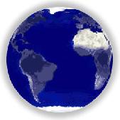
This is a free Flash animation of our spinning planet Earth, very small in file size, yet with excellent graphics. The Earth can be scaled to any size and will enhance your website or presentation. The file is free of charge and does not require installation. It can be viewed in action on our website. The background can be customized to suit your theme.
Category: Web Authoring / Flash Utilities
Publisher: Utech Computer Solutions, License: Freeware, Price: USD $0.00, File Size: 47.2 KB
Platform: Windows, Linux
Cities of Earth is a free beautiful 3D screensaver which shows biggest cities of our planet.
Cities of Earth is a free beautiful 3D screensaver which shows biggest cities of our planet. Features:Aflame Sun, stars, 3D Earth model with highlighted cities.Many of cities with information about its population and country names. So it's a good educational content. Positions of all cities corresponds to its real world coordinates.Ability to add any city to the Earth...
Category: Desktop Enhancements / Screensavers
Publisher: Screenomania 3D Screensavers, License: Freeware, Price: USD $0.00, File Size: 1.7 MB
Platform: Windows
Earth Orbit Objects is free program which predict satellite passes for your local or any selected area. Use flat Earth view to display satellite tracks with visibility circle.
The globe view shows selected satellites around the Earth as a sphere and sky view shows satellites as you would see them in a starry night. The line elements are processed using SGP4...
Category: Home & Education / Miscellaneous
Publisher: Bluewing Trg, License: Freeware, Price: USD $0.00, File Size: 1.6 MB
Platform: Windows
Dark Earth is a campaign setting unlike any you have ever played.
Dark Earth is a campaign setting unlike any you have ever played. It will take your imagination and grab it, caress it, and make you never want to leave.
Category: Games / Adventure & RPG
Publisher: occultentertainment.co.nr, License: Freeware, Price: USD $0.00, File Size: 586.0 KB
Platform: Windows, Mac, 2K, 2K3
Put the web address into the field, press Enter, get Google result. As result you will get the Google pagerank value and web site position in Google directory. It's very convenient to have such simple utility when you need not to install GoogleBar or something like that. If you like to have the source code of this utility in such programming langauges as Perl, Javascript of...
Category: Internet
Publisher: TM Services, License: Freeware, Price: USD $0.00, File Size: 253 B
Platform: Windows
Amazing rotating earth simulation as seen from Moon to Earth distance of 384,403 kilometers/238,857 miles.
Category: Desktop Enhancements / Screensavers
Publisher: earthlike.org, License: Freeware, Price: USD $0.00, File Size: 7.0 MB
Platform: Windows, Mac, Vista