Free Downloads: Gps Naval Maps Norway
License: All | Free
GPS Send Map is a Windows interface program which uses (sendmap.
Gps Send Map is a Windows interface program which uses (sendmap.exe) to load the IMG Maps to the Gps.This program works well and setup is easy, although there seams to be minor issues in some windows OS.The Gps acted as usual and my Maps appeared on the screen as usual. NICE.
Category: Security & Privacy / Other
Publisher: DougsBrat, License: Freeware, Price: USD $0.00, File Size: 1.5 MB
Platform: Windows
With MetroWizzz- the Autorouting MetroGuide Wizard, you can make your Gps capable of autorouting with MetroGuide Maps. The wizard is self explaining. In just 6 simple steps you will have autorouting capabilities with MetroGuide Maps on your Gps. You can upload up to 1Gb of Maps to your Gps.
Category: Home & Education / Miscellaneous
Publisher: Geodude, License: Freeware, Price: USD $0.00, File Size: 962.2 KB
Platform: Windows
The Gps Detector software is used to update the Gps detector's database , updating Maps , routes and camera locations . The device itself is based on pre-installed Gps coordinates, the device can indicate various road hazards like: Fixed cameras, Red light speed cameras and bus lane cameras, Usual speed measurement places and dangerous zones.
Category: Business & Finance / Business Finance
Publisher: Euro Noliker Kft., License: Freeware, Price: USD $0.00, File Size: 5.5 MB
Platform: Windows
Naval Assault GOLD is a continuation of the game Assalto Navale [Naval assault] (1999), a Naval battle simulator, extremely realistic in moves. The GOLD game was released in 2005. The author "restored" graphics, renewed sound system and inserted true photos of pirates. Naval Assault GOLD is multilanguage ENG ITA: enjoy!
Category: Games / Simulations
Publisher: Alex Bernardi, License: Freeware, Price: USD $0.00, File Size: 1.4 MB
Platform: Windows
FREE GPS Software for your Garmin, Magellan or Lowrance GPS.
FREE Gps Software for your Garmin, Magellan or Lowrance Gps.
EasyGPS is the fast and easy way to upload and download waypoints, routes, and tracks between your Windows computer and your Garmin, Magellan, or Lowrance Gps. EasyGPS lists all of your waypoints on the left side of the screen, and shows a plot of your Gps data on the right. Use EasyGPS to back up...
Category: Internet / Communications
Publisher: TopoGrafix, License: Freeware, Price: USD $0.00, File Size: 3.9 MB
Platform: Windows
Map of Africa is one of the many maps created for GPS TrackMaker.
Map of Africa is one of the many Maps created for Gps TrackMaker. You are able to download the installation package from the TrackMaker website. In order to preview the contents of this package, you need to install Gps TrackMaker.
Using the above mentioned application, you will be able to see the Map of Africa. Just click on the "Open Temporary...
Category: Home & Education / Miscellaneous
Publisher: Geo Studio Technology, License: Freeware, Price: USD $0.00, File Size: 18.3 MB
Platform: Windows


 Freeware
GPS Converter will convert GPS coordinates between three different formats: 34. 26965, -116.
76783; N 34° 16. 179', W 116° 46. 07'; and N 34° 16' 10.
Category: Home & Education / Sports
Publisher: ALMSys, Inc., License: Freeware, Price: USD $0.00, File Size: 929.9 KB
Platform: Windows
The fast track to GPS success.
The fast track to Gps success. The Linx MDEV-Gps-SR contains everything needed to rapidly evaluate the SR Series Gps modules and implement them in record time. This all-inclusive Master Development System features a pre-assembled development board with an on-board OLED display for standalone testing. The system can also be attached to a PC via USB and operated using the...
Category: Software Development / Misc. Programming
Publisher: Linx Technologies, Inc., License: Freeware, Price: USD $0.00, File Size: 98.5 MB
Platform: Windows
OkMap is a Gps and map software that:
-Works with vectorial Maps and calibrates raster Maps
-Organizes paths by creating waypoints, routes and tracks
-Uploads/downloads data to/from your Gps
-Uses altitude DEM data
-Supports Gps real-time navigation
-Sends/receives vehicles position and display tracks on Maps in real time
-Provides...
Category: Business & Finance / Applications
Publisher: Gian Paolo Saliola, License: Freeware, Price: USD $0.00, File Size: 20.2 MB
Platform: Windows
GPSCommunicator is a FREE utility to visually represent NMEA GPS position data in realtime.
GPSCommunicator is a FREE utility to visually represent NMEA Gps position data in realtime. It works with NMEA 0183 Gps receivers connected via a serial port. GPSCommunicator has the following features:
- Vessel position display over moving map.
- User selectable Maps.
- Create and save Waypoints.
- Graphical Gps data display
- .NET...
Category: Internet / Misc. Plugins
Publisher: Panazzolo.Com, License: Freeware, Price: USD $0.00, File Size: 772.5 KB
Platform: Windows
With our locr PC software "locr Gps Photo for Windows" you can manage to automatically geotag numerous photos simultaneously. You just require a digital camera, a Gps data logger and the application "locr Gps Photo for Windows".
There are two ways to geotag your photos: The photos can be tagged manually or automatically. For automatic geotagging...
Category: Multimedia & Design / Multimedia App's
Publisher: locr, License: Freeware, Price: USD $0.00, File Size: 490.8 KB
Platform: Windows
Nokia Map Manager is a program that allows you to manage and transfer GPS maps to mobile phone.
Nokia Map Manager is a program that allows you to manage and transfer Gps Maps to mobile phone. The Map Manager is for the 6110 Navigator only. The program is provided with scan function to search Maps on the computer and DVD. Nokia Map Manager is an additional application and is used together with Nokia PC Suite 6.86 and later versions.
Nokia Map Manager helps you to...
Category: Internet / Communications
Publisher: Nokia, License: Freeware, Price: USD $0.00, File Size: 0
Platform: Windows
Used Magellan toolbar for Internet Explorer.
Used Magellan toolbar for Internet Explorer. Find great deals on used Magellan Gps devices at prices you can afford. Whether your looking for the Magellan Roadmate, Magellan Maestro, or Magellan CrossoverGPS you'll find it here at low prices. We are always searching our networks on a daily basis to bring you the best prices in used Magellan Gps devices for your car. Find a great...
Category: Internet / Browsers
Publisher: Used Magellan, License: Freeware, Price: USD $0.00, File Size: 1.1 MB
Platform: Windows
My Gps Logger 1.01 is a program designed to be used with My Fuel Tax 4.0. With My Gps Logger you can log all the locations where your truck has been to a monthly data file. This data file can later be imported into My Fuel Tax 4.0 by calculating the miles in state using Microsoftâ Mappoint. This is what you will need to use My Gps Logger with My Fuel Tax:a laptop with...
Category: Home & Education / Miscellaneous
Publisher: Spinnaker Software Solutions, License: Freeware, Price: USD $0.00, File Size: 477.7 KB
Platform: Windows
GolfLogix is the most precise, durable, and user-friendly golf GPS on the market today.
GolfLogix is the most precise, durable, and user-friendly golf Gps on the market today. Wherever you are on the course, GolfLogix displays the key distances to hazards and the green in big bold numbers all on a sleek black palm-sized device. The screen advances automatically to all of the targets on the golf course so there are no buttons to push or lasers to point during your round.
Category: Home & Education / Hobbies
Publisher: Garmin Ltd or its subsidiaries, License: Freeware, Price: USD $0.00, File Size: 12.2 MB
Platform: Windows
The program accepts NMEA GPS sentences from most GPS receivers that connect to a USB port.
The program accepts NMEA Gps sentences from most Gps receivers that connect to a USB port.
The program can display satellite images of waypoint locations on the track plotter.
Is a free software for recording , monitoring and plotting Gps data, very useful and very easy.
Category: Home & Education / Miscellaneous
Publisher: Club Cruceros de La Paz A.C., License: Freeware, Price: USD $0.00, File Size: 10.6 MB
Platform: Windows
Naval Fighter is an interesting shooting game for free.
Naval Fighter is an interesting shooting game for free. Take your pick of hot fighters. Then take out the navy! Pilot one of three WWII torpedo bombers and destroy all enemies in sight. Move your plane with the mouse and shoot with the left mouse button. Launch torpedoes with the space bar. Get the end of the level by destroying as many enemy units as you can. Move the plane with your...
Category: Games / Arcade
Publisher: NowStat.com, License: Freeware, Price: USD $0.00, File Size: 5.4 MB
Platform: Windows
Golf GPS Devices toolbar for internet explorer.
Golf Gps Devices toolbar for internet explorer. Find golf Gps devices are great bargain prices. We have all the latest golf Gps devices for sale both new and used. Whether you're looking for the iGolf, Golf Buddy, GolfLogix, SonoCaddie, or SkyCaddie, you can find it here along with their accessories. We are always searching our networks to bring you the best deals on golf...
Category: Internet / Browsers
Publisher: Golf GPS Devices, License: Freeware, Price: USD $0.00, File Size: 1.1 MB
Platform: Windows
Your premier software solution for communicating via the serial port on your ICOM D-Star enabled Amateur radios.
Dstar Comms can be used for email deployment, Gps Tracking, reliable communication plus much more!
Main features:
- Send and Receive Text Messages
- Send and Receive PM (Private Messages)
- Send and Receive EMAIL via DSTAR RF Data...
Category: Internet / Chat
Publisher: Matt Miller M0DQW, License: Freeware, Price: USD $0.00, File Size: 4.4 MB
Platform: Windows
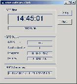
Gps Clock Software is a freeware utility that runs on any Windows NT/2000/XP/2003 workstation or server. The software polls time from a standard NMEA Gps time receiver connected to the host PC's serial port and optionally allows time to be synchronised on the host PC. The Gps clock utility polls GPRMC messages from a standard NMEA Gps time receiver. Information...
Category: Utilities
Publisher: ntp time server, License: Freeware, Price: USD $0.00, File Size: 1.9 MB
Platform: Windows
Screen saver, Norway, nature. .
Screen saver, Norway, nature
Category: Desktop Enhancements / Screensavers
Publisher: Carsten Schmidt, License: Freeware, Price: USD $0.00, File Size: 2.0 MB
Platform: Windows
Are you looking for a Gps tracking system or a Gps tracker but haven't found the one that is ideal for you? Then, look no further as our site has the best deals and information about the kind of Gps tracker you should buy.
Category: Security & Privacy / Other
Publisher: Top GPS Tracking Srl., License: Freeware, Price: USD $0.00, File Size: 722.0 KB
Platform: Windows
Portable GPS Navigation toolbar for Internet Explorer.
Portable Gps Navigation toolbar for Internet Explorer. Find portable Gps units for your car, truck or minvan from top name brands including Tom Tom, Magellan and Garmin. Discover the world of eBay and shop for portable Gps navigation systems directly from your browser toolbar.
Category: Internet / Browsers
Publisher: Portable GPS Navigation System, License: Freeware, Price: USD $0.00, File Size: 1.1 MB
Platform: Windows
GPS Tuner was first launched in 2003.
Gps Tuner was first launched in 2003. Success followed introduction shortly. Over the years it became a best-selling favourite Gps software among off-roaders as a reliable, versatile feature-packed application suiting the needs of outdoor enthusiasts and professional off-road users alike. After five years of continuous development of previous Gps Tuner versions Gps...
Category: Web Authoring / Web Design Utilities
Publisher: GPS Tuner Ltd., License: Freeware, Price: USD $0.00, File Size: 4.5 MB
Platform: Windows
It's a software for making landscape CG or amuzing 3D maps.
It's a software for making landscape CG or amuzing 3D Maps. You can render a beatiful landscape CG on your PC. You can use USGS's DEMs, Grayscale Bitmaps and so on. You can know which mountain you can see from your home.
Support for:
- 3D Navigation by Gps Receiver.
- Full-Raytracing rendering and Z-Buffer rendering.
- rendering clouds,...
Category: Multimedia & Design / Image Editing
Publisher: SUGIMOTO Tomohiko, License: Freeware, Price: USD $0.00, File Size: 5.1 MB
Platform: Windows
FSS Google Maps Downloader is a tool that can download the Google Maps images to your PC. This is a clearly free program. There is no spyware or adware. It's absolutely safe to install and to run. The interface is very simple and self explaining. It runs low on system resources consumption and is supported on all Windows versions. It can save them to your hard disk,...
Category: Internet / Download Managers
Publisher: FreeSmartSoft, License: Freeware, Price: USD $0.00, File Size: 874.0 KB
Platform: Windows
The Gps Controller software is a free program designed to allow you to configure a range of Gps receivers. There are versions that run on Windows desktop computers, or Windows Mobile devices.
Before downloading the software, it recommend downloading and reading the documentation to confirm which version you need.
Category: Home & Education / Miscellaneous
Publisher: Trimble Navigation, License: Freeware, Price: USD $0.00, File Size: 30.9 MB
Platform: Windows
Naval strike is an action game,developed by Media Contact LLC.
Naval strike is an action game,developed by Media Contact LLC. This game is downloadable from the site GameTop.com. As you know these one is also free, you don´t have to fill a registration form or give your personal information.
In this game your mission will be to destroy all the other war planes that come across in your way. In addition you will have some extra...
Category: Games / Action
Publisher: Media Contact LLC, License: Freeware, Price: USD $0.00, File Size: 2.4 MB
Platform: Windows
GPS-CCD:is a novel computational program for the
Prediction of Calpain Cleavage Sites.
Gps-CCD:is a novel computational program for the
Prediction of Calpain Cleavage Sites.
The online service and local packages of Gps-CCD 1.0 were
implemented in JAVA/. For the online service, we tested the Gps-CCD1.0 on a variety of internet browsers, including Internet Explorer 6.0, Netscape Browser 8.1.3 and Firefox 2 under the Windows XPOperating System...
Category: Web Authoring / JavaScript
Publisher: The CUCKOO Workgroup, License: Freeware, Price: USD $0.00, File Size: 19.2 MB
Platform: Windows
TOPO! Explorer is both the website you are viewing now and a free desktop application created by National Geographic Maps. The website contains freely browsable topographic Maps, aerial imagery, hybrids, and a national recreation database filled with updated trails, points-of-interest, photos, videos, trail reports, and descriptions from professional and community sources....
Category: Home & Education / Miscellaneous
Publisher: National Geographic Maps, License: Freeware, Price: USD $0.00, File Size: 22.9 MB
Platform: Windows
ThinkVantage Gps (Global Positioning System) receives signals from the Gps satellites and determines the location of your ThinkPad. This program is easy to install and easy to manipulate.
This package installs the software (Gps driver) to enable the following devices:
- Ericsson F3507g
- Ericsson F3607gw
- Ericsson F5521gw
-...
Category: Utilities / System Utilities
Publisher: Lenovo, License: Freeware, Price: USD $0.00, File Size: 20.6 MB
Platform: Windows
The OSTN02 extension for ArcPad is a FREE tool that automatically transforms Gps data and aligns it with Ordnance Survey (OS) background map. This easy-to-use extension removes the need to manually post-process Gps data by providing’ on the fly’ transformation of WGS84 latitude and longitude into OSTN02 corrected British National Grid coordinate. Data capture using...
Category: Home & Education / Miscellaneous
Publisher: ESRI (UK) Ltd, License: Freeware, Price: USD $0.00, File Size: 8.0 MB
Platform: Windows
Have a Gps and a laptop? Use this to find your way. Make patterns or a trail to share with others. When the application starts, you may pick your area of operations - be it North America, South America, Europe and Asia, or Australia. Your quadrant is determined by where you are in relation to the Equator and the Prime Meridian. Tracking of your position is automatically enabled when the...
Category: Home & Education / Miscellaneous
Publisher: LogicAll Solutions, LLC, License: Freeware, Price: USD $0.00, File Size: 4.6 MB
Platform: Windows
Diffuse maps represent the absorption of light.
Diffuse Maps represent the absorption of light. Diffuse Maps are what people call "textures". They are the color textures or photographic textures usually applied to 3d models.
ShaderMap creates displacement Maps using the light data stored inside of diffuse Maps. Evenly lit diffuse Maps generally create better quality Maps with ShaderMap.
Category: Home & Education / Miscellaneous
Publisher: Rendering Systems Inc., License: Freeware, Price: USD $0.00, File Size: 4.0 MB
Platform: Windows
This guide is all about the naval combat game known only as Exotic Torpedo Submarine Battles.
This guide is all about the Naval combat game known only as Exotic Torpedo Submarine Battles. Within the guide you will find various tips and tricks to help you win the game. In the game you'll sink and destroy ships in exotic locations such as the Argentine Sea and the Caribbean Sea in this sequel to the award winning game Torpedo Submarine Battles 2.
Surface from the depths and...
Category: Games / Misc. Games
Publisher: Exotic Flash Games, License: Freeware, Price: USD $0.00, File Size: 1.8 MB
Platform: Windows
This is a browser experience built especially for fans of Navy athletics.
This is a browser experience built especially for fans of Navy athletics. With the U.S. Naval Academy Browser Theme, you'll enjoy:
- A stunning Navy theme
- Quick links to Navy Facebook and Twitter pages
- Easy access to the best of NavySports.com
- A sidebar of featured news
Category: Internet / Browser Accessories
Publisher: Brand Thunder, License: Freeware, Price: USD $0.00, File Size: 674.7 KB
Platform: Windows
Kinomap Gps File Fixer allows you to process some treatments on Gps file:
- convert almost any Gps file to standard NMEA 0183, compatible with Kinomap
- fill the gaps between points when your file is not 1Hertz: the extra point will be recreated by interpolation
- cut a long file in which there are loops of data (example: race) in several parts
Category: Home & Education / Miscellaneous
Publisher: ExcelLance, License: Freeware, Price: USD $0.00, File Size: 19.6 MB
Platform: Windows
Keep track of discount Garmin GPS deals on with this Firefox toolbar.
Keep track of discount Garmin Gps deals on with this Firefox toolbar.compare and buy all the latest Garmin satellite navigation systems. If you want a discount Garmin Gps system this is the Firefox toolbar to use. We also provide information on the latest offers, price cuts and discount voucher codes to help you buy the latest Garmin Gps at the cheapest price possible in...
Category: Internet / Browsers
Publisher: Discount Garmin GPS, License: Freeware, Price: USD $0.00, File Size: 1.1 MB
Platform: Windows
An easy to use Gps downloading utility that lets you download your Gps waypoints easily and export them into a variety of formats useful for editing, display and importing into many different mapping programs.
Use Lobal to save Gps waypoints as:
- Text Files
- HTML Tables
- Shape Files
- Google Earth KML
- DBase Files.
Category: Utilities / Misc. Utilities
Publisher: Ecological Software Solutions, License: Freeware, Price: USD $0.00, File Size: 2.2 MB
Platform: Windows
Multicam or multiple video source capable webcam/video capture application with Gps filter support, and supports most codecs such as DivX, XViD, FFDShow, etc.
DSGPS.ax - Gps Video Overlay, a DirectShow filter which retrieves Gps and OBD-II data from XPort and/either/or XOBD, and imprints Gps speed, time, date, course, longitude, latitude, MPG, RPM, AIT,...
Category: Multimedia & Design / Video
Publisher: Curious Technology, License: Freeware, Price: USD $0.00, File Size: 78.9 KB
Platform: Windows
ITN Converter is a free and reliable application for travelers.
ITN Converter is a free and reliable application for travelers. If you want to travel to a place that you haven’t explored yet, you can use this software in order to establish your route.
The program has two main functionalities: to plan routes and to convert. This means that it can help you establish your itinerary and convert it to an appropriate format for different Gps...
Category: Multimedia & Design / Digital Media Editors
Publisher: Benichou Software, License: Freeware, Price: USD $0.00, File Size: 904.4 KB
Platform: Windows
Use this software option to differentially post-process raw Gps data collected with the Ashtech MobileMapper Field software. Through post-processing, the positions of every GIS feature you collect in the field can be improved to sub meter (< 1m) accuracy. Create and update Maps for analysis and maintenance in a standard GIS system.
Category: Business & Finance / Business Finance
Publisher: Magellan, License: Freeware, Price: USD $0.00, File Size: 119.2 MB
Platform: Windows
Gps Egypt brings you the best Gps mapping and navigation package on the Egyptian market today with over 55,000 km of road coverage. The package offers the best map coverage available in Egypt, in addition to a cutting-edge software package for voice-based routing and navigation.
Category: Internet / Communications
Publisher: GPS Egypt, License: Freeware, Price: USD $0.00, File Size: 135.6 MB
Platform: Windows
CyCop monitors Heritage security guards at all times via GPS tracking.
CyCop monitors Heritage security guards at all times via Gps tracking.
Some features of the Dashboard include:
- View and search Daily Activity Reports
- View Site Coverage Maps
- View coverage alerts status in real-time
- Site Performance Metrics
- Client feedback form
- Search archived reports and security coverage information
Category: Business & Finance / MS Office Addons
Publisher: Heritage Security Services, License: Freeware, Price: USD $0.00, File Size: 4.2 MB
Platform: Windows
A program for converting OLEX files into GPS Utility Format Files.
A program for converting OLEX files into Gps Utility Format Files.
Gps Utility is an easy-to-use application that allows you to manage, manipulate and map your Gps information.
When you convert the OLEX files you can use the source file name or enter a new target file name.
Category: Audio / Rippers & Encoders
Publisher: GPS Utility Ltd., License: Freeware, Price: USD $0.00, File Size: 404.5 KB
Platform: Windows
MyGPS is a Freeware software for the creation and the management of longitude and latitude calibrated Maps.
The software can define points of interest obtaining their coordinates (waypoints), can create routes (routepoints), can visualize track paths (trackpoints).
Using a serial link, points routes and tracks can be shared with "eTrex" and "Geko" GARMIN...
Category: Home & Education / Miscellaneous
Publisher: GPSInfo, License: Freeware, Price: USD $0.00, File Size: 2.3 MB
Platform: Windows
MapComp is a powerful and free Windows Software for drawing images of linkage Maps and to compare linkage Maps and indicate common markers.
MapInspect can display, print and save images, and has no limit to the number of Maps it can compare (but only neighbouring Maps are compared). Maps can be flipped within MapINspect, an the on-screen order of...
Category: Multimedia & Design / Multimedia App's
Publisher: MapInspect, License: Freeware, Price: USD $0.00, File Size: 616.7 KB
Platform: Windows
Seal Hunter is a freeware 2D shoot ‘em up game featuring not only tons of blood and gore, but also the possibility for four players to ensure the future of Norway’s fishing industry together.
With a large array of weapons at your disposal, you must prevent harmful sea creatures from reaching the ocean in order to ensure a decent catch of fish the next morning....
Category: Games / Action
Publisher: Tomas Olander, License: Freeware, Price: USD $0.00, File Size: 13.0 MB
Platform: Windows
V-Clinic GPS lets you track your training routes and upload the data back to your V-Clinic account.
V-Clinic Gps lets you track your training routes and upload the data back to your V-Clinic account. Then use V-Clinic to share your route with your training buddies. V-Clinic Gps is ideal for cyclists, joggers and outdoor enthusiasts. V-Clinic Gps runs on Gps & Java enabled phones. Use V-Clinic Gps on your own or get professional fitness analysis and...
Category: Home & Education / Health & Nutrition
Publisher: V-CLINIC MOBILE CIRCLES, License: Freeware, Price: USD $0.00, File Size: 235.0 KB
Platform: Unknown
The Approach displays and updates your exact position on stunningly detailed, preloaded course Maps throughout the United States, and many European and other countries. Click to see Garmin's current Approach G5 course listing. Approach's highly sensitive Gps receiver pinpoints your position and removes guesswork from your game. And as you move, Approach automatically updates your...
Category: Home & Education / Miscellaneous
Publisher: GeminiPress Publishing, License: Freeware, Price: USD $0.00, File Size: 45.3 MB
Platform: Windows, Mac, Palm

