Free Downloads: Kml Evaluator
License: All | Free
Easy way to convert Waypoints from KMZ or Kml to GPX file format with the Kml/KMZ to GPX Converter free.
Easy Steps :
- Save your waypoints in KMZ or Kml format with google earth
- Import that format in the Kml/KMZ to GPX Converter free
- Then select waypoint you want to convert to GPX format
- Export the GPX format
- Upload the...
Category: Audio / Rippers & Encoders
Publisher: HotelResortClub.com, License: Freeware, Price: USD $0.00, File Size: 656.6 KB
Platform: Windows
With the help of Kml Color Converter you can pick and mix colors and get the respective codes in 7 systems: Kml, RGB, VB, HTM, CMY, CMYK and HSL. You can also adjust the transparency of the resulted color. When you want to change the chosen color, all you have to do is increase/decrease the intensity of the RGB colors by means of the correspondent up/down arrows.
Category: Multimedia & Design / Media Management
Publisher: Ricardo Sgrillo, License: Freeware, Price: USD $0.00, File Size: 1.9 MB
Platform: Windows
This application will measure paths in Google Earth, either saved in Kml Files, or copied from the clipboard. The application uses the haversine formula to measure distances between points on a spherical object. These distances are approximate, but some test calculations I have made, show that they are in line with Google Earth's built in measuring tool calculations. The application...
Category: Home & Education / Miscellaneous
Publisher: Whaleycopter, License: Freeware, Price: USD $0.00, File Size: 457.5 KB
Platform: Windows
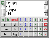
My Calculator is a fast, easy to use and well equipped mathematical expression evaluator.
My Calculator is a fast, easy to use and well equipped mathematical expression Evaluator. It supports the use of variables, complex numbers and different number systems (decimal, hexadecimal, octal and binary). It contains a large number of functions and
Category: Home & Education / Mathematics
Publisher: hem.bredband.net, License: Freeware, Price: USD $0.00, File Size: 172.0 KB
Platform: Windows, Mac
Finding good hosting is not an easy task.
Finding good hosting is not an easy task. There are tens of thousands of web hosts out there and a large majority are poorly run and unreliable. It is not unusual for a webmaster to change hosts many times in as many months because of server downtime, slow connections, and/or poor tech support and customer service.
Finally there is a way that you can analyze web hosts before you pull out...
Category: Utilities / Misc. Utilities
Publisher: Zed Seven Pty Ltd, License: Freeware, Price: USD $0.00, File Size: 383.0 KB
Platform: Windows
BlueMath Calculator is a flexible desktop calculator and math expression evaluator.
BlueMath Calculator is a flexible desktop calculator and math expression Evaluator.
It can calculate simultaneously multiple expressions, showing the results in the same time as you type.
Type the mathematical expressions in a similar way as you would write them on paper.
Category: Business & Finance / Business Finance
Publisher: Blue Project Software, License: Freeware, Price: USD $0.00, File Size: 404.0 KB
Platform: Windows

MB-GPS2KML converts a GPS log file (in plain NMEA format) to a KML file (placemark file for Google Earth) and opens this file in Google Earth. Velocity, number of satellites and HDOP are interpreted as height, color and size of the icons.
Category: Home & Education
Publisher: Markus Bader, License: Freeware, Price: USD $0.00, File Size: 441.4 KB
Platform: Windows
tabbyCalc is a minimalist windows desktop calculator & mathimatical expression evaluator. .
tabbyCalc is a minimalist windows desktop calculator & mathimatical expression evaluator.
Category: Business & Finance / Calculators
Publisher: bradlima.com, License: Freeware, Price: USD $0.00, File Size: 470.0 KB
Platform: Windows, Mac, 2K

OkCustomMap is a software to produce Garmin Custom Maps.
OkCustomMap is a software to produce Garmin Custom Maps.
Supports many map formats:
- OkMap
- Ecw
- GeoTiff
- World files
- OziExplorer
- GpsTuner
You can customize:
- The quality of the output JPEG images (0=Bad, 100=Good)
- The Kml transparency (0=Transparent, 255=Opaque)
- The Kml draw order (0=Invisible, 1-49=Under the vectorial...
Category: Business & Finance / Applications
Publisher: Gian Paolo Saliola, License: Freeware, Price: USD $0.00, File Size: 3.2 MB
Platform: Windows
KMLCSV Converter is a tool that enables you to convert the Kml file generated from Google Earth (free version) into a formatted CSV file (and vice versa). This CSV file can then be uploaded into your Garmin GPS by using Garmin POI Loader, which can be downloaded for free. This allows you to plot all the custom point of interests (POI) with Google Earth first. Then, you can transfer all...
Category: Business & Finance / Calculators
Publisher: Choon-Chern Lim, License: Freeware, Price: USD $0.00, File Size: 2.3 MB
Platform: Windows
Janino is a compiler that reads a Java expression, block, or source file, and generates Java bytecode that is loaded and executed directly. It is not intended to be a development tool, but an embedded compiler for run-time compilation purposes, such as expression evaluators or "server pages" engines like JSP.
Properties
The major design goal was to keep the compiler...
Category: Software Development / Misc. Programming
Publisher: Arno Unkrig, License: Freeware, Price: USD $0.00, File Size: 104.0 KB
Platform: Windows, Linux, Mac
CoPilot Central is the desktop management software companion for CoPilot Live(Android and Windows Mobile). Buy additional map regions and other premium add-ons. Download maps for use with Android versions of CoPilot. Export trips to popular online mapping sites (using Kml format). Backup favorites and settings.
Category: Desktop Enhancements / Shell & Desktop Managers
Publisher: CoPilotLive, License: Freeware, Price: USD $0.00, File Size: 4.7 MB
Platform: Windows
The newest versions of ePubHub _require_ .
-Plain ASCII text files have the extension .txt
-Microsoft Word files have the extension .doc
-Adobe acrobat files have the extension .pdf
-Gemstar eBook files have the extension .prc
-Palm files have the extension .pdb or .prc
-Hiebook files have the extension .Kml
-Html files have the extension .html or .htm
-Adobe eBook files have the...
Category: Utilities / System Utilities
Publisher: ePubHub, License: Freeware, Price: USD $0.00, File Size: 483.5 KB
Platform: Windows
The best open-source Wi-Fi scanning software – for Free!
The best open-source Wi-Fi scanning software – for Free!
With Inssider you can :
– Inspect your Wi-Fi and surrounding networks
– Scan and filter hundreds of nearby access points
– Troubleshoot competing access points and clogged Wi-Fi channels
– Highlight access points for areas with high Wi-Fi concentration
...
Category: Internet / Monitoring
Publisher: MetaGeek, LLC, License: Freeware, Price: USD $0.00, File Size: 1.7 MB
Platform: Windows
This utility scans exe or dll files of your choosing and detects usage of .
This utility scans exe or dll files of your choosing and detects usage of .NET types released by ESRI. It then generates a report of this usage for your review.
Among other things, you can use the information provided to verify that you are not using types from assemblies that require licenses beyond your target license level or to generate a list of types that you can compare...
Category: Utilities / Misc. Utilities
Publisher: Environmental Systems Research Institute, Inc., License: Freeware, Price: USD $0.00, File Size: 743.3 KB
Platform: Windows
Korti is a Google Earth plugin which allows you to see the unique 3D satellite map of Korti within your Google Earth application.
Korti provides you a detailed satellite imagery and geographic information about this geographic place.
To have Korti installed on your PC, first install for free Google Earth and then Korti 3D map plugin. After that, simply double click...
Category: Multimedia & Design / Multimedia App's
Publisher: Maplandia, License: Freeware, Price: USD $0.00, File Size: 309 B
Platform: Windows
Shape2Earth Globe lets you quickly and easily capture Google Earth images for your personal use.
Shape2Earth Globe lets you quickly and easily capture Google Earth images for your personal use. Capture images for use in popular applications like Microsoft Office and ESRI's ArcMap.
Shape2Earth Globe also saves the bounding box of the image in a Kml file. This data is then used to generate a world file and projection file so that your image can be loaded into a GIS, such...
Category: Multimedia & Design / Multimedia App's
Publisher: Shape2Earth, License: Freeware, Price: USD $0.00, File Size: 402.5 KB
Platform: Windows
An easy to use GPS downloading utility that lets you download your GPS waypoints easily and export them into a variety of formats useful for editing, display and importing into many different mapping programs.
Use Lobal to save GPS waypoints as:
- Text Files
- HTML Tables
- Shape Files
- Google Earth Kml
- DBase Files.
Category: Utilities / Misc. Utilities
Publisher: Ecological Software Solutions, License: Freeware, Price: USD $0.00, File Size: 2.2 MB
Platform: Windows
The CubicleSoftTM XLAuditorTM add-in for Microsoft Excel 2000/XP/2003 enables professionals to audit, understand, analyze, create, modify, compare, and debug any formula in any Excel spreadsheet.
If you use Excel frequently, you know about the F9 key and the built-in Excel Evaluator, but this tool is neither of those. Take a good look at the following screenshots to see how...
Category: Business & Finance / Applications
Publisher: CubicleSoft, License: Freeware, Price: USD $0.00, File Size: 1.1 MB
Platform: Windows
Gismaps Viewer is a GIS viewer that can be used for geospatial analysis and map production.
Gismaps Viewer is a GIS viewer that can be used for geospatial analysis and map production.
The main features are:
- read Shape files using geographic coordinate system
- view satellite images (MrSid, jpeg, bmp and tiff file formats)
- generate thematic maps, queries and labels
- export do Google Earth Kml (shp2kml)
- configure map colors and...
Category: Multimedia & Design / Graphics Viewers
Publisher: Gismaps Sistemas Ltda., License: Freeware, Price: USD $0.00, File Size: 10.2 MB
Platform: Windows
PokerStove 1.21 is a game that will help you to calculate Texas Hold´em poker odds.
PokerStove includes a preflop Evaluator able to compute an exact solution quickly..
You can input the cards that each player has discarded, the cards on the board and the dead cards. Then, if you press the "Evaluate" button, you will get an Output in the lower end...
Category: Games / Cards, Casino, Lottery
Publisher: RPS Consulting, License: Freeware, Price: USD $0.00, File Size: 762.6 KB
Platform: Windows
iTag is a utility that allows you to easily add title, description and keyword tags to your digital photos. The data you enter is stored into the actual photo file itself - using the open standards of IPTC and XMP. Many applications can read and write the IPTC/XMP data, but iTag is especially powerful at editing a group of photos all at once. Geocoding your photos is also straight forward...
Category: Multimedia & Design / Media Catalogers
Publisher: iTag Software, License: Freeware, Price: USD $0.00, File Size: 576.9 KB
Platform: Windows
Administrator's Plus is a remarkable student information software system that lets schools collect, manage and analyze whatever student information they choose to track. Due to seamless integration with both the GradeQuick teacher gradebook and the Edline school web portal, Administrator's Plus offers a complete, secure online solution.
The package includes : Student...
Category: Home & Education / Miscellaneous
Publisher: Rediker Software, Inc., License: Freeware, Price: USD $0.00, File Size: 75.3 MB
Platform: Windows
This free software uses 19 intelligent and classic technical analysis methods, new Quotes (delayed 15 minutes) and historical Quotes to analyze stock, displays 18 charts in a window and marks buy/sell signals last 30 days on charts. It can also display Dow's real time intraday charts, stock intraday chart indicators and many good articles about Market Update, Stocks on the Move, News...
Category: Business & Finance / Business Finance
Publisher: Kingsoft, Inc., License: Freeware, Price: USD $0.00, File Size: 1.4 MB
Platform: Windows
GPicSync automatically inserts location in your photos metadata so they can also be used with any 'geocode aware' application like Picasa/Google Earth, Flickr, loc.alize.us.
Main fetures:
- automatically geocode your photos (in the EXIF header)
- use a GPS tracklog in the GPX format or NMEA format (multiple selection possible)
- Support elevation data if...
Category: Multimedia & Design / Digital Media Editors
Publisher: Google Project, License: Freeware, Price: USD $0.00, File Size: 0
Platform: Windows
GeoVisu is a program that displays georeferenced data (images, graphics) and downloads data recorded by some GPS devices.
Category: Multimedia & Design / Graphics Viewers
GeoVisu has a "Moving map" navigation function, which can be used with any NMEA 0183 compatible or Garmin USB GPS device.
Main features:
- Displays georeferenced image formats : GeoTiff, ECW and ECWP, MrSID, OziExplorer Map
Publisher: GeoVisu, License: Freeware, Price: USD $0.00, File Size: 1.7 MB
Platform: Windows
CDML Personal Calculator is a convenient tool that includes 9 different selectable conversion modes including English/Metric Conversions as well as 7 Memory and 8 Financial functions.The program displays the Standard Calculator mode window. Changing between modes is made easy by clicking the Next or Previous mode arrows. All the completed operations are recorded by the program's Tape and...
Category: Home & Education / Miscellaneous
Publisher: CDML Computer Services, Ltd., License: Freeware, Price: USD $0.00, File Size: 2.3 MB
Platform: Windows
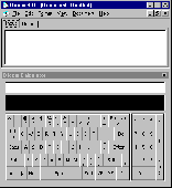
Dicom calculates, converts and computes. The first ever computing tool that deals with dimensions of physical quantities in mathematical expression, Dicom, has the answer to expression like: 30 mi./h.+6 ft./s.+15.24 m./s. to ft./s. Dicom can evaluate expressions anywhere in a rich text formatted document. It has a built-in rich text editor. Process your words, numbers, and measurements at one...
Category: Home & Education
Publisher: Knowbotron, License: Freeware, Price: USD $0.00, File Size: 2.5 MB
Platform: Windows
 Freeware
org, uses file and position names that suit to the display of the TomTom Rider, uses file, route and position names that suit to the display of the Map&Guide Motorrad Tourenplaner, remembers language, paths, window size and position. . .
Category: Business & Finance / Conversion Applications
Publisher: Christian Pesch, License: Freeware, Price: USD $0.00, File Size: 6.6 MB
Platform: Windows, Mac, Linux, Solaris, FreeBSD, OpenBSD, Java
Open Contacts is an address book program with CRM features providing unified, flexible and intuitive interfaces for you to manage and lookup contact info of individuals and organizations. Open Contacts displays only data fields with data. You can seamlessly customize what can be stored in your address book. Essential Features: Store details in sections of data fields that are...
Category: Business & Finance / Personal Info Managers
Publisher: Fonlow IT, License: Freeware, Price: USD $0.00, File Size: 4.5 MB
Platform: Windows
Calcute is a Free and Compact yet Capable Tape Calculator. More advanced than standard calculators, it is actually an expression Evaluator that lets you process arbitrarily complex numeric expressions like: -ln(1+2) * 3% + sin(4 5/6)^7. As shown in this example, you can even enter an exact fractional value like 4 5/6 instead of a decimal approximation like 4.83333333333......
Category: Business & Finance
Publisher: Calcute.com, License: Freeware, Price: USD $0.00, File Size: 137.9 KB
Platform: Windows

Importation/Exportation: Import/export trails to gpx file. Unlimited number of trails, and TrackPoints. Export to gpx, Excel, PDF, XPS and Kml/KMZ. Data table: Very flexible data table that allows sorting by columns, with inheritance of data, attributes, etc. Presentation on map: View on map in accordance with the active trail, which comes from providers of maps, as in 'Satellite'...
Category: Home & Education / Miscellaneous
Publisher: Aplicaciones Topográficas S.L., License: Freeware, Price: USD $0.00, File Size: 27.0 MB
Platform: Windows

The free AvisMap Viewer opens most GIS/CAD and raster image file types and most ArcView, ArcExplorer, and MapInfo projects. Besides just opening and viewing files, the Viewer supports an extensive list of features including visual layer properties control, legend control, thematic mapping, spatial and attribute querying, custom labeling, on-map measurements, hyper-linking, PDF export and much...
Category: Software Development / Components & Libraries
Publisher: AvisMap GIS Technologies, License: Freeware, Price: USD $0.00, File Size: 22.3 MB
Platform: Windows

OkMap is a GPS and map software that:
-Works with vectorial maps and calibrates raster maps
-Organizes paths by creating waypoints, routes and tracks
-Uploads/downloads data to/from your GPS
-Uses altitude DEM data
-Supports GPS real-time navigation
-Sends/receives vehicles position and display tracks on maps in real time
-Provides autorouting and geocoding...
Category: Business & Finance / Applications
Publisher: Gian Paolo Saliola, License: Freeware, Price: USD $0.00, File Size: 20.2 MB
Platform: Windows