Free Downloads: Nmea 183
License: All | Free

HS GPS is a software library (with full C source code) which provides access to a Nmea-183 compliant GPS receiver via a serial communications port, decoding Nmea sentences: $GPGGA, $GPGSA, $GPGSV, $GPGLL, $GPRMC and $GPVTG. Decoded parameters include: time, date, position, altitude, speed, course and heading, according to standard - Nmea-183 (National Marine...
Category: Software Development
Publisher: Hillstone Software, License: Freeware, Price: USD $0.00, File Size: 309.3 KB
Platform: Windows
IPaNema reads any Nmea data from one of the serial ports (Com1-15) and delivers the Nmea data to any user selectable port and IP address using the UDP protocol acting as UDP server.
It can also act as an UDP client, receiving Nmea sentences wrapped in UDP packets and outputs these to a serial communications port
Category: Internet / Misc. Plugins
Publisher: Sailsoft, License: Freeware, Price: USD $0.00, File Size: 263.3 KB
Platform: Windows
GPSCommunicator is a FREE utility to visually represent NMEA GPS position data in realtime.
GPSCommunicator is a FREE utility to visually represent Nmea GPS position data in realtime. It works with Nmea 0183 GPS receivers connected via a serial port. GPSCommunicator has the following features:
- Vessel position display over moving map.
- User selectable maps.
- Create and save Waypoints.
- Graphical GPS data display
- .NET components for use...
Category: Internet / Misc. Plugins
Publisher: Panazzolo.Com, License: Freeware, Price: USD $0.00, File Size: 772.5 KB
Platform: Windows
N2KBuilder software is a powerful, free PC-based tool for designing and verifying the integrity of Nmea 2000 networks.
The N2KBuilder software, when installed on a Windows PC and used as part of an integrated design workflow can be used to plan, document, and validate the design of complex Nmea 2000 networks.
In addition, N2KBuilder will directly produce...
Category: Internet / Misc. Plugins
Publisher: Maretron, LLP, License: Freeware, Price: USD $0.00, File Size: 10.0 MB
Platform: Windows
Latest proAIS software V1.1.3.121 that allows configuration of SPST type Silent Switch and full Nmea 0183 Multiplexing. With this tool you can configure your connection to Nmea 0183. It's easy to install and in the same time i's easy to configure your settings.
Category: Home & Education / Miscellaneous
Publisher: Digital Yacht HQ, License: Freeware, Price: USD $0.00, File Size: 28.4 MB
Platform: Windows
Diffusion is done by sending sentences at format NMEA 0183 using UDP protocol .
Diffusion is done by sending sentences at format Nmea 0183 using UDP protocol .Diffused data come either from a GPS receiver or source issuing on UDP in real time navigation mode, either from a replayed file. In case of replay, position and speed settings are modifiable.GpsDiffuser is at least compatible with itself, GeoVisu and GpsGate.
Category: Utilities / Misc. Utilities
Publisher: GeoVisu team, License: Freeware, Price: USD $0.00, File Size: 1.7 MB
Platform: Windows
The program accepts NMEA GPS sentences from most GPS receivers that connect to a USB port.
The program accepts Nmea GPS sentences from most GPS receivers that connect to a USB port.
The program can display satellite images of waypoint locations on the track plotter.
Is a free software for recording , monitoring and plotting GPS data, very useful and very easy.
Category: Home & Education / Miscellaneous
Publisher: Club Cruceros de La Paz A.C., License: Freeware, Price: USD $0.00, File Size: 10.6 MB
Platform: Windows
GPSsim application is software based GPS device simulator.
GPSsim application is software based GPS device simulator.
GPSsim plays back Nmea data that was saved previously. It is also possible to generate custom Nmea data.
GPSsim allows you to test various PC-based navigation programs as well as use it as data logger application to track vehicle location
Category: Home & Education / Miscellaneous
Publisher: HL-soft, License: Freeware, Price: USD $0.00, File Size: 2.8 MB
Platform: Windows
VisualGPS incorporates many advanced features found in professional programs.
VisualGPS incorporates many advanced features found in professional programs. Its sole purpose is to display graphically specific Nmea 0183 sentences and show the effects of selective availability (SA).
Main Features:
- Azimuth and Elevation Graph - View all satellites that are in view. Each satellite identifies its pseudo random number (PRN) and its azimuth and...
Category: Home & Education / Miscellaneous
Publisher: VisualGPSLLC, License: Freeware, Price: USD $0.00, File Size: 1.7 MB
Platform: Windows

GPS Clock Software is a freeware utility that runs on any Windows NT/2000/XP/2003 workstation or server. The software polls time from a standard Nmea GPS time receiver connected to the host PC's serial port and optionally allows time to be synchronised on the host PC. The GPS clock utility polls GPRMC messages from a standard Nmea GPS time receiver. Information received from the...
Category: Utilities
Publisher: ntp time server, License: Freeware, Price: USD $0.00, File Size: 1.9 MB
Platform: Windows
With this program you can convert NMEA log in format GVN, generated by GeoVisu.
With this program you can convert Nmea log in format GVN, generated by GeoVisu. GVConverter converts all files at format GVN presents in source directory and its sub-directories. It replicates source directory tree-structure into destination directory. Date and time of source file are applied to converted file. It runs on Windows 95/98/NT/2000/XP/2003.
Category: Utilities / Misc. Utilities
Publisher: GeoVisu, License: Freeware, Price: USD $0.00, File Size: 562.5 KB
Platform: Windows
A program to convert GPS-track of *. gpx, *.
mps, *. plt or *. nmea format to Navitel Tracks.
Category: Home & Education / Sports
Publisher: DXsoft, License: Freeware, Price: USD $0.00, File Size: 31.6 KB
Platform: Windows
Yet another tool to read and convert GPS logs from Royaltek RGM-3800 and RBT-2300 (using serial communication), from RBT-3000 (using files), from Nmea logs files (comming from AMOD 3080 datalogger for example). Free download and easy to install. Enjoy.
Category: Utilities / Misc. Utilities
Publisher: eXtraGPS, License: Freeware, Price: USD $0.00, File Size: 2.5 MB
Platform: Windows
Kinomap GPS File Fixer allows you to process some treatments on GPS file:
- convert almost any GPS file to standard Nmea 0183, compatible with Kinomap
- fill the gaps between points when your file is not 1Hertz: the extra point will be recreated by interpolation
- cut a long file in which there are loops of data (example: race) in several parts
Category: Home & Education / Miscellaneous
Publisher: ExcelLance, License: Freeware, Price: USD $0.00, File Size: 19.6 MB
Platform: Windows
Ais Decoder accepts AIS data from an AIS Receiver, the Internet or a Local Network connection, decodes the data and presents the decoded data in a form suitable for display and analysis by mapping program (eg Google Earth or Google Maps), or for analysis using Excel, or by a database (eg MySql).
The decoder will decode all the Nmea content of all 27 AIS mesage types. The...
Category: Business & Finance / Business Finance
Publisher: Neal Arundale, License: Freeware, Price: USD $0.00, File Size: 2.8 MB
Platform: Windows

MB-GPS2KML converts a GPS log file (in plain NMEA format) to a KML file (placemark file for Google Earth) and opens this file in Google Earth. Velocity, number of satellites and HDOP are interpreted as height, color and size of the icons.
Category: Home & Education
Publisher: Markus Bader, License: Freeware, Price: USD $0.00, File Size: 441.4 KB
Platform: Windows
GPS log-maker. Software creates *.plt track file, *.rte route file and, optionally, Nmea-log file.
Category: Internet / SMS
Publisher: dxsoft.com, License: Freeware, Price: USD $0.00, File Size: 85.8 KB
Platform: Unknown
AudioCompass is a navigation program for visually-impaired sailors.
AudioCompass is a navigation program for visually-impaired sailors.
AudioCompass is a simple program: it connects to a vessel’s Nmea-0183 data network, and displays heading course and waypoint information on a compass dial.
Audio tones are generated to assist in the steering of the boat, and speech annunciation is provided for
the relevant navigation data.
Category: Business & Finance / Business Finance
Publisher: Four Fathom Marine Technology, License: Freeware, Price: USD $0.00, File Size: 418.5 KB
Platform: Windows
GeoVisu is a program that displays georeferenced data (images, graphics) and downloads data recorded by some GPS devices.
GeoVisu has a "Moving map" navigation function, which can be used with any Nmea 0183 compatible or Garmin USB GPS device.
Main features:
- Displays georeferenced image formats : GeoTiff, ECW and ECWP, MrSID, OziExplorer...
Category: Multimedia & Design / Graphics Viewers
Publisher: GeoVisu, License: Freeware, Price: USD $0.00, File Size: 1.7 MB
Platform: Windows
This program was designed to check the installation and optimize placement of the antenna for your Automatic Identification System (AIS). This program displays received signal, threshold and signal-to-noise ratio (SNR) data for selected AIS targets. The program has been tested with NASA Marine Instrument's AIS Engine using the standard Nmea 0183 interface.
Category: Utilities / Misc. Utilities
Publisher: The Bellwood Group, License: Freeware, Price: USD $0.00, File Size: 2.2 MB
Platform: Windows
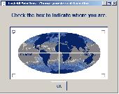
Have a GPS and a laptop? Use this to find your way. Make patterns or a trail to share with others. When the application starts, you may pick your area of operations - be it North America, South America, Europe and Asia, or Australia. Your quadrant is determined by where you are in relation to the Equator and the Prime Meridian. Tracking of your position is automatically enabled when the...
Category: Home & Education / Miscellaneous
Publisher: LogicAll Solutions, LLC, License: Freeware, Price: USD $0.00, File Size: 4.6 MB
Platform: Windows
The GPS TrackManager is an application for planning routes and managing routes, waypoints and trackpoints.
The application support functions such as: open and save trackpoints files in various formats (GPX, Ozi Trackpoint file, Ozi Waypoint file, Nmea log, EasyGPS file), transmit Trackpoints, Waypoints and Routes to Garmin GPS receivers (Geko 201, GPSmap 60C), saves trackpoints as...
Category: Internet / Communications
Publisher: Frank Hamaekers, Write4u, License: Freeware, Price: USD $0.00, File Size: 4.8 MB
Platform: Windows
The fast track to GPS success.
The fast track to GPS success. The Linx MDEV-GPS-SR contains everything needed to rapidly evaluate the SR Series GPS modules and implement them in record time. This all-inclusive Master Development System features a pre-assembled development board with an on-board OLED display for standalone testing. The system can also be attached to a PC via USB and operated using the supplied software. The...
Category: Software Development / Misc. Programming
Publisher: Linx Technologies, Inc., License: Freeware, Price: USD $0.00, File Size: 98.5 MB
Platform: Windows
Falcom Stepp Configurator is a utility tool for The Falcom Stepp device.
Falcom Stepp Configurator is a utility tool for The Falcom Stepp device.Nmea sentences can be used to send commands or configuration data to the Stepp
device. The Stepp Configurator console can be used to send the sentences to the device. The console can also be used to monitor the sentences used by the Stepp
Configurator itself while configuring the device.
Category: Utilities / Misc. Utilities
Publisher: Falcom GmbH, License: Freeware, Price: USD $0.00, File Size: 13.3 MB
Platform: Windows
OziExplorer File Format Converter converts various waypoint, route and track file formats to and from OziExplorers own file formats.
Formats Supported:
- Holux wrt waypoint and tlg track file formats (read and write)
- Magellan Mapsend waypoint and track formats (read only)
- Magellan GPS memory card waypoint and track formats (read only)
- Nmea...
Category: Utilities / Misc. Utilities
Publisher: Des Newman, License: Freeware, Price: USD $0.00, File Size: 262.9 KB
Platform: Windows
Silver lotto system
Here Are The 5 Most Frequently Asked Questions About My Lotto System:
1.
Silver lotto system
Here Are The 5 Most Frequently Asked Questions About My Lotto System:
1. Will it work in my country?
Yes, the System works for most Lotto games in any country. The only two games you can't play so far are 90 number games. The Silver Lotto System accepts all games of 5 to 7 balls and up to 69 numbers.
2. Is there any extra cost after I buy?
No, apart...
Category: Games / Cards, Casino, Lottery
Publisher: Silver lotto system, License: Freeware, Price: USD $0.00, File Size: 1.3 MB
Platform: Windows
Features
- Easy-to-learn WINDOWS™ based user interface
- Easy-to-use thanks to single key functions
- Fully automatic (no user interface needed... suited for mobile applications)
- Very fast because of a special file format (XIM file format)
- Imperial or international units or mixture of both
- Rich, detailed configuration
- Utilizes most...
Category: Multimedia & Design / Multimedia App's
Publisher: Sapper Oy, Finland, License: Freeware, Price: USD $0.00, File Size: 1.6 MB
Platform: Windows
GPicSync automatically inserts location in your photos metadata so they can also be used with any 'geocode aware' application like Picasa/Google Earth, Flickr, loc.alize.us.
Main fetures:
- automatically geocode your photos (in the EXIF header)
- use a GPS tracklog in the GPX format or Nmea format (multiple selection possible)
- Support elevation...
Category: Multimedia & Design / Digital Media Editors
Publisher: Google Project, License: Freeware, Price: USD $0.00, File Size: 0
Platform: Windows
Modular PC-Software package for planning and controlling of arbitrary sea routes with integrated calculation of time-schedules and manifold applications (Data exchange with Diesel Diagnostic System DDM 40) The Software package GLOBAL FLEET CONTROL - GFC40 is suitable for the application on your fleet. Application Profile: + Planning and controlling of arbitrary worldwide sea routes + Waypoint...
Category: Business & Finance / Project Management
Publisher: Ingenieurbuero Richter, License: Freeware, Price: USD $0.00, File Size: 42.9 MB
Platform: Windows
 Freeware
org, uses file and position names that suit to the display of the TomTom Rider, uses file, route and position names that suit to the display of the Map&Guide Motorrad Tourenplaner, remembers language, paths, window size and position. . .
Category: Business & Finance / Conversion Applications
Publisher: Christian Pesch, License: Freeware, Price: USD $0.00, File Size: 6.6 MB
Platform: Windows, Mac, Linux, Solaris, FreeBSD, OpenBSD, Java

OkMap is a GPS and map software that:
-Works with vectorial maps and calibrates raster maps
-Organizes paths by creating waypoints, routes and tracks
-Uploads/downloads data to/from your GPS
-Uses altitude DEM data
-Supports GPS real-time navigation
-Sends/receives vehicles position and display tracks on maps in real time
-Provides autorouting and geocoding...
Category: Business & Finance / Applications
Publisher: Gian Paolo Saliola, License: Freeware, Price: USD $0.00, File Size: 20.2 MB
Platform: Windows