Free Downloads: Nmea Compliant Navigation Software
License: All | Free

HS GPS is a Software library (with full C source code) which provides access to a Nmea-183 Compliant GPS receiver via a serial communications port, decoding Nmea sentences: $GPGGA, $GPGSA, $GPGSV, $GPGLL, $GPRMC and $GPVTG. Decoded parameters include: time, date, position, altitude, speed, course and heading, according to standard - Nmea-183 (National Marine...
Category: Software Development
Publisher: Hillstone Software, License: Freeware, Price: USD $0.00, File Size: 309.3 KB
Platform: Windows
GPSsim application is software based GPS device simulator.
GPSsim application is Software based GPS device simulator.
GPSsim plays back Nmea data that was saved previously. It is also possible to generate custom Nmea data.
GPSsim allows you to test various PC-based Navigation programs as well as use it as data logger application to track vehicle location
Category: Home & Education / Miscellaneous
Publisher: HL-soft, License: Freeware, Price: USD $0.00, File Size: 2.8 MB
Platform: Windows
Diffusion is done by sending sentences at format NMEA 0183 using UDP protocol .
Diffusion is done by sending sentences at format Nmea 0183 using UDP protocol .Diffused data come either from a GPS receiver or source issuing on UDP in real time Navigation mode, either from a replayed file. In case of replay, position and speed settings are modifiable.GpsDiffuser is at least compatible with itself, GeoVisu and GpsGate.
Category: Utilities / Misc. Utilities
Publisher: GeoVisu team, License: Freeware, Price: USD $0.00, File Size: 1.7 MB
Platform: Windows
AudioCompass is a navigation program for visually-impaired sailors.
AudioCompass is a Navigation program for visually-impaired sailors.
AudioCompass is a simple program: it connects to a vessel’s Nmea-0183 data network, and displays heading course and waypoint information on a compass dial.
Audio tones are generated to assist in the steering of the boat, and speech annunciation is provided for
the relevant Navigation...
Category: Business & Finance / Business Finance
Publisher: Four Fathom Marine Technology, License: Freeware, Price: USD $0.00, File Size: 418.5 KB
Platform: Windows
IPaNema reads any Nmea data from one of the serial ports (Com1-15) and delivers the Nmea data to any user selectable port and IP address using the UDP protocol acting as UDP server.
It can also act as an UDP client, receiving Nmea sentences wrapped in UDP packets and outputs these to a serial communications port
Category: Internet / Misc. Plugins
Publisher: Sailsoft, License: Freeware, Price: USD $0.00, File Size: 263.3 KB
Platform: Windows
N2KBuilder Software is a powerful, free PC-based tool for designing and verifying the integrity of Nmea 2000 networks.
The N2KBuilder Software, when installed on a Windows PC and used as part of an integrated design workflow can be used to plan, document, and validate the design of complex Nmea 2000 networks.
In addition, N2KBuilder will...
Category: Internet / Misc. Plugins
Publisher: Maretron, LLP, License: Freeware, Price: USD $0.00, File Size: 10.0 MB
Platform: Windows
VisualGPS incorporates many advanced features found in professional programs.
VisualGPS incorporates many advanced features found in professional programs. Its sole purpose is to display graphically specific Nmea 0183 sentences and show the effects of selective availability (SA).
Main Features:
- Azimuth and Elevation Graph - View all satellites that are in view. Each satellite identifies its pseudo random number (PRN) and its azimuth and...
Category: Home & Education / Miscellaneous
Publisher: VisualGPSLLC, License: Freeware, Price: USD $0.00, File Size: 1.7 MB
Platform: Windows
GPSCommunicator is a FREE utility to visually represent NMEA GPS position data in realtime.
GPSCommunicator is a FREE utility to visually represent Nmea GPS position data in realtime. It works with Nmea 0183 GPS receivers connected via a serial port. GPSCommunicator has the following features:
- Vessel position display over moving map.
- User selectable maps.
- Create and save Waypoints.
- Graphical GPS data display
- .NET components for use...
Category: Internet / Misc. Plugins
Publisher: Panazzolo.Com, License: Freeware, Price: USD $0.00, File Size: 772.5 KB
Platform: Windows
Latest proAIS Software V1.1.3.121 that allows configuration of SPST type Silent Switch and full Nmea 0183 Multiplexing. With this tool you can configure your connection to Nmea 0183. It's easy to install and in the same time i's easy to configure your settings.
Category: Home & Education / Miscellaneous
Publisher: Digital Yacht HQ, License: Freeware, Price: USD $0.00, File Size: 28.4 MB
Platform: Windows

GPS Clock Software is a freeware utility that runs on any Windows NT/2000/XP/2003 workstation or server. The Software polls time from a standard Nmea GPS time receiver connected to the host PC's serial port and optionally allows time to be synchronised on the host PC. The GPS clock utility polls GPRMC messages from a standard Nmea GPS time receiver. Information...
Category: Utilities
Publisher: ntp time server, License: Freeware, Price: USD $0.00, File Size: 1.9 MB
Platform: Windows
The program accepts NMEA GPS sentences from most GPS receivers that connect to a USB port.
The program accepts Nmea GPS sentences from most GPS receivers that connect to a USB port.
The program can display satellite images of waypoint locations on the track plotter.
Is a free Software for recording , monitoring and plotting GPS data, very useful and very easy.
Category: Home & Education / Miscellaneous
Publisher: Club Cruceros de La Paz A.C., License: Freeware, Price: USD $0.00, File Size: 10.6 MB
Platform: Windows
With this program you can convert NMEA log in format GVN, generated by GeoVisu.
With this program you can convert Nmea log in format GVN, generated by GeoVisu. GVConverter converts all files at format GVN presents in source directory and its sub-directories. It replicates source directory tree-structure into destination directory. Date and time of source file are applied to converted file. It runs on Windows 95/98/NT/2000/XP/2003.
Category: Utilities / Misc. Utilities
Publisher: GeoVisu, License: Freeware, Price: USD $0.00, File Size: 562.5 KB
Platform: Windows
The navigation device is a kind of mini computer which contains a GPS satellite navigation receiver.
The Navigation device is a kind of mini computer which contains a GPS satellite Navigation receiver. This allows the device to determine its current position. At least 4 satellites need to be received in order to be able to perform acceptable Navigation. The fifth satellite is required to obtain an altitude. As Navigation takes place in a dynamic state, there is...
Category: Business & Finance / Business Finance
Publisher: United Navigation, License: Freeware, Price: USD $0.00, File Size: 13.8 MB
Platform: Windows
A program to convert GPS-track of *. gpx, *.
mps, *. plt or *. nmea format to Navitel Tracks.
Category: Home & Education / Sports
Publisher: DXsoft, License: Freeware, Price: USD $0.00, File Size: 31.6 KB
Platform: Windows
Yet another tool to read and convert GPS logs from Royaltek RGM-3800 and RBT-2300 (using serial communication), from RBT-3000 (using files), from Nmea logs files (comming from AMOD 3080 datalogger for example). Free download and easy to install. Enjoy.
Category: Utilities / Misc. Utilities
Publisher: eXtraGPS, License: Freeware, Price: USD $0.00, File Size: 2.5 MB
Platform: Windows
GeoVisu is a program that displays georeferenced data (images, graphics) and downloads data recorded by some GPS devices.
GeoVisu has a "Moving map" Navigation function, which can be used with any Nmea 0183 compatible or Garmin USB GPS device.
Main features:
- Displays georeferenced image formats : GeoTiff, ECW and ECWP, MrSID,...
Category: Multimedia & Design / Graphics Viewers
Publisher: GeoVisu, License: Freeware, Price: USD $0.00, File Size: 1.7 MB
Platform: Windows
Portable GPS Navigation toolbar for Internet Explorer.
Portable GPS Navigation toolbar for Internet Explorer. Find portable gps units for your car, truck or minvan from top name brands including Tom Tom, Magellan and Garmin. Discover the world of eBay and shop for portable gps Navigation systems directly from your browser toolbar.
Category: Internet / Browsers
Publisher: Portable GPS Navigation System, License: Freeware, Price: USD $0.00, File Size: 1.1 MB
Platform: Windows
Kinomap GPS File Fixer allows you to process some treatments on GPS file:
- convert almost any GPS file to standard Nmea 0183, compatible with Kinomap
- fill the gaps between points when your file is not 1Hertz: the extra point will be recreated by interpolation
- cut a long file in which there are loops of data (example: race) in several parts
Category: Home & Education / Miscellaneous
Publisher: ExcelLance, License: Freeware, Price: USD $0.00, File Size: 19.6 MB
Platform: Windows
The ASP.NET 2.0 site Navigation system is built on a powerful and flexible architecture that has been designed to be extensible.
In addition to creating a compelling Navigation model that would appeal to both developers and web site designers, one of the other goals for the ASP.NET 2.0 Navigation system was to create an architecture that provided an extensibility...
Category: Web Authoring / Web Design Utilities
Publisher: Microsoft, License: Freeware, Price: USD $0.00, File Size: 155.5 KB
Platform: Windows
Ais Decoder accepts AIS data from an AIS Receiver, the Internet or a Local Network connection, decodes the data and presents the decoded data in a form suitable for display and analysis by mapping program (eg Google Earth or Google Maps), or for analysis using Excel, or by a database (eg MySql).
The decoder will decode all the Nmea content of all 27 AIS mesage types. The...
Category: Business & Finance / Business Finance
Publisher: Neal Arundale, License: Freeware, Price: USD $0.00, File Size: 2.8 MB
Platform: Windows
LXe is a windows based program for communication between your PC and all LX navigation products.
LXe is a windows based program for communication between your PC and all LX Navigation products. It enables you to manage waypoint, airspace and airport databases. You can upload and download data to and from instruments. This is an all inclusive package.
Category: Internet / Communications
Publisher: LX navigation, License: Freeware, Price: USD $0.00, File Size: 16.3 MB
Platform: Windows
Using a UDLP2 Link Shell, any UDLP2-Compliant bot can communicate with any other UDLP2-Compliant bot -- in fact, the current version of the link shell allows up to 15 bots to be in a "chat room" together. Additionally, the UDLP2 protocol is open and published on this website, so any bot programmer is free to make their own bots UDLP2 compatible.
Category: Utilities / Misc. Utilities
Publisher: Gregory G. Leedberg, License: Freeware, Price: USD $0.00, File Size: 1.4 MB
Platform: Windows

MB-GPS2KML converts a GPS log file (in plain NMEA format) to a KML file (placemark file for Google Earth) and opens this file in Google Earth. Velocity, number of satellites and HDOP are interpreted as height, color and size of the icons.
Category: Home & Education
Publisher: Markus Bader, License: Freeware, Price: USD $0.00, File Size: 441.4 KB
Platform: Windows
Cardinal Points is a free map and compass training program used to teach navigation skills.
Cardinal Points is a free map and compass training program used to teach Navigation skills. Using an expansive 360 degree panorama and interactive compass, this unique desktop application guides you through key navigational techniques; the closest thing to really being out there. Map and compass Navigation is not a dying art: GPS is undeniably useful, but nothing beats the simple...
Category: Desktop Enhancements / Shell & Desktop Managers
Publisher: YonYonson, License: Freeware, Price: USD $0.00, File Size: 256.0 KB
Platform: Windows
GPS log-maker. Software creates *.plt track file, *.rte route file and, optionally, Nmea-log file.
Category: Internet / SMS
Publisher: dxsoft.com, License: Freeware, Price: USD $0.00, File Size: 85.8 KB
Platform: Unknown
DeskSeal is a PKCS#7 compliant desktop digital signing, verification and encryption software.
DeskSeal is a PKCS#7 Compliant desktop digital signing, verification and encryption Software.It is wizard-based utility which enables even the novice users to sign and encrypt the files of any format with ease without any prior training required. It supports native PDF signing which allows users to insert visible digital signature in the PDF files.
Category: Utilities / Misc. Utilities
Publisher: Frontier Technologies Corporation, License: Freeware, Price: USD $0.00, File Size: 2.0 MB
Platform: Windows
Medical Doctor's HIPAA compliant email, manage PHI and voice transcription.
Medical Doctor's HIPAA Compliant email, manage PHI and voice transcription. Collaborate with Instant Messaging, File Sharing and Private Message Boards. Send and Receive secure email, share documents and patient information. HIPAA and GLBA Compliant. Works across networks and firewalls without a need for expensive VPN, PKI or complicated network setup and maintenance. Formally...
Category: Internet / Email
Publisher: Secure Medical.net, License: Freeware, Price: USD $0.00, File Size: 8.5 MB
Platform: Windows
COM library for sending emails from Visual Basic 6 and other COM-Compliant programming and scripting languages. Supports multiple recipients, email (MIME) attachments, AUTH and POP3 authentication, HTML email, custom headers.
Category: Software Development / Components & Libraries
Publisher: OstroSoft, License: Freeware, Price: USD $0.00, File Size: 418.0 KB
Platform: Windows
GaroNav is a simple yet useful navigation software.
GaroNav is a simple yet useful Navigation Software.
Features:
-Full text search of streets, cities and pois;
-On screen speedometers, compass, maneuvers indicator, buttons;
-Completely skinnable (alpha blending and custom shapes support for all the controls);
-Listing of standard & external POIs by distance
-Auto day/night...
Category: Home & Education / Miscellaneous
Publisher: Riccardo Garofano, License: Freeware, Price: USD $0.00, File Size: 10.5 MB
Platform: Windows
GPS Egypt brings you the best GPS mapping and Navigation package on the Egyptian market today with over 55,000 km of road coverage. The package offers the best map coverage available in Egypt, in addition to a cutting-edge Software package for voice-based routing and Navigation.
Category: Internet / Communications
Publisher: GPS Egypt, License: Freeware, Price: USD $0.00, File Size: 135.6 MB
Platform: Windows
jQuery menus are different than other plain ul' CSS and HTML menus, they bring life to your site.
jQuery menus are different than other plain ul' CSS and HTML menus, they bring life to your site. They make your site recognizable, memorable for the users. Javascript makes it possible to create more interactive, more responsive and more flexible Navigation to any website. Ranging from simple buttons and horizontal simple menus to dropdown and even menus with cool Lavalamp effect. For...
Category: Web Authoring / JavaScript
Publisher: Apycom jQuery, License: Freeware, Price: USD $0.00, File Size: 30.0 KB
Platform: Windows, Linux, Mac
Macau GeoGuide PC version, developed and maintained by the Macao Cartography and Cadastre Bureau (DSCC), is an interactive map Navigation system running on desktop PC. The main functions are map Navigation, feature searching and path finding. The Software contains rich geographic information and allows the users to explore and search for Macao maps without connecting to the...
Category: Home & Education / Miscellaneous
Publisher: DSCC, License: Freeware, Price: USD $0.00, File Size: 29.5 MB
Platform: Windows
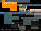
It is a builder of vertical Navigation menus. Use VMenu when you want to add a vertical Navigation menu to your site. Due to the possibility to add captions/subcaptions to the menu, you can group items and create large Navigation menus with really usable interfaces. Menus created with it are completely based on CSS and do not use scripts that is why they are most attractive...
Category: Software Development
Publisher: StrongHtml.com, License: Freeware, Price: USD $0.00, File Size: 406.0 KB
Platform: Windows
Get IEEE-compliant heat trace calculations fast!
Get IEEE-Compliant heat trace calculations fast! Create a complete bill of materials instantly. Manage all of your heat trace projects and drawings - you can even tie pipe and tank data to specific drawings. Run reports to monitor pipe temperatures. ChromaTrace also lets you set up various process scenarios to find the most cost-effective solution fast.
Category: Business & Finance / Calculators
Publisher: Chromalox, Inc., License: Freeware, Price: USD $0.00, File Size: 3.9 MB
Platform: Windows
CSS Tab Designer is a unique and easy to use Software to help you design css-based lists and tabs visually and without any programming knowledge required! With CSS Tab Designer, you can : Quickly design your list visually Choose from a variety of styles/colors (60+ different designs/colors supported) Generate strict xhtml Compliant code and much more!
Category: Internet
Publisher: OverZone Software, License: Freeware, Price: USD $0.00, File Size: 1.3 MB
Platform: Windows
XLGENLINE is an Excel-based Software program that allows the user to perform generalised least squares (GLS) regression analysis that is fully Compliant with the International Standard ISO 6143. XLGENLINE calculates the values and uncertainties of the ‘unknowns’, displays a plot of the fitted regression function, and outputs the parameters of the fit.
Category: Multimedia & Design / Multimedia App's
Publisher: NPL, License: Freeware, Price: USD $0.00, File Size: 2.6 MB
Platform: Windows
This is a different kind of chart plotting and data logging system for Navigation, pilotage and survey use in hydro graphic and also terrestrial applications. It can be run on the smallest Notebook PC for field use or larger Desktop systems. Portable Navigator is ideal for survey work because it enables users to create and update their own detailed vector charts of the area and to...
Category: Multimedia & Design / Multimedia App's
Publisher: ESL and Collins Software, License: Freeware, Price: USD $0.00, File Size: 9.9 MB
Platform: Windows
iGetNet?s Natural Language Navigation allows users to navigate the internet faster directly from the address bar. Using IGN Keywords, you no longer need to type in a long, involved URL to locate what you are looking for. Just type in the address bar what
Category: Internet / Browsers
Publisher: igetnet.com, License: Freeware, Price: USD $0.00, File Size: 96.0 KB
Platform: Windows, Mac, 2K
Z-Stack™ is TI's ZigBee compliant protocol stack for a growing portfolio of IEEE 802.
Z-Stack™ is TI's ZigBee Compliant protocol stack for a growing portfolio of IEEE 802.15.4 products and platforms. Z-Stack™ is Compliant with the ZigBee® 2007 (ZigBee and ZigBee PRO) specification, supporting both ZigBee and ZigBee PRO feature sets on the CC2530 System-on-Chip, MSP430 CC2520, and Stellaris LM3S9B96 CC2520. Z-Stack™ supports the Smart...
Category: Utilities / Misc. Utilities
Publisher: Texas Instruments, License: Freeware, Price: USD $0.00, File Size: 28.5 MB
Platform: Windows
Documents furnished with an electronic signature ensure legally Compliant business processes in the digital world. After signing, they are sent, for example, by email. The recipient of the signed electronic document can easily check it with the free digiSeal® reader from secrypt – and thus verify its authenticity and integrity.
Category: Utilities / System Utilities
Publisher: secrypt GmbH, License: Freeware, Price: USD $0.00, File Size: 13.5 MB
Platform: Windows
When you have a Pocket PC based Navigation system and your Software supports user defined POIs (Points Of Interest), you need POIView SE. This program helps you to manage, view, edit and print these POIs directly on your desktop PC. This version has direct access to the POIHandler POI collection.
Category: Utilities / Misc. Utilities
Publisher: Bluescreen, License: Freeware, Price: USD $0.00, File Size: 439.6 KB
Platform: Windows
KWizCom SharePoint Site Navigation Tree provides a hierarchical view of SharePoint sites, enabling users to easily navigate between WSS sites.
The Site Navigation Tree web part supports both WSS 2.0/SharePoint 2003, WSS 3.0/MOSS 2007 and SharePoint 2010
Category: Software Development / Misc. Programming
Publisher: KWizCom, License: Freeware, Price: USD $0.00, File Size: 23.1 KB
Platform: Windows
Download the complete DirectX SDK, which contains the DirectX Runtime and all DirectX Software required to create DirectX Compliant applications.
This DirectX SDK release contains updates to tools, utilities, samples, documentation, and runtime debug files for x64 and x86 platforms.
Supported Operating Systems:Windows 7;Windows Server 2003;Windows Server...
Category: Software Development / Management & Distribution
Publisher: Microsoft, License: Freeware, Price: USD $0.00, File Size: 571.7 MB
Platform: Windows
Eclipse SQL Explorer is a thin SQL client that allows you to query and browse any JDBC Compliant database. It supports plugins with specialized functionality for individual databases (Oracle, DB2 and MySQL) and can be extended to include specialized support for other databases.
Category: Web Authoring / Web Design Utilities
Publisher: Heiko Hilbert, License: Freeware, Price: USD $0.00, File Size: 73.4 MB
Platform: Windows

OkMap is a GPS and map Software that:
-Works with vectorial maps and calibrates raster maps
-Organizes paths by creating waypoints, routes and tracks
-Uploads/downloads data to/from your GPS
-Uses altitude DEM data
-Supports GPS real-time Navigation
-Sends/receives vehicles position and display tracks on maps in real time
-Provides autorouting and geocoding...
Category: Business & Finance / Applications
Publisher: Gian Paolo Saliola, License: Freeware, Price: USD $0.00, File Size: 20.2 MB
Platform: Windows
CMS presents the Medicare Remit Easy Print (MREP) Software to view and print the Health Insurance Portability and Accountability Act (HIPAA) Compliant 835 for professional providers and suppliers. This Software, which is available for free to Medicare providers and suppliers, can be used to access and print remittance advice information, including special reports, from the...
Category: Business & Finance / Business Finance
Publisher: Dan Melton / ViPS Inc., License: Freeware, Price: USD $0.00, File Size: 1.7 MB
Platform: Windows
MOTOEXTRAS™ offers several bundles of popular maps and other extra content such as 3D city maps at special prices. MOTONAV Toolbox is a FREE Windows utility designed to connect your Navigation device with your PC.
You must download it to see all available updates, purchase updates, download the necessary files and upload updates and new content to your...
Category: Multimedia & Design / Graphics Viewers
Publisher: Nav N Go Kft., License: Freeware, Price: USD $0.00, File Size: 8.0 MB
Platform: Windows
The BIMx Desktop Viewer is a native Mac/Win application that allows you to view the BIM Explorer models (saved in bimx file format) on desktop computers and notebooks. Please note that the BIMx Desktop Viewer application is included in the ArchiCAD 15 package so you don't have to download it if you already have ArchiCAD 15 installed on your computer.
Using GRAPHISOFT BIMx and...
Category: Multimedia & Design / Multimedia App's
Publisher: Graphisoft, License: Freeware, Price: USD $0.00, File Size: 29.6 MB
Platform: Windows
Make page and site navigation simple and intuitive for your users.
Make page and site Navigation simple and intuitive for your users. Choose between CGI or JavaScript development methods. The list appears as a drop-down menu from which you can select one item. On clicking the 'Go' button you are automatically taken to the appropriate URL. The links can be between different sections in the same page, between pages on your site and between sites.
Category: Internet / Tools & Utilities
Publisher: WebGenie Software Pty Ltd, License: Freeware, Price: USD $0.00, File Size: 563.2 KB
Platform: Windows
MySQL Connector/ODBC (also known as MyODBC) allows you to connect to a MySQL database server using the ODBC database API on all Microsoft Windows and most Unix platforms, including through such applications and programming environments such as Microsoft Access, Microsoft Excel, and Borland Delphi.
Standards Compliant
The production-ready version of Connector/ODBC is...
Category: Web Authoring / Web Design Utilities
Publisher: MySQL AB, License: Freeware, Price: USD $0.00, File Size: 0
Platform: Windows