Free Downloads: Raster Image In Mapinfo
License: All | Free
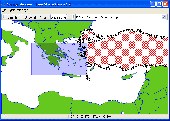
The Geosoft Plug-in for Mapinfo is an extension to the Mapinfo desktop software that provides data retrieval using DAP and also support for reading Geosoft file formats. The plug-in enables users to view Geosoft grid files as a Raster layer inside Mapinfo. The plug-in also enables users to view Geosoft Maps as layers.
Category: Home & Education / Miscellaneous
Publisher: GEOSoft, License: Freeware, Price: USD $0.00, File Size: 109.1 MB
Platform: Windows
EasyLoader is a Windows-only utility available from Pitney Bowes Mapinfo Corporation that allows you to upload Mapinfo .tab files to a remote database.If using this release of the EasyLoader v10.0 MBX via the Tools menu in Mapinfo Professional, it will require Mapinfo Professional v10.0.
Category: Multimedia & Design / Multimedia App's
Publisher: Pitney Bowes Software Inc., License: Freeware, Price: USD $0.00, File Size: 1.8 MB
Platform: Windows
GEScene is a Mapinfo utility that allows images to be exchanged in both directions between Mapinfo and Google Earth. Placemarks can also be created in Google Earth by using Mapinfo as a point of reference to easily pinpoint more obscure locations. Images saved in Google Earth can be registered and displayed in Mapinfo to compliment existing map layers. Conversely,...
Category: Utilities / Misc. Utilities
Publisher: Peter Doyle, License: Freeware, Price: USD $0.00, File Size: 3.2 MB
Platform: Windows
The Mapinfo License Server must be installed on your network and be accessible to all Mapinfo Professional users. Mapinfo Professional is a powerful Microsoft Windows-based mapping and geographic analysis application from the experts in location intelligence. Designed to easily visualize the relationships between data and geography, Mapinfo Professional helps...
Category: Home & Education / Miscellaneous
Publisher: Pitney Bowes MapInfo, License: Freeware, Price: USD $0.00, File Size: 12.1 MB
Platform: Windows
Mapinfo ProViewer™ lets you share location intelligence with clients and co-workers, even if they do not have Mapinfo Professional. ProViewer allows anyone to open, view and manipulate your Mapinfo Professional maps, tables and analyses with easy-to-use functionality including print, zoom, scroll, select objects, measure distances and view details.
Category: Multimedia & Design / Graphics Viewers
Publisher: MapInfo Corporation, License: Freeware, Price: USD $0.00, File Size: 419.6 KB
Platform: Windows
The Mapinfo Line Style Editor works by modifying the file from which Mapinfo reads its line style definitions. MILISTED can open any valid Mapinfo line style definition file, modify it, and save it with any name, however, Mapinfo only experiences the changes when it starts up and reads the mapinfow.pen file it finds in the same directory as mapinfow.exe. You can have...
Category: Multimedia & Design / Digital Media Editors
Publisher: Victor O. Lomtev, License: Freeware, Price: USD $0.00, File Size: 961.7 KB
Platform: Windows
PHOTOMOD GeoMosaic is intended for working with various types of digital images, including aerial and space imagery as well as digitized Raster maps.
The program functionality includes:
- Georeferencing of Raster images;
- Transforming images from one coordinate system to another, using an extensive database supplied or custom created coordinate...
Category: Multimedia & Design / Multimedia App's
Publisher: Racurs, License: Freeware, Price: USD $0.00, File Size: 36.5 MB
Platform: Windows
GlobeXplorer's ImageConnect for Mapinfo is a unique extension that instantly brings georeferenced satellite and aerial photos into your desktop or mobile project from our online database. ImageConnect takes away the time, cost and hassle of locating an Image provider, waiting for delivery, and managing large Image files.
Category: Internet / Misc. Plugins
Publisher: GlobeXplorer, LLC, License: Freeware, Price: USD $0.00, File Size: 2.0 MB
Platform: Windows
It`s a FREE ESRI shape files (*.shp), Mapinfo interchange (*.mif) and AutoCAD *.dxf viewer. Using this utility you can view *.shp files (ESRI shape files), *.mif files (Mapinfo interchange) and AutoDesk AutoCAD *.dxf. No other files are needed.
Category: Multimedia & Design
Publisher: Avangardo, License: Freeware, Price: USD $0.00, File Size: 420.9 KB
Platform: Windows

The free AvisMap Viewer opens most GIS/CAD and Raster Image file types and most ArcView, ArcExplorer, and Mapinfo projects. Besides just opening and viewing files, the Viewer supports an extensive list of features including visual layer properties control, legend control, thematic mapping, spatial and attribute querying, custom labeling, on-map measurements,...
Category: Software Development / Components & Libraries
Publisher: AvisMap GIS Technologies, License: Freeware, Price: USD $0.00, File Size: 22.3 MB
Platform: Windows
GraphicsGale is a software for editing raster format image.
GraphicsGale is a software for editing Raster format Image. You can retouch a photo, paint a picture, and so on. In addition, you can make an animation with seeing its preview in real-time. This feature must be useful for making an animated GIF or a video-game character.
Category: Multimedia & Design / Media Management
Publisher: HUMANBALANCE Co.,Ltd., License: Freeware, Price: USD $0.00, File Size: 1.6 MB
Platform: Windows
This program is a tool for stretching a bitmap Image (a Raster Image), trimming it to a box, and calibrating it. This is primarily of use when dealing with a scanned Image of a paper map. Often when making a scan it is hard to get the Image precisely aligned; sometimes with old maps the paper has stretched. It can be useful where you want to make a tiled map...
Category: Multimedia & Design / Multimedia App's
Publisher: Map Library, License: Freeware, Price: USD $0.00, File Size: 755.8 KB
Platform: Windows
When you are looking for a powerful tool to satisfy various needs regarding vectors, Raster and satellite imagery, you will find ILWIS Academic an efficient application. The program comes with such useful features as points to create maps, lines for segment maps, closed area segments for polygon maps, spatial operations for Raster maps and so on. Whilst using images from satellite...
Category: Home & Education / Miscellaneous
Publisher: ITC, License: Freeware, Price: USD $0.00, File Size: 19.4 MB
Platform: Unknown
Panoply is a Java application which enables the user to plot Raster images of geo-gridded data from netCDF datasets. Panoply is an utility that enable user to plot Raster Image. Depending on the data, it can draw global longitude-latitude images or pole-t
Category: Multimedia & Design / Illustration
Publisher: giss.nasa.gov, License: Freeware, Price: USD $0.00, File Size: 9.4 MB
Platform: Windows, Mac, 2K, 2K3, Vista
Pixelitor is a cross-platform raster graphics editor written in Java.
Pixelitor is a cross-platform Raster graphics editor written in Java. It supports Image filters, drawing, layers, unlimited undo, etc.
Category: Multimedia & Design / Image Editing
Publisher: sourceforge.net, License: Freeware, Price: USD $0.00, File Size: 1.1 MB
Platform: Windows, Mac, Vista
Live DXF2BMP is free software that converts CAD generated drawing to Raster Image; drawings can be generated by any CAD program that support DXF format such as AutoCAD.
The most amazing thing in this utility is that its standalone converter, so no AutoCAD® or other CAD program installation is required! Output Image file properties can be controlled by the user;...
Category: Audio / Rippers & Encoders
Publisher: Engineering Knowledge, License: Freeware, Price: USD $0.00, File Size: 1.6 MB
Platform: Windows
GTXImage CAD is a total Raster and vector drawing system for bringing paper drawings into a modern CAD, EDM or GIS environment. It includes powerful, industry standard two-dimensional CAD functionality that fully supports comprehensive hybrid Raster and vector capabilities. It also provides highly efficient Raster enhancement and editing features that permit you to make the...
Category: Multimedia & Design / Image Editing
Publisher: GTX, License: Freeware, Price: USD $0.00, File Size: 248.0 MB
Platform: Windows
The online Image viewer is a free online Raster imaging service that allows people to view, resize, edit and convert the popular Image formats within their web browsers. By using it, webmasters, bloggers or anyone creating a web site are able to embed the high-quality images into their web pages. Loading PDF, BMP, GIF, ICO, JPEG, JPEG 2000, PCX, PNG, PSD, TIF, WMF, WBMP,...
Category: Multimedia & Design / Graphics Viewers
Publisher: Viscomsoft Online, License: Freeware, Price: USD $0.00, File Size: 655.4 KB
Platform: Windows
With the CAD Studio's utility - GeoRefImg - you can automatically place georeferenced Raster files (pictures) also in AutoCAD or Architectural Desktop (this correlation functionality is by default available only in AutoCAD Map, Civil3D and Raster Design). GeoRefImg - georeferencing for AutoCAD and ADT - automatic repositioning of Raster images (with georeference world...
Category: Multimedia & Design / Image Editing
Publisher: CAD Studio, License: Freeware, Price: USD $0.00, File Size: 55.3 KB
Platform: Windows
 Freeware
JPG to PDF Converter Free is easy to use, document conversion utility, that designed to convert JPG/JPEG into PDF files. Can convert JPG/JPEG and many Raster Image formats into one PDF document in batch mode. If you need to convert some or thousands of JPG or any images, located in one or many different folders, into a PDF, this is your conversion tool. Can merge several JPG...
Category: Business & Finance / Document Management
Publisher: FM Software Studio, License: Freeware, Price: USD $0.00, File Size: 721.0 KB
Platform: Windows
ArcScripts is intended for the free exchange of scripts and tools related to ESRI software products.
ArcScripts is intended for the free exchange of scripts and tools related to ESRI software products. Please alert the moderator if this script is a demo, trial-version, or an advertisement for a retail product.
Akin to the GRIDSPOT AML in workstation ArcInfo, this VB tool overlays a point shapefile or point coverage on a Raster layer and assigns the value of the...
Category: Multimedia & Design / Multimedia App's
Publisher: Dan Rathert, License: Freeware, Price: USD $0.00, File Size: 7.4 KB
Platform: Windows
Freeware
If you want to edit a Raster file in your CAD program, you first have to convert it to a vector file. RasterVect does just that, transforming paper drawings or Raster images into a vector format. Raster images can be imported by scanning original paper drawings. There is TWAIN and WIA support for importing from all scanners. The target vector formats (DXF, WMF, EMF, EPS and...
Category: Multimedia & Design / Image Editing
Publisher: RasterVect Software, License: Freeware, Price: USD $0.00, File Size: 2.8 MB
Platform: Windows
Chips, the Copenhagen Image Processing System, is a general-purpose software package for remote sensing Image processing and spatial data analysis with extensive support for NOAA AVHRR data.
Chips can be used both as a stand-alone system, as well as a powerful supplemental Image-processing tool for GIS products like Mapinfo™ and ArcView™.
Category: Multimedia & Design / Multimedia App's
Publisher: Chips Development Team, License: Freeware, Price: USD $0.00, File Size: 5.9 MB
Platform: Windows
MIview is an OpenGL based medical Image viewer that contains useful tools such as a DICOM anonymizer and format conversion utility. MIView can read DICOM, Analyze/Nifti, and Raster images, and can write Analyze/Nifti and Raster images. It can also read an
Category: Multimedia & Design / Graphics Viewers
Publisher: gbooksoft.com, License: Freeware, Price: USD $0.00, File Size: 1.7 MB
Platform: Windows
The program helps you to to view the Image files on the Mac, and convert them to numerous vector and Raster formats including PDF, JPG, GIF, TIF, PSD, PICT, PNG, BMP, and SGI. You can navigate throught the images in a folder using navigation keys and keyboard shortcuts. Changing the view size allows to view at different zoom amounts.
Category: Multimedia & Design / Graphics Viewers
Publisher: Cristallight Inc., License: Freeware, Price: USD $0.00, File Size: 361.0 KB
Platform: Mac, Linux
LocalConnect is the included application for converting and uploading Vectors, Images, Maps, and Elevation to GISRoam.
LocalConnect includes tools to automatically convert your source data to GISRoam formats and projections in the following formats:
* Elevation in the form of DTED, DEM, ARCGrid, GEOTIFF, SRTM, XYZ Grid, and BIL.
* Imagery in the form of MRsid, ECW, IMG,...
Category: Internet / File Sharing
Publisher: Cogent3D, License: Freeware, Price: USD $0.00, File Size: 26.4 MB
Platform: Windows
The program helps you to view the Image files on the Mac, and convert them to numerous vector and Raster formats including PDF, EPS, JPG, GIF, TIF, PSD, PICT, PNG, BMP, and SGI.
You can navigate through the images in a folder using navigation keys and keyboard shortcuts. Changing the view size allows to view at different zoom amounts.Also you have ability to rotate selected...
Category: Multimedia & Design / Graphics Viewers
Publisher: Cristallight Software, License: Freeware, Price: USD $0.00, File Size: 4.8 MB
Platform: Mac
Pixel-Zip is a Raster Image compressor and decompressor designed specifically for the graphic arts and related markets with especially developed large file, 16-bit and native CMYK mode compression support with algorithms tailored at maximum colour and quality retention. You may not know this, but many similar technologies in the market actually convert CMYK images into RGB,...
Category: Multimedia & Design / Authoring Tools
Publisher: Pixel-Zip Team, License: Freeware, Price: USD $0.00, File Size: 1.2 MB
Platform: Windows
Geomatica FreeView is a flexible data viewing tool supporting over 100 Raster and vector formats for loading, viewing, selection, and enhancement. FreeView is useful for any geospatial data viewing application, and is freely distributable.
FreeView includes a modern interface with many useful display tools, including fast roam and zoom, Image enhancements, numeric...
Category: Business & Finance / Database Management
Publisher: PCI Geomatics, License: Freeware, Price: USD $0.00, File Size: 39.9 MB
Platform: Windows
This stand alone application aids in the loading of CD's of CADRG data from NIMA.
This stand alone application aids in the loading of CD's of CADRG data from NIMA. The application uses ArcInfo Workstation, ArcObjects, and ArcSDE to load each frame file from the CD into either a Raster dataset or a Raster catalog. The application comes with an installer and the unpacked product aswell.
Category: Multimedia & Design / Image Editing
Publisher: ESRI, License: Freeware, Price: USD $0.00, File Size: 1.1 MB
Platform: Windows
SuperEdit is a standalone editor for Tessel Composite Documents (TCD).
SuperEdit is a standalone editor for Tessel Composite Documents (TCD). It offers advanced functions to edit full size Raster images. SuperEdit shares editing capabilities with CADRaster and can be used by customers that do not use AutoCAD.
SuperEdit is excellent tool to correct defects introduced by the source material or scanning process. After that you can use scanned...
Category: Multimedia & Design / Digital Media Editors
Publisher: Tessel Systems, License: Freeware, Price: USD $0.00, File Size: 10.1 MB
Platform: Windows
pdf2raster is a small tool for converting pages of a pdf file into raster images (gif, png or jpg).
pdf2raster is a small tool for converting pages of a pdf file into Raster images (gif, png or jpg).
The quality of the result is very good, specially when using antialias and the file size is relatively small, when applying a color reduction to 256 colors or less.
Category: Multimedia & Design / Media Management
Publisher: RebluSoft, License: Freeware, Price: USD $0.00, File Size: 283.0 KB
Platform: Windows
RASTER Music Tracker (RMT) is a cross-platform tool for making Atari XE/XL music on PC (OS Win9x).
Raster Music Tracker (RMT) is a cross-platform tool for making Atari XE/XL music on PC (OS Win9x). RMT uses Atari XE/XL music routine of my own - They developed it for a very long time and I hope it will take a fancy of all Atari musicians and fans. ;-)
They are still working on this RMT project in my spare time (it means already hundreds of hours of programming, debugging,...
Category: Audio / Music Creation
Publisher: Radek Sterba, License: Freeware, Price: USD $0.00, File Size: 500.0 KB
Platform: Windows
Easily Draw and Create Graphic Images. DrawPad is an easy-to-use Image composition and manipulation program, and an essential tool for all types of graphic design projects, including: Creating banner ads or invitations, Make sketches and paintings on your computer, Draw diagrams, icons and other web graphics. DrawPad is ideal for creating images, drawings, and for paintings. DrawPad...
Category: Multimedia & Design / Graphics Viewers
Publisher: NCH Software, License: Freeware, Price: USD $0.00, File Size: 1.7 MB
Platform: Windows
Easily Draw and Create Graphic Images. DrawPad is an easy-to-use Image composition and manipulation program, and an essential tool for all types of graphic design projects, including: Creating banner ads or invitations, Make sketches and paintings on your computer, Draw diagrams, icons and other web graphics. DrawPad is ideal for creating images, drawings, and for paintings. DrawPad...
Category: Multimedia & Design / Graphics Viewers
Publisher: NCH Software, License: Freeware, Price: USD $0.00, File Size: 12.7 MB
Platform: Mac
Free Image Editor is a bitmap Image-editing application that lets you retouch existing photos or create original graphics. Free Image Editor gives you the tools and supplies of a professional graphic design studio. There is TWAIN and support for importing from any scanner. Free Image Editor provides a rich graphics toolset for digital photography, print production...
Category: Multimedia & Design / Graphics Viewers
Publisher: AskedFiles, License: Freeware, Price: USD $0.00, File Size: 1.6 MB
Platform: Windows
FlamMap is a fire behavior mapping and analysis program that computes potential fire behavior characteristics (spread rate, flame length, fireline intensity, etc.) over an entire FARSITE landscape for constant weather and fuel moisture conditions. For more information, look under National Systems in the menu at the top of each page.
The FlamMap software creates Raster maps...
Category: Business & Finance / Business Finance
Publisher: SEM, License: Freeware, Price: USD $0.00, File Size: 6.2 MB
Platform: Windows
PCX (Personal Computer eXchange) was the native file format for PC Paintbrush and before GIF, JPEG and PNG, was one of the first widely accepted DOS imaging standards. This Image file format was developed by ZSoft Corporation of Marietta, Georgia, USA.
PCX is a Raster Image format, the file header stores metadata about the Image, separately from the...
Category: Multimedia & Design / Graphics Viewers
Publisher: IdeaMK, License: Freeware, Price: USD $0.00, File Size: 10.4 MB
Platform: Windows
Freeware
Stylepix is Style + Pictures. This means your pictures with nice style. Intuitive User Interface StylePix's user interface is intuitive. It is designed to control the selected functions easy and conveniently. Even if you have no experience, you can easily learn how to edit Image and retouching your photos. As a result, StylePix's intuitive UI reduces your working time. It's...
Category: Multimedia & Design / Image Editing
Publisher: Hornil, License: Freeware, Price: USD $0.00, File Size: 2.2 MB
Platform: Windows
TerraView handles vector data (polygons, lines and points) and Raster data (grids and images), both stored in a relational or geo-relational database, including ACCESS, PostgreSQL, MySQL and Oracle. TerraView is able to convert to the current version of TerraLib database only databases in the immediately previous version.
Category: Home & Education / Miscellaneous
Publisher: TerraView, License: Freeware, Price: USD $0.00, File Size: 113.9 MB
Platform: Windows
THBPdf is a command line PDF (Portable Document Format) utility that offers some nifty functions to create and edit existing PDF 's. Create a new PDF file from all common Raster Image files like Gif, Tiff, Jpeg, Jpeg2000 , Jbig2 , PCX, TGA, PSD, ... Pass a folder to your Image files and you will get a multipage PDF file containing all the pictures from the folder....
Category: Multimedia & Design / Multimedia App's
Publisher: THBComponentware, License: Freeware, Price: USD $0.00, File Size: 5.8 MB
Platform: Windows
Ghostscript is the name of a set of software that provides: An interpreter for the PostScript (TM) language, with the ability to convert PostScript language files to many Raster formats, view them on displays, and print them on printers that don't have PostScript language capability built in; An interpreter for Portable Document Format (PDF) files, with the same abilities; The...
Category: Multimedia & Design / Multimedia App's
Publisher: ghostscript.com, License: Freeware, Price: USD $0.00, File Size: 0
Platform: Windows
Easily draw and create graphic images with DrawPad - Graphic Design and Drawing software. DrawPad is an easy-to-use Image composition and manipulation program, and an essential tool for all types of graphic design projects, including: Creating banner ads or invitations, Make sketches and paintings on your computer, Draw diagrams, icons and other web graphics. DrawPad is ideal for...
Category: Multimedia & Design / Graphics Viewers
Publisher: NCH Software, License: Freeware, Price: USD $0.00, File Size: 6.5 MB
Platform: Windows
GenesisIV understands GIS concepts like layers, shape objects and georeferencing.
GenesisIV understands GIS concepts like layers, shape objects and georeferencing. It interfaces to industry standard GIS systems such as Mapinfo and ArcView so you can use your existing data without having to learn new concepts or perform difficult manipulations.
GenesisIV is the only landscape product designed specifically to help teach geographical concepts. You're up...
Category: Multimedia & Design / Multimedia App's
Publisher: Geomantics, License: Freeware, Price: USD $0.00, File Size: 17.6 MB
Platform: Windows
ER Mapper Image Compressor - compressing, mosaicking and color balancing aerial and satellite images to JPEG 2000 and ECW formats makes them manage, share and use in your business activities. ER Mapper Image Compressor is a flexible, high-speed geospatial Image data compression application.
Main features:
-ER Mapper Algorithm (.alg)
-ER Mapper...
Category: Multimedia & Design / Image Editing
Publisher: Earth Resource Mapping, License: Freeware, Price: USD $0.00, File Size: 33.5 MB
Platform: Windows
All-in-one image related tools (Image Viewer, Image Optimizer, Image Resizer, Image Converter, Duplicate Image Finder, etc).
Category: Web Authoring / Image Mapping Tools
Publisher: Fahmy Corporation, License: Freeware, Price: USD $0.00, File Size: 1.6 MB
Platform: Windows
A unique program for make 3D image.
A unique program for make 3D Image. Two creation mode: manual mode use two images created with different angles and offset and fully automatic mode when 3D stereoscoping Image created from one Image with help special 3d algorithms. 3D Image Creator converts an ordinary 2D Image, photo into 3D stereoscopic anagliph Image with special effects, you'll...
Category: Audio / Rippers & Encoders
Publisher: AxaraMedia, License: Freeware, Price: USD $0.00, File Size: 12.2 MB
Platform: Windows
InterpOSe for Digimap is designed to process the data delivered as part of EDINA's new OS MasterMap service for Academic Organisations within the UK. It handles both the Topography and ITN layers of OS MasterMap for conversion to various file formats, including Shape, TAB, mid/mif and DWG/DXF.
The InterpOSe for Digimap edition can slice OS MasterMap data into tiles, which...
Category: Business & Finance / Business Finance
Publisher: Dotted Eyes, License: Freeware, Price: USD $0.00, File Size: 65.5 MB
Platform: Windows
The DualCAD project is an ongoing project "over 17 years" to create a freeware cad application that handles the basic needs of most microstation users. Currently DualCAD is aimed at the 2D user with perhaps rotated views , reference files, and hybrid Raster files. DualCAD can be run under LINUX using WINE. For more advanced CAD needs please look at PcsCustom. DualCAD Review is...
Category: Multimedia & Design / Image Editing
Publisher: Pangaea CAD Solutions, License: Freeware, Price: USD $0.00, File Size: 7.6 MB
Platform: Windows
CyberView Image is built as an advanced, interactive JPEG Image compressor CyberView Image is built as an advanced, interactive JPEG Image compressor. It is based on Powerful Selective Compression Engine.
Excellent compression results and very flexible user interface are the key features of this program. CyberView Image makes it possible to...
Category: Multimedia & Design / Media Catalogers
Publisher: CyberView Corporation, License: Freeware, Price: USD $0.00, File Size: 1.0 MB
Platform: Windows