Free Downloads: Raster Maps Asia
License: All | Free
When you are looking for a powerful tool to satisfy various needs regarding vectors, Raster and satellite imagery, you will find ILWIS Academic an efficient application. The program comes with such useful features as points to create Maps, lines for segment Maps, closed area segments for polygon Maps, spatial operations for Raster Maps and so on. Whilst...
Category: Home & Education / Miscellaneous
Publisher: ITC, License: Freeware, Price: USD $0.00, File Size: 19.4 MB
Platform: Unknown
The Asia Pacific Screen Awards (APSA) promote and acclaim the cinematic excellence and cultural diversity of the vast Asia-Pacific region.
APSA View is the APSA’s online Academy voting platform. The online platform is completely secure for the process of determining the Nominees in the fifth annual Asia Pacific Screen Awards.
Category: Audio / Utilities & Plug-Ins
Publisher: Vplay Pty Ltd, License: Freeware, Price: USD $0.00, File Size: 4.1 MB
Platform: Windows
This program is a tool for stretching a bitmap image (a Raster image), trimming it to a box, and calibrating it. This is primarily of use when dealing with a scanned image of a paper map. Often when making a scan it is hard to get the image precisely aligned; sometimes with old Maps the paper has stretched. It can be useful where you want to make a tiled map from a number of...
Category: Multimedia & Design / Multimedia App's
Publisher: Map Library, License: Freeware, Price: USD $0.00, File Size: 755.8 KB
Platform: Windows
PHOTOMOD GeoMosaic is intended for working with various types of digital images, including aerial and space imagery as well as digitized Raster Maps.
The program functionality includes:
- Georeferencing of Raster images;
- Transforming images from one coordinate system to another, using an extensive database supplied or custom created...
Category: Multimedia & Design / Multimedia App's
Publisher: Racurs, License: Freeware, Price: USD $0.00, File Size: 36.5 MB
Platform: Windows
Representing a new concept in the field of Ham Maps, the Global Overlay Mapping System is packed full of features for all Ham Radio enthusiasts, including : 1 World Map, with specialised satellite images and world region-boundaries. 8 Continental Maps - Europe, Asia, Africa, North and South America, Oceania, Arctic, Antarctica. 29 Sub Continental Maps, with Single...
Category: Home & Education / Miscellaneous
Publisher: MapAbility, License: Freeware, Price: USD $0.00, File Size: 4.9 MB
Platform: Windows
GameBox Asia is our excellent quality, authentic collection of three famous tile games of the Orient.
Incredible graphics, authentic Chinese tile sets and boards, and incredible playability combine to make this the best possible tile game for mobile evices.
Category: Games / Misc. Games
Publisher: PDAmill Game Studio, License: Freeware, Price: USD $0.00, File Size: 1.6 MB
Platform: Windows

OkMap is a GPS and map software that:
-Works with vectorial Maps and calibrates Raster Maps
-Organizes paths by creating waypoints, routes and tracks
-Uploads/downloads data to/from your GPS
-Uses altitude DEM data
-Supports GPS real-time navigation
-Sends/receives vehicles position and display tracks on Maps in real time
-Provides autorouting...
Category: Business & Finance / Applications
Publisher: Gian Paolo Saliola, License: Freeware, Price: USD $0.00, File Size: 20.2 MB
Platform: Windows

FSS Google Maps Downloader is a tool that can download the Google Maps images to your PC. This is a clearly free program. There is no spyware or adware. It's absolutely safe to install and to run. The interface is very simple and self explaining. It runs low on system resources consumption and is supported on all Windows versions. It can save them to your hard disk,...
Category: Internet / Download Managers
Publisher: FreeSmartSoft, License: Freeware, Price: USD $0.00, File Size: 874.0 KB
Platform: Windows
Diffuse maps represent the absorption of light.
Diffuse Maps represent the absorption of light. Diffuse Maps are what people call "textures". They are the color textures or photographic textures usually applied to 3d models.
ShaderMap creates displacement Maps using the light data stored inside of diffuse Maps. Evenly lit diffuse Maps generally create better quality Maps with ShaderMap.
Category: Home & Education / Miscellaneous
Publisher: Rendering Systems Inc., License: Freeware, Price: USD $0.00, File Size: 4.0 MB
Platform: Windows

Tibet is a mysterious area in Central Asia.
Tibet is a mysterious area in Central Asia. It is the highest region on Earth and is commonly referred to as the "Roof of the World." The heart of Buddhism and the magnificent Potala Palace (residence of Dalai Lama) are there. Tibet shows to rare tourists the unusual culture, manners, architecture, environment, etc.
This screensaver will open the window to Tibet on the...
Category: Multimedia & Design / Screen Capture
Publisher: Savers4Free.com, License: Freeware, Price: USD $0.00, File Size: 4.5 MB
Platform: Windows
MapComp is a powerful and free Windows Software for drawing images of linkage Maps and to compare linkage Maps and indicate common markers.
MapInspect can display, print and save images, and has no limit to the number of Maps it can compare (but only neighbouring Maps are compared). Maps can be flipped within MapINspect, an the on-screen order of...
Category: Multimedia & Design / Multimedia App's
Publisher: MapInspect, License: Freeware, Price: USD $0.00, File Size: 616.7 KB
Platform: Windows
FlamMap is a fire behavior mapping and analysis program that computes potential fire behavior characteristics (spread rate, flame length, fireline intensity, etc.) over an entire FARSITE landscape for constant weather and fuel moisture conditions. For more information, look under National Systems in the menu at the top of each page.
The FlamMap software creates Raster...
Category: Business & Finance / Business Finance
Publisher: SEM, License: Freeware, Price: USD $0.00, File Size: 6.2 MB
Platform: Windows
This software development kit (SDK) provides the binaries and programming reference for the Bing Maps Silverlight Control. You can use this control to build your own web sites that use Bing Maps.
The Bing Maps Silverlight Control combines the power of Silverlight and Bing Maps to provide an enhanced mapping experience. Developers can use the Bing...
Category: Utilities / Misc. Utilities
Publisher: Microsoft, License: Freeware, Price: USD $0.00, File Size: 3.8 MB
Platform: Windows
GTXImage CAD is a total Raster and vector drawing system for bringing paper drawings into a modern CAD, EDM or GIS environment. It includes powerful, industry standard two-dimensional CAD functionality that fully supports comprehensive hybrid Raster and vector capabilities. It also provides highly efficient Raster enhancement and editing features that permit you to make the...
Category: Multimedia & Design / Image Editing
Publisher: GTX, License: Freeware, Price: USD $0.00, File Size: 248.0 MB
Platform: Windows
SensAct -SENSORS CONVERSION Maps AND ACTUATORS COMMAND Maps
This software pack contents the sensors conversion Maps and the actuators command Maps like motorized throttles, gasoline injectors corrections, ...
It is mandatory to install it to select the type of sensor and actuators that are equiping the ECUs, because these Maps are no longer...
Category: Business & Finance / Applications
Publisher: Skynam, License: Freeware, Price: USD $0.00, File Size: 3.4 MB
Platform: Windows
PlanetGIS Explorer is a free viewer for PlanetGIS maps and GIS exchange files.
PlanetGIS Explorer is a free viewer for PlanetGIS Maps and GIS exchange files. PlanetGIS Explorer allows you to navigate through Maps, query map elements and view attribute information from linked database tables. Also PlanetGIS Explorer allows you to customize the appearance of Maps for purposes of creating hardcopy printouts, but does not allow you to save any changes to...
Category: Multimedia & Design / Graphics Viewers
Publisher: Planet GIS, License: Freeware, Price: USD $0.00, File Size: 5.4 MB
Platform: Windows
With the CAD Studio's utility - GeoRefImg - you can automatically place georeferenced Raster files (pictures) also in AutoCAD or Architectural Desktop (this correlation functionality is by default available only in AutoCAD Map, Civil3D and Raster Design). GeoRefImg - georeferencing for AutoCAD and ADT - automatic repositioning of Raster images (with georeference world...
Category: Multimedia & Design / Image Editing
Publisher: CAD Studio, License: Freeware, Price: USD $0.00, File Size: 55.3 KB
Platform: Windows
ArcScripts is intended for the free exchange of scripts and tools related to ESRI software products.
ArcScripts is intended for the free exchange of scripts and tools related to ESRI software products. Please alert the moderator if this script is a demo, trial-version, or an advertisement for a retail product.
Akin to the GRIDSPOT AML in workstation ArcInfo, this VB tool overlays a point shapefile or point coverage on a Raster layer and assigns the value of the...
Category: Multimedia & Design / Multimedia App's
Publisher: Dan Rathert, License: Freeware, Price: USD $0.00, File Size: 7.4 KB
Platform: Windows
 Freeware
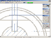
If you want to edit a Raster file in your CAD program, you first have to convert it to a vector file. RasterVect does just that, transforming paper drawings or Raster images into a vector format. Raster images can be imported by scanning original paper drawings. There is TWAIN and WIA support for importing from all scanners. The target vector formats (DXF, WMF, EMF, EPS and...
Category: Multimedia & Design / Image Editing
Publisher: RasterVect Software, License: Freeware, Price: USD $0.00, File Size: 2.8 MB
Platform: Windows
Live Satellite Maps or Google maps is a web server mapping applications.
Live Satellite Maps or Google Maps is a web server mapping applications.Provides scrolling map images and satellite photos around the earth and even the route between different places.Since 6 October 2005, live satellite Maps is part of local Google.Google live satellite Map provides the ability to zoom in or zoom out to show the map.The user can control the map with your...
Category: Home & Education / Science
Publisher: www.satelliteview-of-my-house.com, License: Freeware, Price: USD $0.00, File Size: 643.0 KB
Platform: Windows
Nokia Maps 3D browser plugin is a free mapping product and service by Nokia for its mobile phones and for internet browsers. Nokia Maps includes voice guided navigation for both pedestrians and drivers for 74 countries in 46 different languages and there are Maps for over 180 countries.
See the world in high-resolution 3D. Everything from the sky to the street. Plan...
Category: Internet / Browser Accessories
Publisher: Nokia, License: Freeware, Price: USD $0.00, File Size: 9.8 MB
Platform: Windows
Learn about the history of horse betting and horse racing from its beginnings in the time when the first horses were domesticated around 4500 BC by tribes located in Central Asia in this eBook. You will also learn about the introduction of horse racing to the countries of Britain and the United States of America.
All of the sections in the eBook are listed as...
Category: Games / Cards, Casino, Lottery
Publisher: Horse Betting Tactics, License: Freeware, Price: USD $0.00, File Size: 1.8 MB
Platform: Windows
GDS Images and Document Maps is a unique document search utility.
GDS Images and Document Maps is a unique document search utility. GDS Images and Document Maps is a rather unique application that will enable you to store all your documents and images alongside other important files and folders right on your desktop so that you can use it straight from there, without the need to bother around with looking with looking for every single file...
Category: Utilities / Misc. Utilities
Publisher: toggle, License: Freeware, Price: USD $0.00, File Size: 558.8 KB
Platform: Windows

Install this screensaver and see the images of mighty bears from America, Europe and Asia. You will see giant pandas, polar bears, brown bears and american black bears. Enjoy the views of these mighty animals that are so popular among people of different ciltures as children toys and national symbols.
Category: Desktop Enhancements / Screensavers
Publisher: Cool-Savers.com, License: Freeware, Price: USD $0.00, File Size: 4.6 MB
Platform: Windows
MapCreator combines a cartography and a graphics programme.
MapCreator combines a cartography and a graphics programme. The software is designed to create Maps and animated Maps of the highest quality as often required for presentations. For example, this could be Maps needed for a travel presentation. But also in
Category: Multimedia & Design
Publisher: primap.com, License: Freeware, Price: USD $0.00, File Size: 103.3 MB
Platform: Windows, Vista
CacheMaps retreives a variety of maps for your caches from the Internet.
CacheMaps retreives a variety of Maps for your caches from the Internet.
CacheMaps uses the Geocaching loc- or gpx-files as input. Directely from the Geocaching site or as exported from GSAK.CacheMaps v4 has been designed to be used next to GSAK. A lot of the functionality that was available in previous versions of CacheMaps, is available in GSAK now in a much better form. What...
Category: Audio / Utilities & Plug-Ins
Publisher: BigBird Productions, License: Freeware, Price: USD $0.00, File Size: 153.2 KB
Platform: Windows
GraphicsGale is a software for editing raster format image.
GraphicsGale is a software for editing Raster format image. You can retouch a photo, paint a picture, and so on. In addition, you can make an animation with seeing its preview in real-time. This feature must be useful for making an animated GIF or a video-game character.
Category: Multimedia & Design / Media Management
Publisher: HUMANBALANCE Co.,Ltd., License: Freeware, Price: USD $0.00, File Size: 1.6 MB
Platform: Windows
LocalConnect is the included application for converting and uploading Vectors, Images, Maps, and Elevation to GISRoam.
LocalConnect includes tools to automatically convert your source data to GISRoam formats and projections in the following formats:
* Elevation in the form of DTED, DEM, ARCGrid, GEOTIFF, SRTM, XYZ Grid, and BIL.
* Imagery in the form of MRsid, ECW, IMG,...
Category: Internet / File Sharing
Publisher: Cogent3D, License: Freeware, Price: USD $0.00, File Size: 26.4 MB
Platform: Windows
Panoply is a Java application which enables the user to plot Raster images of geo-gridded data from netCDF datasets. Panoply is an utility that enable user to plot Raster image. Depending on the data, it can draw global longitude-latitude images or pole-t
Category: Multimedia & Design / Illustration
Publisher: giss.nasa.gov, License: Freeware, Price: USD $0.00, File Size: 9.4 MB
Platform: Windows, Mac, 2K, 2K3, Vista
With MapAuthor you can create, print and save desktop Maps, using data that you obtain from commercial sources or perhaps your in-hous GIS department as shapefiles (shapefiles are a very common GIS exchange format.) You can also produce internet-based Maps based on Google Maps, for use on your web site.
MapAuthor allows you to link your own data to Maps, for...
Category: Internet / Misc. Plugins
Publisher: MapAuthor.com, License: Freeware, Price: USD $0.00, File Size: 6.3 MB
Platform: Windows
Download, View, and Print Maps with the MrSID Viewer.
Download, View, and Print Maps with the MrSID Viewer.
To download and view Maps offline you need a special viewer. Maps are stored in MrSID format. The MRSID Viewer is a freeware tool. This library provides access to the MrSID viewer developed by LizardTech.
NOTE:
LizardTech dropped the link for that stand-alone viewer download from...
Category: Multimedia & Design / Graphics Viewers
Publisher: Lizardtech, License: Freeware, Price: USD $0.00, File Size: 2.0 MB
Platform: Windows
Freeware
Free standalone software DataPult Desktop creates heat Maps from your data quickly and efficiently. Key features: Direct data import from MS Excel with one click. The ability to create animated Maps of data over several years. Interactive Maps and diagrams. 39 map colorings for making heat Maps. Intelligent identification of input...
Category: Business & Finance / MS Office Addons
Publisher: DataPult, License: Freeware, Price: USD $0.00, File Size: 21.0 MB
Platform: Windows
You will either mess up your work place with huge Maps and travel guides or just switch on to Schmap Player to guide you for your travel.
This amazing travel guide with elaborated Maps and destinations can be downloaded and used for free. The main interface of this application comprises the guide menu with: European guides, US guides, Canadian guides, Australian guides, and...
Category: Internet / Web Search Utilities
Publisher: Schmap, Inc., License: Freeware, Price: USD $0.00, File Size: 2.0 MB
Platform: Windows
VCbet Asia live casino game is offered for free and all you have to do if you are not a member is to sign up for an account.
When you finish downloading, enter the game's entry page.
Once you login successfully, there will be 2 games for you to choose - "Baccarat" and "Roulette". Baccarat will be further classified into "Traditional...
Category: Games / Cards, Casino, Lottery
Publisher: Victor Chandler International Limited, License: Freeware, Price: USD $0.00, File Size: 4.3 MB
Platform: Windows
VoIP 4 Asia offers free Soft Phone service for all users so that they can turn any PC or Laptop into a full-functioning telephone, so you can make and receive calls to any phone around the world.
Now you are ready to make calls. Enter the number you wish to call and press the green button. For international Calls Dial 00 followed by country code and number, then press green button.
Category: Internet / Communications
Publisher: VOIP4ASIA, License: Freeware, Price: USD $0.00, File Size: 4.9 MB
Platform: Windows
W4MapLauncher is a free software application that contains more than 85 standard maps of W4.
W4MapLauncher is a free software application that contains more than 85 standard Maps of W4.This software application allows you to play on the new Maps in multiplayer or on-line.This launcher has also an aspect mode of 4:3 and 16:10, it is easy to install and to use
Category: Games / Misc. Games
Publisher: AlexBond, License: Freeware, Price: USD $0.00, File Size: 23.8 MB
Platform: Windows
Quantum GIS provides a continously growing number of capabilities provided by core functions and plugins. You can visualize, manage, edit, analyse data, and compose printable Maps. QGIS is an official project of the Open Source Geospatial Foundation (OSGeo). It runs on Linux, Unix, Mac OSX, and Windows and supports numerous vector, Raster, and database formats and functionalities.
Category: Home & Education / Miscellaneous
Publisher: qgis.org, License: Freeware, Price: USD $0.00, File Size: 92.2 MB
Platform: Windows
Pixelitor is a cross-platform raster graphics editor written in Java.
Pixelitor is a cross-platform Raster graphics editor written in Java. It supports image filters, drawing, layers, unlimited undo, etc.
Category: Multimedia & Design / Image Editing
Publisher: sourceforge.net, License: Freeware, Price: USD $0.00, File Size: 1.1 MB
Platform: Windows, Mac, Vista
Pie chart symbols for use as location markers on maps.
Pie chart symbols for use as location markers on Maps. There are three full sets of pies in the font. One is mapped to the upper-case letters A-U, and one to the lower case a-u . The third set is mapped to the number keys: the unshifted keys ` 1 2 3 4 5 6 7 8 9 0 represent 0%, 10%, 20%, 30%, 40%, 50%, 60%, 70%, 80%, 90%, and 100%, and their shifted counterparts ~ ! @ # $ % ^ & * (...
Category: Multimedia & Design / Multimedia App's
Publisher: Curtis Clark, License: Freeware, Price: USD $0.00, File Size: 12.5 KB
Platform: Windows
Avoid getting lost with Nokia Maps, whether you're driving or walking.
Avoid getting lost with Nokia Maps, whether you're driving or walking.It's free and here's what you get:
-full navigation and Maps for over 70 countries
-Drive and Walk navigation in over 90 countries
- real-time voice guidance for Drive and Walk
- Maps for over 180 countries with free updates
- real-time weather services
-...
Category: Internet / Download Managers
Publisher: Nokia, License: Freeware, Price: USD $0.00, File Size: 2.7 MB
Platform: Windows
This stand alone application aids in the loading of CD's of CADRG data from NIMA.
This stand alone application aids in the loading of CD's of CADRG data from NIMA. The application uses ArcInfo Workstation, ArcObjects, and ArcSDE to load each frame file from the CD into either a Raster dataset or a Raster catalog. The application comes with an installer and the unpacked product aswell.
Category: Multimedia & Design / Image Editing
Publisher: ESRI, License: Freeware, Price: USD $0.00, File Size: 1.1 MB
Platform: Windows
VYM (View Your Mind) is a tool to generate and manipulate maps which show your thoughts.
VYM (View Your Mind) is a tool to generate and manipulate Maps which show your thoughts. Such Maps can help you to improve your creativity and effectivity. You can use them for time management, to organize tasks, to get an overview over complex contexts, to sort your ideas etc.
Category: Home & Education / Miscellaneous
Publisher: Uwe Drechsel, License: Freeware, Price: USD $0.00, File Size: 4.0 MB
Platform: Windows
This utility generates random images which resemble real relief maps.
This utility generates random images which resemble real relief Maps. The randomized Maps contain settlements with random names, hills, plains, lakes and seasides. The generated images are public domain and can be used anywhere. Note that the generated se
Category: Multimedia & Design
Publisher: greenfish.xtreemhost.com, License: Freeware, Price: USD $0.00, File Size: 247.0 KB
Platform: Windows, Mac, Vista
xGPS Manager is a must-have tool for iPhone owners.
xGPS Manager is a must-have tool for iPhone owners. It is a desktop application that talks nice to iPhone application xGPS, which is a Maps and navigation tool for iPhones. This desktop application allows you to carry out certain tasks that are harder to do on iPhone.
For example, you can manage your Maps in the desktop application and sync them with the iPhone app....
Category: Home & Education / Miscellaneous
Publisher: Xwaves, License: Freeware, Price: USD $0.00, File Size: 4.5 MB
Platform: Windows
C&C 3 Map Manager streamlines the process of installing custom Maps for C&C 3: Tiberium Wars and Kane's Wrath. Now you can install fan Maps from C&C fansites without having to delve into your computer's folders to find the right place to put them: Map Manager handles this for you. Map Manager also allows you to delete fan Maps after you get sick of...
Category: Games / Tools & Editors
Publisher: CNC Generals World, License: Freeware, Price: USD $0.00, File Size: 612.3 KB
Platform: Windows
With MetroWizzz- the Autorouting MetroGuide Wizard, you can make your GPS capable of autorouting with MetroGuide Maps. The wizard is self explaining. In just 6 simple steps you will have autorouting capabilities with MetroGuide Maps on your GPS. You can upload up to 1Gb of Maps to your GPS.
Category: Home & Education / Miscellaneous
Publisher: Geodude, License: Freeware, Price: USD $0.00, File Size: 962.2 KB
Platform: Windows
MOTOEXTRAS™ offers several bundles of popular Maps and other extra content such as 3D city Maps at special prices. MOTONAV Toolbox is a FREE Windows utility designed to connect your navigation device with your PC.
You must download it to see all available updates, purchase updates, download the necessary files and upload updates and new content to your...
Category: Multimedia & Design / Graphics Viewers
Publisher: Nav N Go Kft., License: Freeware, Price: USD $0.00, File Size: 8.0 MB
Platform: Windows
Get 100s of Bibles, 1,000s of resources, maps and commentaries including all popular Bibles.
Get 100s of Bibles, 1,000s of resources, Maps and commentaries including all popular Bibles. Includes massive numbers of Bible Maps , digital resources and linked lookups. Create and manage your own notes, produce sermons, Bible study classes and more. NIV, NASB coming soon.
Category: Home & Education / Religion & Spirituality
Publisher: Bible Software, License: Freeware, Price: USD $0.00, File Size: 28.2 MB
Platform: Windows
Freeware
MindMaple is an effective software method for brainstorming, note taking, organizing, and managing projects by stimulating both sides of the brain through use of visual contents and Maps. MindMaple is focused on improving user friendly interface to create Maps. The interface allows the user to add topics by click-dragging from an existing topic box, so called the Drawing...
Category: Business & Finance / MS Office Addons
Publisher: MindMaple Inc., License: Freeware, Price: USD $0.00, File Size: 9.7 MB
Platform: Windows
APRS SA does most of the functions of the original APRS(tm) with a big difference: The Maps it uses to plot the locations are Street Atlas 4.0 or 5.0 Maps. This allows great precision in locating objects and stations. This program track a moving vehicle and do it at the street level.
Category: Home & Education / Miscellaneous
Publisher: Brent Hildebrand, KH2Z, License: Freeware, Price: USD $0.00, File Size: 2.0 MB
Platform: Windows