Free Downloads: Satellites Coordinates
License: All | Free
The Use of Videography in Tracking Earth Satellites.
The Use of Videography in Tracking Earth Satellites.Scattered around the world is a network of about sixteen amateur observers who spend most of their spare time looking at earth Satellites.They concentrate on tracking classified military Satellites.Working in close collaboration
this group keeps regular track of about 120 Satellites moving in a wide variety of...
Category: Home & Education / Science
Publisher: www.satelliteimage-of-my-house.com, License: Freeware, Price: USD $0.00, File Size: 1.7 MB
Platform: Windows
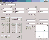
SatCalc is a free software which calculates Azimuth and Elevation for geostationary Satellites used for television broadcast.
Features include the calculation of the LNB skew and calculation of sun outage which occurs in spring and fall. The calculated data is presented graphically and can also be printed out and exported to HTML or CSV.
A list of Longitude...
Category: Business & Finance / Applications
Publisher: Martin Kirisits, License: Freeware, Price: USD $0.00, File Size: 1.6 MB
Platform: Windows
PreviSat is a satellite tracking software for observing purposes.
PreviSat is a satellite tracking software for observing purposes. Very easy to use, it shows the positions of the Satellites in real-time or manual mode. PreviSat is able to make predictions of their passes and also predictions of Iridium flares.
Features
- NORAD SGP4 model (Vallado, 2006)
- Real time / manual mode
- Topocentric / Equatorial /...
Category: Home & Education / Astrology & Numerology
Publisher: Astropedia, License: Freeware, Price: USD $0.00, File Size: 1.4 MB
Platform: Windows
DESA Satellite Tracker allows you to track the International Space Station and other Satellites in real time. The built in radar alarm will alert you to Satellites that would be visible to you and let you know where to look (although you will only be able to actually see the Satellites an hour before sunrise and an hour after sunset).
DESA Satellite Tracker is...
Category: Home & Education / Astrology & Numerology
Publisher: red diligence, License: Freeware, Price: USD $0.00, File Size: 977.8 KB
Platform: Windows
The 3D Satellites wallpaper is a cool wallpaper where you can see planets and stars form the space.
The 3D Satellites wallpaper is a cool wallpaper where you can see planets and stars form the space.The Earth is in the center of the wallpaper an a few shiny stars.This wallpaper is very popular an you will be pleased about it.Is very easy to download and install.
Category: Desktop Enhancements / Misc. Themes
Publisher: WallpaperPimper, License: Freeware, Price: USD $0.00, File Size: 128.0 KB
Platform: Windows
View a 3D planet with satellites and flying astronaut on your screen.
View a 3D planet with Satellites and flying astronaut on your screen. This nice screensaver has everything required for your pleasure and recreation: beautiful 3D graphics (DirectX), gripping music and outstanding scenario.
Category: Desktop Enhancements / Screensavers
Publisher: softoverdose.com, License: Freeware, Price: USD $0.00, File Size: 1.0 MB
Platform: Windows, Mac, 2K, 2K3
DXF2XYZ converts a DXF file to an XYZ file, ie a comma delimited text file containing just xyz Coordinates. It can be useful for extracting the raw XYZ Coordinates from a DXF file containing say contours or other elevation entities.
This utility it limited to extracting the XYZ Coordinates from the following DXF entity types:
POINT, LINE, POLYLINE /...
Category: Business & Finance / Calculators
Publisher: H. Wind, License: Freeware, Price: USD $0.00, File Size: 657.6 KB
Platform: Windows
GoArrow displays an arrow on your screen that points towards coordinates that you specify.
GoArrow displays an arrow on your screen that points towards Coordinates that you specify. This is very handy if you have to run to Coordinates with obstacles in the way (like mountains), or if you're just directionally-challenged.
GoArrow has the ability to find a route between any two locations in Dereth, as well as look up locations' details from either the...
Category: Home & Education / Miscellaneous
Publisher: Digero of Leafcull, License: Freeware, Price: USD $0.00, File Size: 7.7 MB
Platform: Windows
Do you have coordinates for some places of interest?
Do you have Coordinates for some places of interest? Do you want to find them on Earth's surface? There are more than 2,000 coordinate systems available to make Google Earth follow your interests! Plex.Mark! simply placemarks your world!
Have you found a place in Google Earth and you would like to have the Coordinates in your coordinate system? Plex.Mark! will now make...
Category: Internet / Browser Accessories
Publisher: Plexscape, License: Freeware, Price: USD $0.00, File Size: 601.9 KB
Platform: Windows
This program calculates the location of almost any tipe of locator.
This program calculates the location of almost any tipe of locator. It also calculates the distance, azimuth, longitude and latitude betweent two locators. The software converts latitude/longitude Coordinates to Maidenhead locators and vice versa. It converts IARU locator and longitude/latitude Coordinates ti UI-View format Coordinates.
Category: Home & Education / Miscellaneous
Publisher: ON6MU Group, License: Freeware, Price: USD $0.00, File Size: 367.8 KB
Platform: Windows
Earth Orbit Objects is free program which predict satellite passes for your local or any selected area. Use flat Earth view to display satellite tracks with visibility circle.
The globe view shows selected Satellites around the Earth as a sphere and sky view shows Satellites as you would see them in a starry night. The line elements are processed using SGP4 and SDP4...
Category: Home & Education / Miscellaneous
Publisher: Bluewing Trg, License: Freeware, Price: USD $0.00, File Size: 1.6 MB
Platform: Windows
The fast track to GPS success.
The fast track to GPS success. The Linx MDEV-GPS-SR contains everything needed to rapidly evaluate the SR Series GPS modules and implement them in record time. This all-inclusive Master Development System features a pre-assembled development board with an on-board OLED display for standalone testing. The system can also be attached to a PC via USB and operated using the supplied software. The...
Category: Software Development / Misc. Programming
Publisher: Linx Technologies, Inc., License: Freeware, Price: USD $0.00, File Size: 98.5 MB
Platform: Windows

Everest Poker offer the latest in the most exciting form of online poker: Multi-Player Texas Holdem Poker. Everest Poker is proud to offer our players the opportunity to win their way to live, land-based tournaments around the world. We strive to provide our players with an enticing selection of Satellites to popular tournaments so they can rub shoulders with the pros and test their...
Category: Games
Publisher: Everest-Poker, License: Freeware, Price: USD $0.00, File Size: 226.5 KB
Platform: Windows
You can enter your City/State OR Zipcode and it outputs a lot of useful information like Azimuth, Elevation, Latitude, Longitude, and Magnetic Deviation. It also has a text database for the Satellites that makes it easy to modify satellite names and easy to add or delete Satellites.
Category: Home & Education / Miscellaneous
Publisher: NeuroSoft, License: Freeware, Price: USD $0.00, File Size: 1.6 MB
Platform: Windows
The Balloon Browser recognizes and highlights geo-coordinates in web pages.
The Balloon Browser recognizes and highlights geo-Coordinates in web pages. Hovering over a recognized location advises another application to show a map of the corresponding area. For now the only program Balloon Browser can interact with is Google Earth.
Instead of waiting for the one true geo-notation and markup standard, Balloon Browser tries to parse a variety of common...
Category: Internet / Browsers
Publisher: Michael Krause, License: Freeware, Price: USD $0.00, File Size: 5.6 MB
Platform: Windows
The Weather Globe screen saver accesses our servers several times an hour for updated weather information which is automatically uploaded. Weather is downloaded from NOAA (the National Oceanic and Atmospheric Administration) where it is mapped into polar Coordinates on our servers and uploaded to the globe that you see in your screen saver. The weather current within 2 hours. Since this...
Category: Desktop Enhancements / Screensavers
Publisher: PBHLLC, License: Freeware, Price: USD $0.00, File Size: 837.0 KB
Platform: Windows
It is a little utility to automate the reception of the APT signal transmitted by the low orbit Weather Satellites. It will:
Set the receiver to the correct frequency just before the satellite pass (using a serial connection).
Record the audio signal during the pass. (Using the line in input of the sound card). Create overlay for pass using David Taylor's WXtrack.
...
Category: Business & Finance / Applications
Publisher: K.S., License: Freeware, Price: USD $0.00, File Size: 43.4 KB
Platform: Windows
If you have an R2FX, R2ZX, R139 or RX2 receiver, you may have wanted to control it from your computer so that important passes were collected, and not ruined by other Satellites capturing the receiver. My PassControl program allows this scheduling, and being RS232-based, it works under Windows XP, 2000, NT etc. as well as Windows 98 and ME.
Category: Utilities / Misc. Utilities
Publisher: SatSignal Software, License: Freeware, Price: USD $0.00, File Size: 813.4 KB
Platform: Windows
In TruView, users can extract real 3D coordinates and accurately measure distances.
In TruView, users can extract real 3D Coordinates and accurately measure distances. Results appear right on the point cloud image. Markups are also easy to create, save and share with your peers, your service provider, or with clients for more effective communications.
Category: Audio / Utilities & Plug-Ins
Publisher: Leica Geosystems, License: Freeware, Price: USD $0.00, File Size: 7.9 MB
Platform: Windows
ThinkVantage GPS (Global Positioning System) receives signals from the GPS Satellites and determines the location of your ThinkPad. This program is easy to install and easy to manipulate.
Category: Utilities / System Utilities
This package installs the software (GPS driver) to enable the following devices:
- Ericsson F3507g
- Ericsson F3607gw
- Ericsson F5521gw
- Qualcomm HS-USB
Publisher: Lenovo, License: Freeware, Price: USD $0.00, File Size: 20.6 MB
Platform: Windows
The navigation device is a kind of mini computer which contains a GPS satellite navigation receiver.
The navigation device is a kind of mini computer which contains a GPS satellite navigation receiver. This allows the device to determine its current position. At least 4 Satellites need to be received in order to be able to perform acceptable navigation. The fifth satellite is required to obtain an altitude. As navigation takes place in a dynamic state, there is scarcely any constant...
Category: Business & Finance / Business Finance
Publisher: United Navigation, License: Freeware, Price: USD $0.00, File Size: 13.8 MB
Platform: Windows
The Planets Explorer is a computer program that calculates the position of the planets and Satellites of the Solar System, providing a highly realistic tri-dimensional representation of them on the screen. This representation is fully dynamic, in such a way that rotation and translation of cellestial bodies can be observed as if the user had a camera located in any point within the Solar...
Category: Home & Education / Astrology & Numerology
Publisher: Chanchullosa Productions, Inc., License: Freeware, Price: USD $0.00, File Size: 6.2 MB
Platform: Windows
Stellarium is a useful and free GPL software that renders realistic skies in real time with openGL.
Stellarium is a useful and free GPL software that renders realistic skies in real time with openGL. It is available for Linux/Unix, Windows and MacOSX. With Stellarium, you really see what you can see with your eyes, binoculars or a small telescope. Here are some key features of "Stellarium": · Over 120000 stars from the Hipparcos Catalogue with name and infos for the brightest...
Category: Home & Education / Science
Publisher: Fabien Chéreau, License: Freeware, Price: USD $0.00, File Size: 34.0 MB
Platform: Windows, All
Orbitron 3.71is a satellite tracking system for radio amateur and observing purposes.
The program can be also used by weather professionals, satellite communication users, astronomers, UFO hobbyist and astrologers.
The program shows the positions of Satellites at any moment (in real or simulated time).
Orbitron 3.71 can be installed in 35 different...
Category: Internet / Communications
Publisher: Sebastian Stoff, License: Freeware, Price: USD $0.00, File Size: 2.0 MB
Platform: Windows
EPIRBs (Emergency position-indicating rescue beacons) are small radio transmitters that SAR Satellites and aircraft use to locate aircraft, vessels or individuals that need rescuing. They are part of the Global Maritime Distress Safety System. EpirbPlotter allows you to use your PC and soundcard to decode the data messages from these beacons and, in the case of EPIRBs with GPS position...
Category: Home & Education / Miscellaneous
Publisher: COAA, License: Freeware, Price: USD $0.00, File Size: 612.8 KB
Platform: Windows
Satellite Finder is a way to accurately point satellite dishes at communications satellites in geostationary orbit.
Category: Home & Education / Mathematics
Publisher: arachnoid.com, License: Freeware, Price: USD $0.00, File Size: 1.4 MB
Platform: Windows, Mac, 2K
Free automated mouse clicking on your screen by Coordinates or wherever you decide to leave your mouse. Also includes a screen coordinate finder.
Category: Desktop Enhancements / Misc. Themes
Publisher: Mofiki Software, License: Freeware, Price: USD $0.00, File Size: 1.0 MB
Platform: Windows
Aten is a tool to create, edit, and visualise coordinates.
Aten is a tool to create, edit, and visualise Coordinates. It was written primarily to be of use to people performing simulations of condensed matter, but it may very well be useful to others out there dealing with non-periodic systems.
In brief, Aten can:
Provide a GUI for editing atomic Coordinates
Create models, even periodic ones, from...
Category: Software Development / Misc. Programming
Publisher: T Youngs, License: Freeware, Price: USD $0.00, File Size: 5.6 MB
Platform: Windows
Calc 3D is a collection of mathematical tools for highschool and university. The calculator can do statistics, best fits, function plotting, integration. It handles vectors, matrices, complex numbers, Coordinates, regular polygons and intersections. For objects ( like point, line, plane and sphere) distances and intersections are calculated. Cartesian, spherical and cylindrical...
Category: Home & Education
Publisher: Greuer Andreas, License: Freeware, Price: USD $0.00, File Size: 4.1 MB
Platform: Windows
 Freeware
Arm Map Explorer recreates all the functionalities of Google Maps on your desktop while expanding them with new extras. Map Explorer lets you locate and view any place on the planet using dynamic interactive maps. These maps are draggable, which means there is no need for you to click and wait for graphics to reload each time you want to view adjacent parts of a map. Basically, viewing...
Category: Internet / Flash Tools
Publisher: ArmCode, License: Freeware, Price: USD $0.00, File Size: 5.5 MB
Platform: Windows
The Trimble Data Transfer software transfers data from a range of devices to your PC.
The Trimble Data Transfer software transfers data from a range of devices to your PC. You can then import the data into Trimble Total Control software.The following changes have been made to the Trimble Total Control
software for all users since version 2.70:
• Recomputation tolerance flags are now displayed.
• Recomputation now uses starting Coordinates from...
Category: Utilities / Misc. Utilities
Publisher: Trimble Navigation Ltd., License: Freeware, Price: USD $0.00, File Size: 2.2 MB
Platform: Windows

MB-GPS2KML converts a GPS log file (in plain NMEA format) to a KML file (placemark file for Google Earth) and opens this file in Google Earth. Velocity, number of satellites and HDOP are interpreted as height, color and size of the icons.
Category: Home & Education
Publisher: Markus Bader, License: Freeware, Price: USD $0.00, File Size: 441.4 KB
Platform: Windows
The OSTN02 extension for ArcPad is a FREE tool that automatically transforms GPS data and aligns it with Ordnance Survey (OS) background map. This easy-to-use extension removes the need to manually post-process GPS data by providing’ on the fly’ transformation of WGS84 latitude and longitude into OSTN02 corrected British National Grid coordinate. Data capture using GPS and ArcPad is...
Category: Home & Education / Miscellaneous
Publisher: ESRI (UK) Ltd, License: Freeware, Price: USD $0.00, File Size: 8.0 MB
Platform: Windows
Freeware
With this tool you can add GPS Coordinates to vCards - elektronic business cards - that you have previously exported from e. g. Microsoft Outlook. Therefore the tool uses the address data contained within the vCards and adds the exact GPS position on that basis to the vCard. This way you can use these vCards for example in compatible car navigation systems. Among others...
Category: Home & Education / Home Inventory
Publisher: AB-Tools.com, License: Freeware, Price: USD $0.00, File Size: 1.9 MB
Platform: Windows
Astro Helper will tell you the angle of elevation above the horizon (altitude) and the direction in degrees from North (Azimuth) of the selected objects. It will simultaneously display the Coordinates of 22 objects from a database of over 22,000 objects. With these Coordinates you can point your Dobsonian mounted telescope or other "Alt/Az" mounted scope. If you have an...
Category: Home & Education / Astrology & Numerology
Publisher: Mark Casazza Consulting, License: Freeware, Price: USD $0.00, File Size: 3.3 MB
Platform: Windows
Pictures of the Australian region ?
Pictures of the Australian region ? made from data from Satellites ? are used in newspaper, television and Internet or fax weather and climate forecasts. Usually, the pictures are accompanied by a commentary and significant features are highlighted.
Category: Home & Education / Science
Publisher: www.satelliteimage-of-my-house.com, License: Freeware, Price: USD $0.00, File Size: 3.0 MB
Platform: Windows
Archim is a program for drawing the graphs of all kinds of functions. You can define a graph explicitly and parametrically, in polar and spherical Coordinates, on a plane and in space (surface). Archim will be useful for teachers and students, as well as for everyone who is interested min geometry. With Archim, you will draw the graph of any function and form, just use your imagination....
Category: Home & Education
Publisher: Stochastic Lab, License: Freeware, Price: USD $0.00, File Size: 479.6 KB
Platform: Windows
Displays lines and surfaces defined algebraically in 3D space in many forms, including z=f(x,y), cylindrical polar Coordinates, and parametric definitions with one (giving a line) and two (surface) parameters. View controls move the viewpoint through 3D space, using keyboard and mouse. There are options to display a surface, a mesh or a combination. The number of 'steps' on each edge...
Category: Home & Education / Mathematics
Publisher: Walter Milner, License: Freeware, Price: USD $0.00, File Size: 962.0 KB
Platform: Windows
SkySolve it is an application which is supplied an image and with no prior knowledge of where in the sky it was taken, it uses a star pattern matching algorithm and reference database to locate the correct image Coordinates. This makes it especially useful for remote imaging observatories, where the mount pointing may become incorrect. The remote operator can simply take an image...
Category: Software Development / Help File Utilities
Publisher: John Winfield, License: Freeware, Price: USD $0.00, File Size: 371.6 KB
Platform: Windows
Never again forget which picture belongs to which place.
Never again forget which picture belongs to which place. Picopolo, the innovative software for travel and GPS, not only organises digital images but also links them to the exact place where they were taken and assigns them to own or provided maps. Coordinates can be allocated either manually or via direct data upload from GPS receivers. Picopolo easily integrates recorded routes or...
Category: Multimedia & Design / Media Catalogers
Publisher: GDMcom mbH, License: Freeware, Price: USD $0.00, File Size: 61.6 MB
Platform: Windows
A super Computer! Math, finances, statistics, combinative, factorials, calculations of dates, curves y=f(x), series, units conversions, calendars conversions (Gregorian, Julien, republican), Triangle interactive geometry, Pi calculation (10.000 digits) and statistical approach, Fourier series, Taylor developments, functions : Gamma, Bessel, Bernoulli, Fisher, prime numbers, fractionals,...
Category: Home & Education / Mathematics
Publisher: GPMI, License: Freeware, Price: USD $0.00, File Size: 7.6 MB
Platform: Windows
With this FREE AutoCAD add-on you can create terrain sections
from geodetic points(heights) in the drawing. You can also
specify position of pipe(cable, road, ...) or set auxiliary
marks in the section.
Text settings, scale in X,Y axis, height of the reference
plane and type of the terrain section can be set at start-up.
There are two ways how you can create terrain...
Category: Multimedia & Design / Multimedia App's
Publisher: Cadhedral, License: Freeware, Price: USD $0.00, File Size: 69.0 KB
Platform: Windows
This is an add-on for UI-View32 V1.
This is an add-on for UI-View32 V1.65 or later. It decodes the telemetry from PCSAT and provides pass predictions. Besides decoding the PCSAT telemetry, this version will provide orbital pass predictions for both PCSAT and ISS, and will plot the locations of the two Satellites on the UI-View32 map.
Category: Utilities / Misc. Utilities
Publisher: Peak Systems, License: Freeware, Price: USD $0.00, File Size: 2.1 MB
Platform: Windows
Freeware
GPS Converter will convert GPS coordinates between three different formats: 34. 26965, -116.
76783; N 34° 16. 179', W 116° 46. 07'; and N 34° 16' 10.
Category: Home & Education / Sports
Publisher: ALMSys, Inc., License: Freeware, Price: USD $0.00, File Size: 929.9 KB
Platform: Windows
Immageo is all about making your photos as memorable as when you took them, by geotagging each photo. Immageo is a truly exciting example of what you can and should do with your photo collections. Its more than an album organiser, it embeds map locations and notes into your photos. And when you come to review them Immageo displays them all in context of when and where in the Immageo map,...
Category: Multimedia & Design / Media Catalogers
Publisher: Immageo, License: Freeware, Price: USD $0.00, File Size: 11.0 MB
Platform: Windows
PHOTOMOD GeoCalculator is the software for points Coordinates transformation, included in the PHOTOMOD system, as well as a stand-alone free application.
Its installation package includes databases of reference systems used in the world and in Russia (approximately 1500 reference systems). User can also add reference systems on his own by specifying:
-units...
Category: Business & Finance / Applications
Publisher: Racurs, License: Freeware, Price: USD $0.00, File Size: 7.6 MB
Platform: Windows
A PicPack for Stellaris is a free collection of astronomical images that Stellaris can display.
A PicPack for Stellaris is a free collection of astronomical images that Stellaris can display. The images have been collected from the internet for your convenience. This is a great and very interesting program for the amateur astronomer. You will enjoy working with it.
Category: Home & Education / Astrology & Numerology
Publisher: Stellaris Software, License: Freeware, Price: USD $0.00, File Size: 1.2 MB
Platform: Windows
The Grid InQuest software provides a means for transforming Coordinates between ETRS89 (WGS84) and the National coordinate systems of Great Britain, Northern Ireland and the Republic of Ireland. It provides a fully three dimensional transformation incorporating the latest geoid model and is the nationally recognised software for performing these conversions.
In conjunction...
Category: Home & Education / Miscellaneous
Publisher: Quest Geo Solutions Ltd, License: Freeware, Price: USD $0.00, File Size: 0
Platform: Windows
VisualGPS incorporates many advanced features found in professional programs.
VisualGPS incorporates many advanced features found in professional programs. Its sole purpose is to display graphically specific NMEA 0183 sentences and show the effects of selective availability (SA).
Main Features:
- Azimuth and Elevation Graph - View all Satellites that are in view. Each satellite identifies its pseudo random number (PRN) and its azimuth and...
Category: Home & Education / Miscellaneous
Publisher: VisualGPSLLC, License: Freeware, Price: USD $0.00, File Size: 1.7 MB
Platform: Windows
faceAPI provides a suite of image-processing modules created specifically for tracking and understanding faces and facial features. These powerful tracking modules are combined into a complete API toolkit that delivers a rich stream of information that you can incorporate into your own products or services.
Main features:
- Highly robust, real-time, automatic monocular 3D face...
Category: Multimedia & Design / Multimedia App's
Publisher: Seeing Machines, License: Freeware, Price: USD $0.00, File Size: 152.0 MB
Platform: Windows