Free Downloads: Shp
License: All | Free
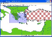
Shape Viewer is a free tool, which you can use to view ESRI Shape files.
Shape Viewer is a free tool, which you can use to view ESRI Shape files.
Shape Viewer can open (.Shp) files that contain the geometry information of the shape file.With Shape Viewer you can also create new (.shx) file, and new empty (.dbf) file for your shape file.
If you have hundreds of shape files, and you want to view their contents rapidly, and you don't want to...
Category: Multimedia & Design / Graphics Viewers
Publisher: Mohammed Hammoud, License: Freeware, Price: USD $0.00, File Size: 35.0 KB
Platform: Windows
With this program you can read and then view geographical data contained in SHP files.
With this program you can read and then view geographical data contained in Shp files. With this program you can also view the data in the accompanying DBF database file and can save this information to SVG files. It works on Microsoft Windows 2000/XP/Vista. The program does not run on Windows 98.
Category: Business & Finance / Database Management
Publisher: Pinecoast Software, Inc., License: Freeware, Price: USD $0.00, File Size: 1.4 MB
Platform: Windows
It`s a FREE ESRI shape files (*.Shp), MapInfo interchange (*.mif) and AutoCAD *.dxf viewer. Using this utility you can view *.Shp files (ESRI shape files), *.mif files (MapInfo interchange) and AutoDesk AutoCAD *.dxf. No other files are needed.
Category: Multimedia & Design
Publisher: Avangardo, License: Freeware, Price: USD $0.00, File Size: 420.9 KB
Platform: Windows
eCITATION is a cooperative effort with the NC Criminal Justice Information Network (CJIN), the NC State Highway Patrol (Shp) and the NC Administrative Office of the Courts (NCAOC) that automates the transfer of citation data directly from a law enforcement Officer’s patrol car to the courts, with minimal paper record creation and elimination of redundant data entry.
Category: Business & Finance / Business Finance
Publisher: Interplat Solutions, Inc., License: Freeware, Price: USD $0.00, File Size: 52.5 MB
Platform: Windows
 Freeware
Convert ESRI ShapeFiles (.Shp) geolocation data into AnyMap format to be used with AnyChart. AnyChart Flash Map Converter allows making use of a wide choice of maps with AnyChart Flash Component, a GIS visualization system that recognizes map data in AnyMap format only. AnyChart Flash Map Converter makes it easy to visualize any geolocation data without hefty expenses associated with...
Category: Web Authoring / Image Mapping Tools
Publisher: AnyChart.Com, License: Freeware, Price: USD $0.00, File Size: 1.6 MB
Platform: Windows
Freeware
AnyFound Photo Recovery Free Edition helps you to search, locate and recover all your inaccessible and lost photos due to accidental format, software malfunction, file or directory deletion, virus attack, unexpected system shutdown and sabotage. Its advanced features like advance search, enhanced photo preview, photo recovery from USB devices. Enhanced photo recovery helps you recover your...
Category: Utilities / File & Disk Management
Publisher: AnyFound Tech Development Co., Ltd., License: Freeware, Price: USD $0.00, File Size: 3.7 MB
Platform: Windows
AnyFound Photo Recovery Free Edition helps you to search, locate and recover all your inaccessible and lost photos due to accidental format, software malfunction, file or directory deletion, virus attack, unexpected system shutdown and sabotage. Its advanced features like advance search, enhanced photo preview, photo recovery from USB devices. Enhanced photo recovery helps you recover your...
Category: Utilities / Backup
Publisher: AnyFound Tech Development Co., Ltd., License: Freeware, Price: USD $0.00, File Size: 3.7 MB
Platform: Windows
You can change the # of objects in the config file.
You can change the # of objects in the config file. However, the trace file is not overwritten/regenerated if it already exists. If you change the # of objects in the config file, but use a trace file that was generated with a different # of objects, some objects might not have traces, which can cause an exception.
Main Features:
- generate mobility traces for mobile...
Category: Web Authoring / Web Design Utilities
Publisher: Georgia Tech, License: Freeware, Price: USD $0.00, File Size: 10.1 MB
Platform: Windows
GeoVisu is a program that displays georeferenced data (images, graphics) and downloads data recorded by some GPS devices.
Category: Multimedia & Design / Graphics Viewers
GeoVisu has a "Moving map" navigation function, which can be used with any NMEA 0183 compatible or Garmin USB GPS device.
Main features:
- Displays georeferenced image formats : GeoTiff, ECW and ECWP, MrSID, OziExplorer Map
Publisher: GeoVisu, License: Freeware, Price: USD $0.00, File Size: 1.7 MB
Platform: Windows
X-Camme e' un add-in per Excel per la progettazione e la realizzazione di meccanismi a camma e intermittori. Camme piane (a disco) con cedente: a bilanciere a punteria: a coltello o a rotella, centrata o deviata Camme cilindriche (a verme, spaziale) con cedente: a punteria: a coltello o rotella a bilanciere (intermittori) Camme e intermittori globoidali meccanismo biella...
Category: Multimedia & Design
Publisher: Studio Tecnico Turci, License: Freeware, Price: USD $0.00, File Size: 13.2 MB
Platform: Windows

The free AvisMap Viewer opens most GIS/CAD and raster image file types and most ArcView, ArcExplorer, and MapInfo projects. Besides just opening and viewing files, the Viewer supports an extensive list of features including visual layer properties control, legend control, thematic mapping, spatial and attribute querying, custom labeling, on-map measurements, hyper-linking, PDF export and much...
Category: Software Development / Components & Libraries
Publisher: AvisMap GIS Technologies, License: Freeware, Price: USD $0.00, File Size: 22.3 MB
Platform: Windows

OkMap is a GPS and map software that:
-Works with vectorial maps and calibrates raster maps
-Organizes paths by creating waypoints, routes and tracks
-Uploads/downloads data to/from your GPS
-Uses altitude DEM data
-Supports GPS real-time navigation
-Sends/receives vehicles position and display tracks on maps in real time
-Provides autorouting and geocoding...
Category: Business & Finance / Applications
Publisher: Gian Paolo Saliola, License: Freeware, Price: USD $0.00, File Size: 20.2 MB
Platform: Windows
Features
- Easy-to-learn WINDOWS™ based user interface
- Easy-to-use thanks to single key functions
- Fully automatic (no user interface needed... suited for mobile applications)
- Very fast because of a special file format (XIM file format)
- Imperial or international units or mixture of both
- Rich, detailed configuration
- Utilizes most...
Category: Multimedia & Design / Multimedia App's
Publisher: Sapper Oy, Finland, License: Freeware, Price: USD $0.00, File Size: 1.6 MB
Platform: Windows