Free Downloads: Spatial Application
License: All | Free
Spatial Workshop is mapping software used for Spatial information integration, query, analysis and reporting.
You build Spatial applications with a few clicks or support complex business processes with geospatial and business data from Oracle, Smallworld, ESRI, maps, files, spreadsheets and other sources.
You can combine and model geospatial data,...
Category: Multimedia & Design / Multimedia App's
Publisher: Spatial Eye bv, License: Freeware, Price: USD $0.00, File Size: 176.7 MB
Platform: Windows
A computer program for the joint analysis of inter-individual spatial and genetic information.
A computer program for the joint analysis of inter-individual Spatial and genetic information. This program performs a variety of Spatial analyses with genetic data including: Mantel Tests, Spatial Autocorrelation Analyses, Allelic Aggregation Index Analyses (AAIA), Mommonier's Algorithm, and "Genetic Landscape Shape" interpolations.
Category: Business & Finance / Applications
Publisher: Mark P. Miller, License: Freeware, Price: USD $0.00, File Size: 4.0 MB
Platform: Windows
SaTScan is a free software that analyzes Spatial, temporal and space-time data using the Spatial, temporal, or space-time scan statistics.
Main features:
- Perform geographical surveillance of disease, to detect Spatial or space-time disease clusters, and to see if they are statistically significant.
- Test whether a disease is randomly distributed over...
Category: Home & Education / Science
Publisher: SaTScan, License: Freeware, Price: USD $0.00, File Size: 10.7 MB
Platform: Windows
Geographic databases management and exploitation, attribute-based and Spatial queries, several join types, several classification methods, thematic cartography, statistics and geo-statistics, Spatial analysis, interpolations, digital elevation models, remote-sensing and image processing, simulation, operational research, interactive metric measurements
Category: Home & Education / Miscellaneous
Publisher: IRD, License: Freeware, Price: USD $0.00, File Size: 14.2 MB
Platform: Windows
Buffalo is an open source, provider agnostic data spatial delivery platform.
Buffalo is an open source, provider agnostic data Spatial delivery platform.
A loosely coupled, message based Spatial data delivery and analytical platform based on free and open source GIS. The platform abstracts the user from the inherent complexity of the platform and provides a wizard based friendly user interface to setup a Spatial data infrastructure. The...
Category: Business & Finance / Business Finance
Publisher: Data World Pty Ltd, License: Freeware, Price: USD $0.00, File Size: 45.7 MB
Platform: Windows
GeoEFM is used in the Spatial analyses phase of the EFM process to help manage and assess Spatial data layers and to quantify the amount and connectivity of ecological habitats generated by different water management or ecosystem restoration scenarios.
In a GeoEFM project, data layers are organized according to management scenario and ecosystem concern.
Category: Multimedia & Design / Multimedia App's
Publisher: HEC, License: Freeware, Price: USD $0.00, File Size: 23.6 MB
Platform: Windows
AccuGlobe Desktop 2007,a standardized platform for delivering solutions to the global GIS community, offers even more of what you demand in a desktop GIS Application. Combining user-friendly design with significantly increased functionality, AccuGlobe Desktop 2007 gives you greater freedom in analyzing Spatial data. In addition to functioning as the core engine behind many...
Category: Multimedia & Design / Multimedia App's
Publisher: Digital Data Technologies, Inc., License: Freeware, Price: USD $0.00, File Size: 9.8 MB
Platform: Windows
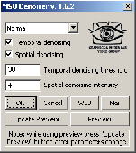
Free high-quality video denoiser plugin for VirtualDub. Easy to use. The filter is designed for noisy video stream processing, video quality improvement, or video preprocessing, e.g. for preprocessing before compression or deinterlacing. Allows flexible denoising level setup in temporal and Spatial dimensions. The filter suppresses noise in both Spatial and temporal domains....
Category: Multimedia & Design
Publisher: Graphics&Media Lab Video Group, License: Freeware, Price: USD $0.00, File Size: 78.7 KB
Platform: Windows
Driving Model Driven Development .
Driving Model Driven Development . Running under Windows, Blueprint is a modelling tool that will become integral to your software development process. The greatest feature of Blueprint is that it gives you the ability to generate any source code or text based on your model. Experience Model Driven Development now. Extremely large systems have been generated entirely from Blueprint templates...
Category: Utilities / Misc. Utilities
Publisher: Geometry Pty Ltd, License: Freeware, Price: USD $0.00, File Size: 2.0 MB
Platform: Windows
You can use your existing digital (vector) maps in Autodesk MapGuide® software by converting them to Spatial Data Files (SDF). SDF is a special data format for delivering large amounts of data quickly over an intranet or the Internet. The SDF Loader is a utility used to create Spatial Data Files (SDF) and their accompanying Spatial Index Files (SIF) from a variety of...
Category: Multimedia & Design / Multimedia App's
Publisher: Autodesk, Inc., License: Freeware, Price: USD $0.00, File Size: 54.6 MB
Platform: Windows
GeoSurveillance is software that combines Spatial statistical routines with some basic Geographic Information Systems (GIS) functions to carry out retrospective and prospective statistical tests for the detection of geographic clustering. In this software, the focus is primarily on the Spatial statistical analysis. Consequently, full GIS functionality is not provided. GIS...
Category: Home & Education / Miscellaneous
Publisher: NCGIA, License: Freeware, Price: USD $0.00, File Size: 2.4 MB
Platform: Windows
Pirate Galaxy is an exciting and free to play game, with lots of Spatial adventures and lots of enemies for you to destroy.It is a science fiction role playing game, multiplayer online game so you can enjoy with your friends on the net.It has also a rich 3D visuals, loads of carefully designed planets to explore and much more
Category: Games / Misc. Games
Publisher: Splitscreen Studios GmbH, License: Freeware, Price: USD $0.00, File Size: 15.7 MB
Platform: Windows
Bojan Mitrovic's Fun3D is a software for generating parametric 3D surfaces, curves, Spatial cellular automatic structures and L-systems.
Main features:
- 2D Export (JPG, PNG)
- 3D Export (JavaView - jvx, DXF)
- Animation
- 3D Surfaces
- 3D Curves
- 3D Cellular Automata (based on Conaway Game of Life)
- L-Systems (also...
Category: Multimedia & Design / Animation
Publisher: Bojan Mitrovic, License: Freeware, Price: USD $0.00, File Size: 4.1 MB
Platform: Windows
The main objective of the software is to facilitate the procedure of the calculation of drought indices,
which may be a complicated task especially in the case of the assessment of the Spatial distribution of indices.
Three drought indices can be calculated using DrinC:
- Deciles
- SPI (Standardized Precipitation Index)
- RDI (Reconnaissance Drought...
Category: Business & Finance / Calculators
Publisher: Lab. of RW & WRM - NTUA, License: Freeware, Price: USD $0.00, File Size: 1.9 MB
Platform: Windows
The Fourier Transform is a powerful tool allowing us to move back and forth between the Spatial and frequency domains. This applet helps students feel comfortable, helping to build a strong intuitive grasp of how signals in one domain correspond to signals in the other.
Students can load scanlines from common image patterns and see that scanline's Fourier Transform in...
Category: Multimedia & Design / Fonts
Publisher: Brown University, License: Freeware, Price: USD $0.00, File Size: 244.7 KB
Platform: Windows
The Autodesk MapGuide SDF Component Toolkit is a development library that allows developers to read, write, and modify point, line, and polygon data within SDFs, the native Spatial Data File format of Autodesk MapGuide, from their own standalone applications or CGI applications.
The Autodesk MapGuide SDF Component Toolkit is a 32-bit DLL that includes header files, an...
Category: Software Development / Misc. Programming
Publisher: Autodesk, Inc., License: Freeware, Price: USD $0.00, File Size: 836.7 KB
Platform: Windows
Chips, the Copenhagen Image Processing System, is a general-purpose software package for remote sensing image processing and Spatial data analysis with extensive support for NOAA AVHRR data.
Chips can be used both as a stand-alone system, as well as a powerful supplemental image-processing tool for GIS products like MapInfo™ and ArcView™.
Category: Multimedia & Design / Multimedia App's
Publisher: Chips Development Team, License: Freeware, Price: USD $0.00, File Size: 5.9 MB
Platform: Windows
The program is intended for simulation of kinematics and dynamics of planar and Spatial mechanical systems. The program is intended for using by students and teachers for educational purposes as well as design engineers for express analysis of designed mechanisms in their everyday work. It does not need from the user any special knowledge and operates with well-known for any design...
Category: Home & Education / Science
Publisher: Laboratory of Computational Mechanics, License: Freeware, Price: USD $0.00, File Size: 17.6 MB
Platform: Windows
gvSIG project is a free and open source Geoinformation System (GIS), that enables users to interactively visualize, manage, modify and analyze Spatial information in the form of digital maps, images and database tables. It is easy to learn, yet versatile and efficient enough for demanding GIS tasks.
Category: Multimedia & Design / Multimedia App's
Publisher: Oxford Archaeology Digital, License: Freeware, Price: USD $0.00, File Size: 273.0 MB
Platform: Windows
HEC-EFM analyses involve: 1) statistical analyses of relationships between hydrology and ecology, 2) hydraulic modeling, and 3) use of Geographic Information Systems (GIS) to display results and other relevant Spatial data.
Most features in the main interface of HEC-EFM focus on the first step in this process (statistical analyses). The main interface has four tabs: Properties,...
Category: Home & Education / Miscellaneous
Publisher: Hydrologic Engineering Center, License: Freeware, Price: USD $0.00, File Size: 9.0 MB
Platform: Windows
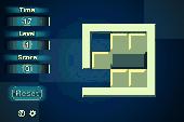
The Sliding Block Puzzle is a unique brain training PC game improving Spatial thinking. Crack a catchy logical puzzle removing the unnecessary elements. Your task is to move the yellow bricks inside the frame in order to get rid of the alien red brick. Warning: at each new level for the first time the puzzle seems unsolvable. However, when you tease your brains, you'll solve the...
Category: Games / Puzzles
Publisher: ToomkyGames.com, License: Freeware, Price: USD $0.00, File Size: 9.3 MB
Platform: Windows
Power Manga, developed by TLK Games, belongs already to the legacy of the space adventure.
Power Manga, developed by TLK Games, belongs already to the legacy of the space adventure. It is one of the best Arcade Game developed under GNU General Public License. The present version for Windows is as neat as exciting. 42 levels, more than 200 sprites, some 14 guards that you must destroy with an arsenal of impressive space fight weaponry gearing handy and fast patrol space vessels. The...
Category: Games / Arcade
Publisher: TLK Games, License: Freeware, Price: USD $0.00, File Size: 7.0 MB
Platform: Windows
Harpex-B Player is a stand-alone Application which can process and play B-format sound files directly to your sound card in stereo or surround.Harpex is a new B-format processing algorithm that takes into account both the non-linear, parametric nature of Spatial hearing and our uncanny ability to resolve simultaneous sounds.
The algorithm is implemented as a C library for...
Category: Audio / Audio Players
Publisher: Harpex Ltd, License: Freeware, Price: USD $0.00, File Size: 1.9 MB
Platform: Windows
This is a demo of a forthcoming game in four Spatial dimensions. The game takes place in a world entirely different to everyday experience. As well as left/right, up/down and forward/back, there's another direction in space - the fourth dimension. Objects phase in and out as your craft rotates into this hidden dimension. The game uses an all-new 4D texturing method to display the...
Category: Games
Publisher: Mushware Limited, License: Freeware, Price: USD $0.00, File Size: 5.7 MB
Platform: Windows
When you are looking for a powerful tool to satisfy various needs regarding vectors, raster and satellite imagery, you will find ILWIS Academic an efficient Application. The program comes with such useful features as points to create maps, lines for segment maps, closed area segments for polygon maps, Spatial operations for raster maps and so on. Whilst using images from satellite...
Category: Home & Education / Miscellaneous
Publisher: ITC, License: Freeware, Price: USD $0.00, File Size: 19.4 MB
Platform: Unknown
AvisMap GIS Engine is the basic development platform for AvisMap GIS suites, which is a new generation component GIS development platform for GIS Application developers. AvisMap GIS Engine 5 provides powerful GIS functions through Active X controls based on Microsoft COM component technique standards. It allows users to rapidly develop professional GIS applications and increase GIS...
Category: Multimedia & Design / Multimedia App's
Publisher: AvisMap GIS Technologies, License: Freeware, Price: USD $0.00, File Size: 60.5 MB
Platform: Windows
OrbisGIS is a Geographic Information System developped for and by research.
OrbisGIS is a Geographic Information System developped for and by research. This cross-platform GIS is developed by French IRSTV institute and is able to manipulate and create vectorial and raster Spatial data. OrbisGIS is distributed under GPL 3 license.
Category: Home & Education / Miscellaneous
Publisher: Free Software Foundation, Inc., License: Freeware, Price: USD $0.00, File Size: 15.4 MB
Platform: Windows
STOCHSIM is a stochastic simulator for biochemical reactions software tool.
STOCHSIM is a stochastic simulator for biochemical reactions software tool. The particles are represented as individual software objects which react according to probabilities derived from concentrations and rate constants. Simple Spatial structures can be built.
Category: Multimedia & Design / Multimedia App's
Publisher: lenov, License: Freeware, Price: USD $0.00, File Size: 129.1 KB
Platform: Windows
The old good Falling Blocks game is coming back in 3D!
The old good Falling Blocks game is coming back in 3D! Enjoy now real, I mean REAL 3D feeling and extremely addictive gameplay. The game is recommended for anyone, since it challenges and trains 3D-thinking, Spatial skills and reflexes. You get 5 different game modes, Anti-boss feature and good performance, even on old graphic cards. Now as freeware!
Category: Games / Arcade
Publisher: Eugen Garber, License: Freeware, Price: USD $0.00, File Size: 583.7 KB
Platform: Windows
ArcReader is a free, easy-to-use desktop mapping Application that allows users to view, explore, and print maps and globes. Anyone with ArcReader can view high-quality interactive maps authored by a high-level ArcGIS Desktop product and published with the ArcGIS Publisher extension.
ArcReader is a free and easy-to-use Application that allows users to view and print...
Category: Desktop Enhancements / Shell & Desktop Managers
Publisher: Environmental System Research Institute, Inc., License: Freeware, Price: USD $0.00, File Size: 499.2 MB
Platform: Windows

The free AvisMap Viewer opens most GIS/CAD and raster image file types and most ArcView, ArcExplorer, and MapInfo projects. Besides just opening and viewing files, the Viewer supports an extensive list of features including visual layer properties control, legend control, thematic mapping, Spatial and attribute querying, custom labeling, on-map measurements, hyper-linking, PDF export...
Category: Software Development / Components & Libraries
Publisher: AvisMap GIS Technologies, License: Freeware, Price: USD $0.00, File Size: 22.3 MB
Platform: Windows
LSI Convolution is a very helpful tool for students.
LSI Convolution is a very helpful tool for students.
Two key properties in signal processing are "linearity" and "Spatial invariance". Students can examine these properties by placing and scaling two impulse functions and then dragging a filter function over them (just as in the Impulse Response applet).
Category: Business & Finance / Calculators
Publisher: Brown University, License: Freeware, Price: USD $0.00, File Size: 1.4 KB
Platform: Windows
JOpt.SDK is Spatial route optimization and planning Java library for automatic resource scheduling and transportation planning. It uses specialized genetic algorithms to calculate an optimized allocation of orders and stops to mobile resources. The algorithm not only provides tours at minimum costs but also considers an arbitrary set of constraints for each tour. JOpt.SDK can solve...
Category: Software Development / Components & Libraries
Publisher: DNA, License: Freeware, Price: USD $0.00, File Size: 97.0 KB
Platform: Unknown
Prodyspace is a new kind of 4d-Panner which has been designed to put Instruments within a mix to the front or to the back. To achieve this effect, the Prodyspace uses delay-modulation (kind of Spatial processing), intelligent filtering and very short reverberation (FDN).
Category: Audio / Utilities & Plug-Ins
Publisher: Prodyon, License: Freeware, Price: USD $0.00, File Size: 972.8 KB
Platform: Windows
A major revision to Patch Analyst has been made in version 3 (and continued in version 4) in that the analysis of regions, as well as the ability to relate a response variable (e.g., an interpolated surface of bird density) to landscape structure, has been added. This is more than a technical enhancement, in that it overcomes a major limitation of traditional landscape analyses.
An...
Category: Business & Finance / Business Finance
Publisher: Rob Rempel, License: Freeware, Price: USD $0.00, File Size: 1.5 MB
Platform: Windows
The DualCAD project is an ongoing project "over 17 years" to create a freeware cad Application that handles the basic needs of most microstation users. Currently DualCAD is aimed at the 2D user with perhaps rotated views , reference files, and hybrid raster files. DualCAD can be run under LINUX using WINE. For more advanced CAD needs please look at PcsCustom. DualCAD Review is...
Category: Multimedia & Design / Image Editing
Publisher: Pangaea CAD Solutions, License: Freeware, Price: USD $0.00, File Size: 7.6 MB
Platform: Windows
The game is highly customizable and supports the creation and use of unlimited user profiles.
The game is highly customizable and supports the creation and use of unlimited user profiles. Each game parameter can be customized both based on the player's profile and the current game level. An unlimited number of players is supported. The game can be played using the keyboard, the mouse, a joystick, and one, two or three switches (or even more). It also features Spatial (3D)...
Category: Games / Action
Publisher: Yannis Georgalis, License: Freeware, Price: USD $0.00, File Size: 7.8 MB
Platform: Windows
GigaBASE inherits most of the features of FastDB, but uses page pool instead of direct mapping of file on virtual memory. So GigaBASE is able to handle database, which size significantly exceeds size of computer physical memory. Convenient and flexible C interface makes development of Application for GigaBASE very easy and automatic scheme evaluation simplifies maintenance and...
Category: Software Development / Misc. Programming
Publisher: Konstantin Knizhnik, License: Freeware, Price: USD $0.00, File Size: 1.9 MB
Platform: Windows
iMosflm is a new and useful software that you can get it for free on your computers.
iMosflm is a new and useful software that you can get it for free on your computers. An easy to use software for all users.
Features:
- Open several or a range of images with CTRL-click or SHIFT-click, respectively
- Display of the active mask for images from Rigaku detectors can now be toggled
- Plots of the number of overloads, Spatial overlaps and...
Category: Utilities / Misc. Utilities
Publisher: MRC-LMB, License: Freeware, Price: USD $0.00, File Size: 4.0 MB
Platform: Windows
GeoBase is a high performance OEM tool for embedding GIS functions in client and server applications. GeoBase has a small memory footprint - both on the hard disk for storage and in RAM during use. Compatible with both .NET and Linux, GeoBase is designed for a rapid development cycle and low deployment cost. The Map Engine displays rich, detailed maps for use in server or client applications....
Category: Software Development / Compilers & Interpreters
Publisher: Telogis, License: Freeware, Price: USD $0.00, File Size: 87.0 MB
Platform: Windows
WEPS is a process-based, continuous, daily time-step model that simulates weather, field conditions, and erosion. It is a user friendly program that has the capability of simulating Spatial and temporal variability of field conditions and soil loss/deposition within a field. WEPS can also simulate complex field shapes, barriers not on the field boundaries, and complex topographies.
Category: Multimedia & Design / Multimedia App's
Publisher: USDA-ARS WERU, License: Freeware, Price: USD $0.00, File Size: 152.6 MB
Platform: Windows
OSGART is a library that simplifies the development of Augmented Reality or Mixed Reality applications by combining the well-known ARToolKit tracking library with OpenSceneGraph.
But rather than acting just as a simple nodekit, the library offers 3 main functionalities: high level integration of video input (video object, shaders), Spatial registration (marker-based,...
Category: Software Development / Components & Libraries
Publisher: Human Interface Technology Laboratory New Zealand, License: Freeware, Price: USD $0.00, File Size: 7.4 MB
Platform: Windows
You can choose how much channels you want to equalize.
You can choose how much channels you want to equalize. It's easy, just tell RTEQ how many channels to show. You probably will never need 300 channels, but why not 24? Use RTEQ like a professional.
Category: Audio / Utilities & Plug-Ins
RTEQ comes in two versions. A standalone version which equalizes real time audio signals and the WinAMP plugin version which equalizes files like MP3s.
Main Features:
Publisher: Andrei Grecu, License: Freeware, Price: USD $0.00, File Size: 874.7 KB
Platform: Windows
3D Soma Puzzle is a three-dimensional logic game that challenges you to assemble various figures with the colored irregular blocks. The puzzle seems to be simple but great variety of solutions for each shape (the simplest figure - cube can be solved by 240 essentially different methods) makes it really challenging. This game will keep any family member entranced and busy for hours (or even...
Category: Games / Misc. Games
Publisher: Yavsoft, License: Freeware, Price: USD $0.00, File Size: 768.0 KB
Platform: Windows
Shape Viewer is a free tool, which you can use to view ESRI Shape files.
Shape Viewer is a free tool, which you can use to view ESRI Shape files.
Shape Viewer can open (.shp) files that contain the geometry information of the shape file.With Shape Viewer you can also create new (.shx) file, and new empty (.dbf) file for your shape file.
If you have hundreds of shape files, and you want to view their contents rapidly, and you don't want to open each...
Category: Multimedia & Design / Graphics Viewers
Publisher: Mohammed Hammoud, License: Freeware, Price: USD $0.00, File Size: 35.0 KB
Platform: Windows
Simulation models can be envisaged as a heuristic device useful to perform ex ante evaluation of the outcomes of a variety of scenarios, translated as different socioeconomic, political, and environmental frameworks. A special class among them, spatially explicit models simulate the dynamics of an environmental system, reproducing the way its Spatial patterns evolve, to project the...
Category: Multimedia & Design / Multimedia App's
Publisher: CSR - UFMG, License: Freeware, Price: USD $0.00, File Size: 89.6 MB
Platform: Windows
GWLF is considered to be a combined distributed/lumped parameter watershed model.
GWLF is considered to be a combined distributed/lumped parameter watershed model. For surface loading, it is distributed in the sense that it allows multiple land use/cover scenarios, but each area is assumed to be homogenous in regard to various attributes considered by the model. Additionally, the model does not spatially distribute the source areas, but simply aggregates the loads from each...
Category: Business & Finance / Business Finance
Publisher: Penn State Institutes of Energy and the Environment, License: Freeware, Price: USD $0.00, File Size: 35.4 MB
Platform: Windows
Bytescout Lossless Video Codec is the free (for non-commercial use) the lossless video compression and decompression video codec for Windows and Windows x64
Free high quality lossless video codec. This codec is intended for lossless video compression (used for saving master copies or intermediate rendering results).
It has the best compression ration among free lossless...
Category: Multimedia & Design / Video
Publisher: Bytescout Software, License: Freeware, Price: USD $0.00, File Size: 2.0 MB
Platform: Windows
The ArcGIS Military Analyst extension incorporates a suite of display and analysis tools tailored to meet the special needs of the defense and intelligence user. With ArcGIS Military Analyst, you can create, query, analyze, and display Spatial data in a variety of formats.
ArcGIS Military Analyst maximizes the use of the standard suite of the Department of Defense geospatial...
Category: Multimedia & Design / Multimedia App's
Publisher: Environmental Systems Research Institute, Inc., License: Freeware, Price: USD $0.00, File Size: 31.9 MB
Platform: Windows
Dapple is a global data explorer designed to provide an open and optimal environment for visualizing, presenting and sharing massive quantities of geoscientific data on desktop computers. Dapple lets you browse, discover and display graphically rich data from global and corporate Spatial servers – Geosoft DAP servers, NASA servers, USGS servers, and the many, many WMS servers...
Category: Desktop Enhancements / Shell & Desktop Managers
Publisher: Geosoft Inc., License: Freeware, Price: USD $0.00, File Size: 38.0 MB
Platform: Windows