Free Downloads: Thematic
License: All | Free
Geographic databases management and exploitation, attribute-based and spatial queries, several join types, several classification methods, Thematic cartography, statistics and geo-statistics, spatial analysis, interpolations, digital elevation models, remote-sensing and image processing, simulation, operational research, interactive metric measurements
Category: Home & Education / Miscellaneous
Publisher: IRD, License: Freeware, Price: USD $0.00, File Size: 14.2 MB
Platform: Windows
gSpatial Toolbar allows you to import, display and manipulate ESRI shapefile data in Google Earth.
gSpatial Toolbar allows you to import, display and manipulate ESRI shapefile data in Google Earth. Annotate your data and perform Thematic queries on your Excel spreadsheet data or ODBC data sources, visualize results in Google Earth
Category: Multimedia & Design / Graphics Viewers
Publisher: gSpatial, License: Freeware, Price: USD $0.00, File Size: 686.1 KB
Platform: Windows
Sweet doggies' screensaver is a product of intensive selection from top quality and highly amusing doggie photos worldwide. It promises to bring big smiles on your face and chase away daily troubles. This screensaver has been rated several times as the most searched download within Thematic area of nature screensavers. Download this screensaver and you will have a bunch of playful...
Category: Desktop Enhancements / Screensavers
Publisher: Free Animated Screensavers, License: Freeware, Price: USD $0.00, File Size: 2.6 MB
Platform: Windows
Gismaps Viewer is a GIS viewer that can be used for geospatial analysis and map production.
Gismaps Viewer is a GIS viewer that can be used for geospatial analysis and map production.
The main features are:
- read Shape files using geographic coordinate system
- view satellite images (MrSid, jpeg, bmp and tiff file formats)
- generate Thematic maps, queries and labels
- export do Google Earth KML (shp2kml)
- configure map colors and...
Category: Multimedia & Design / Graphics Viewers
Publisher: Gismaps Sistemas Ltda., License: Freeware, Price: USD $0.00, File Size: 10.2 MB
Platform: Windows


 Freeware
3DJongPuzzle is the mah jongg - like tile solitaire game for Windows. It is a fun tile matching. Its intuitive interface is very easy to learn, and you'll be playing within a few minutes. The goal of 3DJongPuzzle is to remove all of the tiles from the game board. Tiles can be removed only in pairs and must be free on their top side and on at least one side (right and left). There are many...
Category: Games / Puzzles
Publisher: SoftAKGames, License: Freeware, Price: USD $0.00, File Size: 2.5 MB
Platform: Windows


 Freeware
JLearnIt is a Thematic dictionary that allows you to learn vocabulary thanks to the questionnaire. You can also translate text (word by word) or search for incomplete words, sort the languages to get it in alphabetical order, rearrange the order of the languages, save your score, save as HTML, show only the languages you're interested in. Each word has a level often used(1)...
Category: Home & Education / Language
Publisher: Japplis, License: Freeware, Price: USD $0.00, File Size: 21.7 MB
Platform: Windows
JLearnIt is a Thematic dictionary that allows you to learn vocabulary thanks to the questionnaire. You can also translate text (word by word) or search for incomplete words, sort the languages to get it in alphabetical order, rearrange the order of the languages, save your score, save as HTML, show only the languages you're interested in. Each word has a level often used(1)->technical...
Category: Home & Education / Language
Publisher: Japplis, License: Freeware, Price: USD $0.00, File Size: 31.0 MB
Platform: Mac


 Freeware
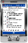
Free organizer for pocket PC to organize tasks and shopping lists in a treelike structure. Quick task adding and reliability are the main features of this easy-to-use software. It is fully synchronized with LeaderTask Personal Organizer. LeaderTask PDA Organizer is a mobile version of LeaderTask for Windows Mobile. With LeaderTask PDA Organizer, you will no longer need your paper notes:...
Category: Business & Finance / Personal Info Managers
Publisher: Time Management, License: Freeware, Price: USD $0.00, File Size: 332.0 KB
Platform: Windows
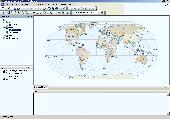
The free AvisMap Viewer opens most GIS/CAD and raster image file types and most ArcView, ArcExplorer, and MapInfo projects. Besides just opening and viewing files, the Viewer supports an extensive list of features including visual layer properties control, legend control, Thematic mapping, spatial and attribute querying, custom labeling, on-map measurements, hyper-linking, PDF export...
Category: Software Development / Components & Libraries
Publisher: AvisMap GIS Technologies, License: Freeware, Price: USD $0.00, File Size: 22.3 MB
Platform: Windows

