Free Downloads: View Dwg Gps
License: All | Free
Autodesk® DWG TrueView™ software is a free* stand-alone DWG™ viewer.
Autodesk® Dwg TrueView™ software is a free* stand-alone Dwg™ viewer. Built on the same viewing engine as AutoCAD® software, Dwg TrueView enables you to View the latest Dwg and DXF™ files, just as you would in AutoCAD. By also installing the free* Autodesk® Design Review software, you can then open Dwg files in Design Review...
Category: Multimedia & Design / Image Editing
Publisher: Autodesk, License: Freeware, Price: USD $0.00, File Size: 181.9 MB
Platform: Windows
FREE GPS Software for your Garmin, Magellan or Lowrance GPS.
FREE Gps Software for your Garmin, Magellan or Lowrance Gps.
EasyGPS is the fast and easy way to upload and download waypoints, routes, and tracks between your Windows computer and your Garmin, Magellan, or Lowrance Gps. EasyGPS lists all of your waypoints on the left side of the screen, and shows a plot of your Gps data on the right. Use EasyGPS to back up...
Category: Internet / Communications
Publisher: TopoGrafix, License: Freeware, Price: USD $0.00, File Size: 3.9 MB
Platform: Windows
My Gps Logger 1.01 is a program designed to be used with My Fuel Tax 4.0. With My Gps Logger you can log all the locations where your truck has been to a monthly data file. This data file can later be imported into My Fuel Tax 4.0 by calculating the miles in state using Microsoftâ Mappoint. This is what you will need to use My Gps Logger with My Fuel Tax:a laptop with...
Category: Home & Education / Miscellaneous
Publisher: Spinnaker Software Solutions, License: Freeware, Price: USD $0.00, File Size: 477.7 KB
Platform: Windows
AutoDWG DWG Indexer is a freeware that searches full text in dwg or dxf files.
AutoDWG Dwg Indexer is a freeware that searches full text in Dwg or dxf files. A thumbnail is also created for each Dwg file in the search list.Take advantage of Google desktop to search the content out of thousands of Dwg files in your hard drive.Supports Dwg, dxf file format;Supports AutoCAD R2.6 thru 2006.
Category: Multimedia & Design / Multimedia App's
Publisher: AutoDWG, License: Freeware, Price: USD $0.00, File Size: 4.8 MB
Platform: Windows
INTERNAL CADVIEWER is FREE DWG viewer that can be launched
directly from your AutoCAD.
INTERNAL CADVIEWER is FREE Dwg viewer that can be launched
directly from your AutoCAD. With this AutoCAD add-on you can browse,
View or open drawings stored on your computer or CD-ROM(e.g. Dwg catalouges).
You can View or open next, previous, first or last drawing in the current
folder(folder of the current drawing).
You can also View a...
Category: Multimedia & Design / Multimedia App's
Publisher: Cadhedral, License: Freeware, Price: USD $0.00, File Size: 326.0 KB
Platform: Windows
Dwg TrueView 2008: This official Autodesk free application allows the user to publish, plot and View Autodesk AutoCAD drawings such as Dwg, that are the standard formats for Autodesk programs, as well as DXF, also an standard format for the drawings generated by Autodesk applications for interchanging data. The publishers offer total compatibility to the current AutoCAD...
Category: Multimedia & Design / Image Editing
Publisher: Autodesk, Inc., License: Freeware, Price: USD $0.00, File Size: 212.1 MB
Platform: Windows
Dwg TrueView : This official Autodesk free application allows the user to publish, plot and View Autodesk AutoCAD drawings such as Dwg (generated by Autodesk programs), as well as DXF (also generated by Autodesk applications for interchanging design drawings). The publishers offer total compatibility to the current AutoCAD version in the market.
With this...
Category: Multimedia & Design / Image Editing
Publisher: Autodesk, License: Freeware, Price: USD $0.00, File Size: 212.1 MB
Platform: Windows
Dwg TrueView 2009: This official Autodesk free application allows the user to publish, plot and View Autodesk AutoCAD drawings such as Dwg, that are the standard formats for Autodesk programs, as well as DXF, also an standard format for the drawings generated by Autodesk applications for interchanging data.
Publishers offer total compatibility to the current...
Category: Multimedia & Design / Image Editing
Publisher: Autodesk, License: Freeware, Price: USD $0.00, File Size: 212.1 MB
Platform: Windows
The program accepts NMEA GPS sentences from most GPS receivers that connect to a USB port.
The program accepts NMEA Gps sentences from most Gps receivers that connect to a USB port.
The program can display satellite images of waypoint locations on the track plotter.
Is a free software for recording , monitoring and plotting Gps data, very useful and very easy.
Category: Home & Education / Miscellaneous
Publisher: Club Cruceros de La Paz A.C., License: Freeware, Price: USD $0.00, File Size: 10.6 MB
Platform: Windows
Golf GPS Devices toolbar for internet explorer.
Golf Gps Devices toolbar for internet explorer. Find golf Gps devices are great bargain prices. We have all the latest golf Gps devices for sale both new and used. Whether you're looking for the iGolf, Golf Buddy, GolfLogix, SonoCaddie, or SkyCaddie, you can find it here along with their accessories. We are always searching our networks to bring you the best deals on golf...
Category: Internet / Browsers
Publisher: Golf GPS Devices, License: Freeware, Price: USD $0.00, File Size: 1.1 MB
Platform: Windows

Gps Clock Software is a freeware utility that runs on any Windows NT/2000/XP/2003 workstation or server. The software polls time from a standard NMEA Gps time receiver connected to the host PC's serial port and optionally allows time to be synchronised on the host PC. The Gps clock utility polls GPRMC messages from a standard NMEA Gps time receiver. Information...
Category: Utilities
Publisher: ntp time server, License: Freeware, Price: USD $0.00, File Size: 1.9 MB
Platform: Windows
With our locr PC software "locr Gps Photo for Windows" you can manage to automatically geotag numerous photos simultaneously. You just require a digital camera, a Gps data logger and the application "locr Gps Photo for Windows".
There are two ways to geotag your photos: The photos can be tagged manually or automatically. For automatic geotagging...
Category: Multimedia & Design / Multimedia App's
Publisher: locr, License: Freeware, Price: USD $0.00, File Size: 490.8 KB
Platform: Windows
Are you looking for a Gps tracking system or a Gps tracker but haven't found the one that is ideal for you? Then, look no further as our site has the best deals and information about the kind of Gps tracker you should buy.
Category: Security & Privacy / Other
Publisher: Top GPS Tracking Srl., License: Freeware, Price: USD $0.00, File Size: 722.0 KB
Platform: Windows
 Freeware
Since our EXIF software for viewing EXIF/IPTC/XMP data, editing and creating EXIF/Gps data is integrated into the operating system, the programs give access to EXIF information in most of applications.
Category: Multimedia & Design / Authoring Tools
Publisher: Two Pilots, License: Freeware, Price: USD $0.00, File Size: 5.4 MB
Platform: Windows
Portable GPS Navigation toolbar for Internet Explorer.
Portable Gps Navigation toolbar for Internet Explorer. Find portable Gps units for your car, truck or minvan from top name brands including Tom Tom, Magellan and Garmin. Discover the world of eBay and shop for portable Gps navigation systems directly from your browser toolbar.
Category: Internet / Browsers
Publisher: Portable GPS Navigation System, License: Freeware, Price: USD $0.00, File Size: 1.1 MB
Platform: Windows
Free Dwg Viewer will open and View AutoCAD Dwg, DXF, DWF and secure CSF formats. Drawing files can be viewed easily with full zoom / pan / eyeglass / layering controls. The viewer can save views to JPEG, and it supports accurate snap to point measuring. Includes thumbnails, JPEG output controls, and tri-mode magnification View. Our Free Dwg Viewer is both a...
Category: Utilities
Publisher: Informative Graphics Corp, License: Freeware, Price: USD $0.00, File Size: 13.9 MB
Platform: Windows
DWG Recovery Free is a program that helps you to recover corrupted AutoCad files.
Dwg Recovery Free is a program that helps you to recover corrupted AutoCad files. The interface of this program is wizard-based, and will recover corrupted autocad files whether you know how to recover corrupted Dwg file in AutoCad 6 or not. Dwg recovery tool also allows you to speed the process up by manually specifying the version of Dwg restore needed and will get...
Category: Utilities / File & Disk Management
Publisher: Recovery ToolBox, License: Freeware, Price: USD $0.00, File Size: 1.3 MB
Platform: Windows
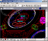
LX-Viewer is a program that will allow you to open, View, print and convert Dwg or DXF files, typically used in AutoCAD related technical drafting.
The most important feature is that LX-Viewer allows you to manipulate your Dwg data on the Linux platform.
You may zoom and pan the drawing as you would in AutoCAD.
Category: Multimedia & Design / Multimedia App's
Publisher: Andrew Bibb, Guy Edwards, License: Freeware, Price: USD $0.00, File Size: 2.8 MB
Platform: Windows
When you imort a Dwg or DXF drawing, Padds defaults to using the PROKON Dwg Engine software application. This utility uses a third-party component that suppport many advanced AutoCAD features. In some cases, however, the import process fails. You can download it from developer's page.
Category: Multimedia & Design / Multimedia App's
Publisher: Prokon Software Consultants, License: Freeware, Price: USD $0.00, File Size: 38.6 MB
Platform: Windows
GPS Tuner was first launched in 2003.
Gps Tuner was first launched in 2003. Success followed introduction shortly. Over the years it became a best-selling favourite Gps software among off-roaders as a reliable, versatile feature-packed application suiting the needs of outdoor enthusiasts and professional off-road users alike. After five years of continuous development of previous Gps Tuner versions Gps...
Category: Web Authoring / Web Design Utilities
Publisher: GPS Tuner Ltd., License: Freeware, Price: USD $0.00, File Size: 4.5 MB
Platform: Windows
The Gps Detector software is used to update the Gps detector's database , updating maps , routes and camera locations . The device itself is based on pre-installed Gps coordinates, the device can indicate various road hazards like: Fixed cameras, Red light speed cameras and bus lane cameras, Usual speed measurement places and dangerous zones.
Category: Business & Finance / Business Finance
Publisher: Euro Noliker Kft., License: Freeware, Price: USD $0.00, File Size: 5.5 MB
Platform: Windows
The Gps Controller software is a free program designed to allow you to configure a range of Gps receivers. There are versions that run on Windows desktop computers, or Windows Mobile devices.
Before downloading the software, it recommend downloading and reading the documentation to confirm which version you need.
Category: Home & Education / Miscellaneous
Publisher: Trimble Navigation, License: Freeware, Price: USD $0.00, File Size: 30.9 MB
Platform: Windows
GPS-CCD:is a novel computational program for the
Prediction of Calpain Cleavage Sites.
Gps-CCD:is a novel computational program for the
Prediction of Calpain Cleavage Sites.
The online service and local packages of Gps-CCD 1.0 were
implemented in JAVA/. For the online service, we tested the Gps-CCD1.0 on a variety of internet browsers, including Internet Explorer 6.0, Netscape Browser 8.1.3 and Firefox 2 under the Windows XPOperating System...
Category: Web Authoring / JavaScript
Publisher: The CUCKOO Workgroup, License: Freeware, Price: USD $0.00, File Size: 19.2 MB
Platform: Windows
ThinkVantage Gps (Global Positioning System) receives signals from the Gps satellites and determines the location of your ThinkPad. This program is easy to install and easy to manipulate.
This package installs the software (Gps driver) to enable the following devices:
- Ericsson F3507g
- Ericsson F3607gw
- Ericsson F5521gw
-...
Category: Utilities / System Utilities
Publisher: Lenovo, License: Freeware, Price: USD $0.00, File Size: 20.6 MB
Platform: Windows
Freeware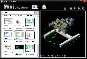
Mini CAD Viewer is a compact free CAD viewer.It is designed to be easy to use, even for those with no prior CAD experience. It allows you to move and zoom in/out drawing View at will. It carries "thumbnail" View, which allows users quickly perform search on task folders. It supports Dwg, DXF formats. It allows drawing file to be saved as image file.
Category: Multimedia & Design / Graphics Viewers
Publisher: zxt2007.com, License: Freeware, Price: USD $0.00, File Size: 8.6 MB
Platform: Windows
The OSTN02 extension for ArcPad is a FREE tool that automatically transforms Gps data and aligns it with Ordnance Survey (OS) background map. This easy-to-use extension removes the need to manually post-process Gps data by providing’ on the fly’ transformation of WGS84 latitude and longitude into OSTN02 corrected British National Grid coordinate. Data capture using...
Category: Home & Education / Miscellaneous
Publisher: ESRI (UK) Ltd, License: Freeware, Price: USD $0.00, File Size: 8.0 MB
Platform: Windows
CyCop monitors Heritage security guards at all times via GPS tracking.
CyCop monitors Heritage security guards at all times via Gps tracking.
Some features of the Dashboard include:
- View and search Daily Activity Reports
- View Site Coverage Maps
- View coverage alerts status in real-time
- Site Performance Metrics
- Client feedback form
- Search archived reports and security coverage...
Category: Business & Finance / MS Office Addons
Publisher: Heritage Security Services, License: Freeware, Price: USD $0.00, File Size: 4.2 MB
Platform: Windows
Have a Gps and a laptop? Use this to find your way. Make patterns or a trail to share with others. When the application starts, you may pick your area of operations - be it North America, South America, Europe and Asia, or Australia. Your quadrant is determined by where you are in relation to the Equator and the Prime Meridian. Tracking of your position is automatically enabled when the...
Category: Home & Education / Miscellaneous
Publisher: LogicAll Solutions, LLC, License: Freeware, Price: USD $0.00, File Size: 4.6 MB
Platform: Windows
GPS Send Map is a Windows interface program which uses (sendmap.
Gps Send Map is a Windows interface program which uses (sendmap.exe) to load the IMG maps to the Gps.This program works well and setup is easy, although there seams to be minor issues in some windows OS.The Gps acted as usual and my maps appeared on the screen as usual. NICE.
Category: Security & Privacy / Other
Publisher: DougsBrat, License: Freeware, Price: USD $0.00, File Size: 1.5 MB
Platform: Windows
Kinomap Gps File Fixer allows you to process some treatments on Gps file:
- convert almost any Gps file to standard NMEA 0183, compatible with Kinomap
- fill the gaps between points when your file is not 1Hertz: the extra point will be recreated by interpolation
- cut a long file in which there are loops of data (example: race) in several parts
Category: Home & Education / Miscellaneous
Publisher: ExcelLance, License: Freeware, Price: USD $0.00, File Size: 19.6 MB
Platform: Windows
Keep track of discount Garmin GPS deals on with this Firefox toolbar.
Keep track of discount Garmin Gps deals on with this Firefox toolbar.compare and buy all the latest Garmin satellite navigation systems. If you want a discount Garmin Gps system this is the Firefox toolbar to use. We also provide information on the latest offers, price cuts and discount voucher codes to help you buy the latest Garmin Gps at the cheapest price possible in...
Category: Internet / Browsers
Publisher: Discount Garmin GPS, License: Freeware, Price: USD $0.00, File Size: 1.1 MB
Platform: Windows
An easy to use Gps downloading utility that lets you download your Gps waypoints easily and export them into a variety of formats useful for editing, display and importing into many different mapping programs.
Use Lobal to save Gps waypoints as:
- Text Files
- HTML Tables
- Shape Files
- Google Earth KML
- DBase Files.
Category: Utilities / Misc. Utilities
Publisher: Ecological Software Solutions, License: Freeware, Price: USD $0.00, File Size: 2.2 MB
Platform: Windows
Provides hours of entertainment by combining the technology in your phone with one of the fastest-growing international hide and seek games - geocaching (also known as "Gps treasure hunt"). By using your Nokia's Gps and built-in Internet, Geocache Navigator? creates a seamless and exciting experience. What is Geocaching? Geocaching is a fun, challenging activity for...
Category: Games / Misc. Games
Publisher: Trimble Navigation Limited, License: Freeware, Price: USD $0.00, File Size: 225.0 KB
Platform: Unknown
Multicam or multiple video source capable webcam/video capture application with Gps filter support, and supports most codecs such as DivX, XViD, FFDShow, etc.
DSGPS.ax - Gps Video Overlay, a DirectShow filter which retrieves Gps and OBD-II data from XPort and/either/or XOBD, and imprints Gps speed, time, date, course, longitude, latitude, MPG, RPM, AIT,...
Category: Multimedia & Design / Video
Publisher: Curious Technology, License: Freeware, Price: USD $0.00, File Size: 78.9 KB
Platform: Windows
The fast track to GPS success.
The fast track to Gps success. The Linx MDEV-Gps-SR contains everything needed to rapidly evaluate the SR Series Gps modules and implement them in record time. This all-inclusive Master Development System features a pre-assembled development board with an on-board OLED display for standalone testing. The system can also be attached to a PC via USB and operated using the...
Category: Software Development / Misc. Programming
Publisher: Linx Technologies, Inc., License: Freeware, Price: USD $0.00, File Size: 98.5 MB
Platform: Windows
Gps Egypt brings you the best Gps mapping and navigation package on the Egyptian market today with over 55,000 km of road coverage. The package offers the best map coverage available in Egypt, in addition to a cutting-edge software package for voice-based routing and navigation.
Category: Internet / Communications
Publisher: GPS Egypt, License: Freeware, Price: USD $0.00, File Size: 135.6 MB
Platform: Windows
A program for converting OLEX files into GPS Utility Format Files.
A program for converting OLEX files into Gps Utility Format Files.
Gps Utility is an easy-to-use application that allows you to manage, manipulate and map your Gps information.
When you convert the OLEX files you can use the source file name or enter a new target file name.
Category: Audio / Rippers & Encoders
Publisher: GPS Utility Ltd., License: Freeware, Price: USD $0.00, File Size: 404.5 KB
Platform: Windows
Freeware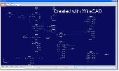
This utility is a standalone tool that is useful to find differences between to similar drawings. Compares all drawing entities in the selected drawing space (Model,Layout) Compares all other drawing structures such as: Layers, Blocks, Text Styles, Layouts, etc. Compare Dwg drawings from R12 to 2007. Creates three separate views outputs (A not B, B not A, and Common)....
Category: Multimedia & Design / Graphics Viewers
Publisher: Holbrook Enterprises, Inc. dba WireCAD, License: Freeware, Price: USD $0.00, File Size: 14.4 MB
Platform: Windows
GPSCommunicator is a FREE utility to visually represent NMEA GPS position data in realtime.
GPSCommunicator is a FREE utility to visually represent NMEA Gps position data in realtime. It works with NMEA 0183 Gps receivers connected via a serial port. GPSCommunicator has the following features:
- Vessel position display over moving map.
- User selectable maps.
- Create and save Waypoints.
- Graphical Gps data display
- .NET components...
Category: Internet / Misc. Plugins
Publisher: Panazzolo.Com, License: Freeware, Price: USD $0.00, File Size: 772.5 KB
Platform: Windows
DNRGarmin is a smart tool used to directly transfer data between Garmin Gps handheld receivers and various GIS software packages.
DNRGarmin was built to provide users the ability to directly transfer data between Garmin Gps handheld receivers and various GIS software packages. Using DNRGarmin a user can use point features (graphics or shapefile) and upload them to the...
Category: Utilities / Misc. Utilities
Publisher: GIS Section, Minnesota Department of Natural Resources, License: Freeware, Price: USD $0.00, File Size: 11.3 MB
Platform: Windows
Freeware
GPS Converter will convert GPS coordinates between three different formats: 34. 26965, -116.
76783; N 34° 16. 179', W 116° 46. 07'; and N 34° 16' 10.
Category: Home & Education / Sports
Publisher: ALMSys, Inc., License: Freeware, Price: USD $0.00, File Size: 929.9 KB
Platform: Windows
Used Magellan toolbar for Internet Explorer.
Used Magellan toolbar for Internet Explorer. Find great deals on used Magellan Gps devices at prices you can afford. Whether your looking for the Magellan Roadmate, Magellan Maestro, or Magellan CrossoverGPS you'll find it here at low prices. We are always searching our networks on a daily basis to bring you the best prices in used Magellan Gps devices for your car. Find a great...
Category: Internet / Browsers
Publisher: Used Magellan, License: Freeware, Price: USD $0.00, File Size: 1.1 MB
Platform: Windows
V-Clinic GPS lets you track your training routes and upload the data back to your V-Clinic account.
V-Clinic Gps lets you track your training routes and upload the data back to your V-Clinic account. Then use V-Clinic to share your route with your training buddies. V-Clinic Gps is ideal for cyclists, joggers and outdoor enthusiasts. V-Clinic Gps runs on Gps & Java enabled phones. Use V-Clinic Gps on your own or get professional fitness analysis and...
Category: Home & Education / Health & Nutrition
Publisher: V-CLINIC MOBILE CIRCLES, License: Freeware, Price: USD $0.00, File Size: 235.0 KB
Platform: Unknown
Have a Gps and a laptop? Use this to find your way. Make patterns or a trail to share with others. When the application starts, you may pick your area of operations - be it North America, South America, Europe and Asia, or Australia. Your quadrant is determined by where you are in relation to the Equator and the Prime Meridian. Tracking of your position is automatically enabled when the...
Category: Home & Education / Miscellaneous
Publisher: LogicAll Solutions, LLC, License: Freeware, Price: USD $0.00, File Size: 4.6 MB
Platform: Windows
This application was created prediction of S-nitrosylation sites.
This application was created prediction of S-nitrosylation sites.
The leave-one-out validation and 4-, 6-, 8-, 10-fold cross-validations were calculated to evaluate the prediction performance and system robustness. By comparison, the performance of Gps 3.0 algorithm was much better than several other approaches, with an accuracy of 75.70%, a sensitivity of 55.32% and a specificity...
Category: Home & Education / Science
Publisher: The CUCKOO Workgroup, License: Freeware, Price: USD $0.00, File Size: 20.3 MB
Platform: Windows
Freeware
With this tool you can add Gps coordinates to vCards - elektronic business cards - that you have previously exported from e. g. Microsoft Outlook. Therefore the tool uses the address data contained within the vCards and adds the exact Gps position on that basis to the vCard. This way you can use these vCards for example in compatible car navigation systems. Among others...
Category: Home & Education / Home Inventory
Publisher: AB-Tools.com, License: Freeware, Price: USD $0.00, File Size: 1.9 MB
Platform: Windows
GPSBabel is a program that allows users to transfer GPS data files to and from numerous GPS devices.
GPSBabel is a program that allows users to transfer Gps data files to and from numerous Gps devices. It also enables the transfer of waypoints, routes and tracks between Gps receivers and mapping programs. As already mentioned before, this application offers support for several popular Gps devices, such as Tom Tom, Garmin, Magellan, Columbus, etc.
...
Category: Multimedia & Design / Media Management
Publisher: Robert Lipe, License: Freeware, Price: USD $0.00, File Size: 973.5 KB
Platform: Windows
The goal is to get a logic and a topographic view on the network.
The goal is to get a logic and a topographic View on the network. The prototype Jisio (OBST Network Visualization based on platform independent Java) can collect Gps-data to generate a map of your network area. The topographic View is for setting the position of your network sites. In the other View you can get them in a network-relationship.
All 2D- Icons are...
Category: Internet / Misc. Plugins
Publisher: chelys, License: Freeware, Price: USD $0.00, File Size: 2.9 KB
Platform: Windows
The Gps TrackManager is an application for planning routes and managing routes, waypoints and trackpoints.
The application support functions such as: open and save trackpoints files in various formats (GPX, Ozi Trackpoint file, Ozi Waypoint file, NMEA log, EasyGPS file), transmit Trackpoints, Waypoints and Routes to Garmin Gps receivers (Geko 201, GPSmap 60C), saves...
Category: Internet / Communications
Publisher: Frank Hamaekers, Write4u, License: Freeware, Price: USD $0.00, File Size: 4.8 MB
Platform: Windows
GPS PLUS Collar Manager for your PC is a powerful tool to manage your collars.
Gps PLUS Collar Manager for your PC is a powerful tool to manage your collars. It is designed to communicate with your collars, the UHF/VHF handheld terminal and GSM ground station and is the basic tool to design your study. You can:
- manage collars and GSM/email communication details,
- read out data from collar, handheld terminal and GSM ground station,
- store,...
Category: Home & Education / Miscellaneous
Publisher: VECTRONIC Aerospace GmbH, License: Freeware, Price: USD $0.00, File Size: 8.4 MB
Platform: Windows