Earth Explorer Screenshot
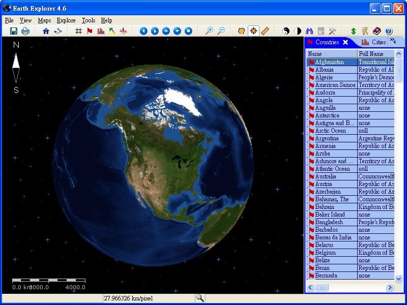
This educational program brings a plethora of geographic information right to your desktop. After you launch Earth Explorer, you'll be greeted by a 3D rendition of the Earth spinning in space. To the right of the globe sits a table of information on countries, cities, and islands. Simply clicking on one of the entries shows you its location on the globe, and scrolling over the table gives you data, such as population, size, and capital. You can zoom in or out on any area of the map, calculate distances between two points, and change the globe's rotation. Earth Explorer also can be configured to show different views, such as those outlining rivers, major cities, and recent earthquakes. Both students and world-curious folks will find this application a fun, interactive way to learn.
1. 3D global view with 50m resolution satellite imagery and shaded relif DEM (digital elevation model) imagery convered entire earth;
2. Inlucde 267 countries and regions, 40000+ cities, 15000+ islands, 1700+ noteworthy historical earthquakes and vector layers includes political boundaries, coastlines, rivers, longitude-latitude grids;
3. Easy-to-use user interfaces;
4. Real-time loading of high resolution data to your desktop;
5. Enable addition to user-definable Place Marks, Paths and personal comments over places.
6. Measure and calculate distance and bearing between any two points, find a particular country, city, island by name;
7. Display Compass, Map Scale and Map Legend.
8. Enable Print and Print Preview, and you could control the resolution and size of your print.
9. Enable operation under full screen mode
10. Enable pan and zoom to rotate and observe the Earth.
11. Scroll on mouse's scroll key to zoom in/out;
12. Configure to show day/night shadow effect, adjust Gamma to control lumination, or choose a star space as background;
Back to Earth Explorer Details page
- Earth Explorer Of Symbian
- Earth Explorer By Mobile
- File Explorer Windows Explorer
- Internet Explorer Dom Explorer
- Down To Earth
- Satelite Earth
- Earth Watch
- Earth Work
- Goggle Earth
- Wallpapers Earth