PCWin Software Download Center
 
Product Home
Download Trial
Purchase
Author Site

Category

 
Audio
Business & Finance
Applications
Auction Tools
Business Finance
CRM
Calculators
Conversion Applications
Database Management
Document Management
Document Plugins
E-commerce
Fax Software
Inventory Systems
Legal
MS Office Addons
Personal Finance
Personal Info Managers
Presentation Tools
Project Management
Sales & Marketing Tools
Small Business Tools
Spreadsheets
Taxes
Vertical Markets
Voice Recognition
Word Processing
Desktop Enhancements
DVD & Video
Games
Home & Education
Internet
Multimedia & Design
Security & Privacy
Software Development
Utilities
Web Authoring


Popular Downloads

 
TubeHunter Ultra
More than 30.000 vista icons
EasySystemCleaner
Aurora Web Editor 2007 Professional
MySpeed PC Lite
eScan Pro Edition
HelpVistaXPDiamond
WAB-Processor
Win Guard Pro
Help Explorer Viewer for Windows
 

New Downloads

 
ServiceCommander
Patch I.T.
ALLPlayer
SQL Balance for MySQL
Batch FTP Upload Synchronizer
SharePoint Permission Workflow
Bluefox RMVB to X converter
S3 Browser
DVR-MS to AVI
DVD to iPhone converter
 

Related Downloads

 
Latitude Longitude
Canada Postal Code
Distance Search
Area Code Listing
Address List
Email Address List
Address Database
Bulk Email Address List
Address Search
Ip Address Search
 

Geo Data International Admin (English)

Geo Data International Admin (English) 1.03

Geodata of international countries with locals, municipalities and postal codes. Georeferences as UTM- and geographic coordinates (WGS84, ETRS89). Suitable for branch searches, periphery searches and distance computations. Download Geo Data International Admin (English) by Killet Software Ing.-GbR

Screenshot of Geo Data International Admin (English)
Publisher: Killet Software Ing.-GbR
License: Demo
Price: USD $195.00
Filesize: 151.6 KB
Date Added: 07/05/2007

Geodata of international countries with locals, municipalities and postal codes. Georeferences as UTM- and geographic coordinates (WGS84, ETRS89). Suitable for branch searches, periphery searches and distance computations. These countries are available: Albania, Andorra, Belgium, Bosnia, Bulgaria, Denmark, Estonia, Finland, France, Georgia, Gibraltar, Greece, Great Britain, Ireland, Italy, Ex Yugoslavia, Canada, Croatia, Latvia, Liechtenstein, Lithuania, Luxembourg, Malta, Macedonia, Mexico, Moldavia, Monaco, Netherlands, Norway, Austria, Poland, Portugal, Romania, Russia, San Marino, Sweden, Switzerland, Slovakia, Slovenia, Spain, Czech Republic, Turkey, Ukraine, Hungary, Vatican, White Russia, USA, Australia, Cyprus and many more. The download contains a test composition of data cutouts of a lot of countries in different file formates and the exact data description. Here the available data fields of the tables are specified: National identification of the country, local identification for the place within the country, postal zip code, place name, local part name, local administrative identification (municipality key), geographical longitude and geographical latitude in degree and deg/min/sec notation, UTM easting and UTM northing on the natural and an uniformal meridian strip, local size (categories), local meaning (categories), 4 hierarchical administrative units, which are superordinate the place. First the data base tables are present in a standard file format (dBase, ASCII / OEM character set). They can be imported directly into MS-EXCEL, MS-ACCESS and in Borlands dBase. In addition the data base tables can be converted with the downloadable freeware program CONVERT into different data formats with the necessary characteristics, selections and sort sequences. For example you can convert the data into the SDF format (Simple Document Format) or into the CSV format (Comma Separated Value) using character sets ASCII / OEM or ANSI / WINDOWS or direct in MySQL.

Platform: Windows 3.x, Windows 95, Windows 98, Windows Me, Windows NT, Windows 2000, Windows XP, Windows 2003, Linux, Windows CE, Unix,Not Applicable

Category: Business & Finance


Download | 
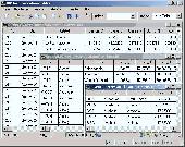
Homepage | Buy Now | Screenshot | Report Error

Related Software

Address Calculation Code Coding
Coordinates Correlation Database Distance
Geo Geographic Germany Latitude
List Listing Local Localities
Longitude Municipality Parts Periphery
Geodaten International Admin (Deutsch) - Geodata of international countries with locals, municipalities and postal codes. Georeferences as UTM- and geographic coordinates (WGS84, ETRS89). Suitable for branch searches, periphery searches and distance computations.
Geo Data German Admin (English) - Geodata of the Federal Republic Germany with municipalities, postal codes, telephone preselections. Georeferences as Gauss Krueger- UTM-, Geographic Coordinates and Ground Elevations. For branch searches, periphery searches and distance computations.
Geodaten German Admin (Deutsch) - Geodata of the Federal Republic Germany with municipalities, postal codes, telephone preselections. Georeferences as Gauss Krueger- UTM-, Geographic Coordinates and Ground Elevations. For branch searches, periphery searches and distance computations.
ORTWIN - ORTWIN is a program for the state-wide inquiry of the localities in Germany.
Geodaten German Houses (deutsch) - For the area of the Federal Republic of Germany more than 19 million House Coordinates with a coverage of 100% are available. The geo data offered here are in high-precision quality and are present in different coordinate and reference systems.
Geodaten German Houses (English) - For the area of the Federal Republic of Germany more than 19 million House Coordinates with a coverage of 100% are available. The geo data offered here are in high-precision quality and are present in different coordinate and reference systems.
Geo data German Streets (English) - For the area of the Federal Republic of Germany more than 2,7 million street coordinates with a coverage of 100% are available. The geo data offered here are in high-precision quality and are present in different coordinate and reference systems.
Geodaten German Streets (deutsch) - For the area of the Federal Republic of Germany more than 2,7 million street coordinates with a coverage of 100% are available. The geo data offered here are in high-precision quality and are present in different coordinate and reference systems.
Geodaten International Houses (deutsch) - For many countries house coordinates are present with coverage degrees upto 100 percent. The geo data offered here are in high-precision quality and are present in different coordinate and reference systems.
Geodaten International Houses (English) - For many countries house coordinates are present with coverage degrees upto 100 percent. The geo data offered here are in high-precision quality and are present in different coordinate and reference systems.

More Software of "Killet Software Ing.-GbR"

Geodaten German Topo - A volume of data with map names, map numbers, corner coordinates and completing data of all official topographic maps of the Federal Republic of Germany. TK25, TK50, TK100 and TK200.
Geodaten International Admin (Deutsch) - Geodata of international countries with locals, municipalities and postal codes. Georeferences as UTM- and geographic coordinates (WGS84, ETRS89). Suitable for branch searches, periphery searches and distance computations.
 

Copyright © 1995-2008 PCWin Download Center. Home | | Privacy | Link to Us | Submit / Update Software