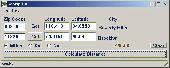
PCWin Software Download Center
 
Product Home
Download Trial
Purchase
Author Site

Category

 
Audio
Business & Finance
Applications
Auction Tools
Business Finance
CRM
Calculators
Conversion Applications
Database Management
Document Management
Document Plugins
E-commerce
Fax Software
Inventory Systems
Legal
MS Office Addons
Personal Finance
Personal Info Managers
Presentation Tools
Project Management
Sales & Marketing Tools
Small Business Tools
Spreadsheets
Taxes
Vertical Markets
Voice Recognition
Word Processing
Desktop Enhancements
DVD & Video
Games
Home & Education
Internet
Multimedia & Design
Security & Privacy
Software Development
Utilities
Web Authoring


Popular Downloads

 
TubeHunter Ultra
More than 30.000 vista icons
EasySystemCleaner
Aurora Web Editor 2007 Professional
MySpeed PC Lite
eScan Pro Edition
HelpVistaXPDiamond
WAB-Processor
Win Guard Pro
Help Explorer Viewer for Windows
 

New Downloads

 
ServiceCommander
Patch I.T.
ALLPlayer
SQL Balance for MySQL
Batch FTP Upload Synchronizer
SharePoint Permission Workflow
Bluefox RMVB to X converter
S3 Browser
DVR-MS to AVI
DVD to iPhone converter
 

Related Downloads

 
Latitude Longitude
Distance Calculator
Air Miles Price
Color Coordinates
Car Kilometers
Vehicle Kilometers
City Latitude
Dell Latitude Resource C
Long Distance
Distance Search
 

Geozip

Geozip 1

Geozip calculates distance between US (optionally Canadian) zip codes or geographical coordinates. You can choose miles, kilometers or nautical miles output. Download Geozip by Island Limited

Screenshot of Geozip
Publisher: Island Limited
License: Shareware
Price: USD $49.00
Filesize: 2.3 MB
Date Added: 07/05/2007

Geozip calculates distance between US (optionally Canadian) zip codes or geographical coordinates, latitude and longitude. It does take into account the curvature of the earth for calculating. You can choose miles, kilometers or nautical miles output. Customixation is available if you need more specific applications using the Geozip geographical distance calculations.

Platform: Windows 95, Windows 98, Windows Me, Windows NT, Windows 2000, Windows XP

Category: Business & Finance


Download | Homepage | Buy Now | Screenshot | Report Error

Related Software

Calculate Calculator Code Codes
Coordinates Distance Geographical Geozip
Kilometers Latitude Longitude Miles
Zip
Info-Pack.com Miles2Kms - Convert Miles to Kilometers and vice versa
Postal Code Distance Wizard - Locates Canadian postal codes that are within close proximity of a specified postal code. Type in a postal code, specify the radius distance in miles/kilometers and within seconds, a list of all postal codes that fall within that radius is displayed.
Spicy ZIP Calculator - Spicy ZIP Calculator allows you to locate all the existing ZIP Codes within a specific radius area in the US.
Geo Data German Admin (English) - Geodata of the Federal Republic Germany with municipalities, postal codes, telephone preselections. Georeferences as Gauss Krueger- UTM-, Geographic Coordinates and Ground Elevations. For branch searches, periphery searches and distance computations.
Geodaten German Admin (Deutsch) - Geodata of the Federal Republic Germany with municipalities, postal codes, telephone preselections. Georeferences as Gauss Krueger- UTM-, Geographic Coordinates and Ground Elevations. For branch searches, periphery searches and distance computations.
Almeria Spain Postal Code Software - The Software includes postal code, city name, colony name, area abbreviation, latitude and longitude, time zone and area code in Almeria. Enter 2 area name and get the distance between them.
GeoMaker - World GeoDatabase - Latitude, Longitude, Altitude For Entire World. Create the GeoDatabase for the entire world. This program create the geographical location Latitude, Longitude, and Altitude (Elevation) for every city, village, region, state
ZIP Code Distance Wizard - Locates ZIP Codes that are within close proximity of a specified ZIP Code. All you do is type in a ZIP Code, specify the radius distance in miles, and within seconds, a list of ZIP Codes that fall within that radius is displayed.
Geo Data International Admin (English) - Geodata of international countries with locals, municipalities and postal codes. Georeferences as UTM- and geographic coordinates (WGS84, ETRS89). Suitable for branch searches, periphery searches and distance computations.
Geodaten International Admin (Deutsch) - Geodata of international countries with locals, municipalities and postal codes. Georeferences as UTM- and geographic coordinates (WGS84, ETRS89). Suitable for branch searches, periphery searches and distance computations.

More Software of "Island Limited"

CSV Converter - This program converts any CSV file to an SQL file with INSERT statements or an HTML table/file. Fields are auto detected and you can specify their names. The maximum field sizes are computed so you know how to create your table.
PassCryptor - PassCryptor keeps your passwords safe with strong encryption using the Twofish Cypher. You don't have to remember all your passwords anymore with this easy to use management tool. Includes one-click link and copy password to clipboard features.
Cantennator - Cantennator calculates dimentions for a can WiFi antenna. You enter the can diameter, and it will calculate where to drill the hole for the connector as well as the optimum can length. Boost your WiFi signal with this cheap and easy to make antenna.
Maritime Quizz - With MaritimeQuizz, learning maritime flags and morse code is easy and fun.
 

Copyright © 1995-2008 PCWin Download Center. Home | | Privacy | Link to Us | Submit / Update Software