Free Downloads: Cogo
License: All | Free
COGO (COordinate GeOmetry) is an engineering tool used to determine geometric relationships.
Cogo (COordinate GeOmetry) is an engineering tool used to determine geometric relationships. There are a number of ways to create a geometric model. There is a command language that allows the user to define and solve geometric problems in engineering terms. There are Windows forms that you fill in to create the geometry. And you can execute Cogo inside of AutoCAD using the...
Category: Multimedia & Design / Image Editing
Publisher: Colorado DOT, License: Freeware, Price: USD $0.00, File Size: 3.5 MB
Platform: Windows
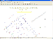
"Sight" Survey is a fully three dimensional coordinate geometry package containing all the tools you need to solve your day-to-day Cogo problems! With a virtually unlimited capacity for points (over 3.5 trillion), "Sight" Survey is capable of projects from the smallest lot survey to the largest subdivision. And, if you're wondering about the word "Site"...
Category: Business & Finance / Business Finance
Publisher: Carlson Software, License: Shareware, Price: USD $995.00, File Size: 79.6 MB
Platform: Windows
A state-of-the art CAD software for land surveying and civil engineering.
A state-of-the art CAD software for land surveying and civil engineering. It is one of the most powerful and intuitive applications ever designed. Specialized drawing tools, Cogo functions and design tools are all tightly integrated in a complete standalone package that runs on PC. It's easy to use, so you'll be up and running in no time.
Category: Multimedia & Design / Image Editing
Publisher: Pythagoras BVBA, License: Demo, Price: USD $0.00, File Size: 14.8 MB
Platform: Windows
 Demo
Demo
DXF Works is an application that allows to extract coordinates and other various data from DXF files. You can choose which entities to process and which data to extract, creating your own file format. DXF Works can process several files at one time and lets save your settings in reusable configuration files. DXF Works can be used for several purposes : extracting coordinates, counting blocks,...
Category: Multimedia & Design / Graphics Viewers
Publisher: DeliCAD, License: Demo, Price: USD $49.00, EUR49, File Size: 783.4 KB
Platform: Windows
FlashPoints is a tool for creating and managing points Groups (topographic points for example). FlashPoints allows you to : * import/export points coordinates from and to a file * create points and their attributes "Number", "Elevation" and "Description" by clicking * modify the points elevation * modify the height and rotation of the attributes * create points on...
Category: Multimedia & Design
Publisher: DeliCAD, License: Shareware, Price: USD $49.00, File Size: 1.2 MB
Platform: Windows
RapidDXF reads ASCII (text) or XLS (Microsoft Excel) files of coordinates and creates DXF (version 12) files of points and thier attributes. The DXF files so created are usable in many CAD software. RapidDXF can process several files at a time and lets you choose your file format and can create 2D or 3D files.
Category: Multimedia & Design
Publisher: DeliCAD, License: Shareware, Price: USD $54.95, File Size: 1.1 MB
Platform: Windows
SceneDraw is an investigative tool, for police and private investigators that need to survey and diagram scenes for criminal and civil litigation. Scene Draw is not a CAD program nor is it a drawing program, it is a Data Driven Diagram software program for your reconstruction purposes. It is the complete data measurement collection software tool for Microsoft Windows 98 to XP. Whether you...
Category: Multimedia & Design
Publisher: DeliCAD and AK Corp, License: Commercial, Price: USD $149.99, File Size: 2.6 MB
Platform: Windows
A comprehensive field software for Windows OS to control your receivers, automate GNSS post processing surveying tasks (Static, Fast Static, Stop&Go, Data Acquisition), and to perform RTK survey and stakeout tasks with the following features:
- Always provides information on receiver while surveying.
- Data logging to receiver and controller.
- Increased...
Category: Utilities / Misc. Utilities
Publisher: JAVAD GNSS Inc., License: Freeware, Price: USD $0.00, File Size: 25.9 MB
Platform: Windows
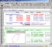
CopanMobile for Palm OS is a very functional and easy-to-use geomatics engineering tool for computing and managing plane surveying and mapping coordinates. It does numerous coordinate geometry (Cogo) calculations, processes and adjusts raw field survey data, computes and adjusts map traverse data, performs map or deed checks, calculates curves, areas and perimeters, performs coordinate...
Category: Multimedia & Design / Multimedia App's
Publisher: Underhill Geomatics Ltd., License: Freeware, Price: USD $0.00, File Size: 341.0 KB
Platform: Palm
CopanMobile for Pocket PC is a very functional and easy-to-use geomatics engineering tool for computing and managing plane surveying and mapping coordinates. It does numerous coordinate geometry (Cogo) calculations, processes and adjusts raw field survey data, computes and adjusts map traverse data, performs map or deed checks, calculates curves, areas and perimeters, performs coordinate...
Category: Business & Finance / Applications
Publisher: Underhill Geomatics Ltd., License: Freeware, Price: USD $0.00, File Size: 341.0 KB
Platform: Windows
Copan for Pocket PC is a very functional and easy-to-use geomatics engineering tool for computing and managing plane surveying and mapping coordinates.
It does numerous coordinate geometry (Cogo) calculations, processes and adjusts raw field survey data, computes and adjusts map traverse data, performs map or deed checks, calculates curves, areas and perimeters, performs...
Category: Multimedia & Design / Multimedia App's
Publisher: Underhill Geomatics Ltd, License: Freeware, Price: USD $0.00, File Size: 662.0 KB
Platform: Windows
Copan for Mobile 6 is a very functional and easy-to-use geomatics engineering tool for computing and managing plane surveying and mapping coordinates.
It does numerous coordinate geometry (Cogo) calculations, processes and adjusts raw field survey data, computes and adjusts map traverse data, performs map or deed checks, calculates curves, areas and perimeters, performs...
Category: Multimedia & Design / Multimedia App's
Publisher: Underhill Geomatics Ltd, License: Freeware, Price: USD $0.00, File Size: 662.0 KB
Platform: Windows
From now on, the most exciting part of a project is not the end – but the beginning.
From now on, the most exciting part of a project is not the end – but the beginning. Make AllyCAD your first choice for all your draughting needs. Its intuitive interface has earned it the reputation as one of the most user-friendly packages on the market. AllyCAD places all the draughting functionality that you need at your fingertips, allowing you to design the way you want to. Its...
Category: Multimedia & Design / Image Editing
Publisher: AllyCAD, License: Shareware, Price: USD $0.00, File Size: 0
Platform: Windows
Copan Pro -- for Windows 98, NT, 2000, ME, XP, Vista, or 7 -- is a very functional and easy-to-use desktop/netbook geomatics engineering tool for computing and managing plane land surveying and mapping coordinates, and drafting survey maps and plans.
It does numerous coordinate geometry (Cogo) calculations, processes and adjusts raw field survey data, computes and adjusts map...
Category: Multimedia & Design / Multimedia App's
Publisher: Underhill Geomatics Ltd, License: Demo, Price: USD $650.00, File Size: 9.0 MB
Platform: Windows
Abykus is an easy-to-use spreadsheet designed for business and scientific applications. The program combines object-oriented functionality with traditional spreadsheet operations, allowing you to store multi-value data types (such as arrays and matrixes) in a single cell. This not only saves valuable space on your worksheets, but it also significantly reduces the overhead needed to manage...
Category: Business & Finance
Publisher: Abykus.com, License: Freeware, Price: USD $0.00, File Size: 581.9 KB
Platform: Windows
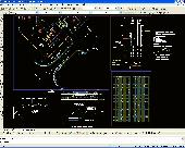
Civil Survey AutoCAD Clone Software, no learning curve for AutoCAD users, Natively reads and writes AutoCAD DWG files, no need for conversion! Includes Data Colector File Import, Cogo, Contours, DTM, Road Design, Sections and Profiles. low-cost alternative to otherwise high priced Land survey, coordinate geometry, digital terrain modeling, and corridor design software including working...
Category: Multimedia & Design / Multimedia App's
Publisher: iCADsales.com, License: Shareware, Price: USD $1399.00, File Size: 157.1 MB
Platform: Windows
With Subassembly Studio, you can now quickly and easily create an unlimited variety of custom parametric subassemblies without any programming whatsoever! Because you can create and modify your custom subassemblies by yourself, you are not only able to remain fully productive, but you will likely find that you can complete your designs faster than previously possible while at the same time...
Category: Multimedia & Design / Image Editing
Publisher: Cad Artisans LLC, License: Demo, Price: USD $0.00, File Size: 14.7 MB
Platform: Windows
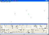
Land surveyors and civil engineers:
o Calculate surveys and manage points, effortlessly
o Run Copan on Windows 2K/XP/Vista/7
o Use it forever and pay nothing
o Choose quadrant bearings or N/S azimuths, and gons or DMS
o Create point files quickly and easily
o Edit any point's number, name, coords, code or note
o Specify groups of points for...
Category: Multimedia & Design / Multimedia App's
Publisher: Underhill Geomatics Ltd, License: Freeware, Price: USD $0.00, File Size: 5.6 MB
Platform: Windows
License: All | Free