Free Downloads: Flash Based Gis Viewer
AvisMap Gis Engine is the basic development platform for AvisMap Gis suites, which is a new generation component Gis development platform for Gis application developers. AvisMap Gis Engine 5 provides powerful Gis functions through Active X controls Based on Microsoft COM component technique standards. It allows users to rapidly develop...
Category: Multimedia & Design / Multimedia App's
Publisher: AvisMap GIS Technologies, License: Freeware, Price: USD $0.00, File Size: 60.5 MB
Platform: Windows
DIVA-GIS is a GIS for plant biodiversity analysis.
DIVA-Gis is a Gis for plant biodiversity analysis. The project will modernize the architecture for better collaboration and extensibility Based on Eclipse RCP.
DIVA-Gis can be used to map and analyze biological distribution data, such as can be provided by natural history collections and genetic resources collections. Typically, the distribution data would...
Category: Business & Finance / Business Finance
Publisher: International Potato Center (CIP), License: Freeware, Price: USD $0.00, File Size: 122.4 MB
Platform: Windows
GeoMedia Viewer is an easy to use, FREE Gis software application for desktop viewing and distribution of geospatial data.It allows an organization to maximize the value of its geospatial data by extending availability to novice users who wouldn’t otherwise have access because of the barriers of purchasing and learning how to use a full Gis software application.
Category: Multimedia & Design / Graphics Viewers
Publisher: Intergraph Corporation, License: Freeware, Price: USD $0.00, File Size: 115.0 MB
Platform: Windows
ArcGIS Explorer is a free, downloadable Gis Viewer that gives you an easy way to explore, visualize and share Gis information. ArcGIS Explorer adds value to any Gis because it helps you deliver your authoritative data to a broad audience.
The ArcGIS Explorer Desktop Current User setup is intended for users who do not have administrator access on their...
Category: Desktop Enhancements / Shell & Desktop Managers
Publisher: Environmental Systems Research Institute, Inc., License: Freeware, Price: USD $0.00, File Size: 94.0 MB
Platform: Windows
ArcGIS Explorer Desktop is a free Gis Viewer that gives you an easy way to explore, visualize, and share Gis information. ArcGIS Explorer adds value to any Gis because it helps you deliver your authoritative data to a broad audience.
Easy and intuitive to use it's easy for anyone to begin working with ArcGIS Explorer, with its intuitive and easy to...
Category: Home & Education / Miscellaneous
Publisher: Environmental Systems Research Institute, Inc., License: Freeware, Price: USD $0.00, File Size: 100.5 MB
Platform: Windows
The Framework Free Viewer is optional but is provided in case you do not have access to Gis software. The Framework Free Viewer is only useful when when working with data provided by Framework Archaeology.
The Framework Free Viewer requires 12MB of disk space to install and once installed will take up 6MB of disk space.
Category: Home & Education / Genealogy
Publisher: Framework Archaeology, License: Freeware, Price: USD $0.00, File Size: 4.4 MB
Platform: Windows

The free AvisMap Viewer opens most Gis/CAD and raster image file types and most ArcView, ArcExplorer, and MapInfo projects. Besides just opening and viewing files, the Viewer supports an extensive list of features including visual layer properties control, legend control, thematic mapping, spatial and attribute querying, custom labeling, on-map measurements,...
Category: Software Development / Components & Libraries
Publisher: AvisMap GIS Technologies, License: Freeware, Price: USD $0.00, File Size: 22.3 MB
Platform: Windows
DIVA-Gis is a free computer program for mapping and geographic data analysis (a geographic information system (Gis). With DIVA-Gis you can make maps of the world, or of a very small area, using, for example, state boundaries, rivers, a satellite image, and the locations of sites where an animal species was observed.
Category: Business & Finance / Applications
Publisher: diva-gis, License: Freeware, Price: USD $0.00, File Size: 3.8 MB
Platform: Windows
PlanetGIS Explorer is a free viewer for PlanetGIS maps and GIS exchange files.
PlanetGIS Explorer is a free Viewer for PlanetGIS maps and Gis exchange files. PlanetGIS Explorer allows you to navigate through maps, query map elements and view attribute information from linked database tables. Also PlanetGIS Explorer allows you to customize the appearance of maps for purposes of creating hardcopy printouts, but does not allow you to save any changes to maps.
Category: Multimedia & Design / Graphics Viewers
Publisher: Planet GIS, License: Freeware, Price: USD $0.00, File Size: 5.4 MB
Platform: Windows
Gismaps Viewer is a GIS viewer that can be used for geospatial analysis and map production.
Gismaps Viewer is a Gis Viewer that can be used for geospatial analysis and map production.
The main features are:
- read Shape files using geographic coordinate system
- view satellite images (MrSid, jpeg, bmp and tiff file formats)
- generate thematic maps, queries and labels
- export do Google Earth KML (shp2kml)
- configure map...
Category: Multimedia & Design / Graphics Viewers
Publisher: Gismaps Sistemas Ltda., License: Freeware, Price: USD $0.00, File Size: 10.2 MB
Platform: Windows
 Shareware
AvisMap Gis Engine is a comprehensive SDK for the development of custom Gis applications and solutions. This SDK provides several ActiveX (OCX) controls which support Visual Basic, VB.NET, C#, Visual C++ and other ActiveX compatible programming languages, with Microsoft Visual Studio versions 6, 2003, 2005, and Express. Supports .NET via COM. While the SDK is excellent for desktop...
Category: Software Development / Components & Libraries
Publisher: AvisMap GIS Technologies, License: Shareware, Price: USD $1199.00, File Size: 57.8 MB
Platform: Windows
AEGIS– the leading GIS software in UK secondary schools.
AEGIS– the leading Gis software in UK secondary schools.
One-off software purchase and free upgrades – no subscriptions.
Brings industry-standard Gis maps to the classroom – Goad town plans, large-scale OS MasterMaps.
Try before you buy with the free AEGIS Viewer download.
Free materials: resources, help...
Category: Home & Education / Miscellaneous
Publisher: AU Enterprises Limited, License: Shareware, Price: USD $0.00, File Size: 0
Platform: Windows
Cityvu is a 3D GIS data viewer able to load CityGML data format from any compatible data source.
Cityvu is a 3D Gis data Viewer able to load CityGML data format from any compatible data source.
Cityvu features 3D hardware rendering using OpenGL with a complete navigation system that allows automated tour of the rendered scene. It has been designed to be used to develop customized software solutions, built on the specific needs. Cityvu supports in addition to...
Category: Multimedia & Design / Graphics Viewers
Publisher: 3D GIS Cityvu, License: Freeware, Price: USD $0.00, File Size: 9.9 MB
Platform: Windows
AutoCAD to Flash Converter let you Flash your AutoCAD DWG files.The best way to share and publish AutoCAD DWG files on the web,better than DWF.AutoCAD to Flash Converter is a dwg Viewer without need of dwg Viewer.NO need of additional Viewer or plug-in to view Flash.AutoCAD to Flash Converter is a vector to vector converter. AutoCAD to...
Category: Multimedia & Design
Publisher: AutoDWG, License: Shareware, Price: USD $198.00, File Size: 3.1 MB
Platform: Windows
Freeware
Convert ESRI ShapeFiles (.SHP) geolocation data into AnyMap format to be used with AnyChart. AnyChart Flash Map Converter allows making use of a wide choice of maps with AnyChart Flash Component, a Gis visualization system that recognizes map data in AnyMap format only. AnyChart Flash Map Converter makes it easy to visualize any geolocation data without hefty...
Category: Web Authoring / Image Mapping Tools
Publisher: AnyChart.Com, License: Freeware, Price: USD $0.00, File Size: 1.6 MB
Platform: Windows
The CANVAS 9 Gis Mapping Edition adds native support for Geographic Information System (Gis) data to Canvas. You can take measurements in geographic coordinates, import industry standard SHAPE and GeoTIFF files into unlimited numbers of automatically aligned overlapping layers and choose among the following options: 2,104 Coordinate Reference Systems 67 Operation Methods (like...
Category: Multimedia & Design / Multimedia App's
Publisher: ACD Systems, License: Shareware, Price: USD $549.99, File Size: 51.9 MB
Platform: Mac, PPC
The Quantum GIS Tethys repository contains a lot of software from OSGeo projects.
The Quantum Gis Tethys repository contains a lot of software from OSGeo projects. Quantum Gis Tethys and all dependencies are included, along with Python, GRASS, GDAL, etc. This is most suitable for people who want to be able to update dependencies from the Quantum Gis Tethys repository easily. The installer is able to install from internet or just download all needed...
Category: Multimedia & Design / Graphics Viewers
Publisher: QGIS Development Team, License: Freeware, Price: USD $0.00, File Size: 369.0 KB
Platform: Windows
Shareware
JC Panorama is a full Flash panorama software that includes the following: 1. JC Panorama Viewer - the Flash panorama Viewer component 2. JC Panorama Editor - the virtual tour creator and panorama editing software (AIR app) JC Panorama Viewer is a Flash component that can be used to display several types of panoramic images: plain, cylindrical,...
Category: Web Authoring / Web Design Utilities
Publisher: FlashComponents, License: Shareware, Price: USD $189.00, File Size: 488.3 KB
Platform: Windows, Mac, Linux
GeoSurveillance is software that combines spatial statistical routines with some basic Geographic Information Systems (Gis) functions to carry out retrospective and prospective statistical tests for the detection of geographic clustering. In this software, the focus is primarily on the spatial statistical analysis. Consequently, full Gis functionality is not provided. Gis...
Category: Home & Education / Miscellaneous
Publisher: NCGIA, License: Freeware, Price: USD $0.00, File Size: 2.4 MB
Platform: Windows
AvisMap Gis Engine is the basic development platform for AvisMap Gis suites, which is a new generation component Gis development platform for Gis application developers.AvisMap Gis Engine Sample Projects is a bundle of sample of different projects that you can see how they work.
Category: Software Development / Misc. Programming
Publisher: AvisMap GIS Technologies, License: Shareware, Price: USD $0.00, File Size: 30.9 MB
Platform: Windows

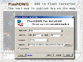
FlashDWG is a dwg to Flash converter, is the best way to share and publish AutoCAD DWG files on the web. FlashDWG is a dwg Viewer without need of dwg Viewer. Converting dwg to Flash(AutoCAD to Flash, dwg to swf) is the best way to share and publish AutoCAD DWG files, better than PDF, better than DWF.no need of additional Viewer or plug-in to view...
Category: Multimedia & Design / Authoring Tools
Publisher: AutoDWG, License: Shareware, Price: USD $198.00, File Size: 3.1 MB
Platform: Unknown
My World Gis™ is a Geographic Information System (Gis) designed specifically for use in middle school through college classrooms. It has been developed by the GEODE Initiative at Northwestern University as part of a research program on the adaptation of scientific visualization and data analysis tools to support inquiry-Based learning.
My World gives...
Category: Home & Education / Miscellaneous
Publisher: Northwestern University, License: Shareware, Price: USD $59.00, File Size: 100.2 MB
Platform: Windows
OpenJUMP is an open source Geographic Information System (Gis), it can read and write shapefiles and simple GML files. It has limited support for the display of images and good support for showing data retrieved from WFS and WMS web-services. So you can use it as Gis Data Viewer.OpenJUMP has limits in reading very large data files and has limited support for cartographic...
Category: Home & Education / Miscellaneous
Publisher: Jump Pilot Project, License: Shareware, Price: USD $0.00, File Size: 0
Platform: Windows
Aleo Flash Pan Zoom Viewer is an easy and fast way to create Flash pan and zoom Viewer for images and SWF files. It features an easy to use user interface and does not require Adobe Flash Studio and knowledge of Flash.
Key features:
* Easy to use interface.
* No requirement of Adobe Flash Studio.
* No requirement of...
Category: Web Authoring / Web Design Utilities
Publisher: Aleo Software Inc., License: Shareware, Price: USD $29.95, File Size: 1.7 MB
Platform: Windows
So that you can identify the Mapping & Gis product that best suits your needs, use this simple Product Comparison. There are four main product types that you can use to create a GPS data collection and maintenance system, or mobile Gis solution. Use the links below to select a product group, and compare the features of each product within that group.
Category: Internet / Communications
Publisher: Trimble Navigation Limited, License: Freeware, Price: USD $0.00, File Size: 2.7 MB
Platform: Windows