Free Downloads: Geo Referenced Moving Map
The MapSys Cadastral GIS offers specialized functionality for each stage of processing including the digital Map creation, plotting cadastral and topographical plans, generating and combining Geo-Referenced data in order to obtain a validated relational Geo-database. This can be used in MapSys or in other GIS programs or database application.
Category: Home & Education / Teaching Tools
Publisher: GEOTOP, License: Freeware, Price: USD $0.00, File Size: 143.9 MB
Platform: Windows
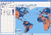
MapCreator 2.0 is a software to create maps and animated maps with a good quality.
MapCreator can be used in presentations because is versatile and can be adequate for any kind of presentation, from travel presentations to professional presentations.
MapCreator is Geo-Referenced so any Map or portion of the Map will have the exactly portions of latitude...
Category: Home & Education / Miscellaneous
Publisher: primap software, License: Freeware, Price: USD $0.00, File Size: 103.3 MB
Platform: Windows
Now you can trace your network activity on world Map.Geo Spider helps you to trace, identify and monitor your network activity on world Map.You can trace any website or IP address. Whois reports give to you more info about site, host, domain, ip address...
Category: Internet / Tools & Utilities
Publisher: Oreware.com, License: Shareware, Price: USD $20.00, File Size: 10.4 MB
Platform: Unknown
The Balloon Browser recognizes and highlights geo-coordinates in web pages.
The Balloon Browser recognizes and highlights Geo-coordinates in web pages. Hovering over a recognized location advises another application to show a Map of the corresponding area. For now the only program Balloon Browser can interact with is Google Earth.
Instead of waiting for the one true Geo-notation and markup standard, Balloon Browser tries to parse a...
Category: Internet / Browsers
Publisher: Michael Krause, License: Freeware, Price: USD $0.00, File Size: 5.6 MB
Platform: Windows
TerraExplorer allows users to shape their own digital world.
TerraExplorer allows users to shape their own digital world.
By editing and annotating Geo-Referenced 3D terrain databases created through TerraBuilder, users can customize the experience to highlight specific geographic content. By overlaying unique or proprietary information onto a 3D Map, the user creates an exciting, interactive application that can...
Category: Home & Education / Miscellaneous
Publisher: Skyline Software Systems, Inc., License: Freeware, Price: USD $0.00, File Size: 29.5 MB
Platform: Windows
USA Real Estate Map Pro is a premium class software for mapping: real estate properties, contact listings, offices and other Geo spatial data. Interactive Real Estate Map is rather simple to integrate with database listings: both to specify the states and counties that should be active on Map, and pass the selected county name or ID back, for further use. Among the...
Category: Business & Finance / Database Management
Publisher: USFlashMap.com, License: Shareware, Price: USD $399.00, File Size: 10.4 MB
Platform: Windows, Mac, Linux, Unix, MS-DOS, AS, 400
G2G is a P2P (peer to peer) extension for ArcGIS Desktop.
G2G is a P2P (peer to peer) extension for ArcGIS Desktop. The extension allows two or more users to collaborate without any intermediate server. G2G (gis to gis) supports:
1) Text chatting,
2) Exchange of Map content (Geo-Referenced screenshots),
3) Ink and graphics collaboration (shared editing),
4) Share navigation (one person can pan the...
Category: Internet / Misc. Servers
Publisher: ESRI, License: Freeware, Price: USD $0.00, File Size: 1.3 MB
Platform: Windows
For many countries street coordinates are present with coverage degrees upto 100 percent. The Geo data offered here are in high-precision quality and are present in different coordinate and reference systems. Street coordinates or also called street section coordinates are meaning the summary of several postal house addresses to an averaged position on street or street section basis. The...
Category: Business & Finance
Publisher: C. Killet Software Ing.-GbR, License: Demo, Price: USD $625.00, File Size: 66.6 KB
Platform: Unknown
For many countries house coordinates are present with coverage degrees upto 100 percent. The Geo data offered here are in high-precision quality and are present in different coordinate and reference systems. House Coordinates or also called Geo Coded Building Addresses are meaning the connection between the postal addresses of buildings and their accurate positions. The house...
Category: Business & Finance
Publisher: C. Killet Software Ing.-GbR, License: Demo, Price: USD $1250.00, File Size: 111.7 KB
Platform: Unknown
For many countries street coordinates are present with coverage degrees upto 100 percent. The Geo data offered here are in high-precision quality and are present in different coordinate and reference systems. Street coordinates or also called street section coordinates are meaning the summary of several postal house addresses to an averaged position on street or street section basis. The...
Category: Business & Finance
Publisher: C. Killet Software Ing.-GbR, License: Demo, Price: USD $625.00, File Size: 66.6 KB
Platform: Unknown
FSM Moving Map is a Freeware software with some neat features.
FSM Moving Map is a Freeware software with some neat features. With proper road maps, you will be able to find your road (or lack of) in FS environment, or fly at ease using Sectional or terminal charts.
The concept is very simple: you, the user define all the maps once you are flying, FSMMM will try to locate the best Map available, and display it on screen....
Category: Home & Education / Miscellaneous
Publisher: RanaInside, License: Freeware, Price: USD $0.00, File Size: 1.1 MB
Platform: Windows
For the area of the Federal Republic of Germany more than 19 million House Coordinates with a coverage of 100% are available. The Geo data offered here are in high-precision quality and are present in different coordinate and reference systems. House Coordinates are the cartographically representable positions of buildings, which are defined by their postal addresses. They are also...
Category: Business & Finance
Publisher: C. Killet Software Ing.-GbR, License: Demo, Price: USD $1250.00, File Size: 111.7 KB
Platform: Unknown

For the area of the Federal Republic of Germany more than 19 million House Coordinates with a coverage of 100% are available. The Geo data offered here are in high-precision quality and are present in different coordinate and reference systems. House Coordinates are the cartographically representable positions of buildings, which are defined by their postal addresses. They are also...
Category: Software Development
Publisher: C. Killet Software Ing.-GbR, License: Demo, Price: USD $1250.00, File Size: 111.7 KB
Platform: Unknown
The database tables contains geodata of the Federal Republic of Germany with Geo Referenced towns, municipalities, town quarters and other administrative units, postal codes, telephone preselections, nature areas, landscapes, climatic zones and official topographical cartographies. The data contain coordinates for navigation and Geo-coding, proximity searches and distance...
Category: Business & Finance / Database Management
Publisher: Killet GeoSoftware Ing.-GbR, License: Data Only, Price: USD $175.00, EUR150, File Size: 3.2 MB
Platform: Windows

For the area of the Federal Republic of Germany more than 2,7 million street coordinates with a coverage of 100% are available. The Geo data offered here are in high-precision quality and are present in different coordinate and reference systems. Street coordinates or also called street section coordinates are meaning the summary of several postal house addresses to an averaged position...
Category: Business & Finance
Publisher: C. Killet Software Ing.-GbR, License: Demo, Price: USD $625.00, File Size: 68.4 KB
Platform: Unknown
For many countries house coordinates are present with coverage degrees upto 100 percent.
For many countries house coordinates are present with coverage degrees upto 100 percent. The Geo data offered here are in high-precision quality and are present in different coordinate and reference systems. House Coordinates or also called Geo Coded Building Addresses are meaning the connection between the postal addresses of buildings or building complexes and their accurate...
Category: Business & Finance / Database Management
Publisher: C. Killet Software Ing.-GbR, License: Demo, Price: USD $1420.00, File Size: 234.0 KB
Platform: Windows
Welcome to the nanoworld of the Pixel Paradox universe of 2099 AD.
Welcome to the nanoworld of the Pixel Paradox universe of 2099 AD. Geo Gizmo is a pollution-free nanodevice that acts as a perpetual-motion machine to generate electricity from artificial gravitons in motion above a quantum energy plate, without any loss of kinetic energy. A constant electrostatic charge flows to the quantum energy plate, which can be linked to vast numbers of identical...
Category: Desktop Enhancements / Screensavers
Publisher: Pixel Paradox, License: Shareware, Price: USD $11.00, File Size: 1.7 MB
Platform: Windows

For the area of the Federal Republic of Germany more than 2,7 million street coordinates with a coverage of 100% are available. The Geo data offered here are in high-precision quality and are present in different coordinate and reference systems. Street coordinates or also called street section coordinates are meaning the summary of several postal house addresses to an averaged position...
Category: Business & Finance
Publisher: C. Killet Software Ing.-GbR, License: Demo, Price: USD $625.00, File Size: 68.4 KB
Platform: Unknown
Today, businesses are going online.
Today, businesses are going online. Effective web marketing starts with the thorough analysis of your potential customers' browsing habits, web site effectiveness monitoring and Geo-targeting.
Raw web server logs offer a lot of valuable marketing information. The only question is what tool we use to extract this precious data from meaningless lines of alphanumeric characters,...
Category: Web Authoring / Web Design Utilities
Publisher: Altstone Software, License: Shareware, Price: USD $49.95, File Size: 12.2 MB
Platform: Windows
Create GPS enabled Geo maps directly on the background of aereal photos and road maps from the internet. Import geodata from Google-Earth, OpenStreetMap, GPS tracks and GPS logger. Map editor , manually digitizing. Specifical graphical objects (borderlines, borderareas) to guarantee exact same borders of neighbour areas..Screen calibration for true to display on the screnn.
Category: Multimedia & Design / Digital Media Editors
Publisher: GPSur Dr. Erhard Regener, License: Shareware, Price: USD $65.00, File Size: 6.4 MB
Platform: Windows
When posting a photo on your favorite Social Network, online photo gallery, or web page, you are inviting danger.Most smartphones and some cameras made today are equipped with Geo tags. Geo tags are imbedded in the picture and use the same concept as GPS.
The Geo tag in the photo is a smart tool that allows the photo to be tagged to an exact location. Unless you know...
Category: Security & Privacy / Other
Publisher: Geotag Security Software, Inc, License: Freeware, Price: USD $0.00, File Size: 2.2 MB
Platform: Windows
FlightSim Commander is a professional flight planner, GPS, Moving Map and navigation tool for Flight Simulator 2004 and Flight Simulator X. Plan a flight professionally using entire routes or route segments. Insert North Atlantic Tracks, PACOTs and SID´s and STAR´s. Save or convert your flight plans in various formats such as FSX, PMDG, Radar Contact, Sqawk Box, IVAO...
Category: Games / Simulations
Publisher: aerosoft, License: Shareware, Price: USD $0.00, File Size: 0
Platform: Windows
GeoSetter is a freeware tool for Windows (XP or higher) for showing and changing Geo data and other metadata (IPTC/XMP/Exif) of image files (e.g. images taken by digital cameras).
fEATURES:
- Reads and writes the formats JPEG and TIFF as well as camera RAW formats DNG (Adobe), CRW, CR2 and THM (Canon), NEF and NRW (Nikon), MRW (Konica Minolta), PEF (Pentax), ORF (Olympus),...
Category: Multimedia & Design / Media Management
Publisher: Friedemann Schmidt, License: Freeware, Price: USD $0.00, File Size: 18.8 MB
Platform: Windows
 Freeware
Arm Map Explorer recreates all the functionalities of Google Maps on your desktop while expanding them with new extras. Map Explorer lets you locate and view any place on the planet using dynamic interactive maps. These maps are draggable, which means there is no need for you to click and wait for graphics to reload each time you want to view adjacent parts of a Map....
Category: Internet / Flash Tools
Publisher: ArmCode, License: Freeware, Price: USD $0.00, File Size: 5.5 MB
Platform: Windows