Free Downloads: Geo Referenced Moving Map
FSNavigator is a flight planner, flight management system and moving map.
FSNavigator is a flight planner, flight management system and Moving Map.
It offers World-wide current Airway and Intersection Database, SID/STAR direct Up-/Download from dedicated Internet Server and Flight Simulator compatible Multiplayer client for Internet and Intranet with display of all involved airplanes.
FSNavigator is a plug-in for FS2004, FS2002, FS2000,...
Category: Software Development / Tools & Editors
Publisher: FSNavigator team, License: Shareware, Price: USD $40.00, File Size: 9.8 MB
Platform: Windows
SmartExporter.DXF for ArcGIS/ArcMap:
- Seamless integration in ArcGIS/ArcMap - adds a DXF export filter easily accessible through the ArcMap export dialog.
- Creates well-formatted DXF files, which can be opened or imported in most CAD, GIS and drawing packages.
- Complete support for all native ArcMap Geo types, labels, layout elements, etc.
- Export in paper and...
Category: Utilities / Misc. Utilities
Publisher: GIS Expert Solutions, License: Shareware, Price: USD $595.00, File Size: 874.5 KB
Platform: Windows
Cool Flash Map Maker is a powerful Flash Map software for developing interactive flash mapping solutions and products for Real Estate, Spacial Statistics, Business Locator Applications, Vector USA Map,World Map, Germany Map,ASIA Map, Canada Map, Europe Map, Australia Map, Austria Map, Africa Map, UK Map, South...
Category: Multimedia & Design / Multimedia App's
Publisher: Go2Share, License: Shareware, Price: USD $29.95, File Size: 17.9 MB
Platform: Windows
You will be able to enjoy many of CompeGPS Lands features such as waypoint and route creation and edition, full communication between PDA and GPS, use of maps and the Moving Map (real-time navigation). CompeGPS Pocket Land allows full communication between GPS and PDA (tracks, waypoints and routes). You will be able to create waypoints and routes, use maps and real-time...
Category: Home & Education
Publisher: CompeGPS TEAM S.L., License: Shareware, Price: USD $76.00, File Size: 3.9 MB
Platform:
 Shareware
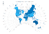
AnyMap JS Maps is an advanced JavaScript/HTML5 mapping library which makes you able to easily create interactive maps that look great on any device including PCs, Macs, iPhones, iPads, Android devices and others - on any platform and in any browser. AnyMap JS is perfect for interactive dashboards and side-by-side reporting. You can use it to display sales by region, election results, weather...
Category: Web Authoring / JavaScript
Publisher: AnyChart JavaScript Charts, License: Shareware, Price: USD $49.00, File Size: 23.3 MB
Platform: Windows, Mac, Linux,
Area Selector is the interactive flash Map, designed to facilitate the conduction of most difficult and strenuous tasks. It saves not only your, but also your customers?, time and energy. Thus you gain more that you could even expect. Our Area Selector is the extremely useful flash Map tool that can help users make a complex Geo spatial selection using intuitive graphical...
Category: Web Authoring / Flash Utilities
Publisher: USFlashMap.com, License: Shareware, Price: USD $399.00, File Size: 48.5 MB
Platform: Windows, Mac, Linux, Unix, MS-DOS, AS, 400
Immageo is all about making your photos as memorable as when you took them, by geotagging each photo. Immageo is a truly exciting example of what you can and should do with your photo collections. Its more than an album organiser, it embeds Map locations and notes into your photos. And when you come to review them Immageo displays them all in context of when and where in the Immageo...
Category: Multimedia & Design / Media Catalogers
Publisher: Immageo, License: Freeware, Price: USD $0.00, File Size: 11.0 MB
Platform: Windows
Allows to display and register rasters of ERDAS Imagine (*.
Allows to display and register rasters of ERDAS Imagine (*.IMG files) in MapInfo. Georeferenced *.IMG images will be displayed directly in MapInfo Professional, MapX, and MapXtreme environments. Additional utilities for free: img2tab utility - creates *.TAB file for each *.IMG file in batch mode. MapInfo Table is created automatically and then can be used to open the...
Category: Utilities / System Utilities
Publisher: MicroOLAP Technologies LTD, License: Shareware, Price: USD $99.95, File Size: 1.1 MB
Platform: Windows
Freeware
Convert ESRI ShapeFiles (.SHP) geolocation data into AnyMap format to be used with AnyChart. AnyChart Flash Map Converter allows making use of a wide choice of maps with AnyChart Flash Component, a GIS visualization system that recognizes Map data in AnyMap format only. AnyChart Flash Map Converter makes it easy to visualize any geolocation data without hefty expenses...
Category: Web Authoring / Image Mapping Tools
Publisher: AnyChart.Com, License: Freeware, Price: USD $0.00, File Size: 1.6 MB
Platform: Windows
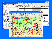
GIS ObjectLand is a universal Geographic Information System for Windows. Key features: - creation of vector-raster maps with arbitrary structure of layers and feature types; - creation of themes. Theme is a user presentation of a Map; - control of displaying features depending on the chosen scale; - spatial data input and editing by assigning feature coordinates and also by...
Category: Business & Finance
Publisher: Radom-T, License: Shareware, Price: USD $99.00, File Size: 24.0 MB
Platform: Windows
This is a simple and yet reliable protection from accidentally accessing Internet websites located in at-risk geographical countries. Save your preferences into a file and load when you need it. 200+ countries and territories. It blocks all TCP/IP and UDP/IP traffic coming out/in from/to computer. Up until recently, the geographical blocking was only available to large companies with...
Category: Internet / Proxy Servers
Publisher: Verigio Communications, License: Shareware, Price: USD $24.95, File Size: 6.8 MB
Platform: Windows

CompeGPS Pocket Air is a new software specially designed for Pocket PC mobile devices, with wich you can obtain a new and revolutionary free flight instrument. You will enjoy most of the CompeGPS PC version functions, like the waypoint and routes creation and edition, full GPS and Pocket PC communication, use of digital maps and Moving Map (real time navigation), to obtain...
Category: Home & Education
Publisher: CompeGPS TEAM S.L., License: Shareware, Price: USD $105.00, File Size: 5.2 MB
Platform:
HydroSHEDS is a mapping product that provides hydrographic information for regional and global-scale applications in a consistent format. It offers a suite of Geo-Referenced data sets (vector and raster) at various scales, including river networks, watershed boundaries, drainage directions, and flow accumulations. HydroSHEDS is based on high-resolution elevation data obtained...
Category: Home & Education / Miscellaneous
Publisher: WWF-CSP, License: Freeware, Price: USD $0.00, File Size: 1.7 MB
Platform: Windows
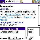
Learn more about countries in the World. Keep this atlas as the reference when you need geographical information such as country location, neighbours, capital, population, economy, military and more including country Map and flag pictures. Whenever you solve a crossword puzzle, perform study research, watch TV news or just get interested in geography - this atlas helps you with detailed,...
Category: Home & Education
Publisher: AbsoluteWord, License: Shareware, Price: USD $19.95, File Size: 4.4 MB
Platform: Palm
Shareware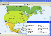
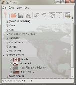
Lookup USA and Canada towns by ZIP, postal code or name and show them on a North American Map. This helps you to check customer information, verify postal addresses, and reduce credit card fraud. Using the program is simple. Just enter a ZIP Code, and the program gives you the matching city, state, latitude, and longitude.
Category: Security & Privacy / Access Control
Publisher: ArmCode, License: Shareware, Price: USD $29.95, EUR24.95, File Size: 5.5 MB
Platform: Windows
Moving Jellyfish Wallpaper shows many very realistic jellyfish Moving from one side to another of your your PC desktop. If you try to catch them using your mouse, they will try to escape. This Moving wallpaper has a SysTray which lets you to close software and get help online. If you like jellyfish, you should give Moving Jellyfish Wallpaper a try. Compatible with...
Category: Desktop Enhancements / Misc. Themes
Publisher: digiaquascr, License: Freeware, Price: USD $0.00, File Size: 589.8 KB
Platform: Windows
Freeware
Bandwidth Vista 2, The Next Generation bandwidth monitor with Geo-IP Connection Mapper. Displays Real-Time TCP and UDP Connections including Country and City. Holds a full log of bandwidth usage. New to Bandwidth Vista 2 is Voice Alerts and a Whois Lookup Tool and two kinds of graph. Bandwidth Vista 2 runs quietly from the system tray displaying network activity while you work or you can...
Category: Utilities / Network
Publisher: Bandwidth Vista, License: Freeware, Price: USD $0.00, File Size: 16.2 MB
Platform: Windows
Metal Slug is a series of run and gun video games first released on Neo-Geo arcade machines and game consoles created by SNK. It was also ported to other consoles, such as the Sega Saturn, the PlayStation, the Neo-Geo Pocket Color and more.
Now You can play on your PC for free on Softendo Mario Games. Collect many interesting weapons and bonuses, fight againts many...
Category: Games / Action
Publisher: Softendo, License: Freeware, Price: USD $0.00, File Size: 7.2 MB
Platform: Windows
OziExplorer is a flamboyant GPS Mapping Software that runs on the PC and works with varieties of GPS receivers such as Garmin, Lowrance, Magellan, Eagle, Brunton, Silva and MLR for the uploading or downloading the waypoints, routes and tracks and most brands of GPS receivers for real time tracking of GPS position.
Using this software, the user can use maps and charts that can be...
Category: Internet / Communications
Publisher: Des Newman, License: Shareware, Price: USD $95.00, File Size: 6.8 MB
Platform: Windows
Freeware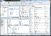
Modern ribbon-based data manipulation tool for Microsoft SQL Server Main features: Quick database browser. Database oriented perspective, database projects. Table designer, edit columns, keys, uniques, checks. Database editor, view and and views, stored procedures, functions, triggers. Export, import - CSV, HTML, SQL, MS Excel, dBase DBF files. Data analysis without importing...
Category: Business & Finance / Database Management
Publisher: JenaSoft, License: Freeware, Price: USD $0.00, File Size: 6.2 MB
Platform: Windows
Remere's Map Editor is a map editor for the OpenTibia Project which was created by Remere.
Remere's Map Editor is a Map editor for the OpenTibia Project which was created by Remere.
Remere's Map Editor is a Map editor coded in C to be used with OpenTibia. It supports many advanced features such as autobordering and placing of composite objects. Runs under both Linux and Windows using wxWidgets and OpenGL.
Category: Games / Tools & Editors
Publisher: Remere, License: Shareware, Price: USD $0.00, File Size: 4.2 MB
Platform: Windows
Geo.De.Sy is a complete drawing environment with survey utilities free for the customers of IQSoft and CivilShop. You can create drawing , open and save DWG and DXF untill Autocad version 2011, insert point to drawing , create grid, dtm beta , image correlation.
It is the first release of the program. It is under hard development. The features that are in active development...
Category: Multimedia & Design / Image Editing
Publisher: IQSoft, License: Freeware, Price: USD $0.00, File Size: 14.3 MB
Platform: Windows
LimitState:Geo is the revolutionary geotechnical stability analysis software that can be used to rapidly determine the critical failure mechanism and margin of safety for any type of problem, including those involving:
Category: Multimedia & Design / Multimedia App's
* slope stability
* retaining walls
* deep excavations
* reinforced earth
* gabion walls
* foundations
* rock slopes
Publisher: LimitState Ltd, License: Shareware, Price: USD $3600.00, File Size: 40.4 MB
Platform: Windows

Moving Koifish Wallpaper shows many very realistic koifish Moving from one side to another of your your PC desktop. If you try to catch them using your mouse, they will try to escape. This Moving wallpaper has a SysTray which lets you to close software and get help online. Compatible with Windows Vista Windows 7 and Windows 8. When trying to run Moving koifish...
Category: Desktop Enhancements / Misc. Themes
Publisher: digiaquascr, License: Freeware, Price: USD $0.00, File Size: 2.8 MB
Platform: Windows
Freeware
An interactive Flash USA Map with all the features you need for your web site or project. This is the ideal solution for dealer maps, real-estate listings, or visualizing state statistics. Nearly every aspect of the Map is customizable. However, unlike competing products, our Map is very simple to install and edit. Just upload XML and SWF files and embed.
Category: Internet / Flash Tools
Publisher: http://www.flashusamap.com/trial/flashus, License: Freeware, Price: USD $0.00, File Size: 93.8 KB
Platform: Unknown