Free Downloads: Land Surveying File Formats
A state-of-the art CAD software for land surveying and civil engineering.
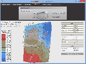
A state-of-the art CAD software for Land Surveying and civil engineering. It is one of the most powerful and intuitive applications ever designed. Specialized drawing tools, cogo functions and design tools are all tightly integrated in a complete standalone package that runs on PC. It's easy to use, so you'll be up and running in no time.
Category: Multimedia & Design / Image Editing
Publisher: Pythagoras BVBA, License: Demo, Price: USD $0.00, File Size: 14.8 MB
Platform: Windows
PC Survey is the best bang for the buck in the surveying software industry.
PC Survey is the best bang for the buck in the Surveying software industry. It has been in development since 1988 and selling since 1994. It is being used by DOT's, universities and private surveyors. It is cheap enough for the small Surveying company, yet powerful enough for governments. PC Survey was the first Surveying package to be developed in Microsoft Windows...
Category: Audio / Utilities & Plug-Ins
Publisher: Soft-Art, License: Shareware, Price: USD $249.00, File Size: 16.1 MB
Platform: Windows
Magellan Real Time Data Server ( RTDS ) is a new software offering Land Surveying companies the possibility of using GNSS equipment to build their own direct IP RTK corrections server.
The RTDS software will collect corrections sent by a GNSS base station and act as a gateway to make them available to any rover that connects to the software. Magellan RTDS is a PC...
Category: Internet / Misc. Servers
Publisher: Plaska GPS Service, Inc., License: Demo, Price: USD $0.00, File Size: 24.6 MB
Platform: Windows
Land the lander as soon as you can.
Land the lander as soon as you can. You must use the parachute at the right time and thrusters to Land it! After you Land it on the all three landing pods, you need to get the satellite signal by going 100 meters away from the ground.
Category: Games / Simulations
Publisher: generationstars.biz, License: Freeware, Price: USD $0.00, File Size: 2.9 MB
Platform: Windows, 2K3
Terra Excess is Land Surveying and civil engineering CAD software developed to be extremely intuitive. Even by those without previous experience, Terra Excess will allow you to handle the following tasks in just a few minutes - GENERATING AND LABELING CONTOUR LINES IN ORDER TO PRODUCE TOPOGRAPHIC PLANS AND MAPS: Terra Excess can generate contour lines from topographic...
Category: Multimedia & Design / Graphics Viewers
Publisher: Terra Excess Software, License: Shareware, Price: USD $298.00, File Size: 46.0 MB
Platform: Windows
Land-PIE is designed specifically for land developments.
Land-PIE is designed specifically for Land developments. The software allows you to handle the critical “what-if” analysis needed for master-planned communities with residential and commercial parcels, or smaller villages and golf course projects. Use it for an initial feasibility study, detailed budget development and on-going tracking and variance reporting.
Category: Software Development / Misc. Programming
Publisher: Real Pro-Jections, Inc., License: Shareware, Price: USD $2700.00, File Size: 1.6 MB
Platform: Windows
Copan Pro -- for Windows 98, NT, 2000, ME, XP, Vista, or 7 -- is a very functional and easy-to-use desktop/netbook geomatics engineering tool for computing and managing plane Land Surveying and mapping coordinates, and drafting survey maps and plans.
It does numerous coordinate geometry (COGO) calculations, processes and adjusts raw field survey data, computes and adjusts...
Category: Multimedia & Design / Multimedia App's
Publisher: Underhill Geomatics Ltd, License: Demo, Price: USD $650.00, File Size: 9.0 MB
Platform: Windows
In this game there are 8 pieces of land, each land has 3 houses.
In this game there are 8 pieces of Land, each Land has 3 houses. You and the computer will take turns to buy houses from those lands, the one who have bought all the houses on a piece of Land is the winner.
You can also download this game and install it in your computer so that you can play it simply by clicking an icon on your desktop.
You can register an...
Category: Games / Misc. Games
Publisher: Novel Games Limited, License: Freeware, Price: USD $0.00, File Size: 255.2 KB
Platform: Windows
Buying land tips and advice, free e-book for Windows.
Buying Land tips and advice, free e-book for Windows. If you are looking to purchase a piece of Land for your own residential use, you need to read this report. Experienced developers understand that there is more involved with a Land purchase than the simple financing of that Land. Exactly how much Land do you want to purchase? One half acre to one and one...
Category: Business & Finance / Personal Finance
Publisher: Buying Land Tips, License: Freeware, Price: USD $0.00, File Size: 428.0 KB
Platform: Windows
If you were looking for a calm, peaceful and relaxing wallpaper, then the right one for you is Immortal-Land. Great graphics and a fantasy scenario will sure make your computer navigation more delightful. Immortal Land can be downloaded as an application, that is very easy to install. After the install finishes, you are free to set Immortal Land as your new wallpaper.
Category: Desktop Enhancements / Screensavers
Publisher: WallpaperPimper, License: Freeware, Price: USD $0.00, File Size: 128.0 KB
Platform: Windows
RelMo is a combination of a surveying program, a CAD program and a 3D rendering program.
RelMo is a combination of a Surveying program, a CAD program and a 3D rendering program. The name is derived from the words Relative Motion which describes what the program can achieve since it has the capability to move objects around a scene using user defined rules.
Category: Multimedia & Design / Image Editing
Publisher: AiTS Software, License: Demo, Price: USD $0.00, File Size: 11.9 MB
Platform: Windows
Topocad is a CAD system made for surveying, mapping, design and GIS.
Topocad is a CAD system made for Surveying, mapping, design and GIS.Topocad is built up by different modules. Start with Topocad Reader, a freeware application that you can use for communication with your instruments, calculation and the result is a map or drawing.
Category: Multimedia & Design / Image Editing
Publisher: Chaos systems AB, License: Shareware, Price: USD $39.00, File Size: 84.2 MB
Platform: Windows
Elisan, his wife Nix, their little daughter and many other good people are living in a Land of dream, but someday the great Jarjar, the Lord of the Dark Land invaded Dream Land with the aid of his evil forces, then took away Elisan's wife, his daughter and the Star of Dream Land, Destroyed the whole Land and made Dream Land drawn in darkness... Now...
Category: Games / Adventure & RPG
Publisher: mahdifanaei, License: Shareware, Price: USD $0.00, File Size: 33.8 KB
Platform: Windows

iPJC is an easy-to-use record keeping system for the land surveying industry.
iPJC is an easy-to-use record keeping system for the Land Surveying industry. It allows your staff to securely store, retrieve and cross-reference all of your company's survey database records -- of estimates, plans, jobs and contacts -- using your web browsers.
It is an open-source system, based on industry-standard web and database server technology. Different levels of...
Category: Business & Finance / Database Management
Publisher: Underhill Geomatics Ltd, License: Freeware, Price: USD $0.00, File Size: 6.5 MB
Platform: Windows, Linux, Mac
Roads of Fantasy is a funny rolling racing arcade game.
Roads of Fantasy is a funny rolling racing arcade game.
Take control of a ball and go a rolling through the obstacle course you’ve ever seen! You can control the ball using the keyboard, the mouse or the joystick. Be careful, the obstacles are popping up around every turn. It’s going to be a crazy race. Beware of spinning prickles and try not to fall down from the...
Category: Games / Arcade
Publisher: Alawar Entertainment, License: Shareware, Price: USD $6.99, File Size: 16.8 MB
Platform: Windows
You will be able to enjoy many of CompeGPS Lands features such as waypoint and route creation and edition, full communication between PDA and GPS, use of maps and the moving map (real-time navigation). CompeGPS Pocket Land allows full communication between GPS and PDA (tracks, waypoints and routes). You will be able to create waypoints and routes, use maps and real-time...
Category: Home & Education
Publisher: CompeGPS TEAM S.L., License: Shareware, Price: USD $76.00, File Size: 3.9 MB
Platform:
Mc Donalds Treasure Land Adventure is a completely free game.
Mc Donalds Treasure Land Adventure is a completely free game. Kids will enjoy to play this game. The main hero of the game is Ronald the clown. The story takes place in a very far away Land. The game uses stunning 2D Graphics to make the player feel that everything is real.
Category: Games / Kids
Publisher: Sega, License: Freeware, Price: USD $0.00, File Size: 1.2 MB
Platform: Windows
CopanMobile for Palm OS is a very functional and easy-to-use geomatics engineering tool for computing and managing plane Surveying and mapping coordinates. It does numerous coordinate geometry (COGO) calculations, processes and adjusts raw field survey data, computes and adjusts map traverse data, performs map or deed checks, calculates curves, areas and perimeters, performs coordinate...
Category: Multimedia & Design / Multimedia App's
Publisher: Underhill Geomatics Ltd., License: Freeware, Price: USD $0.00, File Size: 341.0 KB
Platform: Palm
Evidyon - No Man's Land is a free and opensource 3D MMORPG.
Evidyon - No Man's Land is a free and opensource 3D MMORPG.
This higly addictive Mmorpg has all you want from a commercial game : fast-paced PVP; lot of contents, Guilds, geosids, partys, and more than 60 levels to explore.
Evidyon - No Man's Land is a freeware.
Category: Games / Adventure & RPG
Publisher: archknup, License: Freeware, Price: USD $0.00, File Size: 4.1 MB
Platform: Windows
CopanMobile for Pocket PC is a very functional and easy-to-use geomatics engineering tool for computing and managing plane Surveying and mapping coordinates. It does numerous coordinate geometry (COGO) calculations, processes and adjusts raw field survey data, computes and adjusts map traverse data, performs map or deed checks, calculates curves, areas and perimeters, performs coordinate...
Category: Business & Finance / Applications
Publisher: Underhill Geomatics Ltd., License: Freeware, Price: USD $0.00, File Size: 341.0 KB
Platform: Windows
Inmarsat LaunchPad is a standard user interface that can be used across all Land Portable, Land Mobile and FleetBroadBand terminals.
Support for both BGAN Land Portable, Land Mobile and FleetBroadband terminals in a combined application
- English, Spanish, Chinese, Japanese, French and Russian languages are now supported with all terminals
- User...
Category: Business & Finance / Business Finance
Publisher: Inmarsat, License: Freeware, Price: USD $0.00, File Size: 6.1 MB
Platform: Windows
Survex is an open source cave-surveying software package, licensed under the GPL.
Survex is an open source cave-Surveying software package, licensed under the GPL. It is designed to be portable and can be run on a variety of platforms, including Linux/Unix, Mac OS X, and Microsoft Windows.
Survex is very powerful cave survey software, and is actively developing into a complete cave visualisation package. It has a sophisticated GUI frontend.
Survex has no...
Category: Multimedia & Design / Image Editing
Publisher: The Survex Project, License: Freeware, Price: USD $0.00, File Size: 2.0 MB
Platform: Windows
JointMetriX3D is an innovative system for measuring and assessing rock and terrain surfaces used in geotechnics, engineering geology, and Surveying. It delivers outstanding detailed 3D images and provides 3D software for getting measurements.
The system has significant influence on safety when applied in tunnelling, mining, terrain assessments, or various documentation purposes as...
Category: Software Development / Help File Utilities
Publisher: 3GSM, License: Demo, Price: USD $0.00, File Size: 2.3 KB
Platform: Windows
Copan for Pocket PC is a very functional and easy-to-use geomatics engineering tool for computing and managing plane Surveying and mapping coordinates.
It does numerous coordinate geometry (COGO) calculations, processes and adjusts raw field survey data, computes and adjusts map traverse data, performs map or deed checks, calculates curves, areas and perimeters, performs...
Category: Multimedia & Design / Multimedia App's
Publisher: Underhill Geomatics Ltd, License: Freeware, Price: USD $0.00, File Size: 662.0 KB
Platform: Windows
Copan for Mobile 6 is a very functional and easy-to-use geomatics engineering tool for computing and managing plane Surveying and mapping coordinates.
It does numerous coordinate geometry (COGO) calculations, processes and adjusts raw field survey data, computes and adjusts map traverse data, performs map or deed checks, calculates curves, areas and perimeters, performs...
Category: Multimedia & Design / Multimedia App's
Publisher: Underhill Geomatics Ltd, License: Freeware, Price: USD $0.00, File Size: 662.0 KB
Platform: Windows