Free Downloads: Map Shp Free
 Freeware
Convert ESRI ShapeFiles (.Shp) geolocation data into AnyMap format to be used with AnyChart. AnyChart Flash Map Converter allows making use of a wide choice of maps with AnyChart Flash Component, a GIS visualization system that recognizes Map data in AnyMap format only. AnyChart Flash Map Converter makes it easy to visualize any geolocation data without hefty...
Category: Web Authoring / Image Mapping Tools
Publisher: AnyChart.Com, License: Freeware, Price: USD $0.00, File Size: 1.6 MB
Platform: Windows
Shape Viewer is a free tool, which you can use to view ESRI Shape files.
Shape Viewer is a Free tool, which you can use to view ESRI Shape files.
Shape Viewer can open (.Shp) files that contain the geometry information of the shape file.With Shape Viewer you can also create new (.shx) file, and new empty (.dbf) file for your shape file.
If you have hundreds of shape files, and you want to view their contents rapidly, and you don't...
Category: Multimedia & Design / Graphics Viewers
Publisher: Mohammed Hammoud, License: Freeware, Price: USD $0.00, File Size: 35.0 KB
Platform: Windows
Shareware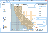
Manco Shapefile Editor is a powerful tool for creating and editing shapefiles, with easy, almost “on the flyâ€, geometry and data editing and possibility of direct creation of the shapefiles from the image files by image processing algorithms. This product is constantly developing and you will receive Free updates just when they come. Since it’s only a start of the...
Category: Multimedia & Design / Image Editing
Publisher: Manco Software, License: Shareware, Price: USD $100.00, File Size: 6.1 MB
Platform: Windows
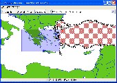
It`s a Free ESRI shape files (*.Shp), MapInfo interchange (*.mif) and AutoCAD *.dxf viewer. Using this utility you can view *.Shp files (ESRI shape files), *.mif files (MapInfo interchange) and AutoDesk AutoCAD *.dxf. No other files are needed.
Category: Multimedia & Design
Publisher: Avangardo, License: Freeware, Price: USD $0.00, File Size: 420.9 KB
Platform: Windows
Cool Flash Map Maker is a powerful Flash Map software for developing interactive flash mapping solutions and products for Real Estate, Spacial Statistics, Business Locator Applications, Vector USA Map,World Map, Germany Map,ASIA Map, Canada Map, Europe Map, Australia Map, Austria Map, Africa Map, UK Map, South...
Category: Multimedia & Design / Multimedia App's
Publisher: Go2Share, License: Shareware, Price: USD $29.95, File Size: 17.9 MB
Platform: Windows
Map Suite Desktop Edition is a powerful and feature-rich .NET mapping control that enables C# and VB.NET software developers to build detailed desktop mapping applications. Utilizing Microsoft's .NET Framework, the APIs for Map Suite Desktop Edition incorporate the very latest technology to deliver a powerful, user-friendly mapping control. In addition, ease of coding and...
Category: Software Development
Publisher: ThinkGeo LLC, License: Commercial, Price: USD $4794.00, File Size: 28.4 MB
Platform: Windows
A powerful OCX that allows the user to load and manage TXF/TDB, MID/MI, Shp/DBF, and raster data files as distinct layers. It permits the user to set visibility thresholds, colors, line attributes, label roads, landmarks, etc. A lot of its power lies in its simplicity. Register the control, open your IDE, drop the component on a blank form and you have a simple, fully functional mapping...
Category: Software Development / Tools & Editors
Publisher: TRIUS, Inc., License: Shareware, Price: USD $189.00, File Size: 2.0 MB
Platform: Windows
Map Suite Engine is a powerful and feature-rich low level component that enables C# and VB.NET software developers to generate great-looking Map images for presentations. At the heart of the Map Suite product line is a non-visual component library designed to generate maps. With this tool in your hands, you will be able to “roll your own” mapping control in Winforms or...
Category: Software Development
Publisher: ThinkGeo LLC, License: Commercial, Price: USD $4794.00, File Size: 15.1 MB
Platform: Windows
With this program you can read and then view geographical data contained in SHP files.
With this program you can read and then view geographical data contained in Shp files. With this program you can also view the data in the accompanying DBF database file and can save this information to SVG files. It works on Microsoft Windows 2000/XP/Vista. The program does not run on Windows 98.
Category: Business & Finance / Database Management
Publisher: Pinecoast Software, Inc., License: Freeware, Price: USD $0.00, File Size: 1.4 MB
Platform: Windows
Map Suite Web Edition is a powerful and feature-rich ASP.Net server control that enables C# and VB.NET software developers to build detailed internet mapping applications. Utilizing Microsoft's .NET Framework, the APIs for Map Suite Web Edition incorporate the very latest technology to deliver a powerful, user-friendly .NET component that makes it easy to develop mapping...
Category: Software Development
Publisher: ThinkGeo LLC, License: Commercial, Price: USD $4794.00, File Size: 28.8 MB
Platform: Windows
Sig Panama Has :
Digital maps of Panama, Digital Map of Panama-City, digital Map of Taboga, digital Map of Bocas del Toro, digital Map of Colon and Free Zone, digital Map of Contadora Island, digital Map of Coronado, Panama, Zona Libre, Map of Panama, Map of Panama City, Map of Colon, Map of Zona Libre,...
Category: Internet / Misc. Plugins
Publisher: DP Imperial, LLC., License: Freeware, Price: USD $0.00, File Size: 44.9 MB
Platform: Windows
GIS ObjectLand is a universal Geographic Information System for Windows. Key features: - creation of vector-raster maps with arbitrary structure of layers and feature types; - creation of themes. Theme is a user presentation of a Map; - control of displaying features depending on the chosen scale; - spatial data input and editing by assigning feature coordinates and also by...
Category: Business & Finance
Publisher: Radom-T, License: Shareware, Price: USD $99.00, File Size: 24.0 MB
Platform: Windows
Shareware
AnyMap JS Maps is an advanced JavaScript/HTML5 mapping library which makes you able to easily create interactive maps that look great on any device including PCs, Macs, iPhones, iPads, Android devices and others - on any platform and in any browser. AnyMap JS is perfect for interactive dashboards and side-by-side reporting. You can use it to display sales by region, election results, weather...
Category: Web Authoring / JavaScript
Publisher: AnyChart JavaScript Charts, License: Shareware, Price: USD $49.00, File Size: 23.3 MB
Platform: Windows, Mac, Linux,
Remere's Map Editor is a map editor for the OpenTibia Project which was created by Remere.
Remere's Map Editor is a Map editor for the OpenTibia Project which was created by Remere.
Remere's Map Editor is a Map editor coded in C to be used with OpenTibia. It supports many advanced features such as autobordering and placing of composite objects. Runs under both Linux and Windows using wxWidgets and OpenGL.
Category: Games / Tools & Editors
Publisher: Remere, License: Shareware, Price: USD $0.00, File Size: 4.2 MB
Platform: Windows
GeoVisu is a program that displays georeferenced data (images, graphics) and downloads data recorded by some GPS devices.
GeoVisu has a "Moving Map" navigation function, which can be used with any NMEA 0183 compatible or Garmin USB GPS device.
Main features:
- Displays georeferenced image formats : GeoTiff, ECW and ECWP, MrSID, OziExplorer...
Category: Multimedia & Design / Graphics Viewers
Publisher: GeoVisu, License: Freeware, Price: USD $0.00, File Size: 1.7 MB
Platform: Windows
Freeware
An interactive Flash USA Map with all the features you need for your web site or project. This is the ideal solution for dealer maps, real-estate listings, or visualizing state statistics. Nearly every aspect of the Map is customizable. However, unlike competing products, our Map is very simple to install and edit. Just upload XML and SWF files and embed.
Category: Internet / Flash Tools
Publisher: http://www.flashusamap.com/trial/flashus, License: Freeware, Price: USD $0.00, File Size: 93.8 KB
Platform: Unknown

Site Map for osCMax - osCMax Module - is very powerful and flexible module for dynamic site Map generation. With help of this module you will achieve two important goals: 1.your customers always will be able to find correct page on your site without any problem. Your visitors will like your site! 2.Search Engine Optimization. If you will use this module in conjunction with SEO...
Category: Software Development
Publisher: MagneticOne, License: Commercial, Price: USD $39.00, File Size: 70.3 KB
Platform: Windows, Linux, Unix, BEOS
Map of Africa is one of the many maps created for GPS TrackMaker.
Map of Africa is one of the many maps created for GPS TrackMaker. You are able to download the installation package from the TrackMaker website. In order to preview the contents of this package, you need to install GPS TrackMaker.
Using the above mentioned application, you will be able to see the Map of Africa. Just click on the "Open Temporary...
Category: Home & Education / Miscellaneous
Publisher: Geo Studio Technology, License: Freeware, Price: USD $0.00, File Size: 18.3 MB
Platform: Windows
Demo
Visualize your data in 3D! Quick, easy and inexpensive. Graph Earth enables management, marketing and other business professionals to create stunning visual representations of their data, all without the time and costs associated with a full-featured GIS. Viewable by Everyone! Create one of a kind deliverables and distribute them to the world, recipients need only install Google Earth to view...
Category: Business & Finance / MS Office Addons
Publisher: Deer Creek Marketing LLC, License: Demo, Price: USD $24.95, File Size: 469.0 KB
Platform: Windows
Site Map for Zen Cart - Zen Cart Module - is very powerful and flexible module for dynamic site Map generation. With help of this module you will achieve two important goals: 1.your customers always will be able to find correct page on your site without any problem. Your visitors will like your site! 2.Search Engine Optimization. If you will use this module in conjunction with SEO...
Category: Internet
Publisher: MagneticOne, License: Commercial, Price: USD $39.00, File Size: 61.5 KB
Platform: Windows, Linux, Unix, BEOS
Shareware
The Advanced points manager imports points to AutoCAD drawing from different data sources. OLE-DB database, Shp (ESRI shape file), GPX (GPS eXchange format), KML (Keyhole Markup Language), GML (Geography Markup Language), TXT, CSV. Additional options: savable configurations, point coordinate transformation from/to any world coordinate system, point can be ACAD point or ACAD block with...
Category: Business & Finance / Vertical Markets
Publisher: CADdicted inc., License: Shareware, Price: USD $119.00, File Size: 609.8 KB
Platform: Windows
Shareware
Total GIS Converter is an affordable converter of GIS files. It converts AEP, GRD, ADF, E00, FLT, APR, Shp, DXF, BT, TOC, RT1, DEM, DLG, ECW, IMG, DGF, GML, SID, MIF, TAB, WOR, DNG, DDF, BIL, TIF, JPEG, TTKPS, TTKGP, TTKLS, LFT, PFT, and TFT files. The target formats are TIFF, PNG, JPEG, BMP. The program can scale your GIS files to optimize their size. Besides, it can slice the output...
Category: Multimedia & Design / Graphics Viewers
Publisher: Softplicity, License: Shareware, Price: USD $99.90, File Size: 7.6 MB
Platform: Windows
Program shows you an actual X3 sector-map, with detailed information about most in-game objects.
Program shows you an actual X3 sector-Map, with detailed information about most in-game objects. The Map is based on a log-file that is created with an in-game script (by Andrei[<>Ace]). If you just want to view the standard Map (or if you don’t have the game) the program will work with the included default Map, which was created with an English X3 game...
Category: Games / Misc. Games
Publisher: SUU Design, License: Freeware, Price: USD $0.00, File Size: 1.4 MB
Platform: Windows
New Zealand Map Reference Converter (NZMapConv) is software that LINZ provides to convert Map references between the old NZMS260 Map series and the new NZTopo50 Map series.NZMapConv is a Windows programme designed to convert individual coordinates entered manually.
Category: Multimedia & Design / Media Management
Publisher: Land Information New Zealand, License: Freeware, Price: USD $0.00, File Size: 2.4 MB
Platform: Windows
When the XMAP software is communicating with an XEDE via the comms cable each Map will show, at the top of the Map display, an RPM and load value (x and y axis for the Map) in real time. Also in each Map a yellow highlighted block will show the current position within the Map. Beside the real-time display on each Map are the undo and redo buttons which...
Category: Home & Education / Miscellaneous
Publisher: ChipTorque, License: Freeware, Price: USD $0.00, File Size: 1.7 MB
Platform: Windows