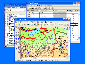
PCWin Software Download Center
 
Product Home
Download Trial
Purchase
Author Site

Category

 
Audio
Business & Finance
Applications
Auction Tools
Business Finance
CRM
Calculators
Conversion Applications
Database Management
Document Management
Document Plugins
E-commerce
Fax Software
Inventory Systems
Legal
MS Office Addons
Personal Finance
Personal Info Managers
Presentation Tools
Project Management
Sales & Marketing Tools
Small Business Tools
Spreadsheets
Taxes
Vertical Markets
Voice Recognition
Word Processing
Desktop Enhancements
DVD & Video
Games
Home & Education
Internet
Multimedia & Design
Security & Privacy
Software Development
Utilities
Web Authoring


Popular Downloads

 
Internet Download Manager
TubeHunter Ultra
EasySystemCleaner
Majestic Waterfalls Screensaver
More than 30.000 vista icons
Visual Renamer
Aurora Web Editor 2007 Professional
MySpeed PC Lite
eScan Pro Edition
HelpVistaXPDiamond
 

New Downloads

 
SharePoint Lookup Boost
Total Doc Organizer
TweakRAM
JustNN
ImTOO Zune Converter Suite
Audio Record Wizard
Rapid PHP Editor 2008
Space Icons
College Scientific Calculator 45
PC Network Clone Free
 

Related Downloads

 
Geoinformation Data Base
Geoinformation System
System Information
Information System
Geographic Information S
Data Services Layer
Data Access Layer
Data Base Vb
Cdb Data Base
Firm Data Base
 

GIS ObjectLand

GIS ObjectLand 2.6.7

GIS ObjectLand is a universal Geographic Information System for Windows. Key features: vector-raster maps; multiuser data editing; import/export for MIF/MID, SHP, DXF, DBF, CSV; access permissions for users; using other DBMS (ODBC); COM interfaces. Download GIS ObjectLand by Radom-T

Screenshot of GIS ObjectLand
Publisher: Radom-T
License: Shareware
Price: USD $99.00
Filesize: 24.0 MB
Date Added: 07/05/2007

GIS ObjectLand is a universal Geographic Information System for Windows.

Key features:
- creation of vector-raster maps with arbitrary structure of layers and feature types;
- creation of themes. Theme is a user presentation of a map;
- control of displaying features depending on the chosen scale;
- spatial data input and editing by assigning feature coordinates and also by interactive drawing with mouse or digitizer;
- sewing of separate pages of an imported map into one unified continuous map;
- copying, merging, and moving maps, layers, and feature types between different geoinformation databases;
- creation of tables of arbitrary structure;
- creation of queries. Query is a user presentation of table built by setting search and sorting conditions, joining tables, calculations and using reference tables;
- copying, merging, and moving tables and queries between different geoinformation databases;
- setting arbitrary links between spatial and table information;
- getting information about the feature selected on the map;
- searching for features on the map by linked records;
- creation of filters. Filter is conditions of feature visualization depending on spatial properties of features and linked table data;
- creation of layouts. Layout is an output form combining spatial, table information and presentation elements;
- import and export of table and spatial information for widespread data formats;
- support of style libraries containing fonts, map symbols, line styles, hatches and fill styles;
- style editors for displaying styles;
- setting for users the access permissions to components;
- multiuser data editing;
- using and editing tables of external database (via ODBC) as linked tables;
- providing automation COM interfaces for user applications.

Platform: Windows 95, Windows 98, Windows Me, Windows NT, Windows 2000, Windows XP, Windows 2003

Category: Business & Finance


Download | Homepage | Buy Now | Screenshot | Report Error

Related Software

Cadaster Cadastre Cartography Csv
Dbf Dxf Features Gdb
Geo Geodesy Geographic Information System Geoinformation Data Base
Geoinformation System Geomatics Gis Gis Technology
Layer Layout Map Mid
Geodesy.NET - With Geodesy.
Geodaten German Topo - A volume of data with map names, map numbers, corner coordinates and completing data of all official topographic maps of the Federal Republic of Germany. TK25, TK50, TK100 and TK200.
TOPOWIN - TOPOWIN is a state-wide register of the German Topographic Cartographies, the German Basic Cartography and of localities with geo references in different coordinate systems.
SQL Edge - SQL Edge not only allows users to execute SQL scripts, but also provides a powerful way to visualize data relationships. With SQL Edge, users can use only one query to retrieve data in a master table, and then browse data in all related detail tables
ORCGeNext - This tool can be used for generating base code (data access layer, business logic layer, presentation layer, startup project, application server, think client) for multi-tier applications which work with databases.
Aglowsoft SQL Query Tools - Build SQL queries,run SQL queries,draw ER diagrams, and visualize data relationships.
Canvas GIS Mapping Edition (Mac) - The CANVAS 9 GIS Mapping Edition adds native support for Geographic Information System (GIS) data to Canvas.
MS SQL Field Box - MS SQL Field Box is a small tool which allows you to view MS SQL Server database structure and paste table or field names in your favorite editor using mouse or keyboard hotkeys.
smart report maker (MySQL Report Generator) - A very easy-to-use PHP/MySQL report generator, it allows you to create and manage unlimited number of MySQL Reports based on tabel or query - so many advanced features , export data in many formats, Customizable apperance and layout
smart report maker (mysql reports maker) - Smart Report Maker is a very easy-to-use PHP/MySQL report generator, it allows you to create and manage unlimited number of MySQL Reports based on a table or query
 

Copyright © 1995-2008 PCWin Download Center. Home | | Privacy | Link to Us | Submit / Update Software