Free Downloads: Plot Grid Map Excel
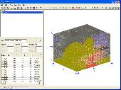
Creating graphs of regular data and irregular data. Creating vertex, Grid and surface model, Delaunay triangles, color Map, contour Plot, vector Plot, 3D contour Plot, 4D scatter, 4D slice and 4D vector.
Category: Home & Education / Science
Publisher: GraphNow, License: Shareware, Price: USD $59.95, File Size: 2.6 MB
Platform: Unknown
OziExplorer3D is an impeccable application for viewing Map images in 3D, along with the options of rotating it in every possible direction, zoom in/out and lots more. The application actually creates Grid of heights using the height data that has been obtained and writes it to a file, along with the other required information, loads the file and the Map image or the image...
Category: Multimedia & Design / Multimedia App's
Publisher: Des Newman, License: Shareware, Price: USD $30.00, File Size: 1.9 MB
Platform: Windows
The easiest way to get a paper map with MapPlot is the Plot Map menu.
The easiest way to get a paper Map with MapPlot is the Plot Map menu.
On the following dialog, simply paper size and scale have to be chosen - the result is ready to be printed directly, edited (e.g. for additional entries) or to be displayed as a preview.
Category: Utilities / Misc. Utilities
Publisher: AGIS GmbH, License: Freeware, Price: USD $0.00, File Size: 5.4 MB
Platform: Windows
Real contour plots are created in Excel.
Real contour plots are created in Excel. You can interact with the contour Plot just like any other Excel Plot.
Contour Plot works with any contour data. It accommodates rectangular data, nearly rectangular data, and irregular data. It includes a data generator for polynomials or any equation.
Category: Business & Finance / MS Office Addons
Publisher: Office Expander, License: Shareware, Price: USD $70.00, File Size: 696.1 KB
Platform: Windows
Excel Graph Multiple Equations Software is an application that allows you to Plot multiple functions in Microsoft Excel. It is able to create multiple charts based on the formulas entered. You can enter an equation manually or load multiple equations from a text file (.txt). The application is able to Plot each equation on an individual graph or all the equations on...
Category: Business & Finance / MS Office Addons
Publisher: Sobolsoft, License: Shareware, Price: USD $19.99, File Size: 2.5 MB
Platform: Windows
In this game there will be a map filled with colored grids.
In this game there will be a Map filled with colored grids. Your colony starts with the home Grid in the center of the Map marked by a flag. The goal of the game is to turn all the grids into the same color. You can change the color of your home Grid and all connected grids by clicking on other colored grids in the Map. Continue the process and you will be...
Category: Games / Misc. Games
Publisher: Novel Games Limited, License: Freeware, Price: USD $0.00, File Size: 264.5 KB
Platform: Windows
 Shareware
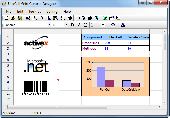
FlexCell is a flexible and easy to use Grid control. Using FlexCell Grid Control, you can create the professional user interfaces and report form in your application. FlexCell Grid Control provides comprehensive functions such as Print, Print Preview, Chart, Merge Cell, Virtual Grid, Sort, Import (from) and Export (to) XML, Export to Excel Workbook (no...
Category: Software Development
Publisher: FlexCell Technologies, License: Shareware, Price: USD $129.00, File Size: 2.4 MB
Platform: Windows
Spitfire is a software tool for the Benefon ESC!
Spitfire is a software tool for the Benefon ESC! GPS/GSM mobile phone which allows users to create and load their own or vendor supplied maps into their handset. Spitfire is low cost and simple to use and can load Map images in a variety of bit Map file formats. It provides tools to geographically calibrate a plain bit Map image and correct distortions introduced by...
Category: Business & Finance / Business Finance
Publisher: Barhop Apps, License: Shareware, Price: USD $39.90, File Size: 2.6 MB
Platform: Windows
If you don't have internet access on your phone, or you want to self-select a larger region of mapping, then the Map Chooser tool can be used to make Map tile selections. Choose your own mapping areas with the flexible select tool that lets you select unlimited areas of mapping. Based on a Grid, you can choose any Grid squares you like - so you can pick an area...
Category: Home & Education / Miscellaneous
Publisher: ViewRanger, License: Freeware, Price: USD $0.00, File Size: 213.2 MB
Platform: Windows
Freeware
Arm Map Explorer recreates all the functionalities of Google Maps on your desktop while expanding them with new extras. Map Explorer lets you locate and view any place on the planet using dynamic interactive maps. These maps are draggable, which means there is no need for you to click and wait for graphics to reload each time you want to view adjacent parts of a Map....
Category: Internet / Flash Tools
Publisher: ArmCode, License: Freeware, Price: USD $0.00, File Size: 5.5 MB
Platform: Windows
Shareware
Toolkit to add GPS functionality to your software and scripts (GPS SDK). All NMEA0183 protocol versions are supported and can be filtered by NMEA sentence type and talker ID. Information on GPS status can also be retrieved: GPS fix quality, satellites used in fix, satellites in view, satellite azimuth, elevation and signal strengths. The toolkit also offers functionality to perform Map...
Category: Software Development / ActiveX
Publisher: Eye4Software B.V., License: Shareware, Price: USD $150.81, File Size: 1.6 MB
Platform: Windows
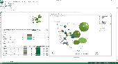
Create stunning 3D bubble charts in Excel with 5dchart Add-In! 5dchart Add-In for Microsoft Excel is an easy-to-use tool for multi-dimensional data visualization. It allows you to display a 3D bubble chart with two additional parameters: 3D coordinates of each bubble and bubble size and colour. Of course, it is the easy way to create 3D scatter Plot too. 5dchart Add-In is...
Category: Business & Finance / MS Office Addons
Publisher: System Approach Ltd., License: Shareware, Price: USD $99.90, File Size: 809.0 KB
Platform: Windows
Grid Imp - imports gridded data into MS-MapPoint, to produce attractive data maps.
Grid Imp - imports gridded data into MS-MapPoint, to produce attractive data maps. Can handle imperfect data, holes, re-gridding, etc. Can be used to import such attributes as pollution data, seismic hazard, geological information, customer/population distribution, etc. Grid Imp is a software that allows you to import data and produce maps. Various text formats supported using...
Category: Home & Education / Science
Publisher: Winwaed Software Technology, License: Shareware, Price: USD $75.00, File Size: 2.0 MB
Platform: Windows
SemGrid (Simple easy manager of Grid data, for SEMoLa).
SemGrid (Simple easy manager of Grid data, for SEMoLa). Some of its features are: Freeware raster GIS, for Windows OS, import and export of Grid layers from ASCII Grid files of Surfer (grd), GeoMedia (asc), ArcGis (asc) and binary or ASCII from Idrisi32 (rdc, rst), GeoEAS, GRASS, Map algebra, Markov chains estimation and simulation and much more.
Category: Business & Finance / Applications
Publisher: Francesco Danuso, University of Udine, License: Freeware, Price: USD $0.00, File Size: 7.9 MB
Platform: Windows
Shareware
FlexCell is a flexible and easy to use Grid control, it provides comprehensive functions, such as exporting to Excel/CSV/PDF/HTML/XML, importing from XML, printing, preview, sorting, charting, cell merging, virtual mode, ownerdraw mode, etc. FlexCell Grid control contains a Grid designer that allows you to design report templates and user interfaces with very little...
Category: Software Development / Components & Libraries
Publisher: FlexCell Technologies, License: Shareware, Price: USD $159.00, File Size: 1.4 MB
Platform: Windows
Shareware
Java toolkit to add coordinate conversion functionality to your Java applications and applets. The toolkit offers functionality to perform Map Grid and datum transformations: latitude and longitude can be converted to various Map grids, like Transverse Mercator (TM), Oblique Mercator, Mercator, Oblique Stereographic, Polar Stereographic, Cassini, Albers Equal Area Conal,...
Category: Software Development / Components & Libraries
Publisher: Eye4Software B.V., License: Shareware, Price: USD $199.00, EUR179, File Size: 155.5 KB
Platform: Unknown
EZplot is an Excel add-in and trademark of Office Expander.
EZplot is an Excel add-in and trademark of Office Expander. The software design is targeted to improve productivity in creating Excel plots and performing data calculations in Microsoft Excel (from the Microsoft Office Suite). A distinctive feature of EZplot is that it creates plots using parameter names instead of requiring manual selection of data. All Plot...
Category: Business & Finance / MS Office Addons
Publisher: Office Expander, License: Shareware, Price: USD $125.00, File Size: 443.5 KB
Platform: Windows
PSI-Plot brings flexibility to technical plotting and data analysis.
PSI-Plot brings flexibility to technical plotting and data analysis. It has a powerful scientific spreadsheet for data analysis, and an object-oriented on screen graphics editor that makes it easy to design and modify graphs. The powerful features combine with the intuitive and user friendly interface have made PSI-Plot one of the most popular data analysis and graphing program....
Category: Multimedia & Design / Multimedia App's
Publisher: Poly Software International, Inc., License: Shareware, Price: USD $0.00, File Size: 0
Platform: Windows
Shareware
GPS SDK to add GPS and coordinate conversion functionality to your software and scripts). All NMEA0183 protocol versions are supported and can be filtered by NMEA sentence type and talker ID. Garmin USB PVT support. Information on GPS status can also be retrieved: GPS fix quality, satellites used in fix, satellites in view, satellite azimuth, elevation and signal strengths. The toolkit also...
Category: Software Development
Publisher: Eye4Software B.V., License: Shareware, Price: USD $99.00, EUR79, File Size: 2.3 MB
Platform: Windows
With LocationWizard you can easily map multiple addresses on a map.
With LocationWizard you can easily Map multiple addresses on a Map. LocationWizard helps you visualize the locations of customers or shops. LocationWizard supports the following database formats: MySQL, PostgreSQL, SQLite, FireBird, InterBase, Microsoft Access, Microsoft Excel and CSV.
Category: Business & Finance / Business Finance
Publisher: Location Wizard team, License: Shareware, Price: USD $85.00, File Size: 7.3 MB
Platform: Windows
Nevron Map for SharePoint is an advanced web part for all versions Microsoft SharePoint (WSS3.0, SharePoint 2007, 2010, 2013 and 2016). It is designed to provide an easy and powerful way to create choropleth maps that are tightly integrated with your data. The Map Web Part delivers a great set of features including: - Multiple Map Layers - unlimited number of Map...
Category: Software Development / Components & Libraries
Publisher: Nevron Software LLC, License: Shareware, Price: USD $889.00, File Size: 121.9 MB
Platform: Windows
- Plot regular and parametric equations.
- Plot regular and parametric equations.
- Plot coordinates tables.
Graphing Calculator 3D is an easy-to-use tool that plots 2D and 3D functions.
Graphing Calculator 3D features :
- Instant quick plotting after each key stroke.
- Cartesian/Polar coordinates in 2D.
- Cart/Cylindrical/Spherical coordinates in 3D.
- Inequalities in 2D and...
Category: Home & Education / Mathematics
Publisher: Runiter Company, License: Shareware, Price: USD $49.95, File Size: 4.3 MB
Platform: Windows
Minerva: Metastasis is another single-player masterpiece by Adam Foster.
Minerva: Metastasis is another single-player masterpiece by Adam Foster. This is a modification for Half-Life 2 and it uses some of its single-player story to add depth to Minerva. Foster had made a single-player Map called "Something Else" for the original Half-Life, and the Plot of Minerva follows the Plot of this first Map. Minerva is a female character...
Category: Games / Action
Publisher: Adam Foster, License: Freeware, Price: USD $0.00, File Size: 0
Platform: Windows
QuickTable can be used as Database Grid EJBs/DataObjects Grid Delimited/Fixed length data file Grid Array/Vector/Collection Grid QuickTable is built on top of JTable, so you don't have to learn any new API. QuickTable is bundled with lots of features including Print Preview, Printing, Find & Replace, Sorting, Skin, copy/paste to Excel, Image...
Category: Software Development
Publisher: QuickTable, License: Freeware, Price: USD $0.00, File Size: 153.0 KB
Platform: Windows, Mac, Linux, Unix, Java
Versamap draws outline maps on 16 map projections.
Versamap draws outline maps on 16 Map projections. The program allows users to print publication quality maps; and to export maps in vector graphic (WMF, CGM, DXF, ASCII) and bitmapped (BMP) formats. Versamap is supplied with digital maps from the Versamap Micro World Database, a world Map with 220,000 points in 10 geographic features. Versamap may be ordered with more detailed...
Category: Home & Education / Genealogy
Publisher: Versamap, License: Shareware, Price: USD $30.00, File Size: 4.0 MB
Platform: Windows