Free Downloads: South America Gps Maps
Have a Gps and a laptop? Use this to find your way. Make patterns or a trail to share with others. When the application starts, you may pick your area of operations - be it North America, South America, Europe and Asia, or Australia. Your quadrant is determined by where you are in relation to the Equator and the Prime Meridian. Tracking of your position is...
Category: Home & Education / Miscellaneous
Publisher: LogicAll Solutions, LLC, License: Freeware, Price: USD $0.00, File Size: 4.6 MB
Platform: Windows
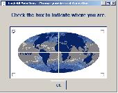
Topo North America is the Most Complete Mapping Software for Recreation.
Topo North America is the Most Complete Mapping Software for Recreation.
Topo North America is the most comprehensive computer mapping program for outdoor recreation, with unsurpassed Maps, available imagery, trip planning features, on-road navigation, and Gps capabilities.
Topo North America is by far the best value for the price -...
Category: Home & Education / Miscellaneous
Publisher: DeLorme, License: Shareware, Price: USD $0.00, File Size: 0
Platform: Windows
Create Gps enabled geo Maps directly on the background of aereal photos and road Maps from the internet. Import geodata from Google-Earth, OpenStreetMap, Gps tracks and Gps logger. Map editor , manually digitizing. Specifical graphical objects (borderlines, borderareas) to guarantee exact same borders of neighbour areas..Screen calibration for true to display...
Category: Multimedia & Design / Digital Media Editors
Publisher: GPSur Dr. Erhard Regener, License: Shareware, Price: USD $65.00, File Size: 6.4 MB
Platform: Windows
 Shareware
Gps Mapping Software for Windows, Loading topographic Maps, realtime navigation, track recording, manage Gps devices and more. The software can be used with various map formats including: GeoTiff, BSB Nautical Charts, AutoCad DXF files, ESRI Shapefiles. Using calibration you can also use scanned or downloaded JPG, BMP, GIF, PNG and TIF Maps. The software can be used...
Category: Home & Education / Science
Publisher: Eye4Software B.V., License: Shareware, Price: USD $149.00, EUR99, File Size: 11.1 MB
Platform: Windows
MetroGold is a Windows tool with which you can upgrade your Garmin MetroGuide Europe or Metroguide North America installation. After the upgrade it's possible to include routing calculation data in your upload of Maps to your Gps. No extra software, apart from Mapsource, is needed, you can transfer the Maps with Mapsource.
Category: Utilities / Misc. Utilities
Publisher: Geodude, License: Shareware, Price: USD $0.00, File Size: 0
Platform: Windows
The story centers on an elderly widower named Carl Fredricksen and an earnest young Wilderness Explorer named Russell who fly to South America in a house suspended by helium balloons.
Up follows the storyline of the film, featuring Carl, Russell, and Dug walking through the jungles of South America. All of the mentioned characters are playable in the game. The...
Category: Games / Adventure & RPG
Publisher: Disney/Pixar, License: Demo, Price: USD $0.00, File Size: 91.0 MB
Platform: Windows
Shareware
Gps Mapping Software for Windows, Loading topographic Maps, manage Gps devices and more. The software can be used with various map formats including: GeoTiff, BSB Nautical Charts, AutoCad DXF files, ESRI Shapefiles. Using calibration you can also use scanned or downloaded JPG, BMP, GIF, PNG and TIF Maps. The software can be used for survey, research, track and trace,...
Category: Home & Education / Science
Publisher: Eye4Software B.V., License: Shareware, Price: USD $75.04, EUR49, File Size: 6.7 MB
Platform: Windows
GPS Send Map is a Windows interface program which uses (sendmap.
Gps Send Map is a Windows interface program which uses (sendmap.exe) to load the IMG Maps to the Gps.This program works well and setup is easy, although there seams to be minor issues in some windows OS.The Gps acted as usual and my Maps appeared on the screen as usual. NICE.
Category: Security & Privacy / Other
Publisher: DougsBrat, License: Freeware, Price: USD $0.00, File Size: 1.5 MB
Platform: Windows
With MetroWizzz- the Autorouting MetroGuide Wizard, you can make your Gps capable of autorouting with MetroGuide Maps. The wizard is self explaining. In just 6 simple steps you will have autorouting capabilities with MetroGuide Maps on your Gps. You can upload up to 1Gb of Maps to your Gps.
Category: Home & Education / Miscellaneous
Publisher: Geodude, License: Freeware, Price: USD $0.00, File Size: 962.2 KB
Platform: Windows
The Gps Detector software is used to update the Gps detector's database , updating Maps , routes and camera locations . The device itself is based on pre-installed Gps coordinates, the device can indicate various road hazards like: Fixed cameras, Red light speed cameras and bus lane cameras, Usual speed measurement places and dangerous zones.
Category: Business & Finance / Business Finance
Publisher: Euro Noliker Kft., License: Freeware, Price: USD $0.00, File Size: 5.5 MB
Platform: Windows
Moagu: The Mother Of All GPS Utilities.
Moagu: The Mother Of All Gps Utilities.
You can convert USGS topographic Maps, aerial/satellite imagery, and any other raster map imagery for use on Garmin handled Gps units.
Garmin Maps have been in a "vector" format; Moagu creates Maps using a "bitmap" format.
Category: Home & Education / Miscellaneous
Publisher: Moagu, License: Shareware, Price: USD $19.95, File Size: 38.2 MB
Platform: Windows
FREE GPS Software for your Garmin, Magellan or Lowrance GPS.
FREE Gps Software for your Garmin, Magellan or Lowrance Gps.
EasyGPS is the fast and easy way to upload and download waypoints, routes, and tracks between your Windows computer and your Garmin, Magellan, or Lowrance Gps. EasyGPS lists all of your waypoints on the left side of the screen, and shows a plot of your Gps data on the right. Use EasyGPS to back up...
Category: Internet / Communications
Publisher: TopoGrafix, License: Freeware, Price: USD $0.00, File Size: 3.9 MB
Platform: Windows
OZtopo provides an alternative set of maps, suitable for use on Garmin GPS units.
OZtopo provides an alternative set of Maps, suitable for use on Garmin Gps units. It has been designed as a detailed set of topographical Maps suitable for bushwalking, 4WDing and general touring . It is comprised of two mapsets, 10m Contours and Roads and Tracks. Both mapsets can be loaded onto a Gps at the same time. They can also be loaded concurrently with any of...
Category: Business & Finance / Business Finance
Publisher: Oztopo, License: Shareware, Price: USD $0.00, File Size: 75.7 MB
Platform: Windows
CompeGPS is an essential software to make the most of your Gps. With this PC software you will be able to download a wide variety of cartography from the internet and also analyse your routes. This software has been specially designed for free flight and motor flight pilots they use Gps and likes to create and accomplish their own routes and then later on analyse. CompeGPS...
Category: Home & Education
Publisher: CompeGPS TEAM S.L., License: Shareware, Price: USD $106.00, File Size: 14.9 MB
Platform: Windows
STATS is the market leader in global football coverage, covering the most prestigious football leagues from South America to Asia. STATS delivers an unparalleled package of premium football content from scores and statistics to editorial content - all in a digital format.
Category: Home & Education / Miscellaneous
Publisher: STATS LLC, License: Demo, Price: USD $0.00, File Size: 5.5 KB
Platform: Windows
CompeGPS is an essential software to make the most of your Gps. With this PC software you will be able to download a wide variety of cartography from the internet and also analyse your routes. This software has been specially designed for 4x4 lovers, bike tourists, excursionists and, in general, everyone who uses Gps, likes to create and accomplish their own routes and then...
Category: Home & Education
Publisher: CompeGPS TEAM S.L., License: Shareware, Price: USD $106.00, File Size: 14.9 MB
Platform: Windows
Eye4Software Gps Mapping is a professional Gps mapping software tool that can be used in numerous applications. Use the software to load, view and edit your Maps, display your position realtime and record all your movements.
The software will work with almost any Gps and can be used on any desktop, laptop or needbook computer running Windows XP or...
Category: Home & Education / Miscellaneous
Publisher: Eye4Software B.V., License: Shareware, Price: USD $130.61, File Size: 14.6 MB
Platform: Windows
Map of Africa is one of the many maps created for GPS TrackMaker.
Map of Africa is one of the many Maps created for Gps TrackMaker. You are able to download the installation package from the TrackMaker website. In order to preview the contents of this package, you need to install Gps TrackMaker.
Using the above mentioned application, you will be able to see the Map of Africa. Just click on the "Open Temporary...
Category: Home & Education / Miscellaneous
Publisher: Geo Studio Technology, License: Freeware, Price: USD $0.00, File Size: 18.3 MB
Platform: Windows
CMC-7 character sets are widely used in automatic check-processing of banking industry throughout Europe, South America and Asia.
Barcodesoft CMC-7 fonts can be embedded into Adobe PDF files.
There are four different CMC7 font sets: each CMC-7 font set has its own height, width and stroke width.
Category: Multimedia & Design / Fonts
Publisher: Barcodesoft, License: Shareware, Price: USD $99.00, File Size: 2.6 MB
Platform: Windows
Representing a new concept in the field of Ham Maps, the Global Overlay Mapping System is packed full of features for all Ham Radio enthusiasts, including : 1 World Map, with specialised satellite images and world region-boundaries. 8 Continental Maps - Europe, Asia, Africa, North and South America, Oceania, Arctic, Antarctica. 29 Sub Continental Maps, with...
Category: Home & Education / Miscellaneous
Publisher: MapAbility, License: Freeware, Price: USD $0.00, File Size: 4.9 MB
Platform: Windows
Marvellous living screensaver from Nevosoft with beautiful nature scenes of South America will help you to relax and achieve peace of mind. Enjoy wonderful evening at Maya valley, living waterfalls and sunset scenes.
Category: Desktop Enhancements / Screensavers
Publisher: NevoSoft, License: Shareware, Price: USD $19.95, File Size: 3.3 MB
Platform: Windows
Freeware
GPS Converter will convert GPS coordinates between three different formats: 34. 26965, -116.
76783; N 34° 16. 179', W 116° 46. 07'; and N 34° 16' 10.
Category: Home & Education / Sports
Publisher: ALMSys, Inc., License: Freeware, Price: USD $0.00, File Size: 929.9 KB
Platform: Windows
SKWEcuadorScreenSaver displays twenty full screen images of beautiful Ecuador, South America.
SKWEcuadorScreenSaver displays twenty full screen images of beautiful Ecuador, South America. Quito, Ecuador's capital city, is located along the equator. Ecuador is packed full of breath taking sites, ranging from green rain forests, steep Andes mountains with volcanoes, and wonderful beaches along the coast. In the city of Quito, both modern and old architecture can be found....
Category: Desktop Enhancements / Screensavers
Publisher: Sophtware Kode Werks, License: Shareware, Price: USD $15.00, File Size: 4.6 MB
Platform: Windows
Multi-application for travelers and outdoor enjoyment. View Maps, sketch them, record your travel needs, calculate the calories of your best sport, get information of American countries and much more. If you travel, America will be a great companion, if you enjoy good programs, this one will enhance your Palm Pilot.
Category: Home & Education / Miscellaneous
Publisher: Alvaro Adarraga, License: Shareware, Price: USD $13.99, File Size: 707.0 KB
Platform: Unknown