Free Downloads: Convert Nmea To Garmin
License: All | Free
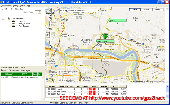
Garmin nRoute is the popular piece of software that allows for auto-routing on a laptop computer with a Garmin GPS unit.
Category: Internet / Misc. Plugins
nRoute is a powerful and feature-rich tool that supports waypoints, tracks, points of interest, addresses and more, but is primarily for navigating and tracking in real time.
nRoute is also compatible with most Garmin units.
Publisher: Garmin Ltd or its subsidiaries, License: Freeware, Price: USD $0.00, File Size: 105.4 MB
Platform: Windows
The Garmin Communicator Plugin is a free Internet browser plugin that transfers data between your Garmin GPS device and your computer.
For example, with the Garmin Communicator Plugin you can add the maps you purchase at Garmin.com to your device. Or, you can upload your training data from your Garmin fitness device to Garmin Connect™.
Category: Internet / Communications
Publisher: Garmin Ltd or its subsidiaries, License: Freeware, Price: USD $0.00, File Size: 14.2 MB
Platform: Windows
Keep track of discount Garmin GPS deals on with this Firefox toolbar.
Keep track of discount Garmin GPS deals on with this Firefox toolbar.compare and buy all the latest Garmin satellite navigation systems. If you want a discount Garmin GPS system this is the Firefox toolbar to use. We also provide information on the latest offers, price cuts and discount voucher codes to help you buy the latest Garmin GPS at the cheapest price...
Category: Internet / Browsers
Publisher: Discount Garmin GPS, License: Freeware, Price: USD $0.00, File Size: 1.1 MB
Platform: Windows
Upgrading software for your Garmin GPS just got easier thanks to WebUpdater—Garmin's free new application that automatically detects and installs the most recent version of operating software for your compatible Garmin GPS. WebUpdater's simple interface makes it easy to upgrade your operating software. Just connect your Garmin GPS to your computer,...
Category: Utilities / Misc. Utilities
Publisher: Garmin Ltd or its subsidiaries, License: Freeware, Price: USD $0.00, File Size: 7.2 MB
Platform: Windows
Free Fleet Management Windows-Desktop standalone application work with Garmin and A1.
Free Fleet Management Windows-Desktop standalone application work with Garmin and A1.You can send messages and STOPs (destinations on Garmin MAP) with short message to driver, direct to his Garmin navigation device.Driver can send message to you using touch-screen keyboard. Ideal for taxi / delivery dispatch. Lowest communication cost by GPRS. Tracking vehicles at map at...
Category: Security & Privacy / Other
Publisher: Clarion LLC, License: Freeware, Price: USD $0.00, File Size: 3.4 MB
Platform: Windows
MarineUpdater is a Windows-based PC application which works in conjunction with a Garmin USB card reader, a Garmin data card, and an Internet connection to generate software update cards for your fixed-mount Garmin marine products. Products which support MarineUpdater will program a data card with information about your Garmin marine product and other Garmin...
Category: Home & Education / Miscellaneous
Publisher: Garmin Ltd or its subsidiaries, License: Freeware, Price: USD $0.00, File Size: 2.0 MB
Platform: Windows
GeoVisu is a program that displays georeferenced data (images, graphics) and downloads data recorded by some GPS devices.
GeoVisu has a "Moving map" navigation function, which can be used with any Nmea 0183 compatible or Garmin USB GPS device.
Main features:
- Displays georeferenced image formats : GeoTiff, ECW and ECWP, MrSID,...
Category: Multimedia & Design / Graphics Viewers
Publisher: GeoVisu, License: Freeware, Price: USD $0.00, File Size: 1.7 MB
Platform: Windows
Garmin MapConverter was developed to be a tool that will allow you to Convert maps and unlock codes on your Windows PC to the Macintosh format. Transferred maps will remain fully accessible on your Windows PC. It works on Windows XP, Windows Vista, Windows 7.
Category: Utilities / Misc. Utilities
Publisher: Garmin Ltd or its subsidiaries, License: Freeware, Price: USD $0.00, File Size: 2.6 MB
Platform: Windows
IPaNema reads any Nmea data from one of the serial ports (Com1-15) and delivers the Nmea data to any user selectable port and IP address using the UDP protocol acting as UDP server.
It can also act as an UDP client, receiving Nmea sentences wrapped in UDP packets and outputs these to a serial communications port
Category: Internet / Misc. Plugins
Publisher: Sailsoft, License: Freeware, Price: USD $0.00, File Size: 263.3 KB
Platform: Windows
With this program you can convert NMEA log in format GVN, generated by GeoVisu.
With this program you can Convert Nmea log in format GVN, generated by GeoVisu. GVConverter converts all files at format GVN presents in source directory and its sub-directories. It replicates source directory tree-structure into destination directory. Date and time of source file are applied to converted file. It runs on Windows 95/98/NT/2000/XP/2003.
Category: Utilities / Misc. Utilities
Publisher: GeoVisu, License: Freeware, Price: USD $0.00, File Size: 562.5 KB
Platform: Windows
KMLCSV Converter is a tool that enables you to Convert the KML file generated from Google Earth (free version) into a formatted CSV file (and vice versa). This CSV file can then be uploaded into your Garmin GPS by using Garmin POI Loader, which can be downloaded for free. This allows you to plot all the custom point of interests (POI) with Google Earth first. Then, you can...
Category: Business & Finance / Calculators
Publisher: Choon-Chern Lim, License: Freeware, Price: USD $0.00, File Size: 2.3 MB
Platform: Windows
GPSCommunicator is a FREE utility to visually represent NMEA GPS position data in realtime.
GPSCommunicator is a FREE utility to visually represent Nmea GPS position data in realtime. It works with Nmea 0183 GPS receivers connected via a serial port. GPSCommunicator has the following features:
- Vessel position display over moving map.
- User selectable maps.
- Create and save Waypoints.
- Graphical GPS data display
- .NET components for use...
Category: Internet / Misc. Plugins
Publisher: Panazzolo.Com, License: Freeware, Price: USD $0.00, File Size: 772.5 KB
Platform: Windows
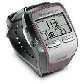
Screensaver with a Garmin Forerunner theme. .
Screensaver with a Garmin Forerunner theme.
Category: Desktop Enhancements / Screensavers
Publisher: Garmin Forerunner 305, License: Freeware, Price: USD $0.00, File Size: 1.5 MB
Platform: Windows
GeePeeEx Editor is specifically designed to produce and edit GPX files destined for Garmin's® Automotive Satnav (GPSr) systems. These files can be used as input to Garmin's® POI Loader to produce enhanced Custom POI's (Points of Interest).
Convert CSV files to GPX. Optionally and uniquely, GeePeeEx Editor will search for valid telephone...
Category: Audio / Rippers & Encoders
Publisher: Them, License: Freeware, Price: USD $0.00, File Size: 2.6 MB
Platform: Windows
FREE GPS Software for your Garmin, Magellan or Lowrance GPS.
FREE GPS Software for your Garmin, Magellan or Lowrance GPS.
EasyGPS is the fast and easy way to upload and download waypoints, routes, and tracks between your Windows computer and your Garmin, Magellan, or Lowrance GPS. EasyGPS lists all of your waypoints on the left side of the screen, and shows a plot of your GPS data on the right. Use EasyGPS to back up and organize...
Category: Internet / Communications
Publisher: TopoGrafix, License: Freeware, Price: USD $0.00, File Size: 3.9 MB
Platform: Windows

OkCustomMap is a software to produce Garmin Custom Maps.
OkCustomMap is a software to produce Garmin Custom Maps.
Supports many map formats:
- OkMap
- Ecw
- GeoTiff
- World files
- OziExplorer
- GpsTuner
You can customize:
- The quality of the output JPEG images (0=Bad, 100=Good)
- The KML transparency (0=Transparent, 255=Opaque)
- The KML draw order (0=Invisible, 1-49=Under the vectorial data,...
Category: Business & Finance / Applications
Publisher: Gian Paolo Saliola, License: Freeware, Price: USD $0.00, File Size: 3.2 MB
Platform: Windows
Turtle Sport is a free software developed to communicate with Garmin fitness products (forerunner and edge).
Turtle Sport retrieves yours training sessions from your Garmin and it makes diagram. You can also order your training sessions by category and training mode. With Turtle Sport, it is also possible to map your GPS training paths in Google Earth.
Athlete...
Category: Home & Education / Miscellaneous
Publisher: TurtleSport, License: Freeware, Price: USD $0.00, File Size: 6.9 MB
Platform: Windows
N2KBuilder software is a powerful, free PC-based tool for designing and verifying the integrity of Nmea 2000 networks.
The N2KBuilder software, when installed on a Windows PC and used as part of an integrated design workflow can be used to plan, document, and validate the design of complex Nmea 2000 networks.
In addition, N2KBuilder will directly produce...
Category: Internet / Misc. Plugins
Publisher: Maretron, LLP, License: Freeware, Price: USD $0.00, File Size: 10.0 MB
Platform: Windows
Palm Desktop for Garmin iQue 3600 is one of the first PDAs to offer built-in GPS, as opposed to the jackets often used with other models.
Mapping integrates well - you can add a location to any address book entry, for example - but you can only route to an address from your present location, not from one distant one to another.
Category: Multimedia & Design / Multimedia App's
Publisher: Garmin Ltd or its subsidiaries, License: Freeware, Price: USD $0.00, File Size: 11.7 MB
Platform: Windows
A program to convert GPS-track of *. gpx, *.
mps, *. plt or *. nmea format to Navitel Tracks.
Category: Home & Education / Sports
Publisher: DXsoft, License: Freeware, Price: USD $0.00, File Size: 31.6 KB
Platform: Windows
This software will not work unless you already own a MapSource product.
This software will not work unless you already own a MapSource product.
Main Features:
- Improved memory issues when running on Windows 7.
- Improved map projection for many map products.
- Changed mouse-wheel functionality to zoom in and out.
- Added support for enhanced map security.
- Fixed unlocking issue.
...
Category: Home & Education / Miscellaneous
Publisher: Garmin Ltd or its subsidiaries, License: Freeware, Price: USD $0.00, File Size: 8.4 MB
Platform: Windows
Latest proAIS software V1.1.3.121 that allows configuration of SPST type Silent Switch and full Nmea 0183 Multiplexing. With this tool you can configure your connection to Nmea 0183. It's easy to install and in the same time i's easy to configure your settings.
Category: Home & Education / Miscellaneous
Publisher: Digital Yacht HQ, License: Freeware, Price: USD $0.00, File Size: 28.4 MB
Platform: Windows
The GPS TrackManager is an application for planning routes and managing routes, waypoints and trackpoints.
The application support functions such as: open and save trackpoints files in various formats (GPX, Ozi Trackpoint file, Ozi Waypoint file, Nmea log, EasyGPS file), transmit Trackpoints, Waypoints and Routes to Garmin GPS receivers (Geko 201, GPSmap 60C), saves...
Category: Internet / Communications
Publisher: Frank Hamaekers, Write4u, License: Freeware, Price: USD $0.00, File Size: 4.8 MB
Platform: Windows
Diffusion is done by sending sentences at format NMEA 0183 using UDP protocol .
Diffusion is done by sending sentences at format Nmea 0183 using UDP protocol .Diffused data come either from a GPS receiver or source issuing on UDP in real time navigation mode, either from a replayed file. In case of replay, position and speed settings are modifiable.GpsDiffuser is at least compatible with itself, GeoVisu and GpsGate.
Category: Utilities / Misc. Utilities
Publisher: GeoVisu team, License: Freeware, Price: USD $0.00, File Size: 1.7 MB
Platform: Windows
Yet another tool to read and Convert GPS logs from Royaltek RGM-3800 and RBT-2300 (using serial communication), from RBT-3000 (using files), from Nmea logs files (comming from AMOD 3080 datalogger for example). Free download and easy to install. Enjoy.
Category: Utilities / Misc. Utilities
Publisher: eXtraGPS, License: Freeware, Price: USD $0.00, File Size: 2.5 MB
Platform: Windows

HS GPS is a software library (with full C source code) which provides access to a Nmea-183 compliant GPS receiver via a serial communications port, decoding Nmea sentences: $GPGGA, $GPGSA, $GPGSV, $GPGLL, $GPRMC and $GPVTG. Decoded parameters include: time, date, position, altitude, speed, course and heading, according to standard - Nmea-183 (National Marine Electronics...
Category: Software Development
Publisher: Hillstone Software, License: Freeware, Price: USD $0.00, File Size: 309.3 KB
Platform: Windows
Kinomap GPS File Fixer allows you to process some treatments on GPS file:
- Convert almost any GPS file to standard Nmea 0183, compatible with Kinomap
- fill the gaps between points when your file is not 1Hertz: the extra point will be recreated by interpolation
- cut a long file in which there are loops of data (example: race) in several parts
Category: Home & Education / Miscellaneous
Publisher: ExcelLance, License: Freeware, Price: USD $0.00, File Size: 19.6 MB
Platform: Windows
The program accepts NMEA GPS sentences from most GPS receivers that connect to a USB port.
The program accepts Nmea GPS sentences from most GPS receivers that connect to a USB port.
The program can display satellite images of waypoint locations on the track plotter.
Is a free software for recording , monitoring and plotting GPS data, very useful and very easy.
Category: Home & Education / Miscellaneous
Publisher: Club Cruceros de La Paz A.C., License: Freeware, Price: USD $0.00, File Size: 10.6 MB
Platform: Windows
GPSsim application is software based GPS device simulator.
GPSsim application is software based GPS device simulator.
GPSsim plays back Nmea data that was saved previously. It is also possible to generate custom Nmea data.
GPSsim allows you to test various PC-based navigation programs as well as use it as data logger application to track vehicle location
Category: Home & Education / Miscellaneous
Publisher: HL-soft, License: Freeware, Price: USD $0.00, File Size: 2.8 MB
Platform: Windows
VisualGPS incorporates many advanced features found in professional programs.
VisualGPS incorporates many advanced features found in professional programs. Its sole purpose is to display graphically specific Nmea 0183 sentences and show the effects of selective availability (SA).
Main Features:
- Azimuth and Elevation Graph - View all satellites that are in view. Each satellite identifies its pseudo random number (PRN) and its azimuth and...
Category: Home & Education / Miscellaneous
Publisher: VisualGPSLLC, License: Freeware, Price: USD $0.00, File Size: 1.7 MB
Platform: Windows

GPS Clock Software is a freeware utility that runs on any Windows NT/2000/XP/2003 workstation or server. The software polls time from a standard Nmea GPS time receiver connected to the host PC's serial port and optionally allows time to be synchronised on the host PC. The GPS clock utility polls GPRMC messages from a standard Nmea GPS time receiver. Information received from the...
Category: Utilities
Publisher: ntp time server, License: Freeware, Price: USD $0.00, File Size: 1.9 MB
Platform: Windows
 Freeware
org, uses file and position names that suit to the display of the TomTom Rider, uses file, route and position names that suit to the display of the Map&Guide Motorrad Tourenplaner, remembers language, paths, window size and position. . .
Category: Business & Finance / Conversion Applications
Publisher: Christian Pesch, License: Freeware, Price: USD $0.00, File Size: 6.6 MB
Platform: Windows, Mac, Linux, Solaris, FreeBSD, OpenBSD, Java
DNRGarmin is a smart tool used to directly transfer data between Garmin GPS handheld receivers and various GIS software packages.
DNRGarmin was built to provide users the ability to directly transfer data between Garmin GPS handheld receivers and various GIS software packages. Using DNRGarmin a user can use point features (graphics or shapefile) and upload them to the...
Category: Utilities / Misc. Utilities
Publisher: GIS Section, Minnesota Department of Natural Resources, License: Freeware, Price: USD $0.00, File Size: 11.3 MB
Platform: Windows
AdriaROUTE Lite version of map is made without Garmin NT technology so users with older device can use AdriaROUTE map. Some of devices that not support NT technology are: (eTrex Legend, eTrex Vista, eTrex LegendC, eTrex VistaC, GPSMAP 60C, GPSMAP 60CS, CPSMAP 76C, GPSMAP 76CS, iQue3600; iQue M4; iQue M5..).
Category: Utilities / Misc. Utilities
Publisher: Navigo Sistem d.o.o., License: Freeware, Price: USD $0.00, File Size: 149.6 MB
Platform: Windows
The Windows PC shareware program for Garmin and Magellan GPS receivers.
The Windows PC shareware program for Garmin and Magellan GPS receivers.
Main Features:
- transfer your waypoints, routes, and tracks from and to the GPS receiver, and save it on your computer disk
- review your waypoints
- enter and edit your waypoints
- define your routes and get the estimated traveling time
- review and edit your...
Category: Home & Education / Miscellaneous
Publisher: Heinrich Pfeifer, License: Freeware, Price: USD $0.00, File Size: 2.9 MB
Platform: Windows

MB-GPS2KML converts a GPS log file (in plain NMEA format) to a KML file (placemark file for Google Earth) and opens this file in Google Earth. Velocity, number of satellites and HDOP are interpreted as height, color and size of the icons.
Category: Home & Education
Publisher: Markus Bader, License: Freeware, Price: USD $0.00, File Size: 441.4 KB
Platform: Windows
Ais Decoder accepts AIS data from an AIS Receiver, the Internet or a Local Network connection, decodes the data and presents the decoded data in a form suitable for display and analysis by mapping program (eg Google Earth or Google Maps), or for analysis using Excel, or by a database (eg MySql).
The decoder will decode all the Nmea content of all 27 AIS mesage types. The...
Category: Business & Finance / Business Finance
Publisher: Neal Arundale, License: Freeware, Price: USD $0.00, File Size: 2.8 MB
Platform: Windows
Northwest Trails is a mapset of trails designed for upload to any map-enabled Garmin GPS receiver.
Northwest Trails is a mapset of trails designed for upload to any map-enabled Garmin GPS receiver. It is more than just a mapset, though; it is also a community effort initiated to record and collect GPS data for trails in the Northwest (Washington, Idaho, Oregon, Montana, Wyoming, Alaska, British Columbia and Alberta) and provide that data for general public use.
The mapset...
Category: Internet / Misc. Plugins
Publisher: Jon F. Stanley, License: Freeware, Price: USD $0.00, File Size: 31.7 MB
Platform: Windows
This program converts from GPX format to CSV format or vice versa.
This program converts from GPX format to CSV format or vice versa. You can create waypoints in MapSource and then Convert them to POI (CSV) files for download or sharing with others.
You can also Convert POI (CSV) files that others have created, and then edit them in MapSource. Now that the Garmin POI loader supports GPX files, GPXtoPOI's most important...
Category: Business & Finance / Calculators
Publisher: MasterClass, License: Freeware, Price: USD $0.00, File Size: 1.4 MB
Platform: Windows
GPS log-maker. Software creates *.plt track file, *.rte route file and, optionally, Nmea-log file.
Category: Internet / SMS
Publisher: dxsoft.com, License: Freeware, Price: USD $0.00, File Size: 85.8 KB
Platform: Unknown
Features
- Easy-to-learn WINDOWS™ based user interface
- Easy-to-use thanks to single key functions
- Fully automatic (no user interface needed... suited for mobile applications)
- Very fast because of a special file format (XIM file format)
- Imperial or international units or mixture of both
- Rich, detailed configuration
- Utilizes most...
Category: Multimedia & Design / Multimedia App's
Publisher: Sapper Oy, Finland, License: Freeware, Price: USD $0.00, File Size: 1.6 MB
Platform: Windows
AudioCompass is a navigation program for visually-impaired sailors.
AudioCompass is a navigation program for visually-impaired sailors.
AudioCompass is a simple program: it connects to a vessel’s Nmea-0183 data network, and displays heading course and waypoint information on a compass dial.
Audio tones are generated to assist in the steering of the boat, and speech annunciation is provided for
the relevant navigation data.
Category: Business & Finance / Business Finance
Publisher: Four Fathom Marine Technology, License: Freeware, Price: USD $0.00, File Size: 418.5 KB
Platform: Windows
Portable GPS Navigation toolbar for Internet Explorer.
Portable GPS Navigation toolbar for Internet Explorer. Find portable gps units for your car, truck or minvan from top name brands including Tom Tom, Magellan and Garmin. Discover the world of eBay and shop for portable gps navigation systems directly from your browser toolbar.
Category: Internet / Browsers
Publisher: Portable GPS Navigation System, License: Freeware, Price: USD $0.00, File Size: 1.1 MB
Platform: Windows
Want to download and be able to add additional custom POI 's to your Navigon Sat Nav but can't work out how? If you have bought one of the newer, 40/70 series Satellite Navigation (Sat Nav) or GPS device from Navigon, then you should be good to go. Simply install and then run Navigon Fresh and use the new POI-Assistant utility.
This is a fairly simple to use and possibly...
Category: Home & Education / Miscellaneous
Publisher: Paul Tomlinson, License: Freeware, Price: USD $0.00, File Size: 17.8 MB
Platform: Windows
This mapset contains topographic, hydro, road, trail, POI, and public land data for the state of Montana. Topo lines dissipate quicker as zoom scale increases. Much improved over the Garmin 24K series when zoomed out. Specialized Night Mode colors to maximize viewability while retaining useful landowner colorization scheme.
Category: Home & Education / Miscellaneous
Publisher: Northwest Environmental Services, License: Freeware, Price: USD $0.00, File Size: 421.3 MB
Platform: Windows
MyGPS is a Freeware software for the creation and the management of longitude and latitude calibrated maps.
The software can define points of interest obtaining their coordinates (waypoints), can create routes (routepoints), can visualize track paths (trackpoints).
Using a serial link, points routes and tracks can be shared with "eTrex" and "Geko" Garmin...
Category: Home & Education / Miscellaneous
Publisher: GPSInfo, License: Freeware, Price: USD $0.00, File Size: 2.3 MB
Platform: Windows
This program was designed to check the installation and optimize placement of the antenna for your Automatic Identification System (AIS). This program displays received signal, threshold and signal-to-noise ratio (SNR) data for selected AIS targets. The program has been tested with NASA Marine Instrument's AIS Engine using the standard Nmea 0183 interface.
Category: Utilities / Misc. Utilities
Publisher: The Bellwood Group, License: Freeware, Price: USD $0.00, File Size: 2.2 MB
Platform: Windows
QuakeMap is a powerful GPS/mapping program for your Windows computer.
QuakeMap is a powerful GPS/mapping program for your Windows computer. It can be downloaded here for free. The trial mode allows you to use most features indefinitely. When you need to unlock certain powerful features, a License Key can be ordered here. QuakeMap is designed for ease of use. It eatures intuitive user interface, supports most popular Garmin and Magellan receivers, reads and...
Category: Utilities / Misc. Utilities
Publisher: quakemap.com, License: Freeware, Price: USD $0.00, File Size: 821.2 KB
Platform: Windows
Have a GPS and a laptop? Use this to find your way. Make patterns or a trail to share with others. When the application starts, you may pick your area of operations - be it North America, South America, Europe and Asia, or Australia. Your quadrant is determined by where you are in relation to the Equator and the Prime Meridian. Tracking of your position is automatically enabled when the...
Category: Home & Education / Miscellaneous
Publisher: LogicAll Solutions, LLC, License: Freeware, Price: USD $0.00, File Size: 4.6 MB
Platform: Windows
Northwest Topos is a mapset containing contours, hydrology, roads, trails, points of interest and more for the State of Washington and adjoining regions. It is designed for upload to any map-enabled Garmin GPS receiver.
As of this release, it covers all of the State of Washington along with the North Idaho Panhandle, much of northern and western Oregon, the areas around...
Category: Home & Education / Miscellaneous
Publisher: Jon F. Stanley, License: Freeware, Price: USD $0.00, File Size: 820.2 MB
Platform: Windows