Free Downloads: Distance And Route Mapping
License: All | Free
Free Satellite Maps is a free tool from Google which offers a satellite mapping service worldwide.
Free Satellite Maps is a free tool from Google which offers a satellite Mapping service worldwide.These are accompanied by a street service, a Route planner and information about business in almost all countries.In this way we can fly the world from satellite view or in birds eye.The level of detail is different depending on where you are located.Major cities have a very excellent...
Category: Home & Education / Science
Publisher: www.satelliteview-of-my-house.com, License: Freeware, Price: USD $0.00, File Size: 612.0 KB
Platform: Windows
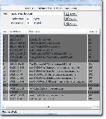
The Off-Route Data Acquiring software is designed to
download off-Route data from the STD-500/510/3300
instruments into a file on your computer.
Connect the data collector/analyzer to your
workstation.
-Load off-Route points you need.
-Select off-Route points of interest from the list.
-Save selected off-Route points...
Category: Business & Finance / Business Finance
Publisher: Technekon, License: Freeware, Price: USD $0.00, File Size: 5.3 MB
Platform: Windows
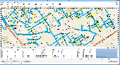
MyRouteOnline is an easy to use Route planner that that allows you to plan routes from Excel spreadsheet. Excel Add-in that uploads addresses and saves time, fuel and money by helping you map multiple locations and find the best Route. Online Route planning goes far beyond paper maps or a GPS system, it is the only way to find the optimal Route for your needs, giving...
Category: Business & Finance / Business Finance
Publisher: MyRouteOnline, License: Freeware, Price: USD $0.00, File Size: 3.1 MB
Platform: Windows
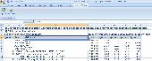
Distance is a Windows-based computer package that allows you to design and analyze Distance sampling surveys of wildlife populations.
Distance evolved from program TRANSECT. However, Distance is quite different from its predecessor as a result of changes in analysis methods and expanded capabilities. The name Distance was chosen because it can be used to...
Category: Home & Education / Miscellaneous
Publisher: Research Unit for Wildlife Population Assessment, University of St Andrews, License: Freeware, Price: USD $0.00, File Size: 20.3 MB
Platform: Windows
A Windows based simulator to find the optimal route to the weather conditions and forecasts.
A Windows based simulator to find the optimal Route to the weather conditions and forecasts. According to one estimate Americans waste more than 65 billion dollars a year sitting in traffic. An efficient routing system is an indispensible tool for any delivery Route.
Manually routing your fleet even on a small scale is out of realm of human capacity and is best left...
Category: Multimedia & Design / Image Editing
Publisher: HouseOfAlgorithms, License: Freeware, Price: USD $0.00, File Size: 1.0 MB
Platform: Windows
The program is intended to edit the network routes table. Visual TCP/IP Router has the convenient graphic interface for a new Route adding and for the deleting of any existent. It's very simple to create new or delete existent Route using the Visaul CP/IP Router. For adding select the connection type, addressable destination, network mask, metric (1 by default), select should this...
Category: Utilities
Publisher: TM Services, License: Freeware, Price: USD $0.00, File Size: 654.1 KB
Platform: Windows
This tool allows to preview route files.
This tool allows to preview Route files. The camera can be moved, rotated and zoomed, you can jump to stations and points of interest, and also enable a series of options. If routes contain errors, a report can be optionally displayed.
A file that is passed as a command line argument is automatically opened at startup. If a CSV file is determined to be a CSV object instead...
Category: Multimedia & Design / Multimedia App's
Publisher: trainsimframework, License: Freeware, Price: USD $0.00, File Size: 171.3 KB
Platform: Windows
On proceeding to Cairo, the caravan took, for the first stage fromAdjeroud, a Route somewhat to the southward of that by which I had goneto Sinai, and joined the latter at Dar el Hamra. Six hours and a halffrom Adjeroud we passed Wady Khoeyfera [Arabic], the bed of a torrent,with trees growing in it, a very little below the level of thesurrounding plain. Here I saw the ruins of a small...
Category: Home & Education / Miscellaneous
Publisher: findassist.info, License: Freeware, Price: USD $0.00, File Size: 532.5 KB
Platform: Windows
AutoPlan IFR generates a Route, validates it using the Eurocontrol IFPS vaidator (CFMUV), interprets any error messages Eurocontrol generates, and excludes the Route segments in these error messages from the next attempt.
Features:
- Automatic airways Route generation
- European Navigation Data
- Shortest Path Routing
- Custom DCT...
Category: Business & Finance / Business Finance
Publisher: Christof Edel, License: Freeware, Price: USD $0.00, File Size: 6.1 MB
Platform: Windows
Live Satellite Maps or Google maps is a web server mapping applications.
Live Satellite Maps or Google maps is a web server Mapping applications.Provides scrolling map images and satellite photos around the earth and even the Route between different places.Since 6 October 2005, live satellite Maps is part of local Google.Google live satellite Map provides the ability to zoom in or zoom out to show the map.The user can control the map with your mouse or...
Category: Home & Education / Science
Publisher: www.satelliteview-of-my-house.com, License: Freeware, Price: USD $0.00, File Size: 643.0 KB
Platform: Windows
iMindMap Basic is a Mind Mapping software which will get you Mind Mapping quickly and easily.
iMindMap Basic is a Mind Mapping software which will get you Mind Mapping quickly and easily. A simple tool to help you start thinking in a clear and creative way, iMindMap Basic uses a process that has been enhancing the way people think for decades. iMindMap Basic is completely free for life and is a great starter package for those who want to start exploring the uses of Mind...
Category: Home & Education / Teaching Tools
Publisher: Buzan Online, License: Freeware, Price: USD $0.00, File Size: 213.6 MB
Platform: Windows
What distance do you cover with your mouse every day?
What Distance do you cover with your mouse every day? The Ashampoo MouseTracer gives you an answer to this and even offers other exciting facts about your mouse. In real-time this small, but impressive tool measures the Distance that your mouse covers on
Category: Desktop Enhancements
Publisher: ashampoo.com, License: Freeware, Price: USD $0.00, File Size: 5.4 MB
Platform: Windows, Mac, Vista
Home
Disclaimer
Alternate Route Project
Home
Disclaimer
Alternate Route Project
Support
...
Category: Business & Finance / Business Finance
Publisher: Alternate Route Project, License: Freeware, Price: USD $0.00, File Size: 10.2 MB
Platform: Windows
ITN Converter is a free and reliable application for travelers.
ITN Converter is a free and reliable application for travelers. If you want to travel to a place that you haven’t explored yet, you can use this software in order to establish your Route.
The program has two main functionalities: to plan routes and to convert. This means that it can help you establish your itinerary and convert it to an appropriate format for different GPS...
Category: Multimedia & Design / Digital Media Editors
Publisher: Benichou Software, License: Freeware, Price: USD $0.00, File Size: 904.4 KB
Platform: Windows
Is a special application to calculate projection Distance and projection size for Mitsubishi Electric projectors. Simply choose the desired model, lens and unit, then enter a value in a box to calculate the following: Distance between projector and screen, required screen dimensions, and the appropriate Distance of the screen from the floor or ceiling. Values can be...
Category: Home & Education / Miscellaneous
Publisher: MITSUBISHI ELECTRIC CORPORATION, License: Freeware, Price: USD $0.00, File Size: 5.9 MB
Platform: Windows
While testing RailDriver® on Trainz 2004, they created their own virtual railroad.
While testing RailDriver® on Trainz 2004, they created their own virtual railroad. Now they're sharing it, and hope you have as much fun running it as they did making it. They decided to make the Route available to you as a free download, along with some extra trains and a session that is sure to test your skill as a dispatcher. Covering 99 baseboards, this Route is...
Category: Games / Simulations
Publisher: P. I. Engineering, Inc., License: Freeware, Price: USD $0.00, File Size: 9.8 MB
Platform: Windows
Pin Distance is the simple, reliable, golf ranging utility program.
Pin Distance is the simple, reliable, golf ranging utility program. It turns your PDA equipped with GPS into an invaluable tool. You will never again have to look for yard markers, just look at your PDA! The program is optimized for ease-of-use on the course so you don't have to fumble with a stylus when you should be focusing on your golf game. Users can easily calibrate a course the...
Category: Utilities / System Utilities
Publisher: Blackfish Software, License: Freeware, Price: USD $0.00, File Size: 41.0 KB
Platform: Mac,
The Microdrone Airborne Mapping extension to Orbit GIS provides the tools required for automated flight and high precision Mapping. It contains a Waypoint Generator, a Microdrone in-flight tracker, and a captation tool. Further image-, stereoprocessing and orthorectification can be executed using the Strabo Photogrammetry extension to Orbit GIS.
Category: Multimedia & Design / Multimedia App's
Publisher: Orbit GeoSpatial Technologies, License: Freeware, Price: USD $0.00, File Size: 30.0 MB
Platform: Windows
 Freeware
Open learning course will teach you a structured move toward to the preparation and delivery of all types of business presentations. You will learn Distance education & you think how to identify the key points that will communicate your message most effectively, fine tune your delivery by profiling your audience and use high-impact visual aids to clarify and reinforce your key points....
Category: Games / Educational Games
Publisher: Distance Education Publishing Company, License: Freeware, Price: USD $0.00, File Size: 0
Platform: Windows, VISTA
This applications is the software for X-Guider, which is a multi-purpose handheld GPS receiver.
This applications is the software for X-Guider, which is a multi-purpose handheld GPS receiver.
This program will help you to set up a Route, planning a trip and share it with your friends.
You can calculate the Distance between the points and even name the points.
Category: Home & Education / Miscellaneous
Publisher: unknown, License: Freeware, Price: USD $0.00, File Size: 6.1 MB
Platform: Windows
SimSRD is a utility for simulation and virtual air traffic control users (e.
SimSRD is a utility for simulation and virtual air traffic control users (e.g. VATSIM) to perform lookups against the UK Standard Route Document when planning flights. SimSRD offers various features:
- Modern user interface.
-Reverse Route lookups: a Route can be searched for by choosing the arrival airfield or waypoint. The list of valid departure...
Category: Multimedia & Design / Multimedia App's
Publisher: James Reynolds, License: Freeware, Price: USD $0.00, File Size: 4.1 MB
Platform: Windows
If you are a cycling enthusiast, Bike Logs may end up being a really helpful application for you, since it allows you to record all the relevant details about your bike rides, no matter if you are a professional or an amateur, how frequently you ride your bike, or for how long. It bases its work on databases that store information such as distances, speeds, routes, and many other details.
...
Category: Games / Sports
Publisher: RedFox Communications, License: Freeware, Price: USD $0.00, File Size: 10.8 MB
Platform: Windows
A powerful training diary for runners of all ability.
A powerful training diary for runners of all ability. Helps improve fitness and motivation. Use Runner's Diary each time you run to record the date, Route, time, Distance, heart rate, comments, weight and shoe usage. Analyse your progress over time towards your fitness goals. The spreadsheet produces a range of amazing information and graphical analysis to help you monitor your...
Category: Home & Education / Miscellaneous
Publisher: Simple Accounts Programmes Ltd, License: Freeware, Price: USD $0.00, File Size: 0
Platform: Windows

iMobile?s, travel Distance calculator application is free mobile application that facilitate frequent travelers to computes Distance and direction quickly between any two points on the earth.
Category: Internet / Communications
Publisher: iMobile, License: Freeware, Price: USD $0.00, File Size: 1024 B
Platform: Windows
Business long distance phone service toolbar for IE for Worldnet's clients.
Business long Distance phone service toolbar for IE for Worldnet's clients. Free for all. Easily keep in touch with Worldnet and upcoming promotions from all of our carriers. Easy to insall and extra features.
Category: Internet / Browsers
Publisher: Business Long Distance Phone Service, License: Freeware, Price: USD $0.00, File Size: 1.1 MB
Platform: Windows
AnalogX HyperTrace is a GUI version of traceroute, which shows you the Route that information travels from your machine to another machine on the internet.
Of course, AnalogX wasn't happy just making a GUI version, HyperTrace is also faster, and not just a little bit - an average of 20-30x faster than before! It displays each hop, machine name, machine response time,...
Category: Internet / Tools & Utilities
Publisher: AnalogX, License: Freeware, Price: USD $0.00, File Size: 347.0 KB
Platform: Windows
TrafficEye allows you to know before you go about the traffic and enables you to plan ahead the Route.
With this program keeping your eye on the roads has never been easier.
The program features: traffic flow, road conditions, traffic cameras, incidents, current weather, maps and much more.
Category: Internet / Communications
Publisher: TheWeatherNetwork, License: Freeware, Price: USD $0.00, File Size: 10.2 MB
Platform: Windows
HSLAB Trace is a FREE visual replacement for the standard trace route utility.
HSLAB Trace is a FREE visual replacement for the standard trace Route utility. The fastest way to get the Route between your computer and any other computer in the world. A utility that traces a packet from your computer to an Internet host, showing how many hops the packet requires to reach the host and how long each hop takes. Start it from your desktop or from your Run box,...
Category: Internet / News Applications
Publisher: Apache Monitor, License: Freeware, Price: USD $0.00, File Size: 4.4 MB
Platform: Windows
A free calculator that calculates the time a trip will take when you know the approximate
speed at which you will travel and the Distance you will travel. You can save this calculator to your desktop and always have a time/Distance calculator at your fingertips. This free software is brought to you by http://urperfectday.com .
Category: Desktop Enhancements / Misc. Themes
Publisher: Real Natural Anxiety Relief, License: Freeware, Price: USD $0.00, File Size: 414.0 KB
Platform: Windows

Oh, great gods that look at us from above!
Oh, great gods that look at us from above! A screensaver of divine beauty. Beauty which transmits at a Distance. The Distance from the monitor up to your eyes is a rejuvenating effect. It is sensational! Screensavers can rejuvenate. We've proved it. See for yourself!
Category: Desktop Enhancements / Screensavers
Publisher: BoxScreenSaver.com, License: Freeware, Price: USD $0.00, File Size: 1.0 MB
Platform: Windows
Depth of field scales are elegant tools for quickly and easily calculating depth of field and hyperfocal Distance. Unfortunately, lens manufacturers don't engrave scales on lenses anymore. Now you can use DOFMaster to make your own scales.
Use DOFMaster to make depth of field scales for use in the field. Just set the focus Distance, and read the near and far...
Category: Business & Finance / Applications
Publisher: Don Fleming, License: Freeware, Price: USD $0.00, File Size: 1.3 MB
Platform: Windows
uSoft Solutions is a custom software developing company since 2006 with great experience and knowledge in the field of computer science and in business. we guarantee no cost overruns, which would not be the case with an internal team or other companies. Tell us your needs and we take care of everything without worries. The software VenteServices has been designed in conjunction with the...
Category: Business & Finance / Business Finance
Publisher: uSoft Solutions, License: Freeware, Price: USD $0.00, File Size: 1.2 MB
Platform: Windows
So that you can identify the Mapping & GIS product that best suits your needs, use this simple Product Comparison. There are four main product types that you can use to create a GPS data collection and maintenance system, or mobile GIS solution. Use the links below to select a product group, and compare the features of each product within that group.
Category: Internet / Communications
Publisher: Trimble Navigation Limited, License: Freeware, Price: USD $0.00, File Size: 2.7 MB
Platform: Windows
The MiDAS Lens Calculator lets you calculate the parameters of your optics and lenses, pick your focal length, and calculate your working Distance, object Distance, field of view, depth of focus and more. And, since it knows your camera model, it will help you minimize motion blur and other undesirable video effects. The MiDAS Lens Calculator even helps you learn the impact of...
Category: Home & Education / Miscellaneous
Publisher: Xcitex, Inc., License: Freeware, Price: USD $0.00, File Size: 1.5 MB
Platform: Windows
Route summarization is a powerful and easy-to-use application that reduces the memory in use on routers and routing protocol network traffic, because it results in fewer entries in the routing table. SummaryRoute also calculates the best summary Route.
Category: Utilities / Misc. Utilities
Publisher: Max2k ( Octavian Merches ), License: Freeware, Price: USD $0.00, File Size: 263.3 KB
Platform: Windows
PMapServer7 is a free add-on for UI-View32.
PMapServer7 is a free add-on for UI-View32. To use it, first download and register a copy of UI-View32. There are versions of PMapServer that will work with with Precision Mapping V5, V6 and V7.UI-View32 street level Mapping of the whole of the USA. To support Precision Mapping, UI-View32 uses a plug-in map server (PMapServer) that integrates seamlessly into the program....
Category: Home & Education / Miscellaneous
Publisher: Bill Diaz, License: Freeware, Price: USD $0.00, File Size: 5.4 MB
Platform: Windows
Trizbort is a simple tool which can be used to create maps for interactive fiction.
Trizbort is a simple tool which can be used to create maps for interactive fiction.
Over the years a number of styles have evolved for interactive fiction Mapping. Trizbort focuses on creating maps in only one of these styles, as popularised by Infocom: labelled boxes for rooms, with lines connecting them.
Whether you're playing or writing interactive fiction,...
Category: Multimedia & Design / Digital Media Editors
Publisher: Genstein, License: Freeware, Price: USD $0.00, File Size: 596.2 KB
Platform: Windows
V-Clinic GPS lets you track your training routes and upload the data back to your V-Clinic account.
V-Clinic GPS lets you track your training routes and upload the data back to your V-Clinic account. Then use V-Clinic to share your Route with your training buddies. V-Clinic GPS is ideal for cyclists, joggers and outdoor enthusiasts. V-Clinic GPS runs on GPS & Java enabled phones. Use V-Clinic GPS on your own or get professional fitness analysis and services from one of our...
Category: Home & Education / Health & Nutrition
Publisher: V-CLINIC MOBILE CIRCLES, License: Freeware, Price: USD $0.00, File Size: 235.0 KB
Platform: Unknown
You are three click away from tons of fun!
You are three click away from tons of fun!!
This is ans easy, real fun, rat performed, crazy strange world, online game. The rats are having fun in this cool completely bizarre game. You will see rats everywhere in this game. A rat who throws the spears. A bunch of rats with balloons marking the Distance of your shoot. A measuring rat with a balloon which will always tell...
Category: Games / Misc. Games
Publisher: Absolutist Ltd., License: Freeware, Price: USD $0.00, File Size: 2.2 MB
Platform: Windows
K&R Easy TRAXX automatically records your path up to 500 waypoints and you can use this path to trace back to your starting point or to upload the Route to your PC.
After you have recorded your path, Easy Traxx can trace back to your starting point. Likewise you can plan a Route or path with the software in GOOGLE-MAP.
Category: Home & Education / Miscellaneous
Publisher: Kasper & Richter GmbH & Co. KG, License: Freeware, Price: USD $0.00, File Size: 6.1 MB
Platform: Windows
MouseOdometer is a nice and easy to manipulate software.
MouseOdometer is a nice and easy to manipulate software. It measures Distance that traveled by the cursor of your mouse. This Distance is shown in statistics for all users.
Also you can start some sort of Racing on mice with other user. So try it now!
Category: Business & Finance / Calculators
Publisher: Mouseodometer, License: Freeware, Price: USD $0.00, File Size: 642.9 KB
Platform: Windows
Freeware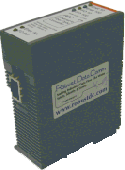
A Fiber Media Converter extends the communication Distance through the use of optical fibre technology. They offer the advantage of immunity to electrical noise as well as long Distance communications. Be it a serial to Fiber Media Converter or Fiber Media Repeater, RDC has a wide range of products to suit almost any application.
Category: Software Development / Databases & Networks
Publisher: Fiber Media Converter, License: Freeware, Price: USD $0.00, File Size: 502.0 KB
Platform: Windows, Mac, Linux,
WGS-84 Calculator is used to calculate geodetic Distance and azimuth between two points (latitude and longitude). In addition, it can calculate a new point from origin using the given azimuth and Distance.
Lat/long values can be inserted using three different formats; DD:MM:SS.ssss, DD:MM.mmmmmm or DD.dddddddd.
Calculations are based on WGS-84 (World...
Category: Home & Education / Mathematics
Publisher: MR Soft Tmi, License: Freeware, Price: USD $0.00, File Size: 502.0 KB
Platform: Windows
If you don't have internet access on your phone, or you want to self-select a larger region of Mapping, then the Map Chooser tool can be used to make map tile selections. Choose your own Mapping areas with the flexible select tool that lets you select unlimited areas of Mapping. Based on a grid, you can choose any grid squares you like - so you can pick an area in...
Category: Home & Education / Miscellaneous
Publisher: ViewRanger, License: Freeware, Price: USD $0.00, File Size: 213.2 MB
Platform: Windows
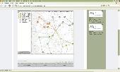
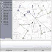
JOpt.SDK is spatial Route optimization and planning Java library for automatic resource scheduling and transportation planning. It uses specialized genetic algorithms to calculate an optimized allocation of orders and stops to mobile resources. The algorithm not only provides tours at minimum costs but also considers an arbitrary set of constraints for each tour. JOpt.SDK can solve...
Category: Software Development
Publisher: DNA, License: Freeware, Price: USD $0.00, File Size: 97.7 KB
Platform: Unknown
VisionScan is software for near and Distance vision quick scanning. It relies on four different methods to test vision. Furthermore it can test for color vision deficiency.
Category: Home & Education
Publisher: ContactsPedia, License: Freeware, Price: USD $0.00, File Size: 392.0 KB
Platform: Windows
VisualRoute Lite Edition analyzes your Internet connection and identifies where problems occur, determining if slow performance is due to your ISP or a problem on the Internet. The graphical report shows the network Route from your computer to your destination, identifies the network devices along the Route and shows where any data loss or slow response occurs. A summary analysis...
Category: Internet
Publisher: Visualware Inc., License: Freeware, Price: USD $0.00, File Size: 4.0 MB
Platform: Windows
TransDEM Trainz Edition is a dedicated version of TransDEM, enhanced with specific export functionality for Auran/N3V Trainz Simulator 2010, Trainz Simulator 2009, Trainz Railroad Simulator 2006 and 2004. This additional export functionality enables the user to create Trainz Route maps in TransDEM, using geo data currently loaded. Direct creation of all files which make up a Trainz...
Category: Multimedia & Design / Image Editing
Publisher: Roland Ziegler, License: Freeware, Price: USD $0.00, File Size: 981.3 KB
Platform: Windows
JOpt.NET TourPlanner is an automated vehicle routing software and dispatching .NET component for logistic applications that can solve Traveling Salesman Problems (TSP) and Capacitated Vehicle Routing Problems with Time Windows (CVRPTW,VRPTW). JOpt.NET offers Route and transport optimisation with respect to various constraints such as time windows, load capacities and pick up and delivery...
Category: Software Development
Publisher: DNA, License: Freeware, Price: USD $0.00, File Size: 3.9 MB
Platform: Windows
Palm Desktop for Garmin iQue 3600 is one of the first PDAs to offer built-in GPS, as opposed to the jackets often used with other models.
Mapping integrates well - you can add a location to any address book entry, for example - but you can only Route to an address from your present location, not from one distant one to another.
Category: Multimedia & Design / Multimedia App's
Publisher: Garmin Ltd or its subsidiaries, License: Freeware, Price: USD $0.00, File Size: 11.7 MB
Platform: Windows