Free Downloads: Ebooks Gis Free
License: All | Free
AvisMap Gis Engine is the basic development platform for AvisMap Gis suites, which is a new generation component Gis development platform for Gis application developers. AvisMap Gis Engine 5 provides powerful Gis functions through Active X controls based on Microsoft COM component technique standards. It allows users to rapidly develop professional...
Category: Multimedia & Design / Multimedia App's
Publisher: AvisMap GIS Technologies, License: Freeware, Price: USD $0.00, File Size: 60.5 MB
Platform: Windows
DIVA-Gis is a Free computer program for mapping and geographic data analysis (a geographic information system (Gis). With DIVA-Gis you can make maps of the world, or of a very small area, using, for example, state boundaries, rivers, a satellite image, and the locations of sites where an animal species was observed.
Category: Business & Finance / Applications
Publisher: diva-gis, License: Freeware, Price: USD $0.00, File Size: 3.8 MB
Platform: Windows
DIVA-GIS is a GIS for plant biodiversity analysis.
DIVA-Gis is a Gis for plant biodiversity analysis. The project will modernize the architecture for better collaboration and extensibility based on Eclipse RCP.
DIVA-Gis can be used to map and analyze biological distribution data, such as can be provided by natural history collections and genetic resources collections. Typically, the distribution data would refer to...
Category: Business & Finance / Business Finance
Publisher: International Potato Center (CIP), License: Freeware, Price: USD $0.00, File Size: 122.4 MB
Platform: Windows
The Quantum GIS Tethys repository contains a lot of software from OSGeo projects.
The Quantum Gis Tethys repository contains a lot of software from OSGeo projects. Quantum Gis Tethys and all dependencies are included, along with Python, GRASS, GDAL, etc. This is most suitable for people who want to be able to update dependencies from the Quantum Gis Tethys repository easily. The installer is able to install from internet or just download all needed...
Category: Multimedia & Design / Graphics Viewers
Publisher: QGIS Development Team, License: Freeware, Price: USD $0.00, File Size: 369.0 KB
Platform: Windows
AccuGlobe Desktop 2007,a standardized platform for delivering solutions to the global Gis community, offers even more of what you demand in a desktop Gis application. Combining user-friendly design with significantly increased functionality, AccuGlobe Desktop 2007 gives you greater freedom in analyzing spatial data. In addition to functioning as the core engine behind many...
Category: Multimedia & Design / Multimedia App's
Publisher: Digital Data Technologies, Inc., License: Freeware, Price: USD $0.00, File Size: 9.8 MB
Platform: Windows
ArcGIS Explorer is a Free, downloadable Gis viewer that gives you an easy way to explore, visualize and share Gis information. ArcGIS Explorer adds value to any Gis because it helps you deliver your authoritative data to a broad audience.
The ArcGIS Explorer Desktop Current User setup is intended for users who do not have administrator access on their...
Category: Desktop Enhancements / Shell & Desktop Managers
Publisher: Environmental Systems Research Institute, Inc., License: Freeware, Price: USD $0.00, File Size: 94.0 MB
Platform: Windows
So that you can identify the Mapping & Gis product that best suits your needs, use this simple Product Comparison. There are four main product types that you can use to create a GPS data collection and maintenance system, or mobile Gis solution. Use the links below to select a product group, and compare the features of each product within that group.
Category: Internet / Communications
Publisher: Trimble Navigation Limited, License: Freeware, Price: USD $0.00, File Size: 2.7 MB
Platform: Windows
ArcGIS Explorer Desktop is a Free Gis viewer that gives you an easy way to explore, visualize, and share Gis information. ArcGIS Explorer adds value to any Gis because it helps you deliver your authoritative data to a broad audience.
Easy and intuitive to use it's easy for anyone to begin working with ArcGIS Explorer, with its intuitive and easy to...
Category: Home & Education / Miscellaneous
Publisher: Environmental Systems Research Institute, Inc., License: Freeware, Price: USD $0.00, File Size: 100.5 MB
Platform: Windows
GeoSurveillance is software that combines spatial statistical routines with some basic Geographic Information Systems (Gis) functions to carry out retrospective and prospective statistical tests for the detection of geographic clustering. In this software, the focus is primarily on the spatial statistical analysis. Consequently, full Gis functionality is not provided. Gis...
Category: Home & Education / Miscellaneous
Publisher: NCGIA, License: Freeware, Price: USD $0.00, File Size: 2.4 MB
Platform: Windows
 Freeware
VSceneGIS Desktop. (Gis) Analysis, Computing and Editing. Customer Project Development, Analysis, Computing and Gis editing. VSceneGIS Desktop applies the concept of Tree and Graph Topology to implement the data model in a Gis. Validation, Editing and Topological Behavior Export and import of data sources: PostgreSQL / PostGIS, Oracle, MySQL, SQLite / SpatiaLite,...
Category: Home & Education / Science
Publisher: vscenegis.com, License: Freeware, Price: USD $0.00, File Size: 118.4 MB
Platform: Windows
GeoMedia Viewer is an easy to use, Free Gis software application for desktop viewing and distribution of geospatial data.It allows an organization to maximize the value of its geospatial data by extending availability to novice users who wouldn’t otherwise have access because of the barriers of purchasing and learning how to use a full Gis software application.
Category: Multimedia & Design / Graphics Viewers
Publisher: Intergraph Corporation, License: Freeware, Price: USD $0.00, File Size: 115.0 MB
Platform: Windows
Over 100 Free ebook icons perfect for customizing the icons for your Ebooks, tutorials and other downloads. They are also great to use on your own desktop for other uses too. Can be used for either non-profit or commercial Ebooks. This is a great way to make your Ebooks stand out from others. Icons range from 32x32 to 48x48 in .ico format. We'll also show you how you...
Category: Web Authoring / Web Design Utilities
Publisher: TheNetter.com, License: Freeware, Price: USD $0.00, File Size: 163.0 KB
Platform: Windows
diet ebooks toolbar for internet Explorer.
diet Ebooks toolbar for internet Explorer.diet Ebooks that you can buy and download in seconds. 1 Best Selling Diet & Fitness E-Book In Internet History.The number one Market Place Health & Fitness Diet Ebooks. Quickly Shrink Your Waistline, Lose Body Fat, Eliminate Low Back Pain And Develop Great Abs - Now With Higher Commissions!
Category: Internet / Browsers
Publisher: diet ebooks, License: Freeware, Price: USD $0.00, File Size: 1.0 MB
Platform: Windows
This eBook gives instant download access to 300+ eBooks located at http://www.
This eBook gives instant download access to 300+ Ebooks located at http://www.hikids57.com! For eight years Don Morrison has been writing Ebooks and giving them away Free in order to teach others how to earn an income from home by doing the same thing! Download 300+ Ebooks at http://www.hikids57.com or http://dondmorrison.com.
Category: Business & Finance / Applications
Publisher: The Hikids57 Company, License: Freeware, Price: USD $0.00, File Size: 5.7 MB
Platform: Windows
Quantum Gis provides a continously growing number of capabilities provided by core functions and plugins. You can visualize, manage, edit, analyse data, and compose printable maps. QGIS is an official project of the Open Source Geospatial Foundation (OSGeo). It runs on Linux, Unix, Mac OSX, and Windows and supports numerous vector, raster, and database formats and functionalities.
Category: Home & Education / Miscellaneous
Publisher: qgis.org, License: Freeware, Price: USD $0.00, File Size: 92.2 MB
Platform: Windows
100 Free Ebook Covers to help you create unique and stylish ebooks.
100 Free Ebook Covers to help you create unique and stylish Ebooks. Can be used with any graphics software and are ready for you to add your title. Can be used for both personal and commercial use (as covers for Ebooks that you sell). Freeware.
Category: Multimedia & Design / Multimedia App's
Publisher: TheNetter.com, License: Freeware, Price: USD $0.00, File Size: 3.4 MB
Platform: Windows
PlanetGIS Explorer is a free viewer for PlanetGIS maps and GIS exchange files.
PlanetGIS Explorer is a Free viewer for PlanetGIS maps and Gis exchange files. PlanetGIS Explorer allows you to navigate through maps, query map elements and view attribute information from linked database tables. Also PlanetGIS Explorer allows you to customize the appearance of maps for purposes of creating hardcopy printouts, but does not allow you to save any changes to maps.
Category: Multimedia & Design / Graphics Viewers
Publisher: Planet GIS, License: Freeware, Price: USD $0.00, File Size: 5.4 MB
Platform: Windows
gvSIG project is a Free and open source Geoinformation System (Gis), that enables users to interactively visualize, manage, modify and analyze spatial information in the form of digital maps, images and database tables. It is easy to learn, yet versatile and efficient enough for demanding Gis tasks.
Category: Multimedia & Design / Multimedia App's
Publisher: Oxford Archaeology Digital, License: Freeware, Price: USD $0.00, File Size: 273.0 MB
Platform: Windows
Free Internet Marketing Ebooks toolbar and tips everyday for Internet Explorer.
Free Internet Marketing Ebooks toolbar and tips everyday for Internet Explorer. Find daily tips for blogging, internet marketing, Free tools, softwares, Free moneymaking methods, work from home, data entry at home, Free Ebooks for internet marketing.
Category: Internet / Browsers
Publisher: Free Internet Marketing Tool, License: Freeware, Price: USD $0.00, File Size: 1.1 MB
Platform: Windows

The Free AvisMap Viewer opens most Gis/CAD and raster image file types and most ArcView, ArcExplorer, and MapInfo projects. Besides just opening and viewing files, the Viewer supports an extensive list of features including visual layer properties control, legend control, thematic mapping, spatial and attribute querying, custom labeling, on-map measurements, hyper-linking, PDF...
Category: Software Development / Components & Libraries
Publisher: AvisMap GIS Technologies, License: Freeware, Price: USD $0.00, File Size: 22.3 MB
Platform: Windows
GenesisIV understands GIS concepts like layers, shape objects and georeferencing.
GenesisIV understands Gis concepts like layers, shape objects and georeferencing. It interfaces to industry standard Gis systems such as MapInfo and ArcView so you can use your existing data without having to learn new concepts or perform difficult manipulations.
GenesisIV is the only landscape product designed specifically to help teach geographical concepts....
Category: Multimedia & Design / Multimedia App's
Publisher: Geomantics, License: Freeware, Price: USD $0.00, File Size: 17.6 MB
Platform: Windows
bestselling ebooks, free download,toolbar on internet explorer.
bestselling Ebooks, Free download,toolbar on internet explorer. view review and download all the books you will ever need
Category: Internet / Browsers
Publisher: Bestselling ebooks, License: Freeware, Price: USD $0.00, File Size: 2.0 MB
Platform: Windows
The Microdrone Airborne Mapping extension to Orbit Gis provides the tools required for automated flight and high precision mapping. It contains a Waypoint Generator, a Microdrone in-flight tracker, and a captation tool. Further image-, stereoprocessing and orthorectification can be executed using the Strabo Photogrammetry extension to Orbit Gis.
Category: Multimedia & Design / Multimedia App's
Publisher: Orbit GeoSpatial Technologies, License: Freeware, Price: USD $0.00, File Size: 30.0 MB
Platform: Windows
The Framework Free Viewer is optional but is provided in case you do not have access to Gis software. The Framework Free Viewer is only useful when when working with data provided by Framework Archaeology.
The Framework Free Viewer requires 12MB of disk space to install and once installed will take up 6MB of disk space.
Category: Home & Education / Genealogy
Publisher: Framework Archaeology, License: Freeware, Price: USD $0.00, File Size: 4.4 MB
Platform: Windows
NexGeo Office™ provides all of the functionality needed to organize a data collection project and manage data collected from Nexteq GPS/Gis handhelds. It provides tools for viewing, editing and exporting data to a format suitable for your existing Gis and CAD infrastructure.
Category: Multimedia & Design / Image Editing
Publisher: Nexteq Navigation, License: Freeware, Price: USD $0.00, File Size: 7.4 MB
Platform: Windows
Create pdf ebooks and reports easily for free by using Tiger PDF Creator.
Create pdf Ebooks and reports easily for Free by using Tiger PDF Creator. You will feel right at home if you have used any type of word processor. Even people without any experience will be able to quickly and easily get Ebooks out fast. Building PDF?s have never been easier using Tiger PDF Creator.The full power of a word processor with a easy to use interface. Insert...
Category: Business & Finance / MS Office Addons
Publisher: Profit Tiger Systems, License: Freeware, Price: USD $0.00, File Size: 11.0 MB
Platform: Windows
With MapAuthor you can create, print and save desktop maps, using data that you obtain from commercial sources or perhaps your in-hous Gis department as shapefiles (shapefiles are a very common Gis exchange format.) You can also produce internet-based maps based on Google Maps, for use on your web site.
MapAuthor allows you to link your own data to maps, for example if you...
Category: Internet / Misc. Plugins
Publisher: MapAuthor.com, License: Freeware, Price: USD $0.00, File Size: 6.3 MB
Platform: Windows
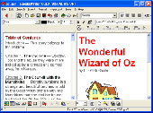
Guten Reader - Enjoy 18000 free public-domain eBooks.
Guten Reader - Enjoy 18000 Free public-domain Ebooks.
Guten Reader searches over 18000 Ebooks which are public domain in the United States. "Highlight dictionary words" identifies 5000 words frequently used on SAT tests. Hover over these highlighted words to see the definition.Guten Reader keeps your current eBook on disk, so you can read offline and...
Category: Home & Education / Miscellaneous
Publisher: Bobbing Software, License: Freeware, Price: USD $0.00, File Size: 1.3 KB
Platform: Windows
Stay connected and get so much more - with the eBOOK Toolbar.
Stay connected and get so much more - with the eBOOK Toolbar.Ebooks Toolbar allows you to get a wide choice of powerful engines, get the latest Free applications for your browser,receive the most important announcements, get Free online books and news and much more.
Category: Internet / Browser Accessories
Publisher: Visicom Media, License: Freeware, Price: USD $0.00, File Size: 2.7 MB
Platform: Windows
SuperGIS DataConvertor is a powerful data conversion tool which is able to convert files between the common Gis formats to the SuperGeo self-defined formats. Therefore, your data can be used in SuperGeo series products, and also the SuperGeo self-defined formats can be used in other related platforms or systems. You will no longer need to worry the compatibility of Gis data, and...
Category: Business & Finance / Calculators
Publisher: SuperGeo, License: Freeware, Price: USD $0.00, File Size: 3.2 MB
Platform: Windows
spatialSQL help contains a detailed description of solutions to some common GIS problems.
spatialSQL help contains a detailed description of solutions to some common Gis problems.
The interface provides a simple mechanism for selecting tables, spatialSQL operators, where clause, distance and other qualifiers and update operators. See the description of features and benefits.
Category: Software Development / Misc. Programming
Publisher: Spatial Projects, License: Freeware, Price: USD $0.00, File Size: 7.6 MB
Platform: Windows
AutoDEM (aka as AutoMNT) is a freeware Gis software to create Digital Elevation Models (DEM) from scanned topographic maps for Windows.
Through different data layers (map, contours, DEM, etc.), AutoDEM provides many tools for :
-Topographic map analysis
-Contour lines extraction and reconstruction
-Contours to DEM interpolation and DEM analysis
-DEM to TIN...
Category: Multimedia & Design / Animation
Publisher: Joachim Pouderoux, License: Freeware, Price: USD $0.00, File Size: 27.6 MB
Platform: Windows
GeoBase is a high performance OEM tool for embedding Gis functions in client and server applications. GeoBase has a small memory footprint - both on the hard disk for storage and in RAM during use. Compatible with both .NET and Linux, GeoBase is designed for a rapid development cycle and low deployment cost. The Map Engine displays rich, detailed maps for use in server or client...
Category: Software Development / Compilers & Interpreters
Publisher: Telogis, License: Freeware, Price: USD $0.00, File Size: 87.0 MB
Platform: Windows
Freeware
Convert ESRI ShapeFiles (.SHP) geolocation data into AnyMap format to be used with AnyChart. AnyChart Flash Map Converter allows making use of a wide choice of maps with AnyChart Flash Component, a Gis visualization system that recognizes map data in AnyMap format only. AnyChart Flash Map Converter makes it easy to visualize any geolocation data without hefty expenses associated with...
Category: Web Authoring / Image Mapping Tools
Publisher: AnyChart.Com, License: Freeware, Price: USD $0.00, File Size: 1.6 MB
Platform: Windows
The Mapping and Gis License Manager software allows you to manage multiple licenses for the GPS Pathfinder Office software. Using the GPS Pathfinder Office License Administrator software, users of the GPS Pathfinder Office software can choose either a single use or a floating license.
Category: Business & Finance / Business Finance
Publisher: Trimble, License: Freeware, Price: USD $0.00, File Size: 26.8 MB
Platform: Windows
Start online business with Ebooks with master resale rights that will help you increase your income and bring visitors to your site. Find Ebooks with the toolbar that will help you expand you business and generate income infront of the computer.
Category: Internet / Browsers
Publisher: eBooks w Master Resale Rights, License: Freeware, Price: USD $0.00, File Size: 1.1 MB
Platform: Windows
Free Flipping Book 3D Maker is a 100% freeware for creating flash flipping pages as Ebooks, making your digital Ebooks looks like a real flipping book with turning effects. Your customers will be attracted by your flash flipping brochures, catalogues, magazines, Ebooks, album, etc. Flip book maker supports Windows 7, Vista, and XP. With Free Flipping Book 3D...
Category: Business & Finance / MS Office Addons
Publisher: FlashFlipBook 3D Ltd., License: Freeware, Price: USD $0.00, File Size: 12.9 MB
Platform: Windows
Cityvu is a 3D GIS data viewer able to load CityGML data format from any compatible data source.
Cityvu is a 3D Gis data viewer able to load CityGML data format from any compatible data source.
Cityvu features 3D hardware rendering using OpenGL with a complete navigation system that allows automated tour of the rendered scene. It has been designed to be used to develop customized software solutions, built on the specific needs. Cityvu supports in addition to CityGML,...
Category: Multimedia & Design / Graphics Viewers
Publisher: 3D GIS Cityvu, License: Freeware, Price: USD $0.00, File Size: 9.9 MB
Platform: Windows
gvSIG Desktop is a powerful geographic information system (Gis) designed to offer a Free solution to all needs related to geographic information management. It is characterized as a comprehensive, easy to use solution, it adapts to the needs of any Gis user. Access to the most common formats, both vector and raster, both local and remote is possible. It integrates with OGC...
Category: Multimedia & Design / Multimedia App's
Publisher: gvSIG Association, License: Freeware, Price: USD $0.00, File Size: 149.5 MB
Platform: Windows
The MapSys Cadastral Gis offers specialized functionality for each stage of processing including the digital map creation, plotting cadastral and topographical plans, generating and combining geo-referenced data in order to obtain a validated relational geo-database. This can be used in MapSys or in other Gis programs or database application.
Category: Home & Education / Teaching Tools
Publisher: GEOTOP, License: Freeware, Price: USD $0.00, File Size: 143.9 MB
Platform: Windows

KooBits 4.0 is an all-new innovative Free ebook reader software that enables you to conveniently view, organize and manage all your Ebooks in commonly used formats such as PDF, ePub, even those interactive Ebooks with animation and multimedia in KBJ format. KooBits 4.0 not only has the basic functions as an universal ebook viewer and ebook manager, like organizing a library...
Category: Business & Finance / MS Office Addons
Publisher: KooBits Pte Ltd, License: Freeware, Price: USD $0.00, File Size: 12.4 MB
Platform: Windows
This gadget is made for Google Desktop users.
This gadget is made for Google Desktop users. It allows you to access Ebooks from your desktop. It?s very easy to use. You just type keyword or keyword phrase and type enter, then you will find the Ebooks what you want. It supports Adobe acrobat pdf file,
Category: Internet / Tools & Utilities
Publisher: search.boocu.com, License: Freeware, Price: USD $0.00, File Size: 308.0 KB
Platform: Windows, Mac, 2K, 2K3, Vista
DNRGarmin is a smart tool used to directly transfer data between Garmin GPS handheld receivers and various Gis software packages.
DNRGarmin was built to provide users the ability to directly transfer data between Garmin GPS handheld receivers and various Gis software packages. Using DNRGarmin a user can use point features (graphics or shapefile) and upload them to the...
Category: Utilities / Misc. Utilities
Publisher: GIS Section, Minnesota Department of Natural Resources, License: Freeware, Price: USD $0.00, File Size: 11.3 MB
Platform: Windows
Use this software option to differentially post-process raw GPS data collected with the Ashtech MobileMapper Field software. Through post-processing, the positions of every Gis feature you collect in the field can be improved to sub meter (< 1m) accuracy. Create and update maps for analysis and maintenance in a standard Gis system.
Category: Business & Finance / Business Finance
Publisher: Magellan, License: Freeware, Price: USD $0.00, File Size: 119.2 MB
Platform: Windows
The MapInfo License Server must be installed on your network and be accessible to all MapInfo Professional users. MapInfo Professional is a powerful Microsoft Windows-based mapping and geographic analysis application from the experts in location intelligence. Designed to easily visualize the relationships between data and geography, MapInfo Professional helps business analysts, planners,...
Category: Home & Education / Miscellaneous
Publisher: Pitney Bowes MapInfo, License: Freeware, Price: USD $0.00, File Size: 12.1 MB
Platform: Windows
Clickbank sells some of the hottest and newest software available on the Internet today. If you are not up on the newest products at Clickbank, then you are behind. With over 10,000 programs and Ebooks, it is a little hard to find the software that you are looking for in the Clickbank Marketplace. There is not a simple way to search it. Until the CB Bar. Search the Clickbank Marketplace...
Category: Internet
Publisher: Clickbank Ebook, License: Freeware, Price: USD $0.00, File Size: 1.0 MB
Platform: Windows
With VisualVision's EBooksWriter you can create Ebooks with ease. It's a professional all-in-one visual environment, not just a compiler: - you build compact self extracting Ebooks with one click; - one ebook, one source file. All visual, no compilation, no coding, no complications...; - no royalties: you're Free to redistribute your ebook / ebrochure over the Internet...
Category: Business & Finance
Publisher: Visual Vision, License: Freeware, Price: USD $0.00, File Size: 2.4 MB
Platform: Windows
Freeware
LotApps Free PDF To EPUB Converter LotApps Free PDF To EPUB Converter is a Free windows softare that quickly converts PDF documents to EPUB ebook formats. So you can read Ebooks more easily on your iPad, iPhone, iPod Touch, Sony Reader or other eBook Readers. 1. Convert PDF to EPUB for Free 2. View your eBook on iPad, iPhone, iPod Touch, Sony Reader, ......
Category: Utilities / System Surveillance
Publisher: LotApps Studio., License: Freeware, Price: USD $0.00, File Size: 5.8 MB
Platform: Windows
GTXImage CAD is a total raster and vector drawing system for bringing paper drawings into a modern CAD, EDM or Gis environment. It includes powerful, industry standard two-dimensional CAD functionality that fully supports comprehensive hybrid raster and vector capabilities. It also provides highly efficient raster enhancement and editing features that permit you to make the most of your...
Category: Multimedia & Design / Image Editing
Publisher: GTX, License: Freeware, Price: USD $0.00, File Size: 248.0 MB
Platform: Windows
Any EBook Converter Free is a Free eBook converter that can batch convert a massive amount of Ebooks in a short time to the format that suits your devices. It is a multithreaded converter with ability to run up to 16 conversion tasks simultaneously instead of monotonously selecting and processing single eBook files. You can flexibly set the maximum parallel conversion...
Category: Home & Education
Publisher: AECF Co., Ltd., License: Freeware, Price: USD $0.00, File Size: 54.4 MB
Platform: Windows