Free Downloads: Mapinfo
License: All | Free
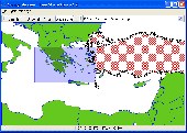
EasyLoader is a Windows-only utility available from Pitney Bowes Mapinfo Corporation that allows you to upload Mapinfo .tab files to a remote database.If using this release of the EasyLoader v10.0 MBX via the Tools menu in Mapinfo Professional, it will require Mapinfo Professional v10.0.
Category: Multimedia & Design / Multimedia App's
Publisher: Pitney Bowes Software Inc., License: Freeware, Price: USD $0.00, File Size: 1.8 MB
Platform: Windows
The Mapinfo License Server must be installed on your network and be accessible to all Mapinfo Professional users. Mapinfo Professional is a powerful Microsoft Windows-based mapping and geographic analysis application from the experts in location intelligence. Designed to easily visualize the relationships between data and geography, Mapinfo Professional helps...
Category: Home & Education / Miscellaneous
Publisher: Pitney Bowes MapInfo, License: Freeware, Price: USD $0.00, File Size: 12.1 MB
Platform: Windows
Mapinfo ProViewer™ lets you share location intelligence with clients and co-workers, even if they do not have Mapinfo Professional. ProViewer allows anyone to open, view and manipulate your Mapinfo Professional maps, tables and analyses with easy-to-use functionality including print, zoom, scroll, select objects, measure distances and view details.
Category: Multimedia & Design / Graphics Viewers
Publisher: MapInfo Corporation, License: Freeware, Price: USD $0.00, File Size: 419.6 KB
Platform: Windows
The Mapinfo Line Style Editor works by modifying the file from which Mapinfo reads its line style definitions. MILISTED can open any valid Mapinfo line style definition file, modify it, and save it with any name, however, Mapinfo only experiences the changes when it starts up and reads the mapinfow.pen file it finds in the same directory as mapinfow.exe. You can have...
Category: Multimedia & Design / Digital Media Editors
Publisher: Victor O. Lomtev, License: Freeware, Price: USD $0.00, File Size: 961.7 KB
Platform: Windows
GEScene is a Mapinfo utility that allows images to be exchanged in both directions between Mapinfo and Google Earth. Placemarks can also be created in Google Earth by using Mapinfo as a point of reference to easily pinpoint more obscure locations. Images saved in Google Earth can be registered and displayed in Mapinfo to compliment existing map layers. Conversely,...
Category: Utilities / Misc. Utilities
Publisher: Peter Doyle, License: Freeware, Price: USD $0.00, File Size: 3.2 MB
Platform: Windows
The Geosoft Plug-in for Mapinfo is an extension to the Mapinfo desktop software that provides data retrieval using DAP and also support for reading Geosoft file formats. The plug-in enables users to view Geosoft grid files as a raster layer inside Mapinfo. The plug-in also enables users to view Geosoft Maps as layers.
Category: Home & Education / Miscellaneous
Publisher: GEOSoft, License: Freeware, Price: USD $0.00, File Size: 109.1 MB
Platform: Windows
It`s a FREE ESRI shape files (*.shp), Mapinfo interchange (*.mif) and AutoCAD *.dxf viewer. Using this utility you can view *.shp files (ESRI shape files), *.mif files (Mapinfo interchange) and AutoDesk AutoCAD *.dxf. No other files are needed.
Category: Multimedia & Design
Publisher: Avangardo, License: Freeware, Price: USD $0.00, File Size: 420.9 KB
Platform: Windows
GlobeXplorer's ImageConnect for Mapinfo is a unique extension that instantly brings georeferenced satellite and aerial photos into your desktop or mobile project from our online database. ImageConnect takes away the time, cost and hassle of locating an image provider, waiting for delivery, and managing large image files.
Category: Internet / Misc. Plugins
Publisher: GlobeXplorer, LLC, License: Freeware, Price: USD $0.00, File Size: 2.0 MB
Platform: Windows
GenesisIV understands GIS concepts like layers, shape objects and georeferencing.
GenesisIV understands GIS concepts like layers, shape objects and georeferencing. It interfaces to industry standard GIS systems such as Mapinfo and ArcView so you can use your existing data without having to learn new concepts or perform difficult manipulations.
GenesisIV is the only landscape product designed specifically to help teach geographical concepts. You're up...
Category: Multimedia & Design / Multimedia App's
Publisher: Geomantics, License: Freeware, Price: USD $0.00, File Size: 17.6 MB
Platform: Windows
InterpOSe for Digimap is designed to process the data delivered as part of EDINA's new OS MasterMap service for Academic Organisations within the UK. It handles both the Topography and ITN layers of OS MasterMap for conversion to various file formats, including Shape, TAB, mid/mif and DWG/DXF.
The InterpOSe for Digimap edition can slice OS MasterMap data into tiles, which...
Category: Business & Finance / Business Finance
Publisher: Dotted Eyes, License: Freeware, Price: USD $0.00, File Size: 65.5 MB
Platform: Windows

The free AvisMap Viewer opens most GIS/CAD and raster image file types and most ArcView, ArcExplorer, and Mapinfo projects. Besides just opening and viewing files, the Viewer supports an extensive list of features including visual layer properties control, legend control, thematic mapping, spatial and attribute querying, custom labeling, on-map measurements, hyper-linking, PDF export...
Category: Software Development / Components & Libraries
Publisher: AvisMap GIS Technologies, License: Freeware, Price: USD $0.00, File Size: 22.3 MB
Platform: Windows
Chips, the Copenhagen Image Processing System, is a general-purpose software package for remote sensing image processing and spatial data analysis with extensive support for NOAA AVHRR data.
Chips can be used both as a stand-alone system, as well as a powerful supplemental image-processing tool for GIS products like Mapinfo™ and ArcView™.
Category: Multimedia & Design / Multimedia App's
Publisher: Chips Development Team, License: Freeware, Price: USD $0.00, File Size: 5.9 MB
Platform: Windows
LocalConnect is the included application for converting and uploading Vectors, Images, Maps, and Elevation to GISRoam.
LocalConnect includes tools to automatically convert your source data to GISRoam formats and projections in the following formats:
* Elevation in the form of DTED, DEM, ARCGrid, GEOTIFF, SRTM, XYZ Grid, and BIL.
* Imagery in the form of MRsid, ECW, IMG,...
Category: Internet / File Sharing
Publisher: Cogent3D, License: Freeware, Price: USD $0.00, File Size: 26.4 MB
Platform: Windows
PHOTOMOD GeoMosaic is intended for working with various types of digital images, including aerial and space imagery as well as digitized raster maps.
The program functionality includes:
- Georeferencing of raster images;
- Transforming images from one coordinate system to another, using an extensive database supplied or custom created coordinate systems;
-...
Category: Multimedia & Design / Multimedia App's
Publisher: Racurs, License: Freeware, Price: USD $0.00, File Size: 36.5 MB
Platform: Windows