Free Downloads: Aerial View Map
ORIMA is an LPS add-on providing advanced aerial triangulation and visual analysis tools.
ORIMA is an LPS add-on providing advanced Aerial triangulation and visual analysis tools. The premiere solution for frame, ADS40 and ADS80 sensors, and other digital sensors, ORIMA is proven and robust technology relied on by photogrammetry professionals around the world. Providing a strong set of analysis tools, ORIMA supports production jobs requiring high throughput.
Category: Multimedia & Design / Multimedia App's
Publisher: Leica Geosystems Geospatial Imaging, LLC, License: Shareware, Price: USD $0.00, File Size: 0
Platform: Windows
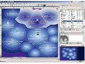
Remere's Map Editor is a map editor for the OpenTibia Project which was created by Remere.
Remere's Map Editor is a Map editor for the OpenTibia Project which was created by Remere.
Remere's Map Editor is a Map editor coded in C to be used with OpenTibia. It supports many advanced features such as autobordering and placing of composite objects. Runs under both Linux and Windows using wxWidgets and OpenGL.
Category: Games / Tools & Editors
Publisher: Remere, License: Shareware, Price: USD $0.00, File Size: 4.2 MB
Platform: Windows
Realistic scenery is all very well, but there really is no substitute for the real thing!
Realistic scenery is all very well, but there really is no substitute for the real thing! Just Flight's VFR Real Scenery is an incredible program that uses the very latest digital Aerial images of the UK to transform Flight Simulator X into the real landscape you can see from the air. We’ve teamed up with Infoterra Ltd, a leader in the provision of Aerial data, for the...
Category: Games / Simulations
Publisher: Just Flight, License: Demo, Price: USD $0.00, File Size: 100.2 MB
Platform: Windows
GenealogMap is an easy-to-use genealogy program with a flexible user interface, visual representations, and publishing and web site creation features. The process of creating a genealogical Map is a visual experience. You simply "draw" the area corresponding to information on your relatives. A wizard-like dialog guides you through the process of gathering the genealogical information...
Category: Home & Education
Publisher: BondarSoft, License: Shareware, Price: USD $25.00, File Size: 2.2 MB
Platform: Windows, Unix
Gismaps Viewer is a GIS viewer that can be used for geospatial analysis and map production.
Gismaps Viewer is a GIS viewer that can be used for geospatial analysis and Map production.
The main features are:
- read Shape files using geographic coordinate system
- View satellite images (MrSid, jpeg, bmp and tiff file formats)
- generate thematic maps, queries and labels
- export do Google Earth KML (shp2kml)
- configure Map...
Category: Multimedia & Design / Graphics Viewers
Publisher: Gismaps Sistemas Ltda., License: Freeware, Price: USD $0.00, File Size: 10.2 MB
Platform: Windows
 Freeware
An interactive Flash USA Map with all the features you need for your web site or project. This is the ideal solution for dealer maps, real-estate listings, or visualizing state statistics. Nearly every aspect of the Map is customizable. However, unlike competing products, our Map is very simple to install and edit. Just upload XML and SWF files and embed.
Category: Internet / Flash Tools
Publisher: http://www.flashusamap.com/trial/flashus, License: Freeware, Price: USD $0.00, File Size: 93.8 KB
Platform: Unknown
PerspecX software helps you create perspective effects on images or text.
PerspecX software helps you create perspective effects on images or text.
Perspective corrections may be made by specifying where any four points on an image should move to when creating a distorted version of the image.
A particular application is to distort an Aerial photograph so that all features exactly match the locations of the same features on a Map.
Category: Multimedia & Design / Digital Media Editors
Publisher: xiberpix, License: Shareware, Price: USD $20.00, File Size: 2.2 MB
Platform: Windows
Map of Africa is one of the many maps created for GPS TrackMaker.
Map of Africa is one of the many maps created for GPS TrackMaker. You are able to download the installation package from the TrackMaker website. In order to preview the contents of this package, you need to install GPS TrackMaker.
Using the above mentioned application, you will be able to see the Map of Africa. Just click on the "Open Temporary...
Category: Home & Education / Miscellaneous
Publisher: Geo Studio Technology, License: Freeware, Price: USD $0.00, File Size: 18.3 MB
Platform: Windows
Plan, Estimate, and Manage Your Static Scanning Project
Features:
- Utilize Aerial imagery from multiple online sources including Bing, Google and Yahoo maps
- Place scan positions using automatic control detection and system range
- Import or create control coordinate network
- Identify three possible scan position times based on traffic...
Category: Business & Finance / Project Management
Publisher: Certainty 3D, License: Freeware, Price: USD $0.00, File Size: 17.6 MB
Platform: Windows
Geosoft Plug-In for ER Viewer enables users to view and use Geosoft grid (.
Geosoft Plug-In for ER Viewer enables users to View and use Geosoft grid (.grd) and Map (.Map) files in the ER Viewer application.
This plug-in use a globe explorer, to find, View, and extract data from a variety of data servers. You can use internal servers as well as public servers including DAP servers, WMS servers, ArcIMS servers, and Tile Servers.
Category: Home & Education / Miscellaneous
Publisher: Geosoft Inc., License: Freeware, Price: USD $0.00, File Size: 50.3 MB
Platform: Windows
New Zealand Map Reference Converter (NZMapConv) is software that LINZ provides to convert Map references between the old NZMS260 Map series and the new NZTopo50 Map series.NZMapConv is a Windows programme designed to convert individual coordinates entered manually.
Category: Multimedia & Design / Media Management
Publisher: Land Information New Zealand, License: Freeware, Price: USD $0.00, File Size: 2.4 MB
Platform: Windows
When the XMAP software is communicating with an XEDE via the comms cable each Map will show, at the top of the Map display, an RPM and load value (x and y axis for the Map) in real time. Also in each Map a yellow highlighted block will show the current position within the Map. Beside the real-time display on each Map are the undo and redo buttons which...
Category: Home & Education / Miscellaneous
Publisher: ChipTorque, License: Freeware, Price: USD $0.00, File Size: 1.7 MB
Platform: Windows
Code Summarizer is a Visual Studio package (Add-In) designed to ease code navigation and code browsing. Code Summarizer is an interactive Map to your C++/C# code. With Code Summarizer you see big picture and details at the same time. You can switch between them without losing context. Code Summarizer allows you to create a logical Map with a collection of code functions from any...
Category: Software Development / Compilers & Interpreters
Publisher: Seinactive Software, License: Shareware, Price: USD $29.99, File Size: 454.0 KB
Platform: Windows
Sig Panama Has :
Digital maps of Panama, Digital Map of Panama-City, digital Map of Taboga, digital Map of Bocas del Toro, digital Map of Colon and Free Zone, digital Map of Contadora Island, digital Map of Coronado, Panama, Zona Libre, Map of Panama, Map of Panama City, Map of Colon, Map of Zona Libre, Map of...
Category: Internet / Misc. Plugins
Publisher: DP Imperial, LLC., License: Freeware, Price: USD $0.00, File Size: 44.9 MB
Platform: Windows
CitySurfGlobe is an application that allows users to view places on Earth in 3D mode.
CitySurfGlobe is an application that allows users to View places on Earth in 3D mode. It provides quick navigation tools for the identification of specific points of interest on the Map.
The application stands as a good touristic guide, as it allows users to access a great amount of information about cities, buildings, parks, means of transport, etc. from specific...
Category: Home & Education / Miscellaneous
Publisher: PiriReis Bilisim Teknolojileri LTD.STI., License: Freeware, Price: USD $0.00, File Size: 11.4 MB
Platform: Windows
Moagu: The Mother Of All GPS Utilities.
Moagu: The Mother Of All GPS Utilities.
You can convert USGS topographic maps, Aerial/satellite imagery, and any other raster Map imagery for use on Garmin handled GPS units.
Garmin maps have been in a "vector" format; Moagu creates maps using a "bitmap" format.
Category: Home & Education / Miscellaneous
Publisher: Moagu, License: Shareware, Price: USD $19.95, File Size: 38.2 MB
Platform: Windows
The POI Warner (GoPal 5 or 6-Edition) allows the user to display POI in 2D and 3D Map View and provides acoustic and visual alerts for any given Points-of-Interest. The POI-Warner for GoPal 5/6 is an add-on that enhances your navigation system with essential features. The POI-Warner warns the user acoustically and visually of POI. It is also possible to integrate a large variety...
Category: Multimedia & Design / Multimedia App's
Publisher: navigating GmbH, License: Shareware, Price: USD $39.00, File Size: 3.2 MB
Platform: Windows
Digital Mapping! A simple move of the mouse pointer gives you a "bird's eye View" of your cemetery, letting you see who is buried next to whom or if there is an available grave next to a specific person. Easy to use. You probably won't need the documentation! Capable of keeping up with annual lawn care dues and printing invoices. Allows for monthly payments of graves. You can print...
Category: Business & Finance
Publisher: Eaglesoar Software, License: Shareware, Price: USD $1790.00, File Size: 4.5 MB
Platform: Windows
WolfPack software is for educational use.
WolfPack software is for educational use. It includes:
-Wolfpack.exe: The executable program.
-Wolfpack.chm: A compiled help file
-30 sample data files located in the Elementary Surveying subdirectory of My Documents
-6 digital Aerial photo files in three resolutions: Only one resolution (low, medium, high) can be loaded with one installation of the software. This...
Category: Home & Education / Miscellaneous
Publisher: Elementary Surveying, License: Freeware, Price: USD $0.00, File Size: 102.8 MB
Platform: Windows
MAPC2MAPC is a program to manipulate digital maps,it loads Map images and calibrate them,loads calibrations in many different formats and Datums,View the calibrated Map,crop and rescale maps whilst preserving the calibration,reproject maps to 'Plate Carre' (Equirectangular),rotate maps to true North.
Category: Multimedia & Design / Digital Media Editors
Publisher: Thorn, License: Shareware, Price: USD $0.00, File Size: 1.6 MB
Platform: Windows
With HD View, you can view and interact with very large images on the Web.
With HD View, you can View and interact with very large images on the Web. HD View supports smooth panning and zooming, as well as appropriate viewing perspectives as you zoom in and out. HD View also makes creating and hosting your own HD View images easy. HD View is available as a plug-in for Windows-based browsers.Recent advances in camera and sensor...
Category: Audio / Utilities & Plug-Ins
Publisher: Microsoft Research, License: Freeware, Price: USD $0.00, File Size: 1.2 MB
Platform: Windows
Time Zones Map is the flash world time Map featuring the time peculiarities of more then 50 cities all over the world. Its eye-catching but still pleasant design, varied functions and multiple application abilities combine everything the ultra-modern flash world time Map must have. You can put our Time Zone Map either on one of your website?s pages or put a banner,...
Category: Web Authoring / Flash Utilities
Publisher: USFlashMap.com, License: Shareware, Price: USD $249.00, File Size: 45.0 KB
Platform: Windows, Mac, Linux, Unix, MS-DOS, AS, 400
ArcGIS for AutoCAD is a free, downloadable plug-in application for AutoCAD that provides improved interoperability between AutoCAD and ArcGIS. Within the AutoCAD environment, you gain easy access to enterprise GIS maps hosted by ArcGIS Server.
In addition, ArcGIS for AutoCAD gives you the ability to prepare CAD data for use with the ArcGIS system while leveraging your existing CAD...
Category: Multimedia & Design / Image Editing
Publisher: Environmental Systems Research Institute, Inc., License: Demo, Price: USD $0.00, File Size: 1.4 MB
Platform: Windows
Covering every month of every theatre of World War II, this huge atlas is for wargamers and anyone interested in World War II. It provides a highly interactive and thought-provoking View of the war, and is a great starting point for what-if scenarios. Each Map contains date, movement, unit strengths and other military details.
From the world overview you can cycle...
Category: Home & Education / Miscellaneous
Publisher: ProFantasy Software, License: Shareware, Price: USD $27.95, File Size: 57.0 MB
Platform: Windows
Now you can plan and organize trips with MapSource, a very useful computer software.
Now you can plan and organize trips with MapSource, a very useful computer software.
MapSource is included with the purchase of a Garmin Map on DVD or CD. With MapSource, you can:
- Back up important trip data separately from your Garmin device.
- Plan routes from the convenience of your computer instead of on your device.
- Create, View, and edit...
Category: Business & Finance / Database Management
Publisher: Garmin Ltd or its subsidiaries, License: Shareware, Price: USD $0.00, File Size: 54.4 MB
Platform: Windows