Free Downloads: Area Calculator Excel Gps Coordinates
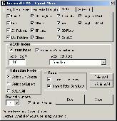
The Surface Area Calculator is a tool for easily calculating surface and planimetric areas, as well as volumes.
The extent and shape of the Area in question are given in terms of the Coordinates of a number of points throughout the Area.
These Coordinates can be specified as either latitude, longitude, and height, as Gps...
Category: Business & Finance / Calculators
Publisher: Microsearch Corp, License: Shareware, Price: USD $134.00, File Size: 1.2 MB
Platform: Windows
- Plot regular and parametric equations.
- Plot regular and parametric equations.
- Plot Coordinates tables.
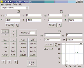
Graphing Calculator 3D is an easy-to-use tool that plots 2D and 3D functions.
Graphing Calculator 3D features :
- Instant quick plotting after each key stroke.
- Cartesian/Polar Coordinates in 2D.
- Cart/Cylindrical/Spherical Coordinates in 3D.
-...
Category: Home & Education / Mathematics
Publisher: Runiter Company, License: Shareware, Price: USD $49.95, File Size: 4.3 MB
Platform: Windows
 Shareware
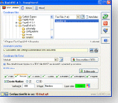
The Eye4Software Coordinate Calculator is an easy to use tool to perform map or Gps coordinate conversions. The software can be used to transform a single coordinate or a batch of Coordinates read from a comma separated, database or ESRI shapefiles. The software is shipped with a MS Access database file, containing more then 3500 ellipsoid, map datum and map grid...
Category: Business & Finance / Calculators
Publisher: Eye4Software B.V., License: Shareware, Price: USD $49.00, EUR39, File Size: 3.2 MB
Platform: Windows

InnerSoft CAD is a add-on for AutoCAD. This group of tools will allows you to: Export to a Excel Sheet the values of Area/Length property or Coordinates for various AutoCAD entities. Import from a Excel Sheet the vertex Coordinates for a set of 2D polylines or 3D polylines (you can choose between 3 different methods). You can also import a set of points from...
Category: Multimedia & Design
Publisher: InnerSoft, License: Demo, Price: USD $100.00, File Size: 444.0 KB
Platform: Windows

InnerSoft CAD is a add-on for AutoCAD. This group of tools will allows you to: Export to a Excel Sheet the values of Area/Length property or Coordinates for various AutoCAD entities. Import from a Excel Sheet the vertex Coordinates for a set of 2D polylines or 3D polylines (you can choose between 3 different methods). You can also import a set of points from...
Category: Multimedia & Design
Publisher: InnerSoft, License: Demo, Price: USD $100.00, File Size: 430.9 KB
Platform: Windows
InnerSoft CAD is a add-on for AutoCAD. This group of tools will allows you to: Export to a Excel Sheet the values of Area/Length property or Coordinates for various AutoCAD entities. Import from a Excel Sheet the vertex Coordinates for a set of 2D polylines or 3D polylines (you can choose between 3 different methods). You can also import a set of points from...
Category: Multimedia & Design
Publisher: InnerSoft, License: Demo, Price: USD $100.00, File Size: 444.0 KB
Platform: Windows
The OSTN02 extension for ArcPad is a FREE tool that automatically transforms Gps data and aligns it with Ordnance Survey (OS) background map. This easy-to-use extension removes the need to manually post-process Gps data by providing’ on the fly’ transformation of WGS84 latitude and longitude into OSTN02 corrected British National Grid coordinate. Data capture using...
Category: Home & Education / Miscellaneous
Publisher: ESRI (UK) Ltd, License: Freeware, Price: USD $0.00, File Size: 8.0 MB
Platform: Windows
The fast track to GPS success.
The fast track to Gps success. The Linx MDEV-Gps-SR contains everything needed to rapidly evaluate the SR Series Gps modules and implement them in record time. This all-inclusive Master Development System features a pre-assembled development board with an on-board OLED display for standalone testing. The system can also be attached to a PC via USB and operated using the...
Category: Software Development / Misc. Programming
Publisher: Linx Technologies, Inc., License: Freeware, Price: USD $0.00, File Size: 98.5 MB
Platform: Windows
Freeware
With this tool you can add Gps Coordinates to vCards - elektronic business cards - that you have previously exported from e. g. Microsoft Outlook. Therefore the tool uses the address data contained within the vCards and adds the exact Gps position on that basis to the vCard. This way you can use these vCards for example in compatible car navigation systems. Among...
Category: Home & Education / Home Inventory
Publisher: AB-Tools.com, License: Freeware, Price: USD $0.00, File Size: 1.9 MB
Platform: Windows
Calc 3D is a collection of mathematical tools for highschool and university. The Calculator can do statistics, best fits, function plotting, integration. It handles vectors, matrices, complex numbers, Coordinates, regular polygons and intersections. For objects ( like point, line, plane and sphere) distances and intersections are calculated. Cartesian, spherical and cylindrical...
Category: Home & Education
Publisher: Greuer Andreas, License: Freeware, Price: USD $0.00, File Size: 4.1 MB
Platform: Windows
InnerSoft CAD is a add-on component for AutoCAD that allows you to Export the values of an Area/ Length property or Coordinates to an Excel Sheet.
Take measurements on AutoCAD for construction project budgets.
Create, open or save different libraries, which contain a series of AutoCAD drawings (*.dxf or *.dwg) organized by books.
Category: Multimedia & Design / Image Editing
Publisher: InnerSoft, License: Shareware, Price: USD $70.00, File Size: 2.9 MB
Platform: Windows
Freeware
GPS Converter will convert GPS coordinates between three different formats: 34. 26965, -116.
76783; N 34° 16. 179', W 116° 46. 07'; and N 34° 16' 10.
Category: Home & Education / Sports
Publisher: ALMSys, Inc., License: Freeware, Price: USD $0.00, File Size: 929.9 KB
Platform: Windows
InnerSoft CAD is a add-on for AutoCAD.
InnerSoft CAD is a add-on for AutoCAD. This group of tools will allows you to: Export to a Excel Sheet the values of Area/Length property or Coordinates for various AutoCAD entities. Import from a Excel Sheet the vertex Coordinates for a set of 2D polylines or 3D polylines (you can choose between 3 different methods). You can also import a set of points from...
Category: Multimedia & Design / Multimedia App's
Publisher: InnerSoft, License: Demo, Price: USD $100.00, File Size: 443.0 KB
Platform: Windows
InnerSoft CAD is a add-on for AutoCAD.
InnerSoft CAD is a add-on for AutoCAD. This group of tools will allows you to: Export to a Excel Sheet the values of Area/Length property or Coordinates for various AutoCAD entities. Import from a Excel Sheet the vertex Coordinates for a set of 2D polylines or 3D polylines (you can choose between 3 different methods). You can also import a set of points from...
Category: Multimedia & Design / Multimedia App's
Publisher: InnerSoft, License: Demo, Price: USD $100.00, File Size: 430.0 KB
Platform: Windows
InnerSoft CAD is a add-on for AutoCAD.
InnerSoft CAD is a add-on for AutoCAD. This group of tools will allows you to: Export to a Excel Sheet the values of Area/Length property or Coordinates for various AutoCAD entities. Import from a Excel Sheet the vertex Coordinates for a set of 2D polylines or 3D polylines (you can choose between 3 different methods). You can also import a set of points from...
Category: Multimedia & Design / Multimedia App's
Publisher: InnerSoft, License: Demo, Price: USD $100.00, File Size: 443.0 KB
Platform: Windows
The Balloon Browser recognizes and highlights geo-coordinates in web pages.
The Balloon Browser recognizes and highlights geo-Coordinates in web pages. Hovering over a recognized location advises another application to show a map of the corresponding Area. For now the only program Balloon Browser can interact with is Google Earth.
Instead of waiting for the one true geo-notation and markup standard, Balloon Browser tries to parse a variety of...
Category: Internet / Browsers
Publisher: Michael Krause, License: Freeware, Price: USD $0.00, File Size: 5.6 MB
Platform: Windows
Spicy ZIP Calculator allows you to locate all the existing ZIP Codes within a specific radius Area in the US. Just enter the ZIP Code and radius Area number (e.g. 30 miles/kilometers), and this application will provide you a complete list of the ZIP Codes and Cities in the entered Area. Spicy ZIP Calculator also measures the distance between two cities/ZIP...
Category: Business & Finance / Calculators
Publisher: SpicyandFree.com, License: Freeware, Price: USD $0.00, File Size: 11.9 MB
Platform: Windows
The Gps Detector software is used to update the Gps detector's database , updating maps , routes and camera locations . The device itself is based on pre-installed Gps Coordinates, the device can indicate various road hazards like: Fixed cameras, Red light speed cameras and bus lane cameras, Usual speed measurement places and dangerous zones.
Category: Business & Finance / Business Finance
Publisher: Euro Noliker Kft., License: Freeware, Price: USD $0.00, File Size: 5.5 MB
Platform: Windows
RapidDXF reads ASCII (text) or XLS (Microsoft Excel) files of Coordinates and creates DXF (version 12) files of points and thier attributes. The DXF files so created are usable in many CAD software. RapidDXF can process several files at a time and lets you choose your file format and can create 2D or 3D files.
Category: Multimedia & Design
Publisher: DeliCAD, License: Shareware, Price: USD $54.95, File Size: 1.1 MB
Platform: Windows
FlashPoints is a tool for creating and managing points Groups (topographic points for example). FlashPoints allows you to : * import/export points Coordinates from and to a file * create points and their attributes "Number", "Elevation" and "Description" by clicking * modify the points elevation * modify the height and rotation of the attributes * create...
Category: Multimedia & Design
Publisher: DeliCAD, License: Shareware, Price: USD $49.00, File Size: 1.2 MB
Platform: Windows
Demo
DXF Works is an application that allows to extract Coordinates and other various data from DXF files. You can choose which entities to process and which data to extract, creating your own file format. DXF Works can process several files at one time and lets save your settings in reusable configuration files. DXF Works can be used for several purposes : extracting Coordinates,...
Category: Multimedia & Design / Graphics Viewers
Publisher: DeliCAD, License: Demo, Price: USD $49.00, EUR49, File Size: 783.4 KB
Platform: Windows
Gps Software for Garmin. Download waypoints, routes and tracks from Garmin Gps. Upload waypoints, routes and tracks to Garmin Gps. Excel and Text files supported! This software is very easy to use!
Category: Utilities / System Utilities
Publisher: Oy Frontbase Ltd, License: Shareware, Price: USD $29.95, File Size: 1.4 MB
Platform: Windows
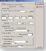
The Wage Calculator allows you to define roster schedules and will automatically calculate associated wage costs by staff, Area, and Department for each day, and the week. It uses a base wage and up to six additional wage loadings to determine the wage structure. Wage classifications, and staff can be freely added. The roster format is by Department and Area, with two staff...
Category: Business & Finance / Applications
Publisher: David Morcom, License: Shareware, Price: USD $57.00, File Size: 204.0 KB
Platform: Unknown
GPS Sway is a simple coordinate conversion program.
Gps Sway is a simple coordinate conversion program. It handles all forms of latitude and longitude (degrees, degrees minutes, degrees minutes seconds) as well as UTM Coordinates and will convert from any form to another. It also handles signs or character direction.
Category: Multimedia & Design / Media Management
Publisher: GPSFileDepot, License: Freeware, Price: USD $0.00, File Size: 154.2 KB
Platform: Windows