Free Downloads: Argument Maps Software Mac
Live Satellite Maps or Google maps is a web server mapping applications.
Live Satellite Maps or Google Maps is a web server mapping applications.Provides scrolling map images and satellite photos around the earth and even the route between different places.Since 6 October 2005, live satellite Maps is part of local Google.Google live satellite Map provides the ability to zoom in or zoom out to show the map.The user can control the map with your...
Category: Home & Education / Science
Publisher: www.satelliteview-of-my-house.com, License: Freeware, Price: USD $0.00, File Size: 643.0 KB
Platform: Windows
 Shareware
GPS Mapping Software for Windows, Loading topographic Maps, realtime navigation, track recording, manage GPS devices and more. The Software can be used with various map formats including: GeoTiff, BSB Nautical Charts, AutoCad DXF files, ESRI Shapefiles. Using calibration you can also use scanned or downloaded JPG, BMP, GIF, PNG and TIF Maps. The Software can...
Category: Home & Education / Science
Publisher: Eye4Software B.V., License: Shareware, Price: USD $149.00, EUR99, File Size: 11.1 MB
Platform: Windows
CompeGPS is an essential Software to make the most of your GPS. With this PC Software you will be able to download a wide variety of cartography from the internet and also analyse your routes. This Software has been specially designed for free flight and motor flight pilots they use GPS and likes to create and accomplish their own routes and then later on analyse....
Category: Home & Education
Publisher: CompeGPS TEAM S.L., License: Shareware, Price: USD $106.00, File Size: 14.9 MB
Platform: Windows
Shareware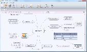
Mind Architect is the mind mapping tool for creating professional looking mind Maps easily. Select from multiple predefined styles, create hyperlinks, embed images, format and style your mind mappings just like you want, even use tables. Export your mind map as PDF, JPG, PNG and more with just one click. MindArchitect is free to be used, if you are editing small or mid sized...
Category: Home & Education
Publisher: Ambiera e.U., License: Shareware, Price: USD $25.00, EUR19, File Size: 2.7 MB
Platform: Windows, Other
Microsoft MapPoint Software gives you the power to turn tabular data into informative Maps to communicate insights with instant impact. You can easily integrate Maps into your Office projects to show your business insights with clarity. Plus, get updated Maps of the US and Canada, with trip routing, turn-by-turn directions, and the ability to share routes with your...
Category: Business & Finance / MS Office Addons
Publisher: Microsoft, License: Shareware, Price: USD $0.00, File Size: 0
Platform: Windows
Test authoring mathematics Software offers 48632 trigonometric equations from basic to advanced, with solutions and easy-to-use authoring options. Considered are all trigonometric and arc-trigonometric functions. A variety of solution methods is applied, including universal substitution, formulas of product and addition of trigonometric functions, power reduction, multiple...
Category: Home & Education / Miscellaneous
Publisher: EMTeachline Software, License: Commercial, Price: USD $0.00, File Size: 4.1 MB
Platform: Windows
Region Map Generator is a tool to make region map with self-definition color. The original Maps in the Software are blank political region ones for different countries or areas. You can color any region with whatever color as you like. By this Software, you can easily make lively Maps. These Maps can be used as data analysis charts, teaching materials,...
Category: Business & Finance / Applications
Publisher: cciyy, License: Shareware, Price: USD $36.95, File Size: 1.3 MB
Platform: Windows
Nokia Maps 3D browser plugin is a free mapping product and service by Nokia for its mobile phones and for internet browsers. Nokia Maps includes voice guided navigation for both pedestrians and drivers for 74 countries in 46 different languages and there are Maps for over 180 countries.
See the world in high-resolution 3D. Everything from the sky to the street. Plan...
Category: Internet / Browser Accessories
Publisher: Nokia, License: Freeware, Price: USD $0.00, File Size: 9.8 MB
Platform: Windows
Freeware
Free standalone Software DataPult Desktop creates heat Maps from your data quickly and efficiently. Key features: Direct data import from MS Excel with one click. The ability to create animated Maps of data over several years. Interactive Maps and diagrams. 39 map colorings for making heat Maps. Intelligent identification of...
Category: Business & Finance / MS Office Addons
Publisher: DataPult, License: Freeware, Price: USD $0.00, File Size: 21.0 MB
Platform: Windows
From the Sacre Coeur to the Arc de Triomphe, your holiday to Paris starts from the moment you open your guide, plus you get Paris Maps and transport Maps.
Discover the best cafe terraces, unmissable museums and galleries, loveliest parks and gardens, best areas to shop or browse, unforgettable shows and live music venues, most fun places for children, and best restaurants to...
Category: Internet / Communications
Publisher: Mobile Systems, License: Shareware, Price: USD $9.80, File Size: 0
Platform: Windows
When you are looking for a powerful tool to satisfy various needs regarding vectors, raster and satellite imagery, you will find ILWIS Academic an efficient application. The program comes with such useful features as points to create Maps, lines for segment Maps, closed area segments for polygon Maps, spatial operations for raster Maps and so on. Whilst using images...
Category: Home & Education / Miscellaneous
Publisher: ITC, License: Freeware, Price: USD $0.00, File Size: 19.4 MB
Platform: Unknown
GDS Images and Document Maps is a unique document search utility.
GDS Images and Document Maps is a unique document search utility. GDS Images and Document Maps is a rather unique application that will enable you to store all your documents and images alongside other important files and folders right on your desktop so that you can use it straight from there, without the need to bother around with looking with looking for every single file...
Category: Utilities / Misc. Utilities
Publisher: toggle, License: Freeware, Price: USD $0.00, File Size: 558.8 KB
Platform: Windows
CompeGPS is an essential Software to make the most of your GPS. With this PC Software you will be able to download a wide variety of cartography from the internet and also analyse your routes. This Software has been specially designed for 4x4 lovers, bike tourists, excursionists and, in general, everyone who uses GPS, likes to create and accomplish their own routes and...
Category: Home & Education
Publisher: CompeGPS TEAM S.L., License: Shareware, Price: USD $106.00, File Size: 14.9 MB
Platform: Windows
CacheMaps retreives a variety of maps for your caches from the Internet.
CacheMaps retreives a variety of Maps for your caches from the Internet.
CacheMaps uses the Geocaching loc- or gpx-files as input. Directely from the Geocaching site or as exported from GSAK.CacheMaps v4 has been designed to be used next to GSAK. A lot of the functionality that was available in previous versions of CacheMaps, is available in GSAK now in a much better form. What...
Category: Audio / Utilities & Plug-Ins
Publisher: BigBird Productions, License: Freeware, Price: USD $0.00, File Size: 153.2 KB
Platform: Windows
Aerial, topograhpic, and other types of Maps are an important resource in the visualization of your information. HuntSmart big game hunting Software gives you the ability to view your information on Maps. Once you enter information with coordinates into the system, this information can be viewed on all available Maps that contain those coordinates. One thing to...
Category: Multimedia & Design / Multimedia App's
Publisher: HuntingSouth, License: Shareware, Price: USD $0.00, File Size: 17.1 MB
Platform: Windows
The question for us to settle now,?
The question for us to settle now,? said Sealy, ?for it is no usewasting time in Argument, is what individuals are there in thedifferent localities that can be made tools of for our purpose?The best course, I think, to pursue is that suggested by Ginsling;that is, to make a canvass of the different localities, and seewho can be influenced ?The question for us to settle now,? said Sealy,...
Category: Home & Education / Genealogy
Publisher: goresource.info, License: Freeware, Price: USD $0.00, File Size: 532.5 KB
Platform: Windows
MAPC2MAPC is a program to manipulate digital Maps,it loads map images and calibrate them,loads calibrations in many different formats and Datums,view the calibrated map,crop and rescale Maps whilst preserving the calibration,reproject Maps to 'Plate Carre' (Equirectangular),rotate Maps to true North.
Category: Multimedia & Design / Digital Media Editors
Publisher: Thorn, License: Shareware, Price: USD $0.00, File Size: 1.6 MB
Platform: Windows
Create GPS enabled geo Maps directly on the background of aereal photos and road Maps from the internet. Import geodata from Google-Earth, OpenStreetMap, GPS tracks and GPS logger. Map editor , manually digitizing. Specifical graphical objects (borderlines, borderareas) to guarantee exact same borders of neighbour areas..Screen calibration for true to display on the screnn.
Category: Multimedia & Design / Digital Media Editors
Publisher: GPSur Dr. Erhard Regener, License: Shareware, Price: USD $65.00, File Size: 6.4 MB
Platform: Windows
This is a product which can be found most useful by scientists, engineers, professors, and students.
This is a product which can be found most useful by scientists, engineers, professors, and students. Scientific Calculator Precision 63 works on Windows 98, Windows ME, Windows 2000, Windows Server 2003, Windows XP and Vista. This calculator follows classical approach when uncertainty of f(x) calculation is estimated by formula max|(derivative(f))|*|x*uncertainty(x)|, where maximum of function...
Category: Home & Education / Mathematics
Publisher: Tvalx, License: Shareware, Price: USD $25.00, File Size: 1.3 MB
Platform: Windows
Terrain Tools - Create maps quickly and easily!
Terrain Tools - Create Maps quickly and easily!
Terrain Tools is the ideal tool for outdoor recreationists, real-estate professionals, farmers, ecologists, archaeologists and others who need to create basic Maps, calculate areas, lengths, bearings and distances.
Overlay GPS tracks on scanned images such as USGS or Canadian NTS topos. Import and export...
Category: Business & Finance / Applications
Publisher: Softree, License: Shareware, Price: USD $124.00, File Size: 15.0 MB
Platform: Windows
Shareware
Offline Map Maker is a tool that help you to get offline tile images from Google Maps, Openstreetmap, Yandex Maps, Yahoo Maps, Mapquest, Gaode map, Tencent Maps, Baidu Maps, Tianditu, Arcgis Online, OneMap, Whereis, mapy.cz, Mappy, Waze, Sentinel-2 map, Strava Gloabal Heatmap, Wikimapia, GoMap.Az, Longdo Map, Bhuvan, National Map Australia, New Zealand...
Category: Internet / Download Managers
Publisher: allmapsoft.com, License: Shareware, Price: USD $79.00, File Size: 31.1 MB
Platform: Windows
With MapAuthor you can create, print and save desktop Maps, using data that you obtain from commercial sources or perhaps your in-hous GIS department as shapefiles (shapefiles are a very common GIS exchange format.) You can also produce internet-based Maps based on Google Maps, for use on your web site.
MapAuthor allows you to link your own data to Maps, for...
Category: Internet / Misc. Plugins
Publisher: MapAuthor.com, License: Freeware, Price: USD $0.00, File Size: 6.3 MB
Platform: Windows
College Scientific Calculator 27 for Windows 98, Windows ME, Windows 2000, Windows Server 2003, Windows XP and Vista.
This is a product which can be found most useful by scientists, engineers, professors, and students.
The pi becomes for them a “floating” number with arbitrary precision. It seems strange, because 2*pi corresponds to one rotation and counting rotations...
Category: Home & Education / Teaching Tools
Publisher: Tvalx, License: Shareware, Price: USD $11.00, File Size: 1.3 MB
Platform: Windows
Download, View, and Print Maps with the MrSID Viewer.
Download, View, and Print Maps with the MrSID Viewer.
To download and view Maps offline you need a special viewer. Maps are stored in MrSID format. The MRSID Viewer is a freeware tool. This library provides access to the MrSID viewer developed by LizardTech.
NOTE:
LizardTech dropped the link for that stand-alone viewer download from...
Category: Multimedia & Design / Graphics Viewers
Publisher: Lizardtech, License: Freeware, Price: USD $0.00, File Size: 2.0 MB
Platform: Windows
PowerMapper allows information architects, usability analysts and web developers to create graphical site Maps with one click, providing site visualization and simple navigation. Maps show thumbnails of web pages and can be tailored using 11 different styles then printed or copied into another application. Key Features: Mapping - create Maps of any site on the World...
Category: Internet
Publisher: Electrum, License: Shareware, Price: USD $349.00, File Size: 1.3 MB
Platform: Windows