Free Downloads: Convert Geotiff
 Shareware
GPS Mapping Software for Windows, Loading topographic maps, manage GPS devices and more. The software can be used with various map formats including: Geotiff, BSB Nautical Charts, AutoCad DXF files, ESRI Shapefiles. Using calibration you can also use scanned or downloaded JPG, BMP, GIF, PNG and TIF maps. The software can be used for survey, research, track and trace, real time...
Category: Home & Education / Science
Publisher: Eye4Software B.V., License: Shareware, Price: USD $75.04, EUR49, File Size: 6.7 MB
Platform: Windows
LocalConnect is the included application for converting and uploading Vectors, Images, Maps, and Elevation to GISRoam.
LocalConnect includes tools to automatically Convert your source data to GISRoam formats and projections in the following formats:
* Elevation in the form of DTED, DEM, ARCGrid, Geotiff, SRTM, XYZ Grid, and BIL.
* Imagery in the form of MRsid,...
Category: Internet / File Sharing
Publisher: Cogent3D, License: Freeware, Price: USD $0.00, File Size: 26.4 MB
Platform: Windows
Thuban is an Interactive Geographic Data Viewer with the following features:
- Vector Data Support: Shapefile, PostGIS Layer and OGR
- Raster Data Support: Geotiff Layer and GDAL
- Comfortable Map Navigation
- Object Identification and Annotation
- Legend Editor and Classification
- Table Queries and Joins
- Projection Support
- Printing...
Category: Utilities / Misc. Utilities
Publisher: Intevation, License: Shareware, Price: USD $0.00, File Size: 772.9 KB
Platform: Windows
This software can stitch tile images into one big seamless image such as Geotiff and GeoJPEG, provides a task list window of downloading where all tasks can be displayed and a global satellite map viewer in the window.
SuperGet GM supports creating new task visually and multi-task while downloading, but no more than five. Another feature is that when downloading, software will...
Category: Utilities / Launchers
Publisher: Arceyes, License: Shareware, Price: USD $49.95, File Size: 3.4 MB
Platform: Windows
Shareware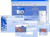
Organize and Sort All your photo collection automatically with Photo Collection Organizer. This digital photos organizer, sorter and renamer will organize, sort and rename all your photos automatically, even if you have and want to organize thousands of photos and they are packed in archives. Key Features: * Organize, sort and rename photos (automatically) - (automatically...
Category: Multimedia & Design / Media Management
Publisher: Photo Collection Organizing, Inc., License: Shareware, Price: USD $39.95, File Size: 11.4 MB
Platform: Windows
Using DIMIN Viewer application you will be able to view images in countless formats, and apply a variety of effects. Dimin Viewer incorporates unique visualization ideas, like Panoramic Photographs Tool and Big Image Navigator. It also features multi language interface to feel yourself at home! Here are some key features of "DIMIN Viewer": · Really cool modern user interface...
Category: Multimedia & Design / Graphics Viewers
Publisher: Dmitry Fedorov, License: Freeware, Price: USD $0.00, File Size: 2.0 MB
Platform: Windows, All
LizardTech GeoViewer is LizardTech's free, standalone application for viewing geospatial imagery, vector overlays, and LiDAR files. LizardTech GeoViewer enables you to combine, view and export visual layers from varied sources, such as local repositories, Express Server catalogs, and WMS and JPIP servers, and provides tools for visualizing LiDAR data in MrSID and LAS formats. LizardTech...
Category: Multimedia & Design / Graphics Viewers
Publisher: Lizardtech, License: Shareware, Price: USD $0.00, File Size: 422.1 KB
Platform: Windows

The free AvisMap Viewer opens most GIS/CAD and raster image file types and most ArcView, ArcExplorer, and MapInfo projects. Besides just opening and viewing files, the Viewer supports an extensive list of features including visual layer properties control, legend control, thematic mapping, spatial and attribute querying, custom labeling, on-map measurements, hyper-linking, PDF export and much...
Category: Software Development / Components & Libraries
Publisher: AvisMap GIS Technologies, License: Freeware, Price: USD $0.00, File Size: 22.3 MB
Platform: Windows
Shareware
GPS Mapping Software for Windows, Loading topographic maps, realtime navigation, track recording, manage GPS devices and more. The software can be used with various map formats including: Geotiff, BSB Nautical Charts, AutoCad DXF files, ESRI Shapefiles. Using calibration you can also use scanned or downloaded JPG, BMP, GIF, PNG and TIF maps. The software can be used for survey, research,...
Category: Home & Education / Science
Publisher: Eye4Software B.V., License: Shareware, Price: USD $149.00, EUR99, File Size: 11.1 MB
Platform: Windows

OkCustomMap is a software to produce Garmin Custom Maps.
OkCustomMap is a software to produce Garmin Custom Maps.
Supports many map formats:
- OkMap
- Ecw
- Geotiff
- World files
- OziExplorer
- GpsTuner
You can customize:
- The quality of the output JPEG images (0=Bad, 100=Good)
- The KML transparency (0=Transparent, 255=Opaque)
- The KML draw order (0=Invisible, 1-49=Under the vectorial data,...
Category: Business & Finance / Applications
Publisher: Gian Paolo Saliola, License: Freeware, Price: USD $0.00, File Size: 3.2 MB
Platform: Windows
LookMOBILE is the latest image-viewing client developed by the IDELIX team for Pocket PC and Windows Mobile handheld devices. It enables users to explore JPEG, bitmap, Geotiff, or TIFF files using IDELIX's patented PDT lens technology. Recognizing that it is difficult to interact with rich, detailed information on small screen devices, the IDELIX team is developing new user interfaces to...
Category: Multimedia & Design / Graphics Viewers
Publisher: IDELIX Software Inc., License: Freeware, Price: USD $0.00, File Size: 29.0 KB
Platform:
Working with raster imagery doesn't have to be complicated.
Working with raster imagery doesn't have to be complicated. Geographic Imager® enhances Adobe Photoshop to make working with spatial imagery quick and efficient. It adds tools to import, edit, manipulate and export geospatial images such as aerial and satellite imagery. Enjoy the use of native Adobe Photoshop functions such as transparencies, filters, pixel editing, and image...
Category: Multimedia & Design / Fonts
Publisher: Avenza Systems Inc., License: Shareware, Price: USD $0.00, File Size: 0
Platform: Windows
The CANVAS 9 GIS Mapping Edition adds native support for Geographic Information System (GIS) data to Canvas. You can take measurements in geographic coordinates, import industry standard SHAPE and Geotiff files into unlimited numbers of automatically aligned overlapping layers and choose among the following options: 2,104 Coordinate Reference Systems 67 Operation Methods (like Mercator,...
Category: Multimedia & Design / Multimedia App's
Publisher: ACD Systems, License: Shareware, Price: USD $549.99, File Size: 51.9 MB
Platform: Mac, PPC
Shareware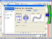
Vextractor is a vectorizer program for transforming raster images into vector formats by building centerlines and outlines. This tool could be used for the vectorizing photo, logotypes and other line art images for use in Vector Graphics Design software. You can also vectorize charts, drawings, maps and schemes for input to CAD or GIS systems. Main features of Vextractor: Input raster...
Category: Multimedia & Design / Image Editing
Publisher: VextraSoft, License: Shareware, Price: USD $99.95, File Size: 3.0 MB
Platform: Windows
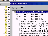
The TIFFProp property sheet shell extension for Microsoft Windows (tm) is a utility for inspecting the contents of TIFF image files. TIFFProp allows the rapid and detailed inspection of many varieties of TIFF files' contents. It integrates intuitively with the shell allowing a few clicks from the file explorer to inspect a TIFF image file. Standard integrated help gives extended explanations...
Category: Utilities
Publisher: Apex Internet Software, License: Shareware, Price: USD $25.00, File Size: 419.8 KB
Platform: Windows
The CANVAS 9 Advanced GIS Mapping Edition adds native support for Geographic Information System (GIS) data to Canvas. You can take measurements in geographic coordinates, import industry standard SHAPE and Geotiff files into unlimited numbers of automatically aligned overlapping layers and choose among the following options:2,104 Coordinate Reference Systems67 Operation Methods (like...
Category: Multimedia & Design / Multimedia App's
Publisher: ACD Systems, License: Shareware, Price: USD $999.95, File Size: 54.2 MB
Platform: Windows
ER Mapper Image Compressor - compressing, mosaicking and color balancing aerial and satellite images to JPEG 2000 and ECW formats makes them manage, share and use in your business activities. ER Mapper Image Compressor is a flexible, high-speed geospatial image data compression application.
Category: Multimedia & Design / Image Editing
Main features:
-ER Mapper Algorithm (.alg)
-ER Mapper Raster Dataset (.ers)
Publisher: Earth Resource Mapping, License: Freeware, Price: USD $0.00, File Size: 33.5 MB
Platform: Windows
Free QT to Zen v Convert, as its name, is free and can be used to convert QT to Zen v.
Free QT to Zen v Convert, as its name, is free and can be used to Convert QT to Zen v. It is a good program for you if you want to Convert QT to Zen v accidently. It can Convert at superfast speed and the converting result is relatively good. The interface is really simple, so it's easy-to-use. You can master it even without any help. It is a professional QT to Zen v...
Category: Audio / Utilities & Plug-Ins
Publisher: soft9.biz Inc., License: Freeware, Price: USD $0.00, File Size: 3.8 MB
Platform: Windows
RM 2 Matroska Free Convert, as its name, is free and can be used to convert RM to Matroska.
RM 2 Matroska Free Convert, as its name, is free and can be used to Convert RM to Matroska. It is a good program for you if you want to Convert RM to Matroska accidently. It can Convert at superfast speed and the converting result is relatively good. The interface is really simple, so it's easy-to-use. You can master it even without any help. It is a professional RM...
Category: Audio / Rippers & Encoders
Publisher: 300aa.com Inc., License: Freeware, Price: USD $0.00, File Size: 3.8 MB
Platform: Windows
The CANVAS 9 Advanced GIS Mapping Edition adds native support for Geographic Information System (GIS) data to Canvas. You can take measurements in geographic coordinates, import industry standard SHAPE and Geotiff files into unlimited numbers of automatically aligned overlapping layers and choose among the following options:·2,104 Coordinate Reference Systems·67 Operation...
Category: Multimedia & Design / Multimedia App's
Publisher: ACD Systems, License: Shareware, Price: USD $999.95, File Size: 51.9 MB
Platform: Mac, PPC

PCHand Free iPad Video Converter is a all-in-one, professional iPad converter freeware.
PCHand Free iPad Video Converter is a all-in-one, professional iPad converter freeware. It free Convert Convert video to ipad video ,Convert video to ipad music, Convert ipad mp4, video to AVI, Convert video to WMV, Convert video to MP4, Convert video to FLV, Convert video to 3GP, Convert video to MPEG, Convert video to MP3,...
Category: Audio / Rippers & Encoders
Publisher: PCHand Software, License: Freeware, Price: USD $0.00, File Size: 13.7 MB
Platform: Windows

PCHand iPhone Video Converter Free is a all-in-one, professional iPhone converter freeware.
PCHand iPhone Video Converter Free is a all-in-one, professional iPhone converter freeware. It free Convert Convert video to iphone video ,Convert video to iphone music, Convert iphone mp4,video to AVI, Convert video to WMV, Convert video to MP4, Convert video to FLV, Convert video to 3GP, Convert video to MPEG, Convert video...
Category: Audio / Rippers & Encoders
Publisher: PCHand Software, License: Freeware, Price: USD $0.00, File Size: 13.7 MB
Platform: Windows
PCHand Free iPod Video Converter is a all-in-one, professional iPod converter freeware.
PCHand Free iPod Video Converter is a all-in-one, professional iPod converter freeware. It free Convert Convert video to ipod video ,Convert video to ipod music, Convert ipod mp4,video to AVI, Convert video to WMV, Convert video to MP4, Convert video to FLV, Convert video to 3GP, Convert video to MPEG, Convert video to MP3,...
Category: Audio / Rippers & Encoders
Publisher: PCHand Software, License: Freeware, Price: USD $0.00, File Size: 13.7 MB
Platform: Windows
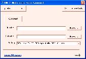
Is it possible to Convert MSG to PST files with all attachments of the emails? Yes, you can easily have .MSG Convert to .PST with attachment using the MSG to PST tool. With this software you can Convert MSG to PST files in batch, just save all messages in a single folder then select the folder using the Add folder button. It provides some of the most exciting features like...
Category: Utilities / File Compression
Publisher: MSG to PST, License: Shareware, Price: USD $49.00, File Size: 7.8 MB
Platform: Windows

PCHand Free Video Converter is a all-in-one, professional video converter freeware.
PCHand Free Video Converter is a all-in-one, professional video converter freeware. It free Convert video to AVI, Convert video to WMV, Convert video to MP4, Convert video to FLV, Convert video to 3GP, Convert video to MPEG, Convert video to MP3, Convert video to AAC, Convert video to AC3 and playback iphone4,iOS 4, iPod, iPhone,...
Category: Audio / Rippers & Encoders
Publisher: PCHand Software, License: Freeware, Price: USD $0.00, File Size: 13.7 MB
Platform: Windows