Free Downloads: Create Vector Maps
 Demo
DemoCreate city Maps that look perfect on screen and on paper. Standard City Icons come in a variety of sizes and resolutions, making city plans perfectly legible on any media from PDA screens to poster-size prints. The smallest size is 16x16, but the largest-resolution versions are in 1200x1200 pixels. Objects of city infrastructure are shown in the isometric projection, allowing for...
Category: Desktop Enhancements / Icon Tools
Publisher: Aha-Soft, License: Demo, Price: USD $99.95, EUR79.95, File Size: 2.7 MB
Platform: Windows, Mac, Linux,
Shareware
Google Maps Terrain Downloader is a tool that can automatically download the google terrain Maps images to your PC. It can download the small tiles and save them to your hard disk. After downloading, you can view the Maps offline by its tool Maps Viewer, or you can combine the small images into one big map image. If you want to make a map of your city by yourself, it...
Category: Internet / Download Managers
Publisher: allmapsoft.com, License: Shareware, Price: USD $29.99, File Size: 305.3 MB
Platform: Windows
Shareware
Google Hybrid Maps Downloader is a tool that can automatically download the google hybrid Maps images to your PC. It can download the small tiles and save them to your hard disk. After downloading, you can view the Maps offline by its tool Maps Viewer, or you can combine the small images into one big map image. If you want to make a map of your city by yourself, it...
Category: Internet / Download Managers
Publisher: allmapsoft.com, License: Shareware, Price: USD $29.99, File Size: 30.6 MB
Platform: Windows

Commercial realtors require accurate and reliable tools to publish available properties online and show them on the website (specifying region, county, state, and city). We have created a unique Interactive Real Estate Map with all USA states and counties on it for real estate business. USA Real Estate Map is a unique and amazing Vector-based tool that is very simple to use. We...
Category: Internet
Publisher: USFlashMap.com, License: Shareware, Price: USD $399.00, File Size: 3.9 MB
Platform: Windows, Mac, Linux, Unix, MS-DOS, AS/400, OS/2
Create online and printed matters of transport infrastructure. Standard Transport Icons are drawn in four angles, come in a variety of sizes and resolutions, and are available as 3D Vector models for clear high-resolution printing. Standard Transport Icons are perfect to illustrate Web sites, brochures and presentations of any transport, logistics or shipping company, and can be...
Category: Desktop Enhancements / Icon Tools
Publisher: Aha-Soft, License: Demo, Price: USD $99.95, EUR79.95, File Size: 7.9 MB
Platform: Windows, Mac, Linux,
![MagicTracer [raster to vector converter] Screenshot](https://media.pcwin.com/images/thumbs/magictracer__raster_to_vector_converter_-350795.gif)
MagicTracer is a raster to vector conversion software for the Windows platform.
MagicTracer is a raster to Vector conversion software for the Windows platform. MagicTracer can turn raster (bitmap) images into Vector linework. With both raster and Vector tools, it is a versatile utility for image processing and Vector cleanup. The Vector convert tool guides you through the threshold and edge detection processes so better results can be...
Category: Multimedia & Design / Multimedia App's
Publisher: Elgorithms, License: Demo, Price: USD $59.95, File Size: 9.7 MB
Platform: Windows
Rationale is the first high-quality "argument processing" software.
Rationale is the first high-quality "argument processing" software. Use Rationale to Create "argument Maps", diagrams of reasoning and argument. Rationale will help students learn the fundamentals of good reasoning, critical thinking, and argumentative essay writing. Three Map Types. Use Grouping, Reasoning, or Analysis Maps depending on the thinking...
Category: Home & Education
Publisher: Austhink Software, License: Demo, Price: USD $59.95, File Size: 7.8 MB
Platform: Windows
PowerMapper allows information architects, usability analysts and web developers to Create graphical site Maps with one click, providing site visualization and simple navigation. Maps show thumbnails of web pages and can be tailored using 11 different styles then printed or copied into another application. Key Features: Mapping - Create Maps of any site...
Category: Internet
Publisher: Electrum, License: Shareware, Price: USD $349.00, File Size: 1.3 MB
Platform: Windows
With SMART Ideas, you can Create multilevel concept Maps that take students through concepts one step at a time for greater clarity. And you can easily convert the Maps into a multipage website for everyone to share.
A bank of colorful and descriptive graphics helps teachers break down information in highly visual ways so students can understand each element of...
Category: Home & Education / Teaching Tools
Publisher: SMART Technologies Inc., License: Shareware, Price: USD $59.00, File Size: 39.5 MB
Platform: Windows
A MATLAB toolbox for simulating the movement of the iRobot Create.
A MATLAB toolbox for simulating the movement of the iRobot Create. Contains multiple GUIs for creating Maps and other input, showing the movement of the Create, and replaying a previously saved session.
-Function output variables in the control program will be saved to the workspace (no need for "global datastore).
-Sonar returns the maximum range...
Category: Utilities / Misc. Utilities
Publisher: Create MATLAB Simulator, License: Shareware, Price: USD $0.00, File Size: 1.5 MB
Platform: Windows
MapCreator combines a cartography and a graphics programme.
MapCreator combines a cartography and a graphics programme. The software is designed to Create Maps and animated Maps of the highest quality as often required for presentations. For example, this could be Maps needed for a travel presentation. But also in
Category: Multimedia & Design
Publisher: primap.com, License: Freeware, Price: USD $0.00, File Size: 103.3 MB
Platform: Windows, Vista
think! Bubble Maps is a Windows tool for creating bubble Maps and capturing your thought. Using simple mouse click, drags and typing, your thoughts get put to paper (virtual), quickly and effectively.
The key feature of think! Bubble Maps is speed which makes it an excellent tool for live capture. You can use this program during meetings, workshops, and seminars.
Category: Multimedia & Design / Multimedia App's
Publisher: Lowrie Associates Ltd, License: Shareware, Price: USD $41.90, File Size: 5.9 MB
Platform: Windows
Shareware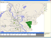
ActualMap is a set of high-performance, .NET mapping components and controls for embedding Maps in desktop (Windows Forms) applications. ActualMap gives you the ability to generate Maps, drill-down capability, thematic mapping, routing, vehicle tracking and other features that will make the Maps fully interactive. Features : Multiple map layers. Dynamic map layers....
Category: Software Development / Components & Libraries
Publisher: VDS Technologies, License: Shareware, Price: USD $799.00, File Size: 8.0 MB
Platform: Windows
PowerMapper allows information architects, usability analysts and web developers to Create graphical site Maps with one click, providing site visualization and simple navigation. Maps show thumbnails of web pages and can be tailored using 7 different styles then printed or copied into another application. Key Features: Mapping - Create Maps of any site...
Category: Internet
Publisher: Electrum, License: Shareware, Price: USD $149.00, File Size: 1.3 MB
Platform: Windows
MapComp is a powerful and free Windows Software for drawing images of linkage Maps and to compare linkage Maps and indicate common markers.
MapInspect can display, print and save images, and has no limit to the number of Maps it can compare (but only neighbouring Maps are compared). Maps can be flipped within MapINspect, an the on-screen order of...
Category: Multimedia & Design / Multimedia App's
Publisher: MapInspect, License: Freeware, Price: USD $0.00, File Size: 616.7 KB
Platform: Windows
With MapAuthor you can Create, print and save desktop Maps, using data that you obtain from commercial sources or perhaps your in-hous GIS department as shapefiles (shapefiles are a very common GIS exchange format.) You can also produce internet-based Maps based on Google Maps, for use on your web site.
MapAuthor allows you to link your own data to...
Category: Internet / Misc. Plugins
Publisher: MapAuthor.com, License: Freeware, Price: USD $0.00, File Size: 6.3 MB
Platform: Windows
TninkGraph is a graphic editor for drawing concept maps.
TninkGraph is a graphic editor for drawing concept Maps. This program contains many interesting and useful features. It provides you with tools to move and design elements. With ThinkGraph you can draw Maps with different layouts: vertical, horizontal, topic Maps; and different styles: boxes, lines, branches. The program saves data in SVG format, so then you can open it in...
Category: Multimedia & Design / Digital Media Editors
Publisher: Michel Kern, License: Freeware, Price: USD $0.00, File Size: 6.3 MB
Platform: Windows
VeryDOC PDF to Vector Converter (PDF2Vector) can be used to batch convert from Acrobat PDF files to other scalable Vector graphics formats, such as EMF, WMF, SVG, Postscript (PS), EPS, SWF (Flash), XPS, HPGL, PCL etc. The software can be run using the handy interface or in batch mode to convert large volumes of PDF files in real-time. VeryDOC PDF to Vector Converter is a...
Category: Business & Finance / Applications
Publisher: verypdf.com Inc, License: Shareware, Price: USD $295.00, File Size: 7.4 MB
Platform: Windows
VeryDOC PDF to Vector Converter (PDF2Vector) can be used to batch convert from Acrobat PDF files to other scalable Vector graphics formats, such as EMF, WMF, SVG, Postscript (PS), EPS, SWF (Flash), XPS, HPGL, PCL etc. The software can be run using the handy interface or in batch mode to convert large volumes of PDF files in real-time. VeryDOC PDF to Vector Converter is a...
Category: Business & Finance / Applications
Publisher: verypdf.com Inc, License: Shareware, Price: USD $1995.00, File Size: 7.4 MB
Platform: Windows
You can use your existing digital (Vector) Maps in Autodesk MapGuide® software by converting them to Spatial Data Files (SDF). SDF is a special data format for delivering large amounts of data quickly over an intranet or the Internet. The SDF Loader is a utility used to Create Spatial Data Files (SDF) and their accompanying Spatial Index Files (SIF) from a variety of...
Category: Multimedia & Design / Multimedia App's
Publisher: Autodesk, Inc., License: Freeware, Price: USD $0.00, File Size: 54.6 MB
Platform: Windows
xGPS Manager is a must-have tool for iPhone owners.
xGPS Manager is a must-have tool for iPhone owners. It is a desktop application that talks nice to iPhone application xGPS, which is a Maps and navigation tool for iPhones. This desktop application allows you to carry out certain tasks that are harder to do on iPhone.
For example, you can manage your Maps in the desktop application and sync them with the iPhone app....
Category: Home & Education / Miscellaneous
Publisher: Xwaves, License: Freeware, Price: USD $0.00, File Size: 4.5 MB
Platform: Windows
When you are looking for a powerful tool to satisfy various needs regarding vectors, raster and satellite imagery, you will find ILWIS Academic an efficient application. The program comes with such useful features as points to Create Maps, lines for segment Maps, closed area segments for polygon Maps, spatial operations for raster Maps and so on. Whilst using...
Category: Home & Education / Miscellaneous
Publisher: ITC, License: Freeware, Price: USD $0.00, File Size: 19.4 MB
Platform: Unknown
CompeGPS is an essential software to make the most of your GPS. With this PC software you will be able to download a wide variety of cartography from the internet and also analyse your routes. This software has been specially designed for free flight and motor flight pilots they use GPS and likes to Create and accomplish their own routes and then later on analyse. CompeGPS allows...
Category: Home & Education
Publisher: CompeGPS TEAM S.L., License: Shareware, Price: USD $106.00, File Size: 14.9 MB
Platform: Windows
HexDraw is an easy to use graphical editor for designing hexagon grid game maps.
HexDraw is an easy to use graphical editor for designing hexagon grid game Maps. With HexDraw you Create playing Maps with up to 200 x 200 hex fields or 67 x 67 inches (170 cm). HexDraw helps you to easily Create different terrain features like roads and hexes in plain colours or textures. (Some textures are included but you may Create your own textures).
Category: Multimedia & Design / Digital Media Editors
Publisher: Joachim Bader Software Manufaktur, License: Shareware, Price: USD $53.95, File Size: 20.4 MB
Platform: Windows
VeryDOC EMF to Vector Converter (EMF2Vector) converts enhanced metafiles (EMF) and Windows metafiles (WMF) to PDF, WMF, EMF, PS (Postscript), EPS, SVG, SWF, XPS, HPGL, PCL etc. Vector formats while preserving the Vector and text information. EMF to Vector Converter is can also convert EMF and WMF files to raster image formats, such as BMP, GIF, JPEG, PNG, TGA, PCX,...
Category: Business & Finance / Applications
Publisher: verypdf.com Inc, License: Shareware, Price: USD $1995.00, File Size: 7.4 MB
Platform: Windows