Free Downloads: Datum
The Geocentric Datum of Australia (GDA) is a coordinate reference system that best fits the shape of the earth as a whole. It has an origin that coincides with the centre of mass of the earth, hence the term 'geocentric'.
The state Datum in Queensland is the Geocentric Datum of Australia 1994 (GDA94) replacing the previously adopted Australian Geodetic...
Category: Home & Education / Miscellaneous
Publisher: Department of Natural Resources and Mines, License: Freeware, Price: USD $0.00, File Size: 7.7 MB
Platform: Windows
 Freeware
Datum Locker assists safe record keeping of account credentials and note taking which are deemed sensitive. Its strength comes from the use of Nullox's linearistic distance cryptographic (LDC) algorithm to securely store your data on disk thereby presenting an intruder with random symbols due to the omittance of a valid key. Datum Locker operates on a timer thus monitoring when...
Category: Security & Privacy / Anti-Spam & Anti-Spy Tools
Publisher: Nullox Software, License: Freeware, Price: USD $0.00, File Size: 522.0 KB
Platform: Windows
This softwareis a program specially designed to convert MapInfo files from the old Australian Geodetic Datum (AGD) to the new Geocentric Datum of Australia (GDA) using the distortion modeling method which is the most accurate method possible. It provides consistency of Australia's mapping Datum with international coordinate systems.
Category: Home & Education / Miscellaneous
Publisher: Peter Meier, License: Shareware, Price: USD $1582.19, File Size: 9.8 MB
Platform: Windows
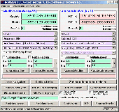
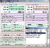
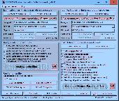
DatumPro is the most comprehensive and accurate co-ordinate conversion package available, handling thousands of coordinate systems, including Gauss Kruger, UTM, and Lambert Conic grids With over 600 Datum conversions and over 450 Grid Projections, and hundreds of specific TM and Lambert conic conformal grids and all the latest EPSG transformations. DatumPro not only converts isolated...
Category: Home & Education / Miscellaneous
Publisher: Geomatix Ltd, License: Shareware, Price: USD $119.00, File Size: 5.6 MB
Platform: Windows
Software from the SeisSoft Company stores its projection and Datum constants in the Windows Registry. A true propeller-head can find these constants in HKEY_CURRENT_USER\Software\SeisSoft. For those
Category: Utilities / System Utilities
Publisher: The SeisSoft Company, License: Freeware, Price: USD $0.00, File Size: 395.5 KB
Platform: Windows
GEOPosCalc is an easy to use and powerfull tool for coordinate systems (grid) and datum conversion.
GEOPosCalc is an easy to use and powerfull tool for coordinate systems (grid) and Datum conversion. It does support more than 200 predefined datums, 20 ellipsoids and 10 coordinate systemsand the ability to define your own datums and ellipsoids.
Category: Home & Education / Science
Publisher: American Outland, License: Shareware, Price: USD $40.00, File Size: 4.7 MB
Platform: Windows
Shareware
Toolkit to add GPS functionality to your software and scripts (GPS SDK). All NMEA0183 protocol versions are supported and can be filtered by NMEA sentence type and talker ID. Information on GPS status can also be retrieved: GPS fix quality, satellites used in fix, satellites in view, satellite azimuth, elevation and signal strengths. The toolkit also offers functionality to perform map grid...
Category: Software Development / ActiveX
Publisher: Eye4Software B.V., License: Shareware, Price: USD $150.81, File Size: 1.6 MB
Platform: Windows
SHPTRANS is a fast, high-precision NTv2 Datum transformation and projection utility which reads and writes shapefiles. SHPTRANS is intended to complement, not replace, existing projection tools such as those within ArcView GIS 3.x and ArcGIS 8.x.SHPTRANS supports the following projections: UTM (tested for North America; intended to support all 60 zones in both hemispheres), MTM 3-degree...
Category: Utilities / Misc. Utilities
Publisher: Bruce Dodson, License: Shareware, Price: USD $0.00, File Size: 335.0 KB
Platform: Windows
Shareware
Java toolkit to add coordinate conversion functionality to your Java applications and applets. The toolkit offers functionality to perform map grid and Datum transformations: latitude and longitude can be converted to various map grids, like Transverse Mercator (TM), Oblique Mercator, Mercator, Oblique Stereographic, Polar Stereographic, Cassini, Albers Equal Area Conal, Gauss Kruger or...
Category: Software Development / Components & Libraries
Publisher: Eye4Software B.V., License: Shareware, Price: USD $199.00, EUR179, File Size: 155.5 KB
Platform: Unknown
Shareware
GPS SDK to add GPS and coordinate conversion functionality to your software and scripts). All NMEA0183 protocol versions are supported and can be filtered by NMEA sentence type and talker ID. Garmin USB PVT support. Information on GPS status can also be retrieved: GPS fix quality, satellites used in fix, satellites in view, satellite azimuth, elevation and signal strengths. The toolkit also...
Category: Software Development
Publisher: Eye4Software B.V., License: Shareware, Price: USD $99.00, EUR79, File Size: 2.3 MB
Platform: Windows
Mechanical Power Tools is a tooling add-on software package which includes a parametric parts library of nuts, bolts, holes, fasteners, etc., along with Datum dimensioning, hole charting, block management, mechanical utilities, plot stamping, and more.
- Efficient, easy to use dialog interface makes setup and creation of fasteners a snap.
- Parametric generation of all...
Category: Software Development / Components & Libraries
Publisher: CAD fx, Inc, License: Shareware, Price: USD $295.00, File Size: 30.7 MB
Platform: Windows
In the Dynamic Link Library GeoDLL geodesic functions like coordinate transformation, Datum changes, meridian strip changes, user defined coordinate and reference systems, distance calculation, maps functions, Digital Elevation Models and more geodesic functions are contained to bind them into own applications. WINDOWS operating system allows building of function libraries intended for...
Category: Software Development
Publisher: Killet Softwareentwicklung GbR, License: Shareware, Price: USD $290.00, File Size: 999.9 KB
Platform: Windows

TRANSDATpro can prove a helpful tool for professionals, providing them with the possibility to perform coordinate transformations fast and easy by use of the coordinate reference systems of their choice. TRANSDATpro performs Coordinate Transformations fast and with high accuracy. The coordinate conversion software supports worldwide thousands of Coordinate Systems, geodetic Reference Systems...
Category: Home & Education / Science
Publisher: Killet GeoSoftware Ing.-GbR, License: Shareware, Price: USD $270.00, EUR240, File Size: 5.3 MB
Platform: Windows
SEVENPAR is a tool for the calculation of highly exact transformation parameters for the Spatial Helmert and Molodensky Transformation, which make possible precise coordinate transformations from one reference system into another. The determined transformation parameters can be entered directly into suitable transformation software, e.g. TRANSDAT Coordinate Transformations, or into the...
Category: Home & Education / Science
Publisher: Killet GeoSoftware Ing.-GbR, License: Shareware, Price: USD $285.00, EUR240, File Size: 7.6 MB
Platform: Windows
ORTWIN is a program for the state-wide inquiry of the localities, postal codes and telephone selections in Germany. It finds postal zip codes, telephone pre selections, coordinates and ground level elevations. The program determines municipal codes, local center points, car license codes, topographic maps, Unlocodes and much more. It arranges localities hierarchically into the structures...
Category: Business & Finance / Sales & Marketing Tools
Publisher: Killet GeoSoftware Ing.-GbR, License: Shareware, Price: USD $120.00, EUR110, File Size: 4.8 MB
Platform: Windows
Shareware
GeoDLL is a Geodetic Development Kit / Geodetic Function Library with worldwide 2D and 3D Coordinate Transformation, Datum Shift, Meridian Convergence and Extra Parameter with highest accuracy. Furthermore: Helmert and Molodensky Parameters, NTv2, HARN, INSPIRE, EPSG, Digital Elevation Model (DEM), distance and Time Zone calculations and much more. GeoDLL for geodetic and GIS development...
Category: Software Development / Components & Libraries
Publisher: Killet GeoSoftware Ing.-GbR, License: Shareware, Price: USD $560.00, EUR500, File Size: 5.4 MB
Platform: Windows
This program is an easy to use geographical projection converter.
This program is an easy to use geographical projection converter. With this program you can convert either manually entered locations or all the locations in a file (the current version only imports ASCII text files for universal compatibility). LOTE develop over 200 regional datums using 24 ellipsoid parameters. This means local Datum shifts require less you defined input.
Category: Home & Education / Miscellaneous
Publisher: Ecological Software Solutions, License: Freeware, Price: USD $0.00, File Size: 1.6 MB
Platform: Windows

TRANSDAT geosoftware executes coordinate transformations and geodetic Datum shifts between many coordinate and reference systems of America, Australasia, Europe, Germany special and world-wide, with high precision and high speed: 1.The current and historical coordinate and reference systems of all countries of the European Union (EU) including the eastern extensions and the systems of...
Category: Home & Education / Science
Publisher: Killet Software Ing.-GbR, License: Shareware, Price: USD $170.00, EUR160, File Size: 4.4 MB
Platform: Windows
Shareware
The Eye4Software Coordinate Calculator is an easy to use tool to perform map or GPS coordinate conversions. The software can be used to transform a single coordinate or a batch of coordinates read from a comma separated, database or ESRI shapefiles. The software is shipped with a MS Access database file, containing more then 3500 ellipsoid, map Datum and map grid definitions around the...
Category: Business & Finance / Calculators
Publisher: Eye4Software B.V., License: Shareware, Price: USD $49.00, EUR39, File Size: 3.2 MB
Platform: Windows
Shareware
Preventing Your PC from Software Nuisance AyRecovery Professional is the best PC protection software. It is a big leap in technology protecting computer from virus, user/system problems that has never been available before. AyRecovery protects PCs virtually from any software problems and allows computer users, regardless their skill levels, to fix their computer problems easily and quickly...
Category: Utilities / Backup
Publisher: Ristom Software Tech Co.,Ltd, License: Shareware, Price: USD $49.95, File Size: 8.7 MB
Platform: Windows
Shareware
TOPOWIN is a state-wide register of the German Topographic Cartographies, the German Basic Cartography and of localities with geo references in different coordinate systems. It is also a topographic information system. In the division of planning and execution of economical and scientific projects frequently topographic documents are used. The program TOPOWIN makes information available of the...
Category: Home & Education / Miscellaneous
Publisher: Killet GeoSoftware Ing.-GbR, License: Shareware, Price: USD $125.00, EUR110, File Size: 4.5 MB
Platform: Windows
TRANSDAT Geosoftware executes coordinate transformations and geodetic Datum shifts between lots of coordinate and reference systems of Germany, Europe, America, Australia and world wide in high quality and with high performance: 1. The German Coordinate and Reference Systems of the old and new Federal Countries including the 40 Prussian Soldner Land Registers and Soldner Berlin and...
Category: Business & Finance / Applications
Publisher: Killet Softwareentwicklung GbR, License: Shareware, Price: USD $230.00, File Size: 2.6 MB
Platform: Windows
Desktopkalender mit Motiven aus dem Schwarzwald.
Desktopkalender mit Motiven aus dem Schwarzwald. Mit der Installation wird die Kalender-Software so eingerichtet, dass sie automatisch startet, jedes Mal wenn Windows hochfährt. Das Programm selbst verschwindet unauffällig im Systemtray und zeigt dort das aktuelle Datum an. Jeden Tag oder jede Stunde erscheint automatisch ein neues Hintergrundbild. Weitere nützliche...
Category: Desktop Enhancements / Wallpaper
Publisher: DTgrafic GmbH, License: Freeware, Price: USD $0.00, File Size: 4.3 MB
Platform: Windows