Free Downloads: Earth Maps
Virtual Earth 3D brings you another step closer to knowing "what it is like out there".
Virtual Earth 3D brings you another step closer to knowing "what it is like out there". You can search, browse, and organize local information viewed in three dimensions, just the way it exists in the real world. This enables you to more effectively find the data that is relevant to you, making Live Maps more useful than ever. Even better, it's just plain fun!
Category: Home & Education / Genealogy
Publisher: Microsoft, License: Freeware, Price: USD $0.00, File Size: 13.0 MB
Platform: Windows, all
Build your world in 3D
Use the Earth as a starting point to bring your ideas to virtual life.
Build your world in 3D
Use the Earth as a starting point to bring your ideas to virtual life. Go anywhere in the world and with a few clicks design a house or replicate your favorite building. When you're finished, share your creations online. No matter what your 3D design background may be, 3DVIA Shape for Maps makes designing realistic, 3D models fun, easy and...
Category: Multimedia & Design / Multimedia App's
Publisher: Dassault Systemes, License: Freeware, Price: USD $0.00, File Size: 508.8 KB
Platform: Windows
Live Satellite Maps or Google maps is a web server mapping applications.
Live Satellite Maps or Google Maps is a web server mapping applications.Provides scrolling map images and satellite photos around the Earth and even the route between different places.Since 6 October 2005, live satellite Maps is part of local Google.Google live satellite Map provides the ability to zoom in or zoom out to show the map.The user can control the map with...
Category: Home & Education / Science
Publisher: www.satelliteview-of-my-house.com, License: Freeware, Price: USD $0.00, File Size: 643.0 KB
Platform: Windows
Create GPS enabled geo Maps directly on the background of aereal photos and road Maps from the internet. Import geodata from Google-Earth, OpenStreetMap, GPS tracks and GPS logger. Map editor , manually digitizing. Specifical graphical objects (borderlines, borderareas) to guarantee exact same borders of neighbour areas..Screen calibration for true to display on the screnn.
Category: Multimedia & Design / Digital Media Editors
Publisher: GPSur Dr. Erhard Regener, License: Shareware, Price: USD $65.00, File Size: 6.4 MB
Platform: Windows
With Cartopro Evolution create,modify and save routes, tracks, and waypoints by simple click on the screen.
Main features:
-Simple and reliable.
-Scan your Maps directly from Cartopro
-3 types of powerful calibrations are available
-Large number of Datums available. You can also add them manually.
-Import and Export your track, routes and...
Category: Home & Education / Miscellaneous
Publisher: Sigrist Alain, License: Shareware, Price: USD $0.00, File Size: 0
Platform: Windows
Earth 2160 is the official sequel of the award winning, very popular and top selling Earth series and continues the brand of Earth 2140 and Earth 2150.
Only a few thousand humans managed to escape from the Earth before its collapse in 2150 A.D. They spent the next few years on the terra forming of the red planet, developing new technologies and building...
Category: Games / Strategy & War
Publisher: ZUXXEZ Entertainment AG, License: Demo, Price: USD $0.00, File Size: 3.5 MB
Platform: Windows
Free Earth Screensaver will bring the blue planet to your desktop.
Free Earth Screensaver will bring the blue planet to your desktop. You can view the Earth from the night side, the day side and from the moon. This screensaver lets you see the pictures of our planet that you have never seen before. Earth is the third planet from the Sun and is the densest and fifth-largest of the eight planets in the Solar System. This unique Earth...
Category: Desktop Enhancements / Misc. Themes
Publisher: CustomAquariumScr, License: Freeware, Price: USD $0.00, File Size: 3.0 MB
Platform: Windows

OkMap is a GPS and map software that:
-Works with vectorial Maps and calibrates raster Maps
-Organizes paths by creating waypoints, routes and tracks
-Uploads/downloads data to/from your GPS
-Uses altitude DEM data
-Supports GPS real-time navigation
-Sends/receives vehicles position and display tracks on Maps in real time
-Provides autorouting and...
Category: Business & Finance / Applications
Publisher: Gian Paolo Saliola, License: Freeware, Price: USD $0.00, File Size: 20.2 MB
Platform: Windows
View amazing satellite images of earth with the free version of google earth software.
View amazing satellite images of Earth with the free version of google Earth software.Google Earth is a totally free software which enables you zoom in from satellite,view,rotate or tilt just like a camera of the entire Earth inside your pc.It works just point and click on any part of Earth or by typing addrees name of city or country and google Earth...
Category: Home & Education / Miscellaneous
Publisher: www.satelliteimage-of-my-house.com, License: Freeware, Price: USD $0.00, File Size: 798.0 KB
Platform: Windows
Beautiful Earth is a Wallpaper generator and Screen Saver.
Beautiful Earth is a Wallpaper generator and Screen Saver. Beautiful Earth shows you how the Earth looks like from the space at this very moment. You can see which parts of the Earth are enjoying the sun light. And in night areas you can see the city lights. Based on NASA's Blue Marble and City Lights satellite images.
Category: Desktop Enhancements / Screensavers
Publisher: GimmeGoody.com, License: Shareware, Price: USD $24.99, File Size: 2.7 MB
Platform: Windows
See our Earth?s beauty in high-resolution! Fully customizable by you - you can change the size of the images as well as the transitions of the slide show. Download this screensaver and enjoy it today!
Category: Desktop Enhancements / Screensavers
Publisher: leetsoftware.com, License: Freeware, Price: USD $0.00, File Size: 3.5 MB
Platform: Windows, Mac, 2K, 2K3
GPicSync automatically inserts location in your photos metadata so they can also be used with any 'geocode aware' application like Picasa/Google Earth, Flickr, loc.alize.us.
Main fetures:
- automatically geocode your photos (in the EXIF header)
- use a GPS tracklog in the GPX format or NMEA format (multiple selection possible)
- Support elevation...
Category: Multimedia & Design / Digital Media Editors
Publisher: Google Project, License: Freeware, Price: USD $0.00, File Size: 0
Platform: Windows

FSS Google Maps Downloader is a tool that can download the Google Maps images to your PC. This is a clearly free program. There is no spyware or adware. It's absolutely safe to install and to run. The interface is very simple and self explaining. It runs low on system resources consumption and is supported on all Windows versions. It can save them to your hard disk,...
Category: Internet / Download Managers
Publisher: FreeSmartSoft, License: Freeware, Price: USD $0.00, File Size: 874.0 KB
Platform: Windows
Superoverlay software is a Google Earth application for tiling raster datasets and creating view based regions in KML or KMZ files.
Also Superoverlay can generate world files for all images in ArcView style (jgw, tfw,...). It helps you put large image overlays into Google Earth (for example alternative Maps or aerial photography). GE Sky mode is supported.
Category: Home & Education / Miscellaneous
Publisher: GIS Center, License: Shareware, Price: USD $0.00, File Size: 0
Platform: Windows
Shape2Earth leverages freely available and easy to use Geographic Information System (GIS) software to create professional visualizations for viewing in GoogleTM Earth.
Main features:
-Convert Any Shapefile to KML - Shape2Earth reprojects your data on the fly
-Apply Thematic Symbology to your Data - Color code to display information
-Present Data in Custom...
Category: Multimedia & Design / Image Editing
Publisher: Google, License: Demo, Price: USD $0.00, File Size: 9.5 MB
Platform: Windows
T2K PLUS or Tiles2Kml PLUS enables you to efficiently load large set of imagery or raster Maps very quickly into Google Earth using Region-Based Network Links. This method has an onRegion option, which specifically loads the Region data only when the Region is active. Thus only the needed set of data is loaded with multiple levels of detail, larger amounts of data are loaded only...
Category: Multimedia & Design / Authoring Tools
Publisher: Tiles2kml, License: Demo, Price: USD $40.00, File Size: 8.4 MB
Platform: Windows
Diffuse maps represent the absorption of light.
Diffuse Maps represent the absorption of light. Diffuse Maps are what people call "textures". They are the color textures or photographic textures usually applied to 3d models.
ShaderMap creates displacement Maps using the light data stored inside of diffuse Maps. Evenly lit diffuse Maps generally create better quality Maps with ShaderMap.
Category: Home & Education / Miscellaneous
Publisher: Rendering Systems Inc., License: Freeware, Price: USD $0.00, File Size: 4.0 MB
Platform: Windows
NOVA Maps provides appraisers and appraisal users with complete, high-resolution location Maps (also known as “street Maps”) for forms and addenda in seconds. NOVA Maps even automatically places labels for subject properties and comparables.
For just pennies per map and with just a click of the mouse, users have access to the entire United...
Category: Home & Education / Miscellaneous
Publisher: Day One, License: Demo, Price: USD $0.00, File Size: 5.7 MB
Platform: Windows
WW2D allows you to explore Earth using satellite imagery, topographic Maps and image from other data sources also providing large placenames and boundaries database and allowing you to install community-made add-ons for even more info about our planet.
Category: Business & Finance / Business Finance
Publisher: Vitaliy Pronkin, License: Freeware, Price: USD $0.00, File Size: 6.6 MB
Platform: Windows
GeoFeeder is a GeoRSS viewer in Adobe AIR.
GeoFeeder is a GeoRSS viewer in Adobe AIR.
It focuses on the map (in all flavors: Virtual Earth, Google Maps, Yahoo Maps, OpenStreetMap …) and on the data. An advanced, html-capable tooltip window displays the feed-entries’ information. A list allows for simple sorting by title. It’s feed “database” is shared between all...
Category: Internet / Misc. Plugins
Publisher: Markus Schorer, License: Freeware, Price: USD $0.00, File Size: 565.0 KB
Platform: Windows
 Shareware
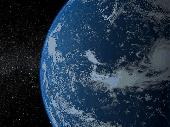
Solar System - Earth 3D screensaver invites you for an instant trip to space where you can admire the magnificent view of our planet shown against the twinkling stars. You can see the change of night and day along with the play of sunrays, as the Earth slowly revolves round the Sun. The screensaver uses modern shader technologies to produce photo-realistic effects. It's one of the...
Category: Desktop Enhancements / Screensavers
Publisher: Rixane Interactive, License: Shareware, Price: USD $17.95, EUR17.95, File Size: 16.2 MB
Platform: Windows
The Earth is probably the best planet I?
The Earth is probably the best planet I?ve ever been to, so I like to keep abreast of what?s going on in the world. I found this desktop background great for monitoring cloud cover, the advance of day and night and nocturnal lights around the globe.
Category: Desktop Enhancements / Wallpaper
Publisher: codefromthe70s.org, License: Freeware, Price: USD $0.00, File Size: 6.2 MB
Platform: Windows
The Earth Screensaver is a screensaver for your computer that will help you relax and get away from your everyday routine by means of watching our planet from space. You will see the Earth with its continents, seas and oceans, clouds and lights of big cities, notice the miraculous glow of the atmosphere, feel the endless space filled with countless stars and mysterious nebulae....
Category: Desktop Enhancements / Screensavers
Publisher: IndaSoftware, License: Shareware, Price: USD $14.00, File Size: 1.0 MB
Platform: Windows
Shareware
Google Hybrid Maps Downloader is a tool that can automatically download the google hybrid Maps images to your PC. It can download the small tiles and save them to your hard disk. After downloading, you can view the Maps offline by its tool Maps Viewer, or you can combine the small images into one big map image. If you want to make a map of your city by yourself, it...
Category: Internet / Download Managers
Publisher: allmapsoft.com, License: Shareware, Price: USD $29.99, File Size: 30.6 MB
Platform: Windows
Shareware
Google Maps Terrain Downloader is a tool that can automatically download the google terrain Maps images to your PC. It can download the small tiles and save them to your hard disk. After downloading, you can view the Maps offline by its tool Maps Viewer, or you can combine the small images into one big map image. If you want to make a map of your city by yourself, it...
Category: Internet / Download Managers
Publisher: allmapsoft.com, License: Shareware, Price: USD $29.99, File Size: 305.3 MB
Platform: Windows