Free Downloads: Earth Maps
License: All | Free
Virtual Earth 3D brings you another step closer to knowing "what it is like out there".
Virtual Earth 3D brings you another step closer to knowing "what it is like out there". You can search, browse, and organize local information viewed in three dimensions, just the way it exists in the real world. This enables you to more effectively find the data that is relevant to you, making Live Maps more useful than ever. Even better, it's just plain fun!
Category: Home & Education / Genealogy
Publisher: Microsoft, License: Freeware, Price: USD $0.00, File Size: 13.0 MB
Platform: Windows, all
Build your world in 3D
Use the Earth as a starting point to bring your ideas to virtual life.
Build your world in 3D
Use the Earth as a starting point to bring your ideas to virtual life. Go anywhere in the world and with a few clicks design a house or replicate your favorite building. When you're finished, share your creations online. No matter what your 3D design background may be, 3DVIA Shape for Maps makes designing realistic, 3D models fun, easy and...
Category: Multimedia & Design / Multimedia App's
Publisher: Dassault Systemes, License: Freeware, Price: USD $0.00, File Size: 508.8 KB
Platform: Windows
Live Satellite Maps or Google maps is a web server mapping applications.
Live Satellite Maps or Google Maps is a web server mapping applications.Provides scrolling map images and satellite photos around the Earth and even the route between different places.Since 6 October 2005, live satellite Maps is part of local Google.Google live satellite Map provides the ability to zoom in or zoom out to show the map.The user can control the map with...
Category: Home & Education / Science
Publisher: www.satelliteview-of-my-house.com, License: Freeware, Price: USD $0.00, File Size: 643.0 KB
Platform: Windows
Free Earth Screensaver will bring the blue planet to your desktop.
Free Earth Screensaver will bring the blue planet to your desktop. You can view the Earth from the night side, the day side and from the moon. This screensaver lets you see the pictures of our planet that you have never seen before. Earth is the third planet from the Sun and is the densest and fifth-largest of the eight planets in the Solar System. This unique Earth...
Category: Desktop Enhancements / Misc. Themes
Publisher: CustomAquariumScr, License: Freeware, Price: USD $0.00, File Size: 3.0 MB
Platform: Windows

OkMap is a GPS and map software that:
-Works with vectorial Maps and calibrates raster Maps
-Organizes paths by creating waypoints, routes and tracks
-Uploads/downloads data to/from your GPS
-Uses altitude DEM data
-Supports GPS real-time navigation
-Sends/receives vehicles position and display tracks on Maps in real time
-Provides autorouting and...
Category: Business & Finance / Applications
Publisher: Gian Paolo Saliola, License: Freeware, Price: USD $0.00, File Size: 20.2 MB
Platform: Windows
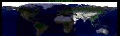
View amazing satellite images of earth with the free version of google earth software.
View amazing satellite images of Earth with the free version of google Earth software.Google Earth is a totally free software which enables you zoom in from satellite,view,rotate or tilt just like a camera of the entire Earth inside your pc.It works just point and click on any part of Earth or by typing addrees name of city or country and google Earth...
Category: Home & Education / Miscellaneous
Publisher: www.satelliteimage-of-my-house.com, License: Freeware, Price: USD $0.00, File Size: 798.0 KB
Platform: Windows
See our Earth?s beauty in high-resolution! Fully customizable by you - you can change the size of the images as well as the transitions of the slide show. Download this screensaver and enjoy it today!
Category: Desktop Enhancements / Screensavers
Publisher: leetsoftware.com, License: Freeware, Price: USD $0.00, File Size: 3.5 MB
Platform: Windows, Mac, 2K, 2K3
GPicSync automatically inserts location in your photos metadata so they can also be used with any 'geocode aware' application like Picasa/Google Earth, Flickr, loc.alize.us.
Main fetures:
- automatically geocode your photos (in the EXIF header)
- use a GPS tracklog in the GPX format or NMEA format (multiple selection possible)
- Support elevation...
Category: Multimedia & Design / Digital Media Editors
Publisher: Google Project, License: Freeware, Price: USD $0.00, File Size: 0
Platform: Windows

FSS Google Maps Downloader is a tool that can download the Google Maps images to your PC. This is a clearly free program. There is no spyware or adware. It's absolutely safe to install and to run. The interface is very simple and self explaining. It runs low on system resources consumption and is supported on all Windows versions. It can save them to your hard disk,...
Category: Internet / Download Managers
Publisher: FreeSmartSoft, License: Freeware, Price: USD $0.00, File Size: 874.0 KB
Platform: Windows
Diffuse maps represent the absorption of light.
Diffuse Maps represent the absorption of light. Diffuse Maps are what people call "textures". They are the color textures or photographic textures usually applied to 3d models.
ShaderMap creates displacement Maps using the light data stored inside of diffuse Maps. Evenly lit diffuse Maps generally create better quality Maps with ShaderMap.
Category: Home & Education / Miscellaneous
Publisher: Rendering Systems Inc., License: Freeware, Price: USD $0.00, File Size: 4.0 MB
Platform: Windows
WW2D allows you to explore Earth using satellite imagery, topographic Maps and image from other data sources also providing large placenames and boundaries database and allowing you to install community-made add-ons for even more info about our planet.
Category: Business & Finance / Business Finance
Publisher: Vitaliy Pronkin, License: Freeware, Price: USD $0.00, File Size: 6.6 MB
Platform: Windows
GeoFeeder is a GeoRSS viewer in Adobe AIR.
GeoFeeder is a GeoRSS viewer in Adobe AIR.
It focuses on the map (in all flavors: Virtual Earth, Google Maps, Yahoo Maps, OpenStreetMap …) and on the data. An advanced, html-capable tooltip window displays the feed-entries’ information. A list allows for simple sorting by title. It’s feed “database” is shared between all...
Category: Internet / Misc. Plugins
Publisher: Markus Schorer, License: Freeware, Price: USD $0.00, File Size: 565.0 KB
Platform: Windows
The Earth is probably the best planet I?
The Earth is probably the best planet I?ve ever been to, so I like to keep abreast of what?s going on in the world. I found this desktop background great for monitoring cloud cover, the advance of day and night and nocturnal lights around the globe.
Category: Desktop Enhancements / Wallpaper
Publisher: codefromthe70s.org, License: Freeware, Price: USD $0.00, File Size: 6.2 MB
Platform: Windows

OkCustomMap is a software to produce Garmin Custom Maps.
OkCustomMap is a software to produce Garmin Custom Maps.
Supports many map formats:
- OkMap
- Ecw
- GeoTiff
- World files
- OziExplorer
- GpsTuner
You can customize:
- The quality of the output JPEG images (0=Bad, 100=Good)
- The KML transparency (0=Transparent, 255=Opaque)
- The KML draw order (0=Invisible, 1-49=Under the vectorial data,...
Category: Business & Finance / Applications
Publisher: Gian Paolo Saliola, License: Freeware, Price: USD $0.00, File Size: 3.2 MB
Platform: Windows
Ais Decoder accepts AIS data from an AIS Receiver, the Internet or a Local Network connection, decodes the data and presents the decoded data in a form suitable for display and analysis by mapping program (eg Google Earth or Google Maps), or for analysis using Excel, or by a database (eg MySql).
The decoder will decode all the NMEA content of all 27 AIS mesage types. The...
Category: Business & Finance / Business Finance
Publisher: Neal Arundale, License: Freeware, Price: USD $0.00, File Size: 2.8 MB
Platform: Windows
A Journey To The Center Of The Earth, by Jules Verne (1864)Prof.
A Journey To The Center Of The Earth, by Jules Verne (1864)Prof. Lindenbrook leads his intrepid party on an expedition to the centre of the Earth, via a volcano in Iceland, encountering all manner of prehistoric monsters and life-threatening hazards on the way.
Category: Home & Education / Miscellaneous
Publisher: Southern Ocean Software, License: Freeware, Price: USD $0.00, File Size: 747.5 KB
Platform: Windows
Satellite earth is a software for viewing satellite and aerial imagery of the Earth.
Satellite Earth is a software for viewing satellite and aerial imagery of the Earth.Satellite Earth allows you to enjoy virtual travel around the world, look up local information and plan trips, exploring multimedia content and share information about your trips.Explore towns, cities and terrain relief shown in three-dimensional images of high resolution associated with...
Category: Home & Education / Science
Publisher: www.satelliteview-of-my-house.com, License: Freeware, Price: USD $0.00, File Size: 584.0 KB
Platform: Windows
Cities of Earth 3D Screensaver shows many cities of the Earth as if you were in the space.
Cities of Earth 3D Screensaver shows many cities of the Earth as if you were in the space. It also displays information about the cities including their countries, the number of inhabitants, and the time in their time zones. It also represents the time in your time zone in the lower right corner of the screen. From the settings menu in the properties (screensaver tab) you can also...
Category: Desktop Enhancements / Screensavers
Publisher: Screenomania.com, License: Freeware, Price: USD $0.00, File Size: 1.7 MB
Platform: Windows
MapComp is a powerful and free Windows Software for drawing images of linkage Maps and to compare linkage Maps and indicate common markers.
MapInspect can display, print and save images, and has no limit to the number of Maps it can compare (but only neighbouring Maps are compared). Maps can be flipped within MapINspect, an the on-screen order of...
Category: Multimedia & Design / Multimedia App's
Publisher: MapInspect, License: Freeware, Price: USD $0.00, File Size: 616.7 KB
Platform: Windows
Sonic and Tails have crashed into Earth and have transformed into humans and changed their name to fit in. Race to the end of each level destroying enemies and collecting stars on the way. Be careful the evil Dr. Robotnik has followed you to Earth! Use the space bar to jump, and press down plus space bar to do a power spin and use the arrow keys to move!
Sonic Earth...
Category: Games / Arcade
Publisher: softendo.com, License: Freeware, Price: USD $0.00, File Size: 7.4 MB
Platform: Windows
Microsoft Location Finder 3.0 is a handy tool, which using the current location of the computer, generates orientation Maps, distances and optimal routes between two cities, and 3D visual tours.
The program generates this information using Wi-Fi signals detected within the area near the PC. However this PC does not need Wi-Fi, but any type of Internet connection. It runs on...
Category: Home & Education / Miscellaneous
Publisher: Microsoft, License: Freeware, Price: USD $0.00, File Size: 3.9 MB
Platform: Windows
Mirkwood - Middle Earth Tale 3.
Mirkwood - Middle Earth Tale 3. A finished Tolkien inspiredRPG that features a journey through the dark forrest in Middle Earth called Mirkwood. Get ready for adventure, get ready to change history, get ready to play Mirkwood!
Category: Games / Adventure & RPG
Publisher: jockethebeast.phatcode.net, License: Freeware, Price: USD $0.00, File Size: 317.0 KB
Platform: Unknown
Korti is a Google Earth plugin which allows you to see the unique 3D satellite map of Korti within your Google Earth application.
Korti provides you a detailed satellite imagery and geographic information about this geographic place.
To have Korti installed on your PC, first install for free Google Earth and then Korti 3D map plugin. After that, simply double...
Category: Multimedia & Design / Multimedia App's
Publisher: Maplandia, License: Freeware, Price: USD $0.00, File Size: 309 B
Platform: Windows
In 2049, the human population of Earth embarks on a migratory voyage to try to colonize other planets. They leave mechanical "orbots" to clean up the mess they made on Earth through littering and pollution.
Raster, a high-level orbot who watches Earth through a planetwide computer network, is accidentally attached to a working nuclear missile by a...
Category: Games / Action
Publisher: segabandonware, License: Freeware, Price: USD $0.00, File Size: 1.5 MB
Platform: Windows
Imagenes satelite is a free satelite images slideshow screensaver for your desktop.
Imagenes satelite is a free satelite images slideshow screensaver for your desktop.View high resolution and beautihigh quality satelite images of Earth from space.This screensavers contains full color images that fit automatically on your screen.View satellite images of Earth from several kilometers from above the sky.Fly above the surface of the Earth and see the beauty of...
Category: Desktop Enhancements / Screensavers
Publisher: www.vista-satelite.com, License: Freeware, Price: USD $0.00, File Size: 3.3 MB
Platform: Windows
Aliens are attacking Earth and you must stop them.
Aliens are attacking Earth and you must stop them. Use your military skills to blast the aliens into submission and save the planet! Cool graphics and upgrades make this an exciting battle!
Category: Games / Action
Publisher: MyRealGames.com, License: Freeware, Price: USD $0.00, File Size: 5.7 MB
Platform: Windows
The Use of Videography in Tracking Earth Satellites.
The Use of Videography in Tracking Earth Satellites.Scattered around the world is a network of about sixteen amateur observers who spend most of their spare time looking at Earth satellites.They concentrate on tracking classified military satellites.Working in close collaboration
this group keeps regular track of about 120 satellites moving in a wide variety of orbits...
Category: Home & Education / Science
Publisher: www.satelliteimage-of-my-house.com, License: Freeware, Price: USD $0.00, File Size: 1.7 MB
Platform: Windows
EOLi (Earth Observation Link) is the European Space Agency's client for Earth Observation Catalogue and Ordering Services.
Using EOLi, you can browse the metadata and preview images of Earth Observation data acquired by the satellites ENVISAT, ERS, Landsat, IKONOS, DMC, ALOS, SPOT, Kompsat, Proba, JERS, IRS, Nimbus, NOAA, SCISAT, SeaStar, Terra/Aqua.
Category: Multimedia & Design / Multimedia App's
Publisher: European Space Agency, License: Freeware, Price: USD $0.00, File Size: 54.7 MB
Platform: Windows
This software development kit (SDK) provides the binaries and programming reference for the Bing Maps Silverlight Control. You can use this control to build your own web sites that use Bing Maps.
The Bing Maps Silverlight Control combines the power of Silverlight and Bing Maps to provide an enhanced mapping experience. Developers can use the Bing...
Category: Utilities / Misc. Utilities
Publisher: Microsoft, License: Freeware, Price: USD $0.00, File Size: 3.8 MB
Platform: Windows
GEScene is a MapInfo utility that allows images to be exchanged in both directions between MapInfo and Google Earth. Placemarks can also be created in Google Earth by using MapInfo as a point of reference to easily pinpoint more obscure locations. Images saved in Google Earth can be registered and displayed in MapInfo to compliment existing map layers. Conversely, the...
Category: Utilities / Misc. Utilities
Publisher: Peter Doyle, License: Freeware, Price: USD $0.00, File Size: 3.2 MB
Platform: Windows
Earth Time Screensaver puts the correct time, day and night regions, location of the Moon and current phase on your desktop with an Earth map. This unique screensaver will allow you to stay informed of what time it is in any part of the world. It is free software, you can free to give copies to your anyone, and post it on other sites.
Category: Desktop Enhancements / Misc. Themes
Publisher: CustomAquariumScr, License: Freeware, Price: USD $0.00, File Size: 3.0 MB
Platform: Windows
SensAct -SENSORS CONVERSION Maps AND ACTUATORS COMMAND Maps
This software pack contents the sensors conversion Maps and the actuators command Maps like motorized throttles, gasoline injectors corrections, ...
It is mandatory to install it to select the type of sensor and actuators that are equiping the ECUs, because these Maps are no longer...
Category: Business & Finance / Applications
Publisher: Skynam, License: Freeware, Price: USD $0.00, File Size: 3.4 MB
Platform: Windows
Army of Earth is an online action/strategy team combat game, allowing hundreds of players and up to 6 teams to play together in an open, outdoor 3D environment. It is easy to learn and use, with mouse-based controls, yet provides deep gameplay. It is a TEAM game and mastery will require not only team strategic thinking but also leadership skills. It is fully 3D, but has very modest...
Category: Games / Strategy & War
Publisher: Fundictive LLC, License: Freeware, Price: USD $0.00, File Size: 7.3 MB
Platform: Windows
PlanetGIS Explorer is a free viewer for PlanetGIS maps and GIS exchange files.
PlanetGIS Explorer is a free viewer for PlanetGIS Maps and GIS exchange files. PlanetGIS Explorer allows you to navigate through Maps, query map elements and view attribute information from linked database tables. Also PlanetGIS Explorer allows you to customize the appearance of Maps for purposes of creating hardcopy printouts, but does not allow you to save any changes to...
Category: Multimedia & Design / Graphics Viewers
Publisher: Planet GIS, License: Freeware, Price: USD $0.00, File Size: 5.4 MB
Platform: Windows
Virtual Earth 3D brings you another step closer to knowing "what it is like out there".
Virtual Earth 3D brings you another step closer to knowing "what it is like out there". You can search, browse, and organize local information viewed in three dimensions, just the way it exists in the real world. This enables you to more effectively find
Category: Home & Education / Miscellaneous
Publisher: microsoft.com, License: Freeware, Price: USD $0.00, File Size: 1.2 MB
Platform: Windows, Vista
Display realistic model of the Earth on a background of twinkling stars.
Display realistic model of the Earth on a background of twinkling stars.You can see times of rising/setting of Moon and Sun.You can configure the product as your Screen Saver.
Category: Desktop Enhancements / Screensavers
Publisher: LAVResearch, License: Freeware, Price: USD $0.00, File Size: 1.0 MB
Platform: Windows
Download the new version of Google Earth satellite with Google Pack.
Download the new version of Google Earth satellite with Google Pack.Google pack includes 13 totally free software selected by google for your better internet experience.Software included in google pack - Google Earth,Norton Security Scan,Google Desktop,Google Toolbar for Internet Explorer,Spyware Doctor Starter Edition,Picasa photo editor,Mozilla Firefox internet browser,Google...
Category: Home & Education / Science
Publisher: www.satelliteimage-of-my-house.com, License: Freeware, Price: USD $0.00, File Size: 589.0 KB
Platform: Windows
Let your desktop take you on an incredible journey into space!
Let your desktop take you on an incredible journey into space! Marvel at planet Earth, receive weather forecasts and view times anywhere in the world. Zoom or rotate the Earth and watch storms from the safety of your home.
Main features:
- Zoom in and out and rotate the Earth
- View weather forecast and time anywhere in the world
-...
Category: Desktop Enhancements / Screensavers
Publisher: Inbox.com, LLC, License: Freeware, Price: USD $0.00, File Size: 8.6 MB
Platform: Windows
Put this extremely realistic 3D Earth screensaver on your monitor and find yourself on an orbital station ready to make your own space research of our home planet. With this free screensaver you will see the unforgettable views of the Earth from space. The slightly visible atmosphere of the planet and the Moon, rotating around, turn your screen into a window of a spaceship....
Category: Desktop Enhancements / Screensavers
Publisher: 3D Savers, License: Freeware, Price: USD $0.00, File Size: 3.1 MB
Platform: Windows
Halo: Hell on Earth Trilogy is a 2D side-scroller which takes place in the year 2552.
Halo: Hell on Earth Trilogy is a 2D side-scroller which takes place in the year 2552. The Covenant have invaded Earth. Masterchief is missing - he teleported with a covenant cruiser. You the last hope of humanity - you have to destroy all the five Covenan
Category: Games / Action
Publisher: dobermannsoftware.com, License: Freeware, Price: USD $0.00, File Size: 14.6 MB
Platform: Windows
Earth Orbit Objects is free program which predict satellite passes for your local or any selected area. Use flat Earth view to display satellite tracks with visibility circle.
The globe view shows selected satellites around the Earth as a sphere and sky view shows satellites as you would see them in a starry night. The line elements are processed using SGP4...
Category: Home & Education / Miscellaneous
Publisher: Bluewing Trg, License: Freeware, Price: USD $0.00, File Size: 1.6 MB
Platform: Windows
Earth3D is a program that visualizes the earth in a realtime 3D view.
Earth3D is a program that visualizes the Earth in a realtime 3D view. It uses data from NASA,USGS, the CIA and the city of Osnabrück.
Main features:
- viewing the Earth as a whole
- zooming in until countries, cities and even single houses become visible
- embedding external data like current earthquake positions or cloud data.
Category: Multimedia & Design / Graphics Viewers
Publisher: Dominique Andre Gunia, License: Freeware, Price: USD $0.00, File Size: 3.1 MB
Platform: Windows
 Freeware
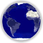
This is a free Flash animation of our spinning planet Earth, very small in file size, yet with excellent graphics. The Earth can be scaled to any size and will enhance your website or presentation. The file is free of charge and does not require installation. It can be viewed in action on our website. The background can be customized to suit your theme.
Category: Web Authoring / Flash Utilities
Publisher: Utech Computer Solutions, License: Freeware, Price: USD $0.00, File Size: 47.2 KB
Platform: Windows, Linux
Cities of Earth is a free beautiful 3D screensaver which shows biggest cities of our planet.
Cities of Earth is a free beautiful 3D screensaver which shows biggest cities of our planet. Features:Aflame Sun, stars, 3D Earth model with highlighted cities.Many of cities with information about its population and country names. So it's a good educational content. Positions of all cities corresponds to its real world coordinates.Ability to add any city to the Earth...
Category: Desktop Enhancements / Screensavers
Publisher: Screenomania 3D Screensavers, License: Freeware, Price: USD $0.00, File Size: 1.7 MB
Platform: Windows
Nokia Maps 3D browser plugin is a free mapping product and service by Nokia for its mobile phones and for internet browsers. Nokia Maps includes voice guided navigation for both pedestrians and drivers for 74 countries in 46 different languages and there are Maps for over 180 countries.
See the world in high-resolution 3D. Everything from the sky to the street. Plan...
Category: Internet / Browser Accessories
Publisher: Nokia, License: Freeware, Price: USD $0.00, File Size: 9.8 MB
Platform: Windows
When you are looking for a powerful tool to satisfy various needs regarding vectors, raster and satellite imagery, you will find ILWIS Academic an efficient application. The program comes with such useful features as points to create Maps, lines for segment Maps, closed area segments for polygon Maps, spatial operations for raster Maps and so on. Whilst using images...
Category: Home & Education / Miscellaneous
Publisher: ITC, License: Freeware, Price: USD $0.00, File Size: 19.4 MB
Platform: Unknown
Dark Earth is a campaign setting unlike any you have ever played.
Dark Earth is a campaign setting unlike any you have ever played. It will take your imagination and grab it, caress it, and make you never want to leave.
Category: Games / Adventure & RPG
Publisher: occultentertainment.co.nr, License: Freeware, Price: USD $0.00, File Size: 586.0 KB
Platform: Windows, Mac, 2K, 2K3
GDS Images and Document Maps is a unique document search utility.
GDS Images and Document Maps is a unique document search utility. GDS Images and Document Maps is a rather unique application that will enable you to store all your documents and images alongside other important files and folders right on your desktop so that you can use it straight from there, without the need to bother around with looking with looking for every single file...
Category: Utilities / Misc. Utilities
Publisher: toggle, License: Freeware, Price: USD $0.00, File Size: 558.8 KB
Platform: Windows
MapCreator combines a cartography and a graphics programme.
MapCreator combines a cartography and a graphics programme. The software is designed to create Maps and animated Maps of the highest quality as often required for presentations. For example, this could be Maps needed for a travel presentation. But also in
Category: Multimedia & Design
Publisher: primap.com, License: Freeware, Price: USD $0.00, File Size: 103.3 MB
Platform: Windows, Vista
CacheMaps retreives a variety of maps for your caches from the Internet.
CacheMaps retreives a variety of Maps for your caches from the Internet.
CacheMaps uses the Geocaching loc- or gpx-files as input. Directely from the Geocaching site or as exported from GSAK.CacheMaps v4 has been designed to be used next to GSAK. A lot of the functionality that was available in previous versions of CacheMaps, is available in GSAK now in a much better form. What...
Category: Audio / Utilities & Plug-Ins
Publisher: BigBird Productions, License: Freeware, Price: USD $0.00, File Size: 153.2 KB
Platform: Windows