Free Downloads: Esri Support
LP360 for ArcGIS™ is a first-of-its-kind LIDAR software extension for the ESRI™ ArcGIS environment.
LP360 for ArcGIS™ is a first-of-its-kind LIDAR software extension for the Esri™ ArcGIS environment. The LP360 LIDAR extension uses a specially-designed ArcMap™ data layer to access points directly from industry standard LAS files. LP360 completely integrates LIDAR point cloud datasets into ArcGIS without requiring an import or conversion process. With LP360 LIDAR data...
Category: Multimedia & Design / Image Editing
Publisher: QCoherent Software, License: Shareware, Price: USD $0.00, File Size: 0
Platform: Windows
FloppyGIS runs on Windows. It is a free compact Shapefile Viewer. It also supports image files that have geo-reference from Esri World Files.
Category: Multimedia & Design / Graphics Viewers
Publisher: ldinakis.googlepages.com, License: Freeware, Price: USD $0.00, File Size: 619.0 KB
Platform: Windows, Vista
PostGIS is unique software that adds Support for geographic objects to the PostgreSQL object-relational database.
In effect, PostGIS "spatially enables" the PostgreSQL server, allowing it to be used as a back-end spatial database for geographic information systems (GIS), much like Esri's SDE or Oracle's Spatial extension. PostGIS follows the...
Category: Business & Finance / Database Management
Publisher: Refractions Research, License: Shareware, Price: USD $0.00, File Size: 11.2 MB
Platform: Windows
 Shareware
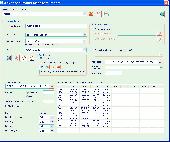
The Advanced points manager imports points to AutoCAD drawing from different data sources. OLE-DB database, SHP (Esri shape file), GPX (GPS eXchange format), KML (Keyhole Markup Language), GML (Geography Markup Language), TXT, CSV. Additional options: savable configurations, point coordinate transformation from/to any world coordinate system, point can be ACAD point or ACAD block with...
Category: Business & Finance / Vertical Markets
Publisher: CADdicted inc., License: Shareware, Price: USD $119.00, File Size: 609.8 KB
Platform: Windows
Windows GUI utility for SDE. Preview Shape and Coverage files before you load them to SDE. Export, Describe, Delete, and examine Layers stored in SDE. Creates batch command line scripts for administration of SDE. ArcScripts is intended for the free exchange of scripts and tools related to Esri software products
Category: Home & Education / Miscellaneous
Publisher: ESRI, Redlands CA. 92373, License: Freeware, Price: USD $0.00, File Size: 4.9 MB
Platform: Windows
Spatial Workshop is mapping software used for spatial information integration, query, analysis and reporting.
You build spatial applications with a few clicks or Support complex business processes with geospatial and business data from Oracle, Smallworld, Esri, maps, files, spreadsheets and other sources.
You can combine and model geospatial data,...
Category: Multimedia & Design / Multimedia App's
Publisher: Spatial Eye bv, License: Freeware, Price: USD $0.00, File Size: 176.7 MB
Platform: Windows
The HydroDaVE Explorer is an interactive, web-enabled, Windows application that integrates GIS capabilities and allows users to access the SQL database through an internet-connected computer. HDX supports the Esri shapefile format and the free OpenStreetMap. The user can select specific monitoring stations (wells or surface water stations) and display them in map view on top of...
Category: Business & Finance / Business Finance
Publisher: Wildermuth Synergies LLC., License: Demo, Price: USD $0.00, File Size: 24.5 MB
Platform: Windows
Shareware
MPSuperShape is a shape manipulation tool for Microsoft MapPoint. MPSuperShape can be used to combine multiple shapes into one large shape, find the intersections (overlaps) between shapes, find boundary shapes around groups of pushpins, simplify shapes, delete multiple shapes, change shape colors, import/export shape files, and to create web pages. Import shape options include Esri...
Category: Business & Finance / Business Finance
Publisher: Winwaed Software Technology LLC, License: Shareware, Price: USD $75.00, File Size: 13.6 MB
Platform: Windows
AtlasStyler is a user-friendly application to style geodata.
AtlasStyler is a user-friendly application to style geodata. The resulting styles can be saved to XML files that follow the OGC SLD/SE standard 1.0. The AtlasStyler is a "stand-alone" application, that can be used independently for any vector data. Esri Shapefiles, OGC WFS and PostGIS datasources are supported.
Category: Software Development / Misc. Programming
Publisher: Geopublisher, License: Freeware, Price: USD $0.00, File Size: 6.9 KB
Platform: Windows
ArcGIS for AutoCAD is a free, downloadable plug-in application for AutoCAD that provides improved interoperability between AutoCAD and ArcGIS. Within the AutoCAD environment, you gain easy access to enterprise GIS maps hosted by ArcGIS Server.
In addition, ArcGIS for AutoCAD gives you the ability to prepare CAD data for use with the ArcGIS system while leveraging your existing CAD...
Category: Multimedia & Design / Image Editing
Publisher: Environmental Systems Research Institute, Inc., License: Demo, Price: USD $0.00, File Size: 1.4 MB
Platform: Windows
CoordTrans converts geographic coordinates between different coordinate systems.
CoordTrans converts geographic coordinates between different coordinate systems.
CoordTrans is very easy to use, and full of Wizards to help you with more complex tasks.
Convert between UTM, WGS84 and NAD27 / NAD83, and more... almost all projections and datums on Earth are supported. See complete list..
You can convert single coordinates, or coordinates...
Category: Business & Finance / Business Finance
Publisher: Franson, License: Shareware, Price: USD $49.00, File Size: 6.5 MB
Platform: Windows
GeoImaging Tools for ArcGIS provides ArcGIS users a suite of tools for processing and analyzing imagery in the GIS.
PCI Geomatics is introducing a suite of modules that integrate directly into ArcGIS for achieving common image related tasks.
Users now have the option to save the correction parameters into the Raster Processing Definition (RPDef) format, reducing data...
Category: Software Development / Misc. Programming
Publisher: PCI Geomatics, License: Shareware, Price: USD $0.00, File Size: 43.5 KB
Platform: Windows
MAPublisher® cartography software seamlessly integrates over 50 GIS mapping tools into the Adobe Illustrator environment to help you create maps the way you want, how you want.
MAPublisher supports Esri ArcGIS 10 geodatabases and ArcMap document (MXD) files.
Category: Multimedia & Design / Multimedia App's
Publisher: Avenza Systems Inc., License: Shareware, Price: USD $1399.00, File Size: 157.2 MB
Platform: Windows
Offering full ARES® functionality, ARES Commander Edition additionally integrates the ACIS 3D Solid Modeler. Also, it is fully programmable and customizable through common program languages. And, it reads and writes Esri® Shape files, allowing you to visualize maps and geographic models created by GIS applications.
Professional CAD with 3D-Modeling and additional...
Category: Multimedia & Design / Image Editing
Publisher: Graebert GmbH, License: Shareware, Price: USD $1389.66, File Size: 81.4 MB
Platform: Windows
The MapMart On-Demand™ toolbar enables a user to access aerial, satellite, DEM, topography and vector data from within the ArcMap application. Once a user installs the plug-in within Esri ArcMap 9.2 or 9.3, users will be able to research, preview, purchase and download imagery and data for their projects inside ArcMap
Category: Software Development / Misc. Programming
Publisher: MapMart, License: Freeware, Price: USD $0.00, File Size: 954.8 KB
Platform: Windows
Geocando is a 3d Viewer for visualisation and querying of geodata and geomodels.
Geocando is a 3d Viewer for visualisation and querying of geodata and geomodels. It is especially developed for Paradigm's GOCAD® objects. Another supported format is the typical GIS exchange format Esri Shapefile. In Geocando the objects can be visualized with different symbols, colours, scalebars, vertical exaggeration factors,etc. Typical features like get coordinates and...
Category: Multimedia & Design / Graphics Viewers
Publisher: Manuel Feige, License: Freeware, Price: USD $0.00, File Size: 9.4 MB
Platform: Windows
The Track Star AVLS Software system represents a new standard for performance and value in the fleet management software industry. This application offers users a unique range of flexibility that allows the software to become an integral part of their operations instead of forcing methodology changes to conform to the software.
The AVLS system is a very scalable product that can...
Category: Home & Education / Miscellaneous
Publisher: Track Star International, Inc, License: Demo, Price: USD $0.00, File Size: 5.9 MB
Platform: Windows
Shareware
GPS Mapping Software for Windows, Loading topographic maps, realtime navigation, track recording, manage GPS devices and more. The software can be used with various map formats including: GeoTiff, BSB Nautical Charts, AutoCad DXF files, Esri Shapefiles. Using calibration you can also use scanned or downloaded JPG, BMP, GIF, PNG and TIF maps. The software can be used for survey, research,...
Category: Home & Education / Science
Publisher: Eye4Software B.V., License: Shareware, Price: USD $149.00, EUR99, File Size: 11.1 MB
Platform: Windows
Grid Translator Pro (GTP) for ArcGIS® is an add-on application for ArcGIS® and one stop solution for ArcGIS® users to enable a wide range of raster and imaging formats within the ArcGIS® suite products. ArcGIS® is a family of products developed by Esri Inc. including desktop and server products. To work properly, GTP for ArcGIS® requires one of the following...
Category: Business & Finance / Business Finance
Publisher: Geomatics Systems, License: Shareware, Price: USD $400.00, File Size: 12.4 MB
Platform: Windows
Chesapeake's newest product for real-time mosaics is currently being offered as an option to SonarWiz customers who require real-time mosaic capabilities in an easy to use and affordable package. Also provides complete post processing capabilities. Features include automatic gain control, TVG, beam angle correction integrated bottom tracker and navigation editor. Complete post-processing...
Category: Business & Finance / Business Finance
Publisher: Chesapeake Technology, Inc., License: Shareware, Price: USD $250.00, File Size: 162.2 MB
Platform: Windows
The fGIS Editor is a multi-purpose, full-featured, powerful, and easy-to-use GIS application.
The fGIS Editor is a multi-purpose, full-featured, powerful, and easy-to-use GIS application. Created by the same technical expertise behind the popular freeware fGIS program, the fGIS Editor provides a clear, supported upgrade path for current users of fGIS. The fGIS Editor is built upon the TatukGIS Editor and combines the familiar features found in fGIS with the new, powerful features found...
Category: Multimedia & Design / Multimedia App's
Publisher: TatukGIS Consulting, License: Shareware, Price: USD $99.00, File Size: 4.8 MB
Platform: Windows
The WinPower V3.9.0.3 is released at 2012/02/22 with the following updates:
- Support Ubuntu 10.10 OS
- Support Mac 10.7 OS
- Support Vmware ESXi 5.0
- Support USB communication on Solaris OS
- Support adding hostname for remote PC
- Support SNMP Central Monitoring function by RFC1628.mib
Category: Utilities / Misc. Utilities
Publisher: UPS Software, License: Freeware, Price: USD $0.00, File Size: 39.3 MB
Platform: Windows
The first product from WebBridge series for operation with Internet tiles maps in the environment of ArcGIS. The program allows to connect directly in project ArcMap the raster layer linked to one of Internet services, to display depending on scale appropriate level of an Internet map. The program does not demand usage ArcGIS Server/ImageServer or access to Virtual Earth through Esri Web...
Category: Internet / Misc. Plugins
Publisher: MitrichTools, License: Demo, Price: USD $0.00, File Size: 581.5 KB
Platform: Windows
Shareware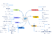
MyDraw for Mac is an advanced diagramming software and vector graphics drawing tool. This diagram software includes powerful features to help you create flowcharts, org charts, mind maps, network diagrams, floor plans, family tree diagrams, general business diagrams, vector drawings, flyers, certificates and others. Following are the major features of the application: -100+ Diagram...
Category: Business & Finance / Applications
Publisher: Nevron Software LLC, License: Shareware, Price: USD $69.00, File Size: 273.5 MB
Platform: Mac
Shareware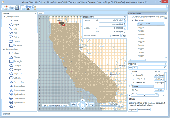
Manco Shapefile Editor is a powerful tool for creating and editing shapefiles, with easy, almost “on the flyâ€, geometry and data editing and possibility of direct creation of the shapefiles from the image files by image processing algorithms. This product is constantly developing and you will receive free updates just when they come. Since it’s only a start of the project,...
Category: Multimedia & Design / Image Editing
Publisher: Manco Software, License: Shareware, Price: USD $100.00, File Size: 6.1 MB
Platform: Windows