Free Downloads: Garmin Usa Map
GPSMaster.NET can best be described as a mixture of Google Earth, World Wind, SeeYou, OziExplorer and Garmin Mapsource. GPSMaster.NET is a Windows application (for both x86 and x64) and can communicate (via serial or USB) with any Garmin GPS that implements the Garmin communication protocol. Support for other brands of GPS or logger will be added in future releases.
Category: Internet / Communications
Publisher: Edwin Oude Vrielink, License: Shareware, Price: USD $141.85, File Size: 11.6 MB
Platform: Windows
MarineUpdater is a Windows-based PC application which works in conjunction with a Garmin USB card reader, a Garmin data card, and an Internet connection to generate software update cards for your fixed-mount Garmin marine products. Products which support MarineUpdater will program a data card with information about your Garmin marine product and other Garmin...
Category: Home & Education / Miscellaneous
Publisher: Garmin Ltd or its subsidiaries, License: Freeware, Price: USD $0.00, File Size: 2.0 MB
Platform: Windows
Want to brush up on the names and locations of the 48 contiguous states of the USA?
Want to brush up on the names and locations of the 48 contiguous states of the Usa? This program from the Family Games Web Center will help you. United States Geography Tutor presents a scrolling Map of the U.S. along with a list of states. As your mouse pointer passes over the Map, the state under the pointer highlights, along with its entry in the list. Simply browse the...
Category: Home & Education / Genealogy
Publisher: AHA! Software Inc., License: Freeware, Price: USD $0.00, File Size: 500.0 KB
Platform: Windows
OziExplorer is a flamboyant GPS Mapping Software that runs on the PC and works with varieties of GPS receivers such as Garmin, Lowrance, Magellan, Eagle, Brunton, Silva and MLR for the uploading or downloading the waypoints, routes and tracks and most brands of GPS receivers for real time tracking of GPS position.
Using this software, the user can use maps and charts that...
Category: Internet / Communications
Publisher: Des Newman, License: Shareware, Price: USD $95.00, File Size: 6.8 MB
Platform: Windows
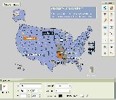
Map Suite Geocode Usa is a powerful and feature-rich .NET geocoding engine that comes complete with a highly optimized dataset encompassing the entire United States. Map Suite Geocode Usa features a fast, user-friendly .NET interface that enables C# and VB.NET software developers to take a United States address and quickly find its geographical location. In addition...
Category: Software Development
Publisher: ThinkGeo LLC, License: Commercial, Price: USD $2394.00, File Size: 341.1 KB
Platform: Windows
Anychart is a flexible Macromedia Flash based-solution, which allows you to easily display any sort of data dealing with geographical locations. It contains United States Maps with Counties, World Map, etc. XML data file and a set of customizable options make AnyChart Maps a universal solution for web developers. AnyChart allows you to create superb, compact, interactive maps....
Category: Software Development
Publisher: AnyChart.Com, License: Shareware, Price: USD $199.00, File Size: 2.8 MB
Platform: Windows, Mac, Linux, Palm,
Northwest Trails is a mapset of trails designed for upload to any map-enabled Garmin GPS receiver.
Northwest Trails is a mapset of trails designed for upload to any Map-enabled Garmin GPS receiver. It is more than just a mapset, though; it is also a community effort initiated to record and collect GPS data for trails in the Northwest (Washington, Idaho, Oregon, Montana, Wyoming, Alaska, British Columbia and Alberta) and provide that data for general public use.
The...
Category: Internet / Misc. Plugins
Publisher: Jon F. Stanley, License: Freeware, Price: USD $0.00, File Size: 31.7 MB
Platform: Windows
Moagu: The Mother Of All GPS Utilities.
Moagu: The Mother Of All GPS Utilities.
You can convert USGS topographic maps, aerial/satellite imagery, and any other raster Map imagery for use on Garmin handled GPS units.
Garmin maps have been in a "vector" format; Moagu creates maps using a "bitmap" format.
Category: Home & Education / Miscellaneous
Publisher: Moagu, License: Shareware, Price: USD $19.95, File Size: 38.2 MB
Platform: Windows
GeoVisu is a program that displays georeferenced data (images, graphics) and downloads data recorded by some GPS devices.
GeoVisu has a "Moving Map" navigation function, which can be used with any NMEA 0183 compatible or Garmin USB GPS device.
Main features:
- Displays georeferenced image formats : GeoTiff, ECW and ECWP, MrSID,...
Category: Multimedia & Design / Graphics Viewers
Publisher: GeoVisu, License: Freeware, Price: USD $0.00, File Size: 1.7 MB
Platform: Windows
Sukhumvit is a sample Map of the area around Ploenchit and Sukhumvit Roads in Bangkok including Soi Nana/Soi 4 and Soi Cowboy.This Map - as are all Rotweiler maps - is fully routable and searchable on all Garmin GPSrs.This demo Map includes an area familiar to most residents and visitors to Bangkok
Category: Home & Education / Miscellaneous
Publisher: Rotweilermaps, License: Demo, Price: USD $0.00, File Size: 393.0 KB
Platform: Windows
Know Your USA is a popular geographycal software for learning all about the United States.
Know Your Usa is a popular geographycal software for learning all about the United States. Every major geographic and geopolitical feature of the United States is included. The main topics featured in Know Your Usa: About the Usa, Regions, States, State Capitals, Major Cities, Rivers, Mountains, Lakes, Oceanography and National Parks
Category: Home & Education / Miscellaneous
Publisher: EdWare, License: Shareware, Price: USD $199.00, File Size: 42.8 MB
Platform: Windows
Interactive Flash Dealer Store locator is a unique vector-based tool that helps you to originally represent the information about your business locations. Now it is not only a simple list of offices or stores but also an interactive flash Map with nice animation. Moreover this flash locator can be customized to perfectly fit your website design. This Map can make your...
Category: Internet
Publisher: USFlashMap.com, License: Shareware, Price: USD $399.00, File Size: 3.9 MB
Platform: Windows, Mac, Linux, Unix, MS-DOS, AS/400, OS/2
To get started, download the free Garmin Voice Studio program and install it on your PC¹.
To get started, download the free Garmin Voice Studio program and install it on your PC¹. You will be led through a series of phrases that can be edited and reviewed directly within the application.
To achieve the best quality recordings, an external microphone is recommended. Once finished, you’ll be ready to go with custom voices on your compatible device!...
Category: Audio / Music Management
Publisher: Garmin Ltd or its subsidiaries, License: Shareware, Price: USD $0.00, File Size: 0
Platform: Windows
OZtopo provides an alternative set of maps, suitable for use on Garmin GPS units.
OZtopo provides an alternative set of maps, suitable for use on Garmin GPS units. It has been designed as a detailed set of topographical maps suitable for bushwalking, 4WDing and general touring . It is comprised of two mapsets, 10m Contours and Roads and Tracks. Both mapsets can be loaded onto a GPS at the same time. They can also be loaded concurrently with any of Garmin's...
Category: Business & Finance / Business Finance
Publisher: Oztopo, License: Shareware, Price: USD $0.00, File Size: 75.7 MB
Platform: Windows
Whether you're exploring new coastline or cruising your favorite bay, BlueChart Atlantic contains the most detailed marine cartography around. These electronic nautical maps give you peace of mind when navigating offshore.
The BlueChart Atlantic CD-ROM includes coverage for several offshore regions — select one of these regions to view and download charts with this purchase....
Category: Home & Education / Miscellaneous
Publisher: Garmin Ltd or its subsidiaries, License: Shareware, Price: USD $0.00, File Size: 0
Platform: Windows


 Shareware
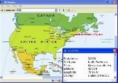
Lookup Usa and Canada towns by ZIP, postal code or name and show them on a North American Map. This helps you to check customer information, verify postal addresses, and reduce credit card fraud. Using the program is simple. Just enter a ZIP Code, and the program gives you the matching city, state, latitude, and longitude.
Category: Security & Privacy / Access Control
Publisher: ArmCode, License: Shareware, Price: USD $29.95, EUR24.95, File Size: 5.5 MB
Platform: Windows
?Statue of Liberty? is an Animated Wallpaper by EleFun Multimedia devoted to the Independence Day of Usa. Statue of Liberty is one of the most famous sculptures in the Usa and the world. It is often called ?the symbol of New York and the Usa?, ?the symbol of freedom and democracy?, ?Lady Freedom?. There is a torch in one of its hands, and the other hand holds a plate with...
Category: Desktop Enhancements / Misc. Themes
Publisher: Elefun Multimedia, License: Shareware, Price: USD $14.95, File Size: 5.3 MB
Platform: Windows
Screensaver with a Garmin Forerunner theme. .
Screensaver with a Garmin Forerunner theme.
Category: Desktop Enhancements / Screensavers
Publisher: Garmin Forerunner 305, License: Freeware, Price: USD $0.00, File Size: 1.5 MB
Platform: Windows
Nevron Map for SharePoint is an advanced web part for all versions Microsoft SharePoint (WSS3.0, SharePoint 2007, 2010, 2013 and 2016). It is designed to provide an easy and powerful way to create choropleth maps that are tightly integrated with your data. The Map Web Part delivers a great set of features including: - Multiple Map Layers - unlimited number of Map...
Category: Software Development / Components & Libraries
Publisher: Nevron Software LLC, License: Shareware, Price: USD $889.00, File Size: 121.9 MB
Platform: Windows
DNRGarmin is a smart tool used to directly transfer data between Garmin GPS handheld receivers and various GIS software packages.
DNRGarmin was built to provide users the ability to directly transfer data between Garmin GPS handheld receivers and various GIS software packages. Using DNRGarmin a user can use point features (graphics or shapefile) and upload them to the...
Category: Utilities / Misc. Utilities
Publisher: GIS Section, Minnesota Department of Natural Resources, License: Freeware, Price: USD $0.00, File Size: 11.3 MB
Platform: Windows
FREE GPS Software for your Garmin, Magellan or Lowrance GPS.
FREE GPS Software for your Garmin, Magellan or Lowrance GPS.
EasyGPS is the fast and easy way to upload and download waypoints, routes, and tracks between your Windows computer and your Garmin, Magellan, or Lowrance GPS. EasyGPS lists all of your waypoints on the left side of the screen, and shows a plot of your GPS data on the right. Use EasyGPS to back up and organize...
Category: Internet / Communications
Publisher: TopoGrafix, License: Freeware, Price: USD $0.00, File Size: 3.9 MB
Platform: Windows


 Shareware
GPS SDK to add GPS and coordinate conversion functionality to your software and scripts). All NMEA0183 protocol versions are supported and can be filtered by NMEA sentence type and talker ID. Garmin USB PVT support. Information on GPS status can also be retrieved: GPS fix quality, satellites used in fix, satellites in view, satellite azimuth, elevation and signal strengths. The...
Category: Software Development
Publisher: Eye4Software B.V., License: Shareware, Price: USD $99.00, EUR79, File Size: 2.3 MB
Platform: Windows
MapToaster Topo New Zealand is New Zealand's only topographical mapping suite, with options for your computer and Garmin GPS, including:
- all the rich detail of the LINZ topo maps - seamless across NZ. Now includes Topo50 and Topo250 Map series.
- 1:50,000 though 1:2 million scale maps on your PC and 1:50,000 on your GPS
- integrated aerial and...
Category: Home & Education / Miscellaneous
Publisher: Integrated Mapping Ltd, License: Shareware, Price: USD $0.00, File Size: 38.5 MB
Platform: Windows
Garmin MapConverter was developed to be a tool that will allow you to convert maps and unlock codes on your Windows PC to the Macintosh format. Transferred maps will remain fully accessible on your Windows PC. It works on Windows XP, Windows Vista, Windows 7.
Category: Utilities / Misc. Utilities
Publisher: Garmin Ltd or its subsidiaries, License: Freeware, Price: USD $0.00, File Size: 2.6 MB
Platform: Windows
Palm Desktop for Garmin iQue 3600 is one of the first PDAs to offer built-in GPS, as opposed to the jackets often used with other models.
Mapping integrates well - you can add a location to any address book entry, for example - but you can only route to an address from your present location, not from one distant one to another.
Category: Multimedia & Design / Multimedia App's
Publisher: Garmin Ltd or its subsidiaries, License: Freeware, Price: USD $0.00, File Size: 11.7 MB
Platform: Windows

