Free Downloads: Gis Service Data
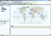
ArcGIS Explorer is a free, downloadable Gis viewer that gives you an easy way to explore, visualize and share Gis information. ArcGIS Explorer adds value to any Gis because it helps you deliver your authoritative Data to a broad audience.
The ArcGIS Explorer Desktop Current User setup is intended for users who do not have administrator access on their...
Category: Desktop Enhancements / Shell & Desktop Managers
Publisher: Environmental Systems Research Institute, Inc., License: Freeware, Price: USD $0.00, File Size: 94.0 MB
Platform: Windows
Cityvu is a 3D GIS data viewer able to load CityGML data format from any compatible data source.
Cityvu is a 3D Gis Data viewer able to load CityGML Data format from any compatible Data source.
Cityvu features 3D hardware rendering using OpenGL with a complete navigation system that allows automated tour of the rendered scene. It has been designed to be used to develop customized software solutions, built on the specific needs. Cityvu supports in...
Category: Multimedia & Design / Graphics Viewers
Publisher: 3D GIS Cityvu, License: Freeware, Price: USD $0.00, File Size: 9.9 MB
Platform: Windows
PocketGIS is a powerful mobile Geographical Information System (Gis) for field Data capture which can display and edit map geometry and attributes. PocketGIS brings real Gis functionality to highly portable handheld devices which are lightweight, convenient and have a long battery life.
Category: Utilities / Misc. Utilities
Publisher: Pocket Systems Ltd, License: Shareware, Price: USD $499.00, File Size: 42.8 MB
Platform: Windows
OpenJUMP is an open source Geographic Information System (Gis), it can read and write shapefiles and simple GML files. It has limited support for the display of images and good support for showing Data retrieved from WFS and WMS web-services. So you can use it as Gis Data Viewer.OpenJUMP has limits in reading very large Data files and has limited support for...
Category: Home & Education / Miscellaneous
Publisher: Jump Pilot Project, License: Shareware, Price: USD $0.00, File Size: 0
Platform: Windows
SuperGIS Spatial Statistical Analyst is a set of application software integrating geostatistical methods and Gis functions. Besides exploring of spatial Data, query and demonstrating of attribute Data, and the basic statistic capabilities, it also allows users to perform geostatistical analysis to obtain a better understanding about the variance and relativity of spatial...
Category: Multimedia & Design / Multimedia App's
Publisher: SuperGeo Technologies Inc, License: Demo, Price: USD $0.00, File Size: 3.6 MB
Platform: Windows
ArcGIS for AutoCAD is a free, downloadable plug-in application for AutoCAD that provides improved interoperability between AutoCAD and ArcGIS. Within the AutoCAD environment, you gain easy access to enterprise Gis maps hosted by ArcGIS Server.
In addition, ArcGIS for AutoCAD gives you the ability to prepare CAD Data for use with the ArcGIS system while leveraging your...
Category: Multimedia & Design / Image Editing
Publisher: Environmental Systems Research Institute, Inc., License: Demo, Price: USD $0.00, File Size: 1.4 MB
Platform: Windows
GeoSurveillance is software that combines spatial statistical routines with some basic Geographic Information Systems (Gis) functions to carry out retrospective and prospective statistical tests for the detection of geographic clustering. In this software, the focus is primarily on the spatial statistical analysis. Consequently, full Gis functionality is not provided. Gis...
Category: Home & Education / Miscellaneous
Publisher: NCGIA, License: Freeware, Price: USD $0.00, File Size: 2.4 MB
Platform: Windows
With MapAuthor you can create, print and save desktop maps, using Data that you obtain from commercial sources or perhaps your in-hous Gis department as shapefiles (shapefiles are a very common Gis exchange format.) You can also produce internet-based maps based on Google Maps, for use on your web site.
MapAuthor allows you to link your own Data to maps, for...
Category: Internet / Misc. Plugins
Publisher: MapAuthor.com, License: Freeware, Price: USD $0.00, File Size: 6.3 MB
Platform: Windows
Shape2Earth leverages freely available and easy to use Geographic Information System (Gis) software to create professional visualizations for viewing in GoogleTM Earth.
Main features:
-Convert Any Shapefile to KML - Shape2Earth reprojects your Data on the fly
-Apply Thematic Symbology to your Data - Color code to display information
-Present...
Category: Multimedia & Design / Image Editing
Publisher: Google, License: Demo, Price: USD $0.00, File Size: 9.5 MB
Platform: Windows
ArcGIS Workflow Manager (formerly Job Tracking for ArcGIS [JTX]) is an extension to ArcGIS Desktop and ArcGIS Server that lets organizations develop and enforce standard, repeatable Gis workflows across the enterprise.
Workflow Manager greatly improves the efficiency of Gis operations by organizing and automating the relationships between the activities in a Gis...
Category: Home & Education / Miscellaneous
Publisher: ESRI, License: Shareware, Price: USD $2500.00, File Size: 1.1 MB
Platform: Windows
GenesisIV understands GIS concepts like layers, shape objects and georeferencing.
GenesisIV understands Gis concepts like layers, shape objects and georeferencing. It interfaces to industry standard Gis systems such as MapInfo and ArcView so you can use your existing Data without having to learn new concepts or perform difficult manipulations.
GenesisIV is the only landscape product designed specifically to help teach geographical concepts....
Category: Multimedia & Design / Multimedia App's
Publisher: Geomantics, License: Freeware, Price: USD $0.00, File Size: 17.6 MB
Platform: Windows
ArcGIS Data Reviewer (formerly Gis Data ReViewer) is an extension to ArcGIS for Desktop that provides a complete system to automate and simplify your Data quality control (QC) process. Data Reviewer lets you centrally manage the error QC lifecycle process—finding, correcting, and verifying errors—thereby eliminating any paper trail associated with...
Category: Utilities / Misc. Utilities
Publisher: Environmental Systems Research Institute, Inc., License: Shareware, Price: USD $0.00, File Size: 30.9 MB
Platform: Windows


 Freeware
Convert ESRI ShapeFiles (.SHP) geolocation Data into AnyMap format to be used with AnyChart. AnyChart Flash Map Converter allows making use of a wide choice of maps with AnyChart Flash Component, a Gis visualization system that recognizes map Data in AnyMap format only. AnyChart Flash Map Converter makes it easy to visualize any geolocation Data without hefty...
Category: Web Authoring / Image Mapping Tools
Publisher: AnyChart.Com, License: Freeware, Price: USD $0.00, File Size: 1.6 MB
Platform: Windows
AutoDEM (aka as AutoMNT) is a freeware Gis software to create Digital Elevation Models (DEM) from scanned topographic maps for Windows.
Through different Data layers (map, contours, DEM, etc.), AutoDEM provides many tools for :
-Topographic map analysis
-Contour lines extraction and reconstruction
-Contours to DEM interpolation and DEM analysis
-DEM...
Category: Multimedia & Design / Animation
Publisher: Joachim Pouderoux, License: Freeware, Price: USD $0.00, File Size: 27.6 MB
Platform: Windows
Geosoft's Target™ for ArcGIS software, built on Geosoft's industry-leading Oasis montaj™ software, simplifies the visualization and analysis of subsurface drillhole and borehole geology Data within your ESRI Gis environment.
Target for ArcGIS processes large volume drillhole Data with ease and generates professional-quality maps for...
Category: Software Development / Misc. Programming
Publisher: Geosoft Inc., License: Shareware, Price: USD $0.00, File Size: 0
Platform: Windows
The free AvisMap Viewer opens most Gis/CAD and raster image file types and most ArcView, ArcExplorer, and MapInfo projects. Besides just opening and viewing files, the Viewer supports an extensive list of features including visual layer properties control, legend control, thematic mapping, spatial and attribute querying, custom labeling, on-map measurements, hyper-linking, PDF export...
Category: Software Development / Components & Libraries
Publisher: AvisMap GIS Technologies, License: Freeware, Price: USD $0.00, File Size: 22.3 MB
Platform: Windows
DNRGarmin is a smart tool used to directly transfer Data between Garmin GPS handheld receivers and various Gis software packages.
DNRGarmin was built to provide users the ability to directly transfer Data between Garmin GPS handheld receivers and various Gis software packages. Using DNRGarmin a user can use point features (graphics or shapefile) and...
Category: Utilities / Misc. Utilities
Publisher: GIS Section, Minnesota Department of Natural Resources, License: Freeware, Price: USD $0.00, File Size: 11.3 MB
Platform: Windows


 Shareware
Total Gis Converter is an affordable converter of Gis files. It converts AEP, GRD, ADF, E00, FLT, APR, SHP, DXF, BT, TOC, RT1, DEM, DLG, ECW, IMG, DGF, GML, SID, MIF, TAB, WOR, DNG, DDF, BIL, TIF, JPEG, TTKPS, TTKGP, TTKLS, LFT, PFT, and TFT files. The target formats are TIFF, PNG, JPEG, BMP. The program can scale your Gis files to optimize their size. Besides, it can slice...
Category: Multimedia & Design / Graphics Viewers
Publisher: Softplicity, License: Shareware, Price: USD $99.90, File Size: 7.6 MB
Platform: Windows
WinTopo Pro converts images from scanners and other digital sources into vector Data suitable for CAD, Gis and CNC systems. You can scan old plans, archive drawings, or even photos and convert them into useful CAD Data. Any image which is stored in TIFF, GIF, JPEG, PNG or BMP format can be processed by WinTopo Pro into DXF and other vector file formats.
Category: Multimedia & Design / Media Management
Publisher: SoftSoft Ltd., License: Shareware, Price: USD $0.00, File Size: 2.1 MB
Platform: Windows
SAGA is a free geographic information system (Gis), with a special 'Application Programming Interface' (API) for geographic Data processing. This API makes it easy to implement new algorithms. The SAGA API supports grid Data, vector Data, and tables.
Category: Software Development / Misc. Programming
Publisher: aringel, oconrad, reklov_w, License: Shareware, Price: USD $0.00, File Size: 9.4 MB
Platform: Windows
Use this software option to differentially post-process raw GPS Data collected with the Ashtech MobileMapper Field software. Through post-processing, the positions of every Gis feature you collect in the field can be improved to sub meter (< 1m) accuracy. Create and update maps for analysis and maintenance in a standard Gis system.
Category: Business & Finance / Business Finance
Publisher: Magellan, License: Freeware, Price: USD $0.00, File Size: 119.2 MB
Platform: Windows
The MapSys Cadastral Gis offers specialized functionality for each stage of processing including the digital map creation, plotting cadastral and topographical plans, generating and combining geo-referenced Data in order to obtain a validated relational geo-database. This can be used in MapSys or in other Gis programs or database application.
Category: Home & Education / Teaching Tools
Publisher: GEOTOP, License: Freeware, Price: USD $0.00, File Size: 143.9 MB
Platform: Windows
The fGIS Editor is a multi-purpose, full-featured, powerful, and easy-to-use GIS application.
The fGIS Editor is a multi-purpose, full-featured, powerful, and easy-to-use Gis application. Created by the same technical expertise behind the popular freeware fGIS program, the fGIS Editor provides a clear, supported upgrade path for current users of fGIS. The fGIS Editor is built upon the TatukGIS Editor and combines the familiar features found in fGIS with the new, powerful features...
Category: Multimedia & Design / Multimedia App's
Publisher: TatukGIS Consulting, License: Shareware, Price: USD $99.00, File Size: 4.8 MB
Platform: Windows
GeoBase is a high performance OEM tool for embedding Gis functions in client and server applications. GeoBase has a small memory footprint - both on the hard disk for storage and in RAM during use. Compatible with both .NET and Linux, GeoBase is designed for a rapid development cycle and low deployment cost. The Map Engine displays rich, detailed maps for use in server or client...
Category: Software Development / Compilers & Interpreters
Publisher: Telogis, License: Freeware, Price: USD $0.00, File Size: 87.0 MB
Platform: Windows
The Microdrone Airborne Mapping extension to Orbit Gis provides the tools required for automated flight and high precision mapping. It contains a Waypoint Generator, a Microdrone in-flight tracker, and a captation tool. Further image-, stereoprocessing and orthorectification can be executed using the Strabo Photogrammetry extension to Orbit Gis.
Category: Multimedia & Design / Multimedia App's
Publisher: Orbit GeoSpatial Technologies, License: Freeware, Price: USD $0.00, File Size: 30.0 MB
Platform: Windows


