Free Downloads: Gis Viewer 3
Map Suite Wpf Desktop Edition takes Gis application development for the Windows desktop to a whole new level.Using the intuitive object model, even developers inexperienced in Geographic Information Systems (Gis) can have fully functional maps working in minutes. With blazing fast rendering performance, powerful mapping features and support for the most popular data formats, Map...
Category: Internet / Misc. Plugins
Publisher: ThinkGeo, License: Shareware, Price: USD $4995.00, File Size: 69.1 MB
Platform: Windows
ArcGIS Workflow Manager (formerly Job Tracking for ArcGIS [JTX]) is an extension to ArcGIS Desktop and ArcGIS Server that lets organizations develop and enforce standard, repeatable Gis workflows across the enterprise.
Workflow Manager greatly improves the efficiency of Gis operations by organizing and automating the relationships between the activities in a Gis...
Category: Home & Education / Miscellaneous
Publisher: ESRI, License: Shareware, Price: USD $2500.00, File Size: 1.1 MB
Platform: Windows
My World Gis™ is a Geographic Information System (Gis) designed specifically for use in middle school through college classrooms. It has been developed by the GEODE Initiative at Northwestern University as part of a research program on the adaptation of scientific visualization and data analysis tools to support inquiry-based learning.
My World gives learners...
Category: Home & Education / Miscellaneous
Publisher: Northwestern University, License: Shareware, Price: USD $59.00, File Size: 100.2 MB
Platform: Windows
Christine-GIS is a useful, easy-to-use tool that brings geographic information to your desktop.
Christine-Gis is a useful, easy-to-use tool that brings geographic information to your desktop. Christine gives you the power to visualize, explore, query and analyze data spatially. A key feature of Christine is that it's easy to load tabular data, such as dBASE files and data from database servers.
Category: Home & Education / Miscellaneous
Publisher: christine-gis.com, License: Shareware, Price: USD $0.00, File Size: 0
Platform: Windows
Quantum Gis provides a continously growing number of capabilities provided by core functions and plugins. You can visualize, manage, edit, analyse data, and compose printable maps. QGIS is an official project of the Open Source Geospatial Foundation (OSGeo). It runs on Linux, Unix, Mac OSX, and Windows and supports numerous vector, raster, and database formats and functionalities.
Category: Home & Education / Miscellaneous
Publisher: qgis.org, License: Freeware, Price: USD $0.00, File Size: 92.2 MB
Platform: Windows
 Shareware
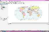
AvisMap Desktop Professional 5 is a professional desktop Gis software for map editing, managing, analysis attribute data, aid decision-making transactions and output map, print tables, 3D modeling, and other functions. As a complete analysis management tool, AvisMap Despro 5 is applicable in land management, forestry, electric power, telecom, traffic, city pipe network, resource...
Category: Multimedia & Design / Graphics Viewers
Publisher: AvisMap GIS Technologies, License: Shareware, Price: USD $499.00, File Size: 22.2 MB
Platform: Windows
Shareware
Total Gis Converter is an affordable converter of Gis files. It converts AEP, GRD, ADF, E00, FLT, APR, SHP, DXF, BT, TOC, RT1, DEM, DLG, ECW, IMG, DGF, GML, SID, MIF, TAB, WOR, DNG, DDF, BIL, TIF, JPEG, TTKPS, TTKGP, TTKLS, LFT, PFT, and TFT files. The target formats are TIFF, PNG, JPEG, BMP. The program can scale your Gis files to optimize their size. Besides, it can slice...
Category: Multimedia & Design / Graphics Viewers
Publisher: Softplicity, License: Shareware, Price: USD $99.90, File Size: 7.6 MB
Platform: Windows
InstantAtlas™ DeskTop, a product developed by GeoWise and which you can buy from ESRI (UK), enables information analysts and Gis professionals to create highly-interactive web solutions that combine statistics and Gis data to improve visualisation, enhance communication, and engage people in more informed decision making.
InstantAtlas DeskTop is quick and easy...
Category: Multimedia & Design / Multimedia App's
Publisher: GeoWise, License: Demo, Price: USD $0.00, File Size: 552.0 KB
Platform: Windows
PocketGIS is a powerful mobile Geographical Information System (Gis) for field data capture which can display and edit map geometry and attributes. PocketGIS brings real Gis functionality to highly portable handheld devices which are lightweight, convenient and have a long battery life.
Category: Utilities / Misc. Utilities
Publisher: Pocket Systems Ltd, License: Shareware, Price: USD $499.00, File Size: 42.8 MB
Platform: Windows
Encom PA provides advanced interactive visualisation in one-, two-, and three-dimensions with support for most geophysical and geological information types used by companies to cover regional exploration through to mine development.
Encom PA is an interactive geophysical interpretation tool for the analysis of data in point, profile, drillholes, grid, RGB image, remote sensing, Gis...
Category: Multimedia & Design / Graphics Viewers
Publisher: Encom Technology Pty Ltd, License: Freeware, Price: USD $0.00, File Size: 36.5 MB
Platform: Windows
GenesisIV understands GIS concepts like layers, shape objects and georeferencing.
GenesisIV understands Gis concepts like layers, shape objects and georeferencing. It interfaces to industry standard Gis systems such as MapInfo and ArcView so you can use your existing data without having to learn new concepts or perform difficult manipulations.
GenesisIV is the only landscape product designed specifically to help teach geographical concepts....
Category: Multimedia & Design / Multimedia App's
Publisher: Geomantics, License: Freeware, Price: USD $0.00, File Size: 17.6 MB
Platform: Windows
The Microdrone Airborne Mapping extension to Orbit Gis provides the tools required for automated flight and high precision mapping. It contains a Waypoint Generator, a Microdrone in-flight tracker, and a captation tool. Further image-, stereoprocessing and orthorectification can be executed using the Strabo Photogrammetry extension to Orbit Gis.
Category: Multimedia & Design / Multimedia App's
Publisher: Orbit GeoSpatial Technologies, License: Freeware, Price: USD $0.00, File Size: 30.0 MB
Platform: Windows
The Keymap SDK is a set of C classes designed with the purpose of simplifying the development process of Gis applications for programmers. It supports a wide range of Gis features, include built-in GPS support, symbology and advanced road styles. Unlike other Gis products which are usually shipped as ActiveX components, Keymap SDK is a set of C classes that can be easily...
Category: Software Development / Misc. Programming
Publisher: 17 Degree Inc., License: Demo, Price: USD $0.00, File Size: 0
Platform: Windows
NexGeo Office™ provides all of the functionality needed to organize a data collection project and manage data collected from Nexteq GPS/Gis handhelds. It provides tools for viewing, editing and exporting data to a format suitable for your existing Gis and CAD infrastructure.
Category: Multimedia & Design / Image Editing
Publisher: Nexteq Navigation, License: Freeware, Price: USD $0.00, File Size: 7.4 MB
Platform: Windows
Shareware
GPS Mapping Software for Windows, Loading topographic maps, realtime navigation, track recording, manage GPS devices and more. The software can be used with various map formats including: GeoTiff, BSB Nautical Charts, AutoCad DXF files, ESRI Shapefiles. Using calibration you can also use scanned or downloaded JPG, BMP, GIF, PNG and TIF maps. The software can be used for survey, research, track...
Category: Home & Education / Science
Publisher: Eye4Software B.V., License: Shareware, Price: USD $149.00, EUR99, File Size: 11.1 MB
Platform: Windows
With MapAuthor you can create, print and save desktop maps, using data that you obtain from commercial sources or perhaps your in-hous Gis department as shapefiles (shapefiles are a very common Gis exchange format.) You can also produce internet-based maps based on Google Maps, for use on your web site.
MapAuthor allows you to link your own data to maps, for example if you...
Category: Internet / Misc. Plugins
Publisher: MapAuthor.com, License: Freeware, Price: USD $0.00, File Size: 6.3 MB
Platform: Windows
Software development kit for CAD/CAM/ GIS and graphic software developers.
Software development kit for CAD/CAM/ Gis and graphic software developers. Converts from raster to vector and refines architect, mechanical, tech drawing, maps, math graphs, graphics for books and journals and more. ActiveX and Com Component are also available. Refines vector graphics, creates fine lines and shapes. Scanned drawings are recognized and represented in a vector format to be...
Category: Software Development / Tools & Editors
Publisher: AlgoLab Inc., License: Shareware, Price: USD $0.00, File Size: 2.7 MB
Platform: Windows
SuperGIS Spatial Statistical Analyst is a set of application software integrating geostatistical methods and Gis functions. Besides exploring of spatial data, query and demonstrating of attribute data, and the basic statistic capabilities, it also allows users to perform geostatistical analysis to obtain a better understanding about the variance and relativity of spatial data, to improve...
Category: Multimedia & Design / Multimedia App's
Publisher: SuperGeo Technologies Inc, License: Demo, Price: USD $0.00, File Size: 3.6 MB
Platform: Windows
MapObjects—Java Edition 2 is the newest version of Esri's pure Java solution for the Gis Java developer.Support for additional file formats such as MrSID, CAD (DGN, DXG, and DWG), SDC, military formats, and much more.Support for Mac OS X and IBM AIX operating systems in addition to continued support for HP-UX, Linux, Solaris, and Windows.
MapObjects—Java Edition is...
Category: Software Development / Misc. Programming
Publisher: ESRI, License: Demo, Price: USD $0.00, File Size: 2.2 MB
Platform: Windows
SuperGIS DataManager is an application which can help you to manage the layers.
SuperGIS DataManager is an application which can help you to manage the layers. Due to the rise of Gis, a number of Gis formats are used worldwide. SuperGIS DataManager supports most of the common feature and raster layers to be displayed, copied, moved, deleted, etc.
Category: Utilities / Misc. Utilities
Publisher: SuperGeo, License: Demo, Price: USD $0.00, File Size: 66.8 MB
Platform: Windows
SuperGIS DataConvertor is a powerful data conversion tool which is able to convert files between the common Gis formats to the SuperGeo self-defined formats. Therefore, your data can be used in SuperGeo series products, and also the SuperGeo self-defined formats can be used in other related platforms or systems. You will no longer need to worry the compatibility of Gis data, and...
Category: Business & Finance / Calculators
Publisher: SuperGeo, License: Freeware, Price: USD $0.00, File Size: 3.2 MB
Platform: Windows
Topocad is a CAD system made for surveying, mapping, design and GIS.
Topocad is a CAD system made for surveying, mapping, design and Gis.Topocad is built up by different modules. Start with Topocad Reader, a freeware application that you can use for communication with your instruments, calculation and the result is a map or drawing.
Category: Multimedia & Design / Image Editing
Publisher: Chaos systems AB, License: Shareware, Price: USD $39.00, File Size: 84.2 MB
Platform: Windows
MindManager Viewer is a free viewer that will allow you to open any MindManager (.
MindManager Viewer is a free Viewer that will allow you to open any MindManager (.mmap) files in read-only status. The Viewer is capable of reading notes, utilizing hyperlinks, opening attachments and standard navigation of map files.
The standalone Viewer is based on MindManager 7 for Windows, but can open files created in MindManager 9 or 8.
Category: Business & Finance / Project Management
Publisher: Mindjet LLC, License: Freeware, Price: USD $0.00, File Size: 26.4 MB
Platform: Windows
spatialSQL help contains a detailed description of solutions to some common GIS problems.
spatialSQL help contains a detailed description of solutions to some common Gis problems.
The interface provides a simple mechanism for selecting tables, spatialSQL operators, where clause, distance and other qualifiers and update operators. See the description of features and benefits.
Category: Software Development / Misc. Programming
Publisher: Spatial Projects, License: Freeware, Price: USD $0.00, File Size: 7.6 MB
Platform: Windows
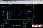
AutoCAD DWG Viewer,a lite and fast DWG Viewer
ACAD DWG Viewer,a lite and fast dwg Viewer, browse , view and print DWG, DXF files. Supports AutoCAD 2007 drawing format. It works with the terminal server, for instance Citrix, Now, Print to scale is supported.
Category: Multimedia & Design
Publisher: DWG Viewer, License: Shareware, Price: USD $62.00, File Size: 3.1 MB
Platform: Windows