Free Downloads: Gps Maps Nav Track
FlashB1Nav (for windows XP/Vista/7) is a software application designed especially for B1 Nav devices.
It lets you send b1n files to your B1 Nav devices.
This instrument adds to the features of the B1 all the navigation features needed for Cross Country and Competition Flights.
The B1 Nav integrates the latest Gps technology wich...
Category: Home & Education / Miscellaneous
Publisher: Flymaster Avionics, Lda., License: Freeware, Price: USD $0.00, File Size: 13.6 MB
Platform: Windows


 Shareware
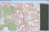
Gps Mapping Software for Windows, Loading topographic Maps, realtime navigation, Track recording, manage Gps devices and more. The software can be used with various map formats including: GeoTiff, BSB Nautical Charts, AutoCad DXF files, ESRI Shapefiles. Using calibration you can also use scanned or downloaded JPG, BMP, GIF, PNG and TIF Maps. The software can...
Category: Home & Education / Science
Publisher: Eye4Software B.V., License: Shareware, Price: USD $149.00, EUR99, File Size: 11.1 MB
Platform: Windows


 Shareware
Gps Mapping Software for Windows, Loading topographic Maps, manage Gps devices and more. The software can be used with various map formats including: GeoTiff, BSB Nautical Charts, AutoCad DXF files, ESRI Shapefiles. Using calibration you can also use scanned or downloaded JPG, BMP, GIF, PNG and TIF Maps. The software can be used for survey, research, Track and...
Category: Home & Education / Science
Publisher: Eye4Software B.V., License: Shareware, Price: USD $75.04, EUR49, File Size: 6.7 MB
Platform: Windows
Create Gps enabled geo Maps directly on the background of aereal photos and road Maps from the internet. Import geodata from Google-Earth, OpenStreetMap, Gps tracks and Gps logger. Map editor , manually digitizing. Specifical graphical objects (borderlines, borderareas) to guarantee exact same borders of neighbour areas..Screen calibration for true to display...
Category: Multimedia & Design / Digital Media Editors
Publisher: GPSur Dr. Erhard Regener, License: Shareware, Price: USD $65.00, File Size: 6.4 MB
Platform: Windows
The fast track to GPS success.
The fast Track to Gps success. The Linx MDEV-Gps-SR contains everything needed to rapidly evaluate the SR Series Gps modules and implement them in record time. This all-inclusive Master Development System features a pre-assembled development board with an on-board OLED display for standalone testing. The system can also be attached to a PC via USB and operated using...
Category: Software Development / Misc. Programming
Publisher: Linx Technologies, Inc., License: Freeware, Price: USD $0.00, File Size: 98.5 MB
Platform: Windows
GPS Send Map is a Windows interface program which uses (sendmap.
Gps Send Map is a Windows interface program which uses (sendmap.exe) to load the IMG Maps to the Gps.This program works well and setup is easy, although there seams to be minor issues in some windows OS.The Gps acted as usual and my Maps appeared on the screen as usual. NICE.
Category: Security & Privacy / Other
Publisher: DougsBrat, License: Freeware, Price: USD $0.00, File Size: 1.5 MB
Platform: Windows
With MetroWizzz- the Autorouting MetroGuide Wizard, you can make your Gps capable of autorouting with MetroGuide Maps. The wizard is self explaining. In just 6 simple steps you will have autorouting capabilities with MetroGuide Maps on your Gps. You can upload up to 1Gb of Maps to your Gps.
Category: Home & Education / Miscellaneous
Publisher: Geodude, License: Freeware, Price: USD $0.00, File Size: 962.2 KB
Platform: Windows
The Gps Detector software is used to update the Gps detector's database , updating Maps , routes and camera locations . The device itself is based on pre-installed Gps coordinates, the device can indicate various road hazards like: Fixed cameras, Red light speed cameras and bus lane cameras, Usual speed measurement places and dangerous zones.
Category: Business & Finance / Business Finance
Publisher: Euro Noliker Kft., License: Freeware, Price: USD $0.00, File Size: 5.5 MB
Platform: Windows
Moagu: The Mother Of All GPS Utilities.
Moagu: The Mother Of All Gps Utilities.
You can convert USGS topographic Maps, aerial/satellite imagery, and any other raster map imagery for use on Garmin handled Gps units.
Garmin Maps have been in a "vector" format; Moagu creates Maps using a "bitmap" format.
Category: Home & Education / Miscellaneous
Publisher: Moagu, License: Shareware, Price: USD $19.95, File Size: 38.2 MB
Platform: Windows
FREE GPS Software for your Garmin, Magellan or Lowrance GPS.
FREE Gps Software for your Garmin, Magellan or Lowrance Gps.
EasyGPS is the fast and easy way to upload and download waypoints, routes, and tracks between your Windows computer and your Garmin, Magellan, or Lowrance Gps. EasyGPS lists all of your waypoints on the left side of the screen, and shows a plot of your Gps data on the right. Use EasyGPS to back up...
Category: Internet / Communications
Publisher: TopoGrafix, License: Freeware, Price: USD $0.00, File Size: 3.9 MB
Platform: Windows
Gps Egypt brings you the best Gps mapping and navigation package on the Egyptian market today with over 55,000 km of road coverage. The package offers the best map coverage available in Egypt, in addition to a cutting-edge software package for voice-based routing and navigation.
Category: Internet / Communications
Publisher: GPS Egypt, License: Freeware, Price: USD $0.00, File Size: 135.6 MB
Platform: Windows
OZtopo provides an alternative set of maps, suitable for use on Garmin GPS units.
OZtopo provides an alternative set of Maps, suitable for use on Garmin Gps units. It has been designed as a detailed set of topographical Maps suitable for bushwalking, 4WDing and general touring . It is comprised of two mapsets, 10m Contours and Roads and Tracks. Both mapsets can be loaded onto a Gps at the same time. They can also be loaded concurrently with any of...
Category: Business & Finance / Business Finance
Publisher: Oztopo, License: Shareware, Price: USD $0.00, File Size: 75.7 MB
Platform: Windows
CompeGPS is an essential software to make the most of your Gps. With this PC software you will be able to download a wide variety of cartography from the internet and also analyse your routes. This software has been specially designed for free flight and motor flight pilots they use Gps and likes to create and accomplish their own routes and then later on analyse. CompeGPS...
Category: Home & Education
Publisher: CompeGPS TEAM S.L., License: Shareware, Price: USD $106.00, File Size: 14.9 MB
Platform: Windows
NavRepository is a powerful simple-to-use version control tool for MS Dynamics NAV.
NavRepository is a powerful simple-to-use version control tool for MS Dynamics Nav. NavRepository eases the development and maintenance of Navision objects by providing a local repository for Nav objects, this way allowing integration of Navision with external version control systems, such as SVN or CVS. NavRepository makes the daily work of Nav developers and consultants...
Category: Software Development / Help File Utilities
Publisher: NavUtils, License: Freeware, Price: USD $0.00, File Size: 2.1 MB
Platform: Windows
CompeGPS is an essential software to make the most of your Gps. With this PC software you will be able to download a wide variety of cartography from the internet and also analyse your routes. This software has been specially designed for 4x4 lovers, bike tourists, excursionists and, in general, everyone who uses Gps, likes to create and accomplish their own routes and then...
Category: Home & Education
Publisher: CompeGPS TEAM S.L., License: Shareware, Price: USD $106.00, File Size: 14.9 MB
Platform: Windows
Eye4Software Gps Mapping is a professional Gps mapping software tool that can be used in numerous applications. Use the software to load, view and edit your Maps, display your position realtime and record all your movements.
The software will work with almost any Gps and can be used on any desktop, laptop or needbook computer running Windows XP or...
Category: Home & Education / Miscellaneous
Publisher: Eye4Software B.V., License: Shareware, Price: USD $130.61, File Size: 14.6 MB
Platform: Windows
Map of Africa is one of the many maps created for GPS TrackMaker.
Map of Africa is one of the many Maps created for Gps TrackMaker. You are able to download the installation package from the TrackMaker website. In order to preview the contents of this package, you need to install Gps TrackMaker.
Using the above mentioned application, you will be able to see the Map of Africa. Just click on the "Open Temporary...
Category: Home & Education / Miscellaneous
Publisher: Geo Studio Technology, License: Freeware, Price: USD $0.00, File Size: 18.3 MB
Platform: Windows
Want to download and be able to add additional custom POI 's to your Navigon Sat Nav but can't work out how? If you have bought one of the newer, 40/70 series Satellite Navigation (Sat Nav) or Gps device from Navigon, then you should be good to go. Simply install and then run Navigon Fresh and use the new POI-Assistant utility.
This is a fairly simple...
Category: Home & Education / Miscellaneous
Publisher: Paul Tomlinson, License: Freeware, Price: USD $0.00, File Size: 17.8 MB
Platform: Windows


 Freeware
GPS Converter will convert GPS coordinates between three different formats: 34. 26965, -116.
76783; N 34° 16. 179', W 116° 46. 07'; and N 34° 16' 10.
Category: Home & Education / Sports
Publisher: ALMSys, Inc., License: Freeware, Price: USD $0.00, File Size: 929.9 KB
Platform: Windows
OziPhotoTool combines the technology of a Gps receiver and a digital camera to automatically keep a record of where digital photos were taken. It is designed to be used in conjunction with OziExplorer. Most digital cameras have EXIF metadata stored as part of the photo. This includes is the date and time the photo was taken. Many Gps units have 'tracklogs'. The Gps keeps a...
Category: Utilities
Publisher: OziPhotoTool, License: Shareware, Price: USD $25.00, File Size: 14.3 MB
Platform: Windows
Telephony for Microsoft Dynamics Nav
activeTAPI for Microsoft Dynamics Nav offers end users and Microsoft Dynamics Partners an easy and reliable way to integrate TAPI-Telephony with their Microsoft Dynamics Nav application.activeTAPI-DyNAV integrates TAPI Telephony right out-of-the-box with your Microsoft Dynamics Nav application.
Category: Internet / Communications
Publisher: Schmidt e-Services GmbH & Gertz EDV-Beratung, License: Freeware, Price: USD $0.00, File Size: 2.7 MB
Platform: Windows
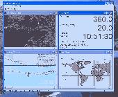
The program accepts NMEA GPS sentences from most GPS receivers that connect to a USB port.
The program accepts NMEA Gps sentences from most Gps receivers that connect to a USB port.
The program can display satellite images of waypoint locations on the Track plotter.
Is a free software for recording , monitoring and plotting Gps data, very useful and very easy.
Category: Home & Education / Miscellaneous
Publisher: Club Cruceros de La Paz A.C., License: Freeware, Price: USD $0.00, File Size: 10.6 MB
Platform: Windows
TopoFusion is a GPS Mapping program for Windows.
TopoFusion is a Gps Mapping program for Windows. It downloads Maps (Topo, Aerial Photo and Satellite) automatically from several public map servers.
It seamlessly displays imagery from Terraserver and the OnEarth Server. Maps are downloaded on demand (as the user pans or zooms around the map) and cached on the user's hard drive for faster (and offline) storage.
Category: Utilities / Misc. Utilities
Publisher: TopoFusion, License: Shareware, Price: USD $69.95, File Size: 7.4 MB
Platform: Windows
The five essential benefits:
PLAN ROUTES - Use real colour Maps on a PC, Pocket PC or Smartphone to help you find your way. Simply click on the map to plan your route and see leg distance, compass bearing, journey length and estimated trip time. You can even visualise your routes in a continuous 3D landscape.
PRINT Maps - Create and print...
Category: Home & Education / Miscellaneous
Publisher: Memory-Map, Inc., License: Shareware, Price: USD $0.00, File Size: 18.6 MB
Platform: Windows
Gps Navigator with using a scanned Maps and possibility to open a lot of Maps together. - you can show a current Gps data (Speed, Direction, Longitude, Latitude, Time, Date, Height); - you can open any of scanned Maps (in a "bmp" or "dib" format); - you can calibrate the scanned Maps yourself by two calibration points only (left-top and...
Category: Home & Education
Publisher: Valeri Vlassov, License: Demo, Price: USD $19.00, File Size: 4.6 MB
Platform: Windows


