Free Downloads: Gps Time Synchronization
 Shareware
With AnyMP4 iPhone Gps Spoofer for Mac, you own one of the best Gps location spoofers for iOS devices. It lets you set the virtual Gps location within a few clicks. Whats more, you can play location-based games from anywhere in the world easily. Key Functions: 1. Fake yours iPhone location easily. AnyMP4 iPhone Gps Spoofer for Mac is an easy-to-use...
Category: Software Development
Publisher: AnyMP4 Studio, License: Shareware, Price: USD $9.96, File Size: 72.5 MB
Platform: Mac
The Gps Controller software is a free program designed to allow you to configure a range of Gps receivers. There are versions that run on Windows desktop computers, or Windows Mobile devices.
Before downloading the software, it recommend downloading and reading the documentation to confirm which version you need.
Category: Home & Education / Miscellaneous
Publisher: Trimble Navigation, License: Freeware, Price: USD $0.00, File Size: 30.9 MB
Platform: Windows
Shareware
Gps Mapping Software for Windows, Loading topographic maps, manage Gps devices and more. The software can be used with various map formats including: GeoTiff, BSB Nautical Charts, AutoCad DXF files, ESRI Shapefiles. Using calibration you can also use scanned or downloaded JPG, BMP, GIF, PNG and TIF maps. The software can be used for survey, research, track and trace, real...
Category: Home & Education / Science
Publisher: Eye4Software B.V., License: Shareware, Price: USD $75.04, EUR49, File Size: 6.7 MB
Platform: Windows
Gps Express provides a feature rich interface to serial NMEA-0183 protocol data and works with most NMEA-0183 devices, including Gps Receivers. Gps Express is available in three versions (Standard, Professional, Graphical). STANDARD displays the title, value, and units for each parameter. Manual,Scan operation. Navigation buttons. Manual,automatic sentence triggering....
Category: Utilities
Publisher: Steelwater Solutions Corporation, License: Shareware, Price: USD $65.00, File Size: 2.1 MB
Platform: Windows
NovaGPS provides manual or automatic setting of Time and location from consumer-grade (or better) Gps receivers. NovaGPS is not the same as Dr. Tom Clark's Totally Accurate Clock because NovaGPS does not require a specialized Gps receiver or modification to other Gps receivers.
Instead, NovaGPS offers accuracy to better than 0.5 seconds using...
Category: Home & Education / Miscellaneous
Publisher: Northern Lights Software Associates, License: Shareware, Price: USD $19.95, File Size: 1.0 MB
Platform: Windows
GPS-CCD:is a novel computational program for the
Prediction of Calpain Cleavage Sites.
Gps-CCD:is a novel computational program for the
Prediction of Calpain Cleavage Sites.
The online service and local packages of Gps-CCD 1.0 were
implemented in JAVA/. For the online service, we tested the Gps-CCD1.0 on a variety of internet browsers, including Internet Explorer 6.0, Netscape Browser 8.1.3 and Firefox 2 under the Windows XPOperating System...
Category: Web Authoring / JavaScript
Publisher: The CUCKOO Workgroup, License: Freeware, Price: USD $0.00, File Size: 19.2 MB
Platform: Windows
ThinkVantage Gps (Global Positioning System) receives signals from the Gps satellites and determines the location of your ThinkPad. This program is easy to install and easy to manipulate.
This package installs the software (Gps driver) to enable the following devices:
- Ericsson F3507g
- Ericsson F3607gw
- Ericsson F5521gw
-...
Category: Utilities / System Utilities
Publisher: Lenovo, License: Freeware, Price: USD $0.00, File Size: 20.6 MB
Platform: Windows
The OSTN02 extension for ArcPad is a FREE tool that automatically transforms Gps data and aligns it with Ordnance Survey (OS) background map. This easy-to-use extension removes the need to manually post-process Gps data by providing’ on the fly’ transformation of WGS84 latitude and longitude into OSTN02 corrected British National Grid coordinate. Data capture using...
Category: Home & Education / Miscellaneous
Publisher: ESRI (UK) Ltd, License: Freeware, Price: USD $0.00, File Size: 8.0 MB
Platform: Windows
Have a Gps and a laptop? Use this to find your way. Make patterns or a trail to share with others. When the application starts, you may pick your area of operations - be it North America, South America, Europe and Asia, or Australia. Your quadrant is determined by where you are in relation to the Equator and the Prime Meridian. Tracking of your position is automatically enabled when the...
Category: Home & Education / Miscellaneous
Publisher: LogicAll Solutions, LLC, License: Freeware, Price: USD $0.00, File Size: 4.6 MB
Platform: Windows

Improve your golf game with a handheld Gps that gives distance to pin, club suggestions, locations of hazards and much more. Wherever in the world you play golf, the sureshotgps will allow you to obtain distances from tee to green. Experience the difference with better club selection, speedier play and statistical information per round of golf. The sureshotgps relies on Gps...
Category: Home & Education
Publisher: Absolute Software Pty Ltd, License: Shareware, Price: USD $399.00, File Size: 3.8 MB
Platform: Windows
Shareware
SyncBreeze Server is a powerful, easy-to-use and fast file Synchronization server allowing one to synchronize files between directories, disks, network shares and NAS storage devices. SyncBreeze Server provides multiple one-way and two-way file Synchronization modes, periodic file Synchronization capabilities, multi-way file Synchronization, real-Time file...
Category: Utilities / Backup
Publisher: Flexense, License: Shareware, Price: USD $125.00, File Size: 3.8 MB
Platform: Windows
GPSCAD Transfer is an application for transferring points between a gps device and autocad.
GPSCAD Transfer is an application for transferring points between a Gps device and autocad. The present version works with a Magellan Gps device, but the next release will also work with a Garmin Gps device. It allows you to convert latitude and longitude to utm zone nad 83 in either the US or in metric measurement system.
Category: Multimedia & Design / Image Editing
Publisher: Timberwolf Software Solutions, LLC, License: Shareware, Price: USD $0.00, File Size: 2.6 MB
Platform: Windows
GPS Send Map is a Windows interface program which uses (sendmap.
Gps Send Map is a Windows interface program which uses (sendmap.exe) to load the IMG maps to the Gps.This program works well and setup is easy, although there seams to be minor issues in some windows OS.The Gps acted as usual and my maps appeared on the screen as usual. NICE.
Category: Security & Privacy / Other
Publisher: DougsBrat, License: Freeware, Price: USD $0.00, File Size: 1.5 MB
Platform: Windows
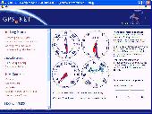
Develop precise, efficient, and reliable Gps software in record Time with this multithreaded component for desktop and mobile devices, including PocketPC, Windows CE, Tablet PC, Smartphone and now Windows Mobile! Over fifty classes in one lightweight assembly give you unparalleled features while saving you hundreds of dollars in Gps device testing. Gps.NET is...
Category: Software Development
Publisher: GeoFrameworks, LLC, License: Commercial, Price: USD $199.00, File Size: 8.5 MB
Platform: Windows,
Kinomap Gps File Fixer allows you to process some treatments on Gps file:
- convert almost any Gps file to standard NMEA 0183, compatible with Kinomap
- fill the gaps between points when your file is not 1Hertz: the extra point will be recreated by interpolation
- cut a long file in which there are loops of data (example: race) in several parts
Category: Home & Education / Miscellaneous
Publisher: ExcelLance, License: Freeware, Price: USD $0.00, File Size: 19.6 MB
Platform: Windows
Shareware
Gps Mapping Software for Windows, Loading topographic maps, realtime navigation, track recording, manage Gps devices and more. The software can be used with various map formats including: GeoTiff, BSB Nautical Charts, AutoCad DXF files, ESRI Shapefiles. Using calibration you can also use scanned or downloaded JPG, BMP, GIF, PNG and TIF maps. The software can be used for survey,...
Category: Home & Education / Science
Publisher: Eye4Software B.V., License: Shareware, Price: USD $149.00, EUR99, File Size: 11.1 MB
Platform: Windows
Gps Express provides a feature rich interface to serial NMEA-0183 protocol data and works with most NMEA-0183 devices, including Gps Receivers. Gps Express is available in three versions (Standard, Professional, Graphical). STANDARD displays the title, value, and units for each parameter. Manual,Scan operation. Navigation buttons. Manual,automatic sentence triggering....
Category: Internet / Dial-up & Connectivity
Publisher: Steelwater Solutions Corporation, License: Shareware, Price: USD $30.00, File Size: 2.1 MB
Platform: Windows, Vista
Keep track of discount Garmin GPS deals on with this Firefox toolbar.
Keep track of discount Garmin Gps deals on with this Firefox toolbar.compare and buy all the latest Garmin satellite navigation systems. If you want a discount Garmin Gps system this is the Firefox toolbar to use. We also provide information on the latest offers, price cuts and discount voucher codes to help you buy the latest Garmin Gps at the cheapest price possible in...
Category: Internet / Browsers
Publisher: Discount Garmin GPS, License: Freeware, Price: USD $0.00, File Size: 1.1 MB
Platform: Windows
An easy to use Gps downloading utility that lets you download your Gps waypoints easily and export them into a variety of formats useful for editing, display and importing into many different mapping programs.
Use Lobal to save Gps waypoints as:
- Text Files
- HTML Tables
- Shape Files
- Google Earth KML
- DBase Files.
Category: Utilities / Misc. Utilities
Publisher: Ecological Software Solutions, License: Freeware, Price: USD $0.00, File Size: 2.2 MB
Platform: Windows
Gps Express provides a feature rich interface to serial NMEA-0183 protocol data and works with most NMEA-0183 devices, including Gps Receivers. Gps Express is available in three versions (Standard, Professional, Graphical). STANDARD displays the title, value, and units for each parameter. Manual,Scan operation. Navigation buttons. Manual,automatic sentence triggering....
Category: Internet / Communications
Publisher: Steelwater Solutions Corporation, License: Shareware, Price: USD $65.00, File Size: 2.1 MB
Platform: Windows
Real Time Sync compares files in specified folders and copies the modified file to the counterpart folder, once the updated detected. Unlike other file sync tools that just copy files with the most recent modification Time, Real Time Sync uses a true bi-directional Synchronization algorithm that does not depend on system clock accuracy, and also propagates file...
Category: Utilities / Command Line Utilities
Publisher: DJYsoft., Inc, License: Shareware, Price: USD $38.00, File Size: 10.7 MB
Platform: Windows
Gps Egypt brings you the best Gps mapping and navigation package on the Egyptian market today with over 55,000 km of road coverage. The package offers the best map coverage available in Egypt, in addition to a cutting-edge software package for voice-based routing and navigation.
Category: Internet / Communications
Publisher: GPS Egypt, License: Freeware, Price: USD $0.00, File Size: 135.6 MB
Platform: Windows
VIETMAP Gps Fleet Management is a great Gps tracking software for companies that need to know where are all the cars in some moment. It is a great and helpful software when you want to check out if your drivers are on schedule. This software also helps you if your car is stolen.
Category: Business & Finance / Business Finance
Publisher: VIETMAP, License: Demo, Price: USD $0.00, File Size: 111.6 MB
Platform: Windows
With our locr PC software "locr Gps Photo for Windows" you can manage to automatically geotag numerous photos simultaneously. You just require a digital camera, a Gps data logger and the application "locr Gps Photo for Windows".
There are two ways to geotag your photos: The photos can be tagged manually or automatically. For automatic geotagging...
Category: Multimedia & Design / Multimedia App's
Publisher: locr, License: Freeware, Price: USD $0.00, File Size: 490.8 KB
Platform: Windows
A program for converting OLEX files into GPS Utility Format Files.
A program for converting OLEX files into Gps Utility Format Files.
Gps Utility is an easy-to-use application that allows you to manage, manipulate and map your Gps information.
When you convert the OLEX files you can use the source file name or enter a new target file name.
Category: Audio / Rippers & Encoders
Publisher: GPS Utility Ltd., License: Freeware, Price: USD $0.00, File Size: 404.5 KB
Platform: Windows