Free Downloads: Image Coordinate
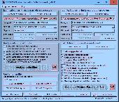
CoordTrans converts geographic coordinates between different coordinate systems.
CoordTrans converts geographic coordinates between different Coordinate systems.
CoordTrans is very easy to use, and full of Wizards to help you with more complex tasks.
Convert between UTM, WGS84 and NAD27 / NAD83, and more... almost all projections and datums on Earth are supported. See complete list..
You can convert single coordinates, or...
Category: Business & Finance / Business Finance
Publisher: Franson, License: Shareware, Price: USD $49.00, File Size: 6.5 MB
Platform: Windows
The Geocentric Datum of Australia (GDA) is a Coordinate reference system that best fits the shape of the earth as a whole. It has an origin that coincides with the centre of mass of the earth, hence the term 'geocentric'.
The state datum in Queensland is the Geocentric Datum of Australia 1994 (GDA94) replacing the previously adopted Australian Geodetic Datum 1984 (AGD84).
Category: Home & Education / Miscellaneous
Publisher: Department of Natural Resources and Mines, License: Freeware, Price: USD $0.00, File Size: 7.7 MB
Platform: Windows
Asymptote is a powerful descriptive vector graphics language that provides a natural Coordinate-based framework for technical drawing. Labels and equations are typeset with LaTeX, for high-quality PostScript output.
A major advantage of Asymptote over other graphics packages is that it is a programming language, as opposed to just a graphics program.
Category: Multimedia & Design / Multimedia App's
Publisher: Andy Hammerlindl, John Bowman, Tom Prince, License: Freeware, Price: USD $0.00, File Size: 3.5 MB
Platform: Windows
The fGIS Editor is a multi-purpose, full-featured, powerful, and easy-to-use GIS application.
The fGIS Editor is a multi-purpose, full-featured, powerful, and easy-to-use GIS application. Created by the same technical expertise behind the popular freeware fGIS program, the fGIS Editor provides a clear, supported upgrade path for current users of fGIS. The fGIS Editor is built upon the TatukGIS Editor and combines the familiar features found in fGIS with the new, powerful features found...
Category: Multimedia & Design / Multimedia App's
Publisher: TatukGIS Consulting, License: Shareware, Price: USD $99.00, File Size: 4.8 MB
Platform: Windows
SEVENPAR is a tool for the calculation of highly exact transformation parameters for the Spatial Helmert and Molodensky Transformation, which make possible precise Coordinate transformations from one reference system into another. The determined transformation parameters can be entered directly into suitable transformation software, e.g. TRANSDAT Coordinate Transformations, or...
Category: Home & Education / Science
Publisher: Killet GeoSoftware Ing.-GbR, License: Shareware, Price: USD $285.00, EUR240, File Size: 7.6 MB
Platform: Windows
Rocanda Land Tracker software will allow you to convert any LSD location in Alberta, British Columbia, Saskatchewan or Manitoba into a corresponding latitude/longitude Coordinate. which you can then input into mapping software such as Garmin's Mapsource products, or OziExplorer.
Category: Business & Finance / MS Office Addons
Publisher: Rocanda, License: Shareware, Price: USD $179.00, File Size: 8.6 MB
Platform: Windows
The Grid InQuest software provides a means for transforming coordinates between ETRS89 (WGS84) and the National Coordinate systems of Great Britain, Northern Ireland and the Republic of Ireland. It provides a fully three dimensional transformation incorporating the latest geoid model and is the nationally recognised software for performing these conversions.
In conjunction...
Category: Home & Education / Miscellaneous
Publisher: Quest Geo Solutions Ltd, License: Freeware, Price: USD $0.00, File Size: 0
Platform: Windows
 Shareware
GPS SDK to add GPS and Coordinate conversion functionality to your software and scripts). All NMEA0183 protocol versions are supported and can be filtered by NMEA sentence type and talker ID. Garmin USB PVT support. Information on GPS status can also be retrieved: GPS fix quality, satellites used in fix, satellites in view, satellite azimuth, elevation and signal strengths. The...
Category: Software Development
Publisher: Eye4Software B.V., License: Shareware, Price: USD $99.00, EUR79, File Size: 2.3 MB
Platform: Windows
ZGrapher is a simple graphic utility.
ZGrapher is a simple graphic utility. It can be helpful for any user, from a schoolboy to a professional mathematician. Using this program you can plot graphs of the following types: Y(x), X(y), R(a) – in polar coordinates, X(t) and Y(t) – parametric equations and graphs of tables. To create a graph you should specify its parameters – formula, graph’s width, style,...
Category: Home & Education / Mathematics
Publisher: Palam Software, Inc., License: Freeware, Price: USD $0.00, File Size: 619.8 KB
Platform: Windows
This applet constructs quadrilaterals from the x and y Coordinate values of four given points, and also determines the category of the constructed quadrilateral (rectangle, square etc.).
Category: Home & Education / Mathematics
Publisher: eridanus.info, License: Freeware, Price: USD $0.00, File Size: 10.6 KB
Platform: Linux, Windows
Shareware
Java toolkit to add Coordinate conversion functionality to your Java applications and applets. The toolkit offers functionality to perform map grid and datum transformations: latitude and longitude can be converted to various map grids, like Transverse Mercator (TM), Oblique Mercator, Mercator, Oblique Stereographic, Polar Stereographic, Cassini, Albers Equal Area Conal, Gauss Kruger or...
Category: Software Development / Components & Libraries
Publisher: Eye4Software B.V., License: Shareware, Price: USD $199.00, EUR179, File Size: 155.5 KB
Platform: Unknown
Graphics4VO is developed for use with CA-Visual Objects (Version 2.
Graphics4VO is developed for use with CA-Visual Objects (Version 2.0 upto 2.8). It is based on 32-Bit-WINDOWS-API. The library allows development of graphics oriented CA-Visual Objects applications for 32-Bit Windows operating systems. The Graphics Library Graphics4VO includes classes, methods and functions for integration of graphic elements into Windows applications. It could be used to add...
Category: Software Development / Components & Libraries
Publisher: Killet Softwareentwicklung GbR, License: Shareware, Price: USD $130.00, File Size: 3.8 MB
Platform: Windows
Explain why and how a pinball shooter can be used to help understand ideas about reactions.
Explain why and how a pinball shooter can be used to help understand ideas about reactions.
Describe on a microscopic level what contributes to a successful reaction (with illustrations).
Describe how the reaction Coordinate can be used to predict whether a reaction will proceed or slow.
Use the potential energy diagram to determine: The activation energy for the...
Category: Home & Education / Science
Publisher: University of Colorado, Department of Physics, License: Freeware, Price: USD $0.00, File Size: 1.9 MB
Platform: Windows
COGO (COordinate GeOmetry) is an engineering tool used to determine geometric relationships.
COGO (Coordinate GeOmetry) is an engineering tool used to determine geometric relationships. There are a number of ways to create a geometric model. There is a command language that allows the user to define and solve geometric problems in engineering terms. There are Windows forms that you fill in to create the geometry. And you can execute COGO inside of AutoCAD using the Windows forms...
Category: Multimedia & Design / Image Editing
Publisher: Colorado DOT, License: Freeware, Price: USD $0.00, File Size: 3.5 MB
Platform: Windows
Graphics4VO is developed for use with CA-Visual Objects (Version 2.
Graphics4VO is developed for use with CA-Visual Objects (Version 2.0 upto 2.8). It is based on 32-Bit-WINDOWS-API. The library allows development of graphics oriented CA-Visual Objects applications for 32-Bit Windows operating systems. The Graphics Library Graphics4VO includes classes, methods and functions for integration of graphic elements into Windows applications. It could be used to add...
Category: Software Development / Components & Libraries
Publisher: Killet Softwareentwicklung GbR, License: Shareware, Price: USD $130.00, File Size: 3.8 MB
Platform: Windows
Graphing Software without the Learning Curve
Whether graphing equations or making a Coordinate grid, HandyGraph helps you create attractive graphical images quickly.
This graphing program was designed for teaching math. We understand the work involved with teaching, and we created HandyGraph to make your job a bit easier. You can make accurate high-quality graph images...
Category: Business & Finance / MS Office Addons
Publisher: Del Rey, License: Shareware, Price: USD $59.00, File Size: 3.4 MB
Platform: Windows
CopanMobile for Palm OS is a very functional and easy-to-use geomatics engineering tool for computing and managing plane surveying and mapping coordinates. It does numerous Coordinate geometry (COGO) calculations, processes and adjusts raw field survey data, computes and adjusts map traverse data, performs map or deed checks, calculates curves, areas and perimeters, performs...
Category: Multimedia & Design / Multimedia App's
Publisher: Underhill Geomatics Ltd., License: Freeware, Price: USD $0.00, File Size: 341.0 KB
Platform: Palm
The Survey Import and Export program works with AutoCAD (dwg) and Coordinate data in formats such as txt, ascii, and csv. The configurable interface makes matching survey descriptions (as assigned in the field) to text, blocks (with attributes) or various point types, straightforward. SQL drives the included Survey.mdb to support the constuction and management of field book description...
Category: Multimedia & Design / Multimedia App's
Publisher: CADD Productivity, License: Shareware, Price: USD $119.00, File Size: 3.1 MB
Platform: Windows
CopanMobile for Pocket PC is a very functional and easy-to-use geomatics engineering tool for computing and managing plane surveying and mapping coordinates. It does numerous Coordinate geometry (COGO) calculations, processes and adjusts raw field survey data, computes and adjusts map traverse data, performs map or deed checks, calculates curves, areas and perimeters, performs...
Category: Business & Finance / Applications
Publisher: Underhill Geomatics Ltd., License: Freeware, Price: USD $0.00, File Size: 341.0 KB
Platform: Windows
Freeware
A NetCDF file is a format of file that usually uses in climate data. NetCDF files usually has multi-dimension that each dimension is a separate variable. NetCDF variables that contain Coordinate data are referred to as Coordinate variables, scalar Coordinate variables, or multidimensional Coordinate variables. For example, if you want to save the rainfall data for a...
Category: Home & Education / Science
Publisher: AgriMetSoft, License: Freeware, Price: USD $0.00, File Size: 13.9 MB
Platform: Windows
TeamAgenda is a real-time, cross-platform group scheduler and resource manager that allows work groups to Coordinate their activities, set up meetings and optimize their time management. TeamAgenda provides project management windows and automated timesheet production. It lets you send meeting notifications to non-TeamAgenda users by email and manage your time on a laptop or via a web...
Category: Business & Finance / Personal Info Managers
Publisher: Teamsoft Inc., License: Shareware, Price: USD $0.00, File Size: 0
Platform: Windows
GraphSight Junior is an easy to use freeware handy 2D math-graphing program.
GraphSight Junior is an easy to use freeware handy 2D math-graphing program. It was originally designed to help students and teachers satisfy their day-after-day math plotting needs. It makes it easy to plot and explore common Y(X) = F(X) Cartesian graphs, set text labels on the Coordinate plane, zoom or shift a graph with just a single click & move of mouse. The resulting picture...
Category: Home & Education / Miscellaneous
Publisher: CradleFields.com, License: Freeware, Price: USD $0.00, File Size: 393.0 KB
Platform: Windows
With Geodesy.NET, you can quickly and easily convert geographic coordinates from one system to another. Several hundred Coordinate system conversions are supported, and all conversions can be done in under three lines of code. Full support is included for both desktops as well as mobile devices! This software is included FREE with any purchase of our GIS.NET 3.0 mapping component for...
Category: Software Development / Components & Libraries
Publisher: GeoFrameworks, LLC, License: Commercial, Price: USD $799.00, File Size: 123.7 MB
Platform: Windows,
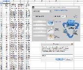
Draw points in AutoCAD and generate 3D models using data in Excel.
XLPoints Plus is the easiest way to massively draw points in AutoCAD and generate 3D models using Coordinate data in Excel. Key Features: - Quickly draw points using Coordinate data in Excel. - Create new drawings or update existing ones by establishing an open channel with AutoCAD. - Create "true" 3D faces or simply connect all points with a 3D polyline. For the 3D...
Category: Multimedia & Design
Publisher: Productivity Tools, License: Shareware, Price: USD $30.00, File Size: 1.7 MB
Platform: Windows
Archimedes Grapher is a kind of powerful and convenient tool software which supports functional graph plotting, numerical calculation, unit conversion, and slide show. It can plot all kinds of graphs (functional graphs, table graphs, polar equation, parameter equation, inequation and etc.), implement all kinds of calculations (multivariable scientific calculation, generating numerical table,...
Category: Home & Education / Miscellaneous
Publisher: NewXor Software,Inc, License: Shareware, Price: USD $28.00, File Size: 2.1 MB
Platform: Windows