Free Downloads: Kml Excelconverter
Korti is a Google Earth plugin which allows you to see the unique 3D satellite map of Korti within your Google Earth application.
Korti provides you a detailed satellite imagery and geographic information about this geographic place.
To have Korti installed on your PC, first install for free Google Earth and then Korti 3D map plugin. After that, simply double click...
Category: Multimedia & Design / Multimedia App's
Publisher: Maplandia, License: Freeware, Price: USD $0.00, File Size: 309 B
Platform: Windows
Shape2Earth Globe lets you quickly and easily capture Google Earth images for your personal use.
Shape2Earth Globe lets you quickly and easily capture Google Earth images for your personal use. Capture images for use in popular applications like Microsoft Office and ESRI's ArcMap.
Shape2Earth Globe also saves the bounding box of the image in a Kml file. This data is then used to generate a world file and projection file so that your image can be loaded into a GIS, such...
Category: Multimedia & Design / Multimedia App's
Publisher: Shape2Earth, License: Freeware, Price: USD $0.00, File Size: 402.5 KB
Platform: Windows
CityCAD Viewer is an application for opening and exploring CityCAD models.
CityCAD Viewer is an application for opening and exploring CityCAD models. If you are a CityCAD user, this means you can share your models more easily with others.
CityCAD Viewer can be used to:
-Open, explore and save CityCAD models.
-Select elements within a CityCAD model and view information about them.
-Change the group or phase of elements in a city model.
...
Category: Multimedia & Design / Image Editing
Publisher: Holistic City, License: Shareware, Price: USD $0.00, File Size: 0
Platform: Windows

TRANSDATpro can prove a helpful tool for professionals, providing them with the possibility to perform coordinate transformations fast and easy by use of the coordinate reference systems of their choice. TRANSDATpro performs Coordinate Transformations fast and with high accuracy. The coordinate conversion software supports worldwide thousands of Coordinate Systems, geodetic Reference Systems...
Category: Home & Education / Science
Publisher: Killet GeoSoftware Ing.-GbR, License: Shareware, Price: USD $270.00, EUR240, File Size: 5.3 MB
Platform: Windows
With GeoIPTC you will be able to read the IPTC city information in pictures and get the corresponding coordinates to your photos from several free services and embed this into the pictures in standard tags in a very professional way. You will also create sets of pictures with all the metadata they contain including geographical tags as Kml or KMZ files for a quick view of the selection...
Category: Multimedia & Design / Media Catalogers
Publisher: SoftExperience, License: Shareware, Price: USD $112.00, File Size: 7.3 MB
Platform: Windows
An easy to use GPS downloading utility that lets you download your GPS waypoints easily and export them into a variety of formats useful for editing, display and importing into many different mapping programs.
Use Lobal to save GPS waypoints as:
- Text Files
- HTML Tables
- Shape Files
- Google Earth Kml
- DBase Files.
Category: Utilities / Misc. Utilities
Publisher: Ecological Software Solutions, License: Freeware, Price: USD $0.00, File Size: 2.2 MB
Platform: Windows
 Demo
Demo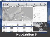
HoudahGeo is a photo geocoding and geotagging tool for Mac. Use HoudahGeo to attach GPS coordinates and location names to your photos. HoudahGeo writes EXIF and XMP geotags to JPEG and RAW image files. This creates a permanent record of where a photo was taken. Just like a GPS-enabled camera. HoudahGeo is the only application that can both write future-proof GPS tags to original images...
Category: Multimedia & Design / Media Catalogers
Publisher: Houdah Software s.à r.l, License: Demo, Price: USD $39.00, File Size: 22.9 MB
Platform: Mac
Shape2Earth leverages freely available and easy to use Geographic Information System (GIS) software to create professional visualizations for viewing in GoogleTM Earth.
Main features:
-Convert Any Shapefile to Kml - Shape2Earth reprojects your data on the fly
-Apply Thematic Symbology to your Data - Color code to display information
-Present Data in Custom...
Category: Multimedia & Design / Image Editing
Publisher: Google, License: Demo, Price: USD $0.00, File Size: 9.5 MB
Platform: Windows
Gismaps Viewer is a GIS viewer that can be used for geospatial analysis and map production.
Gismaps Viewer is a GIS viewer that can be used for geospatial analysis and map production.
The main features are:
- read Shape files using geographic coordinate system
- view satellite images (MrSid, jpeg, bmp and tiff file formats)
- generate thematic maps, queries and labels
- export do Google Earth Kml (shp2kml)
- configure map colors and...
Category: Multimedia & Design / Graphics Viewers
Publisher: Gismaps Sistemas Ltda., License: Freeware, Price: USD $0.00, File Size: 10.2 MB
Platform: Windows
This software is designed specifically to make the whole process of downloading data from a group of GPS devices, formatting the data into a race replay and then watching the replay as fast and pain free as possible.
Main Features:
- One-click GPS data downloading from up to 21 Velocitek devices in one batch ( USB hub required)
- Automatic Microsoft Virtual Earth...
Category: Internet / Download Managers
Publisher: Velocitek, License: Shareware, Price: USD $0.00, File Size: 5.4 MB
Platform: Windows
iTag is a utility that allows you to easily add title, description and keyword tags to your digital photos. The data you enter is stored into the actual photo file itself - using the open standards of IPTC and XMP. Many applications can read and write the IPTC/XMP data, but iTag is especially powerful at editing a group of photos all at once. Geocoding your photos is also straight forward...
Category: Multimedia & Design / Media Catalogers
Publisher: iTag Software, License: Freeware, Price: USD $0.00, File Size: 576.9 KB
Platform: Windows
T2K PLUS or Tiles2Kml PLUS enables you to efficiently load large set of imagery or raster maps very quickly into Google Earth using Region-Based Network Links. This method has an onRegion option, which specifically loads the Region data only when the Region is active. Thus only the needed set of data is loaded with multiple levels of detail, larger amounts of data are loaded only when the...
Category: Multimedia & Design / Authoring Tools
Publisher: Tiles2kml, License: Demo, Price: USD $40.00, File Size: 8.4 MB
Platform: Windows
Avisoft-SASLab Pro is a powerful Windows application (compatible to Windows 98/2000/XP/Vista/7) for investigating animal acoustic communication. It provides a broad range of processing and analysis tools that can greatly increase the efficiency in extensive sound analysis projects.
Avisoft-SASLab Pro is compatible:
- Supports all common soundcards and USB audio...
Category: Audio / Utilities & Plug-Ins
Publisher: Avisoft Bioacoustics, License: Demo, Price: USD $0.00, File Size: 5.6 MB
Platform: Windows

OziPhotoTool combines the technology of a GPS receiver and a digital camera to automatically keep a record of where digital photos were taken. It is designed to be used in conjunction with OziExplorer. Most digital cameras have EXIF metadata stored as part of the photo. This includes is the date and time the photo was taken. Many GPS units have 'tracklogs'. The GPS keeps a record of points that...
Category: Utilities
Publisher: OziPhotoTool, License: Shareware, Price: USD $25.00, File Size: 14.3 MB
Platform: Windows
GPicSync automatically inserts location in your photos metadata so they can also be used with any 'geocode aware' application like Picasa/Google Earth, Flickr, loc.alize.us.
Main fetures:
- automatically geocode your photos (in the EXIF header)
- use a GPS tracklog in the GPX format or NMEA format (multiple selection possible)
- Support elevation data if...
Category: Multimedia & Design / Digital Media Editors
Publisher: Google Project, License: Freeware, Price: USD $0.00, File Size: 0
Platform: Windows
GeoVisu is a program that displays georeferenced data (images, graphics) and downloads data recorded by some GPS devices.
Category: Multimedia & Design / Graphics Viewers
GeoVisu has a "Moving map" navigation function, which can be used with any NMEA 0183 compatible or Garmin USB GPS device.
Main features:
- Displays georeferenced image formats : GeoTiff, ECW and ECWP, MrSID, OziExplorer Map
Publisher: GeoVisu, License: Freeware, Price: USD $0.00, File Size: 1.7 MB
Platform: Windows
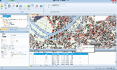
Spatial Manager Desktop is a desktop application designed to manage spatial data in a simple, fast and inexpensive way. Developed by a group of professionals working in the areas of GIS, Planning, Infrastructure and Civil Engineering, it provides the user with powerful tools to address the most common tasks of management and operation in the world of spatial information. Spatial Manager...
Category: Multimedia & Design / Graphics Viewers
Publisher: Spatial Manager, License: Shareware, Price: USD $149.00, File Size: 114.3 MB
Platform: Windows
Freeware
org, uses file and position names that suit to the display of the TomTom Rider, uses file, route and position names that suit to the display of the Map&Guide Motorrad Tourenplaner, remembers language, paths, window size and position. . .
Category: Business & Finance / Conversion Applications
Publisher: Christian Pesch, License: Freeware, Price: USD $0.00, File Size: 6.6 MB
Platform: Windows, Mac, Linux, Solaris, FreeBSD, OpenBSD, Java
Open Contacts is an address book program with CRM features providing unified, flexible and intuitive interfaces for you to manage and lookup contact info of individuals and organizations. Open Contacts displays only data fields with data. You can seamlessly customize what can be stored in your address book. Essential Features: Store details in sections of data fields that are...
Category: Business & Finance / Personal Info Managers
Publisher: Fonlow IT, License: Freeware, Price: USD $0.00, File Size: 4.5 MB
Platform: Windows

Importation/Exportation: Import/export trails to gpx file. Unlimited number of trails, and TrackPoints. Export to gpx, Excel, PDF, XPS and Kml/KMZ. Data table: Very flexible data table that allows sorting by columns, with inheritance of data, attributes, etc. Presentation on map: View on map in accordance with the active trail, which comes from providers of maps, as in 'Satellite'...
Category: Home & Education / Miscellaneous
Publisher: Aplicaciones Topográficas S.L., License: Freeware, Price: USD $0.00, File Size: 27.0 MB
Platform: Windows
AutoCAD 2010 compatible CAD software you can afford, now Windows 7 compatible - Try for free.
AutoCAD 2010 compatible CAD software you can afford, now Windows 7 compatible - Try for free. progeCAD is low cost design software for editing Autodesk AutoCAD DWG files offering a similar interface, but costing only 10% of AutoCAD. NOW SUPPORTS WINDOWS 7. CAD design drawing and detailing software for industrial design, architectural drawing, building kitchen and bath planning, civil...
Category: Multimedia & Design / Multimedia App's
Publisher: CADDIT CAD Software, License: Shareware, Price: USD $399.00, File Size: 168.3 MB
Platform: Windows
AutoCAD and AutoCAD LT 2014 compatible! Edit AutoCAD files without AutoCAD using best-in-class solution. CAD design software for building and landscape design, civil and structural drafting. Print PDF, DWF, STL file for 3D printing of drawings & full 3D modeling and 3D rendering. Edit complex AutoCAD files with xrefs, blocks, hatching, mtext and more. Includes free EasyArch for architectural...
Category: Multimedia & Design
Publisher: CADDIT CAD Software, License: Shareware, Price: USD $399.00, AUD445, File Size: 297.0 MB
Platform: Windows, Other
progeCAD offers an affordable way to read and write AutoCAD files, using similar commands and toolbars as used in previous releases of AutoCAD itself. Many choose progeCAD over AutoCAD LT because of it's low cost (currently a little over AUD $500) and features like 3D modelling and AutoLISP which are blocked in AutoCAD LT. progeCAD is commonly used in a wide variety of industry domains,...
Category: Multimedia & Design
Publisher: CADDIT CAD Software, License: Shareware, Price: USD $499.00, AUD545, File Size: 443.5 MB
Platform: Windows, Other

The free AvisMap Viewer opens most GIS/CAD and raster image file types and most ArcView, ArcExplorer, and MapInfo projects. Besides just opening and viewing files, the Viewer supports an extensive list of features including visual layer properties control, legend control, thematic mapping, spatial and attribute querying, custom labeling, on-map measurements, hyper-linking, PDF export and much...
Category: Software Development / Components & Libraries
Publisher: AvisMap GIS Technologies, License: Freeware, Price: USD $0.00, File Size: 22.3 MB
Platform: Windows

OkMap is a GPS and map software that:
-Works with vectorial maps and calibrates raster maps
-Organizes paths by creating waypoints, routes and tracks
-Uploads/downloads data to/from your GPS
-Uses altitude DEM data
-Supports GPS real-time navigation
-Sends/receives vehicles position and display tracks on maps in real time
-Provides autorouting and geocoding...
Category: Business & Finance / Applications
Publisher: Gian Paolo Saliola, License: Freeware, Price: USD $0.00, File Size: 20.2 MB
Platform: Windows