Free Downloads: Kml Gpx Converter
Creating a map based on Gpx files for your GPS and for MapSource/BaseCamp on your computer is possible with several existing programs, but it's certainly not easy to accomplish. With IMGfromGPX it's a matter of a few mouse clicks! This program can generate a map with the following features:
tracks in 8 different colors, as lines or areas;
POIs divided into...
Category: Home & Education / Miscellaneous
Publisher: JaVaWa GPS-tools, License: Shareware, Price: USD $0.00, File Size: 4.9 MB
Platform: Windows
Superoverlay software is a Google Earth application for tiling raster datasets and creating view based regions in Kml or KMZ files.
Also Superoverlay can generate world files for all images in ArcView style (jgw, tfw,...). It helps you put large image overlays into Google Earth (for example alternative maps or aerial photography). GE Sky mode is supported.
Category: Home & Education / Miscellaneous
Publisher: GIS Center, License: Shareware, Price: USD $0.00, File Size: 0
Platform: Windows
This free utility counts the number of finds and tabulates the finders by name for the caches in a Gpx file.
Use it to keep track of how many cachers have found your caches, or to compare the activity of your caches with your geocaching neighbors and which of your neighbors have found the most of your caches. The program provides results in simple text files and in CSV files...
Category: Utilities / Misc. Utilities
Publisher: Jim Evans, License: Freeware, Price: USD $0.00, File Size: 377.9 KB
Platform: Windows
 Demo
Demo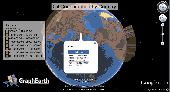
Visualize your data in 3D! Quick, easy and inexpensive. Graph Earth enables management, marketing and other business professionals to create stunning visual representations of their data, all without the time and costs associated with a full-featured GIS. Viewable by Everyone! Create one of a kind deliverables and distribute them to the world, recipients need only install Google Earth to view...
Category: Business & Finance / MS Office Addons
Publisher: Deer Creek Marketing LLC, License: Demo, Price: USD $24.95, File Size: 469.0 KB
Platform: Windows
iTag is a utility that allows you to easily add title, description and keyword tags to your digital photos. The data you enter is stored into the actual photo file itself - using the open standards of IPTC and XMP. Many applications can read and write the IPTC/XMP data, but iTag is especially powerful at editing a group of photos all at once. Geocoding your photos is also straight forward...
Category: Multimedia & Design / Media Catalogers
Publisher: iTag Software, License: Freeware, Price: USD $0.00, File Size: 576.9 KB
Platform: Windows
Shareware
An add-on for AUTOCAD or BricsCAD, which makes the triangulation of a set of POINT entities, the intersection curves (isolines) between a set of 3DFACE entities and a set of equidistance plans, horizontally or vertically and the volume and center of gravity of a set of bodies or between surfaces composed of 3DFACE entities. You can also load and draw a file of points having the format: Number...
Category: Multimedia & Design / Graphics Viewers
Publisher: Rcad Software, License: Shareware, Price: USD $64.00, EUR59, File Size: 2.5 MB
Platform: Windows

OkCustomMap is a software to produce Garmin Custom Maps.
OkCustomMap is a software to produce Garmin Custom Maps.
Supports many map formats:
- OkMap
- Ecw
- GeoTiff
- World files
- OziExplorer
- GpsTuner
You can customize:
- The quality of the output JPEG images (0=Bad, 100=Good)
- The Kml transparency (0=Transparent, 255=Opaque)
- The Kml draw order (0=Invisible, 1-49=Under the vectorial...
Category: Business & Finance / Applications
Publisher: Gian Paolo Saliola, License: Freeware, Price: USD $0.00, File Size: 3.2 MB
Platform: Windows
Avisoft-SASLab Pro is a powerful Windows application (compatible to Windows 98/2000/XP/Vista/7) for investigating animal acoustic communication. It provides a broad range of processing and analysis tools that can greatly increase the efficiency in extensive sound analysis projects.
Avisoft-SASLab Pro is compatible:
- Supports all common soundcards and USB audio...
Category: Audio / Utilities & Plug-Ins
Publisher: Avisoft Bioacoustics, License: Demo, Price: USD $0.00, File Size: 5.6 MB
Platform: Windows

OkMap is a GPS and map software that:
-Works with vectorial maps and calibrates raster maps
-Organizes paths by creating waypoints, routes and tracks
-Uploads/downloads data to/from your GPS
-Uses altitude DEM data
-Supports GPS real-time navigation
-Sends/receives vehicles position and display tracks on maps in real time
-Provides autorouting and geocoding...
Category: Business & Finance / Applications
Publisher: Gian Paolo Saliola, License: Freeware, Price: USD $0.00, File Size: 20.2 MB
Platform: Windows
Demo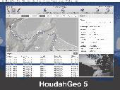
HoudahGeo is a photo geocoding and geotagging tool for Mac. Use HoudahGeo to attach GPS coordinates and location names to your photos. HoudahGeo writes EXIF and XMP geotags to JPEG and RAW image files. This creates a permanent record of where a photo was taken. Just like a GPS-enabled camera. HoudahGeo is the only application that can both write future-proof GPS tags to original images...
Category: Multimedia & Design / Media Catalogers
Publisher: Houdah Software s.à r.l, License: Demo, Price: USD $39.00, File Size: 22.9 MB
Platform: Mac
CacheMagnet is a free, open source geocaching waypoint management program.
CacheMagnet is a free, open source geocaching waypoint management program.
With CacheMagnet, you can read and display contents of .Gpx or .LOC files, download waypoints to your GPSr, load .ZIP files from geocaching.com pocket queries, edit cache descriptions and waypoint locations (great for puzzle caches), save changes to Gpx files, print reports and maps, combine...
Category: Home & Education / Miscellaneous
Publisher: Brian Erickson, License: Freeware, Price: USD $0.00, File Size: 609.0 KB
Platform: Windows
GeoVisu is a program that displays georeferenced data (images, graphics) and downloads data recorded by some GPS devices.
Category: Multimedia & Design / Graphics Viewers
GeoVisu has a "Moving map" navigation function, which can be used with any NMEA 0183 compatible or Garmin USB GPS device.
Main features:
- Displays georeferenced image formats : GeoTiff, ECW and ECWP, MrSID, OziExplorer Map
Publisher: GeoVisu, License: Freeware, Price: USD $0.00, File Size: 1.7 MB
Platform: Windows
T2K Pro integrates the rich world of GIS datasets and transfers your Geographic information data into Google earth. T2K Pro handles rich data types and access large volumes of geographic data stored in files and databases; T2K PRO handles raster (imagery), Vector Map data and GPS Tracks/ Waypoints/ Routes. Tiles2kml Pro provides a complete suite of conversion tools to easily visualize and...
Category: Multimedia & Design / Authoring Tools
Publisher: Tiles2kml, License: Demo, Price: USD $90.00, File Size: 20.9 MB
Platform: Windows
Shareware
Sometimes, when we want to change the GPS location, we need to use location changer. If you are looking for an easy-to-use location changer, you could have a try with Aiseesoft AnyCoord for Mac. It is can help you change your location simply. Key functions: 1. Change GPS location As a powerful location changer, Aiseesoft AnyCoord for Mac enables you to change the GPS location to a...
Category: Utilities / Network
Publisher: Aiseesoft Studio, License: Shareware, Price: USD $9.56, File Size: 71.9 MB
Platform: Mac
Shareware
MPSuperShape is a shape manipulation tool for Microsoft MapPoint. MPSuperShape can be used to combine multiple shapes into one large shape, find the intersections (overlaps) between shapes, find boundary shapes around groups of pushpins, simplify shapes, delete multiple shapes, change shape colors, import/export shape files, and to create web pages. Import shape options include ESRI Shape (SHP)...
Category: Business & Finance / Business Finance
Publisher: Winwaed Software Technology LLC, License: Shareware, Price: USD $75.00, File Size: 13.6 MB
Platform: Windows
Spatial Manager Desktop is a desktop application designed to manage spatial data in a simple, fast and inexpensive way. Developed by a group of professionals working in the areas of GIS, Planning, Infrastructure and Civil Engineering, it provides the user with powerful tools to address the most common tasks of management and operation in the world of spatial information. Spatial Manager...
Category: Multimedia & Design / Graphics Viewers
Publisher: Spatial Manager, License: Shareware, Price: USD $149.00, File Size: 114.3 MB
Platform: Windows
Shareware
iWhere iPhone Location Changer is a great location changer for iOS device. 4 modes such one-stop mode, multi-stop mode, and joystick mode help you simulate GPS location routes. You can customize the route and speed, allowing you to play geo-based games such as Pokmon Go, Monster Hunter Now anywhere. AdditionallyiWhere iPhone Location Changer can easily change the location on your iPhone with...
Category: Utilities / System Surveillance
Publisher: iWhere Technology, License: Shareware, Price: USD $49.99, File Size: 97.9 MB
Platform: Mac
Shareware
iWhere iPhone Location Changer is a great location changer for iOS device. 4 modes such one-stop mode, multi-stop mode, and joystick mode help you simulate GPS location routes. You can customize the route and speed, allowing you to play geo-based games such as Pokmon Go, Monster Hunter Now anywhere. AdditionallyiWhere iPhone Location Changer can easily change the location on your iPhone with...
Category: Utilities / System Surveillance
Publisher: iWhere Technology, License: Shareware, Price: USD $49.99, File Size: 1.9 MB
Platform: Windows

TRANSDAT geosoftware executes coordinate transformations and geodetic datum shifts between many coordinate and reference systems of America, Australasia, Europe, Germany special and world-wide, with high precision and high speed: 1.The current and historical coordinate and reference systems of all countries of the European Union (EU) including the eastern extensions and the systems of non-EU...
Category: Home & Education / Science
Publisher: Killet Software Ing.-GbR, License: Shareware, Price: USD $170.00, EUR160, File Size: 4.4 MB
Platform: Windows
WIA-Loader transfers pictures from a camera or flash card to the PC.
WIA-Loader transfers pictures from a camera or flash card to the PC. It offers many options to name image files and folders and give you the possibility to geocode pictures with Gpx-files.
Category: Multimedia & Design / Graphics Viewers
Publisher: mortara.org, License: Freeware, Price: USD $0.00, File Size: 3.8 MB
Platform: Windows, Mac, 2K, 2K3, Vista
CacheMaps retreives a variety of maps for your caches from the Internet.
CacheMaps retreives a variety of maps for your caches from the Internet.
CacheMaps uses the Geocaching loc- or Gpx-files as input. Directely from the Geocaching site or as exported from GSAK.CacheMaps v4 has been designed to be used next to GSAK. A lot of the functionality that was available in previous versions of CacheMaps, is available in GSAK now in a much better form. What...
Category: Audio / Utilities & Plug-Ins
Publisher: BigBird Productions, License: Freeware, Price: USD $0.00, File Size: 153.2 KB
Platform: Windows

The free AvisMap Viewer opens most GIS/CAD and raster image file types and most ArcView, ArcExplorer, and MapInfo projects. Besides just opening and viewing files, the Viewer supports an extensive list of features including visual layer properties control, legend control, thematic mapping, spatial and attribute querying, custom labeling, on-map measurements, hyper-linking, PDF export and much...
Category: Software Development / Components & Libraries
Publisher: AvisMap GIS Technologies, License: Freeware, Price: USD $0.00, File Size: 22.3 MB
Platform: Windows
Live!Flight allows that everyone can track your flight in flight simulator in real-time, all over the world. Your aircraft is displayed as a 3D-model in a map of NASA World Wind.
For that purpose Live!Flight transmits position and flight attitude information. With a refreshing rate of 2 times per second you can see every aircraft's movement. A lot of more information like...
Category: Business & Finance / Business Finance
Publisher: Christoph Paulus, License: Shareware, Price: USD $29.00, File Size: 4.2 MB
Platform: Windows
ArBa3d is a 3D modeling software that allows to create a 3D model from a set of digital photos.
ArBa3d is a 3D modeling software that allows to create a 3D model from a set of digital photos. The tool takes as input a set of photos taken from different viewpoints. It tesselates the vertices and constraint edges from the user input to produce a 3D model that can then be exported to different 3D formats (vrml, obj, x, flt, x3d, Kml). The 3D models can also be displayed on the Web,...
Category: Multimedia & Design / Image Editing
Publisher: ArBa3d.com, License: Shareware, Price: USD $0.00, File Size: 5.3 MB
Platform: Windows
QuakeMap is a powerful GPS/mapping program for your Windows computer.
QuakeMap is a powerful GPS/mapping program for your Windows computer. It can be downloaded here for free. The trial mode allows you to use most features indefinitely. When you need to unlock certain powerful features, a License Key can be ordered here. QuakeMap is designed for ease of use. It eatures intuitive user interface, supports most popular Garmin and Magellan receivers, reads and writes...
Category: Utilities / Misc. Utilities
Publisher: quakemap.com, License: Freeware, Price: USD $0.00, File Size: 821.2 KB
Platform: Windows