Free Downloads: Networks Graphical Mapping
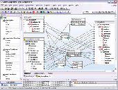
Spark is a realtime modulator software for Digital Radio Mondiale (DRM), DRM and other radio standards. The software supports all code rates, bandwidths and robustness modes (A, B, C, D, E) published in the DRM standard as well as all Mapping schemes, such as Standard Mapping (4, 16 and 64 QAM), Symmetrical Hierarcical Mapping and Mixed Hierarchical Mapping....
Category: Audio / Audio Players
Publisher: Michael Feilen, License: Shareware, Price: USD $59.00, File Size: 2.9 MB
Platform: Windows
HuntMASTER Software Suit is an advanced Mapping DF platform capable of interconecting a bunch of DF Stations into one HuntNET remotelly administred and coordinated network. This software is a Windows Graphical user interface program that can be used at any DF Site, or at a remote Control Station Location.
Category: Internet / Misc. Plugins
Publisher: HuntMaster Software, License: Demo, Price: USD $0.00, File Size: 14.1 MB
Platform: Windows
Solution Language Tool is an intelligent mind Mapping tool and activity Mapping tool for capturing, refining and sharing ideas.
Category: Business & Finance / Database Management
Organizing thoughts, presenting ideas and planning activities is now faster and easier than ever.
Human brains have superior capacity to handle images, colors and shapes compared with textual and numerical information.
Publisher: Solution Language Oy, License: Shareware, Price: USD $104.10, File Size: 6.8 MB
Platform: Windows
Altova MapForce 2011 Standard Edition is a Graphical XML data Mapping tool for converting XML data in one format to any another XML format. MapForce converts data instantly or autogenerates industry-standard XSLT 1.0 or XSLT 2.0 data transformation code for use in recurrent conversions. This visual data integration tool is so powerful and so easy to use that you will soon wonder...
Category: Web Authoring / XML/CSS Utilities
Publisher: Altova Inc., License: Demo, Price: USD $249.00, EUR199, File Size: 27.6 MB
Platform: Windows
Osprey is a software platform for visualization and manipulation of complex interaction networks.
Osprey is a software platform for visualization and manipulation of complex interaction Networks.
Osprey builds data-rich Graphical representations that are color-coded for gene function and experimental interaction data. Mouse-over functions allow rapid elaboration and organization of network diagrams in a spoke model format.Osprey also allows for user-defined...
Category: Internet / Misc. Plugins
Publisher: Bobby-Joe Breitkreutz, Chris Stark, License: Freeware, Price: USD $0.00, File Size: 21.4 MB
Platform: Windows
A Business Process Mapping Software Product for the mapping of processes and information flows.
A Business Process Mapping Software Product for the Mapping of processes and information flows. Activity Mapping, flowchart Mapping and document control can all be achieved via this simple-to-use tool. The user installs the file and can instantly begin to map information flows specific to any process. The tool helps the organization to fulfill the ISO 9000:2000...
Category: Business & Finance / Applications
Publisher: Process-Worx Ltd, License: Demo, Price: USD $74.99, File Size: 696.3 KB
Platform: Windows
 Freeware
WeFi enables reliable connection to Wi-Fi wherever wireless Networks are available, and helps keep you connected to the fastest most reliable network around. Wefi users can move between open Wi-Fi Networks automatically, without having to manually choose or click around between new Networks. WeFi users can monitor approved friends' online status and location, and know the...
Category: Software Development / Tools & Editors
Publisher: WeFi, License: Freeware, Price: USD $0.00, File Size: 8.5 MB
Platform: Windows
GPSeismic® is a suite of survey, Mapping, and data management applications to support geophysical exploration.
GPSeismic applications offer advanced functionality to assist
the GNSS, INS, and conventional surveyor with a variety of tasks including the following:
-A wide range of both Graphical, numeric and SQL based controller upload point selection methods...
Category: Business & Finance / Applications
Publisher: Dynamic Survey Solutions, Inc., License: Freeware, Price: USD $0.00, File Size: 162.8 MB
Platform: Windows
SST Summit & SST Stratus are a complete package for desktop and mobile Mapping, record-keeping, and reporting.
Create records of farm operations like planting, chemical applications, harvest, and much more.
Data is easily shared with the accompanying installation of Stratus as well as with other Summits.
From easy-to-use field boundary...
Category: Multimedia & Design / Graphics Viewers
Publisher: SST Development Group, License: Shareware, Price: USD $0.00, File Size: 4.0 MB
Platform: Windows
Demo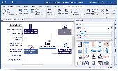
MindView is a professional mind Mapping software that allows you to visually brainstorm, organize and present ideas. Known for its award winning MS Office integration this mind Mapping software lets you be more productive, turning ideas into action faster than ever before! With 6 interchangeable views, unique project management features and powerful collaboration options; MindView...
Category: Business & Finance / Project Management
Publisher: MatchWare A/S, License: Demo, Price: USD $20.00, File Size: 712.5 MB
Platform: Windows
An optional NAM component Network Widening Mod adds a series of variable width surface Networks by extending the game's default Road and One-Way Road Networks with special starter pieces. 44 puzzle pieces which include Wide-Radius Curves, transitions to Maxis Networks and other NWM Networks, and neighbor connectors for two-way dual-tile Networks.
...
Category: Games / Tools & Editors
Publisher: The NAM Team, License: Shareware, Price: USD $0.00, File Size: 7.4 MB
Platform: Windows
MindVisualizer Standard Edition is a visual information management software that utilizes Mind Mapping and Concept Mapping methodologies, offering an innovative approach for:* Brainstorming and Ideation* Decision Making and Solve Complex Problems* Note Taking and Creative Writing* Mind Mapping and Business Process Mapping* Knowledge/Document Management* To Do lists...
Category: Business & Finance / Applications
Publisher: InnovationGear.com, License: Shareware, Price: USD $79.00, File Size: 9.6 MB
Platform: Windows
The CANVAS 9 GIS Mapping Edition adds native support for Geographic Information System (GIS) data to Canvas. You can take measurements in geographic coordinates, import industry standard SHAPE and GeoTIFF files into unlimited numbers of automatically aligned overlapping layers and choose among the following options: 2,104 Coordinate Reference Systems 67 Operation Methods (like Mercator,...
Category: Multimedia & Design / Multimedia App's
Publisher: ACD Systems, License: Shareware, Price: USD $549.99, File Size: 51.9 MB
Platform: Mac, PPC
JFTP is a Graphical FTP (File Transfer Protocol) client software for transferring files from one computer to another over TCP/IP Networks such as Internet.
JFTP can connect to any system that has a valid Internet address and an FTP server program, allowing you to transfer files between a wide variety of systems, including Windows, UNIX and iSeries (AS/400) systems.
...
Category: Internet / FTP
Publisher: jMethods, Inc., License: Shareware, Price: USD $0.00, File Size: 16.1 MB
Platform: Windows
This smart and elegant weather add-on for your Flight Simulator serves its purpose in the most efficient way.
Branded with elegance, simplicity, realism, flexibility and intuitiveness, this exclusive software is best suited for professional users dealing with entire weather synthesis and processing systems.
This perfect add-on for Flight Simulator serves in entire weather...
Category: Games / Action
Publisher: HiFi Flightware, License: Commercial, Price: USD $44.99, File Size: 0
Platform: Windows
Ultimate Unwrap 3D is a specialty Windows UV mapping tool for unfolding and unwrapping 3D models.
Ultimate Unwrap 3D is a specialty Windows UV Mapping tool for unfolding and unwrapping 3D models. It is ideal for gamers, artists, modellers, and hobbyists, and easy enough to use for all levels of computer users. It includes an easy-to-use UV coordinate editor, a standard set of UV Mapping projections such as planar, box, cylindrical, and spherical.
Category: Multimedia & Design / Animation
Publisher: Ultimate Unwrap3D Pro, License: Shareware, Price: USD $59.95, File Size: 6.4 MB
Platform: Windows
The HAM Intelligent Calculator, or HAMIC, is a program designed to simplify a number of calculations commonly used by HAMs. It is designed for the HAM radio hobbyist, but may be useful to others as well. HAMIC has a simple to use, but powerful Graphical interface that allows solving simple circuits such as resistors in series or parallel, or more complex circuits such as L...
Category: Home & Education / Miscellaneous
Publisher: SweetScape, License: Shareware, Price: USD $20.00, File Size: 1.2 MB
Platform: Windows
Shareware
GPS Mapping Software for Windows, Loading topographic maps, realtime navigation, track recording, manage GPS devices and more. The software can be used with various map formats including: GeoTiff, BSB Nautical Charts, AutoCad DXF files, ESRI Shapefiles. Using calibration you can also use scanned or downloaded JPG, BMP, GIF, PNG and TIF maps. The software can be used for survey, research,...
Category: Home & Education / Science
Publisher: Eye4Software B.V., License: Shareware, Price: USD $149.00, EUR99, File Size: 11.1 MB
Platform: Windows
Scanning for wireless networks is now easier and more personalized!
Scanning for wireless Networks is now easier and more personalized! AirRadar allows you to scan for open Networks and tag them as favourites or filter them out. View detailed network information, graph network signal strength, and automatically join the best open network in range.
Whether you are driving around looking for wireless Networks, stuck in traffic, sitting...
Category: Internet / News Applications
Publisher: Koingo Software, License: Shareware, Price: USD $19.95, File Size: 6.9 MB
Platform: Mac
With the Graham Process Mapping Software and methodology, detailed process maps are easy to draw, easy to edit and easy to read. Eight basic process Mapping symbols cover all aspects of work at the element level. Symbols click in place on the snap-to grid on the charting screen. Objects are easy to place, move and remove. Lines draw automatically. Text is positioned and aligned...
Category: Multimedia & Design / Multimedia App's
Publisher: The Ben Graham Corporation, License: Shareware, Price: USD $485.00, File Size: 21.1 MB
Platform: Windows
Hibernator is a pure java Eclipse plugin that enables synchronisation of a java class and the related Hibernate Mapping file. A user can edit their busisness class and not have to update the matching Hibernate. Hibernate facilitated the storage and retrieval of Java domain objects via Object/Relational Mapping. Hibernate is a collection of related projects enabling developers to...
Category: Web Authoring / JavaScript
Publisher: Daniel Bradby, License: Shareware, Price: USD $0.00, File Size: 2.8 MB
Platform: Windows
Map Suite Desktop Edition is a powerful and feature-rich .NET Mapping control that enables C# and VB.NET software developers to build detailed desktop Mapping applications. Utilizing Microsoft's .NET Framework, the APIs for Map Suite Desktop Edition incorporate the very latest technology to deliver a powerful, user-friendly Mapping control. In addition, ease of coding and...
Category: Software Development
Publisher: ThinkGeo LLC, License: Commercial, Price: USD $4794.00, File Size: 28.4 MB
Platform: Windows
APRS Live is an add-on for Depiction Mapping software that allows APRS packet information received over RF via your radio and TNC to be displayed in Depiction’s Mapping and simulation environment. No Internet connection is needed—APRS Live connects to your TNC via your computer's serial port, allowing you to use the power of Depiction to display current APRS...
Category: Home & Education / Miscellaneous
Publisher: Smucker Data Solutions, License: Shareware, Price: USD $39.95, File Size: 4.4 MB
Platform: Windows
* Real-time Mapping of ports to processes (applications and services)! * History since boot-time of all TCP, UDP and RAW ports open through Winsock and respective Mapping to processes! * Log since boot-time of data sent and received (up to 500 MB) by above ports! * Sophisticated archiving feature allowing to review previous sessions with the same detail as the current session.
Category: Internet
Publisher: AtelierWeb Software, License: Shareware, Price: USD $35.50, File Size: 4.4 MB
Platform: Windows
So that you can identify the Mapping & GIS product that best suits your needs, use this simple Product Comparison. There are four main product types that you can use to create a GPS data collection and maintenance system, or mobile GIS solution. Use the links below to select a product group, and compare the features of each product within that group.
Category: Internet / Communications
Publisher: Trimble Navigation Limited, License: Freeware, Price: USD $0.00, File Size: 2.7 MB
Platform: Windows